Tchefuncte River
| Tchefuncte River | |
| River | |
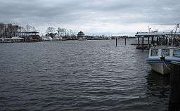 Tchefuncte River as seen at Madisonville | |
| Country | United States |
|---|---|
| State | Louisiana |
| Parishes | Washington, Tangipahoa, St. Tammany |
| Tributaries | |
| - left | Bogue Falaya |
| Cities | Covington, Madisonville |
| Source | |
| - location | Tangipahoa Parish, Louisiana [1]
|
| - coordinates | 30°54′22″N 90°20′59″W / 30.90611°N 90.34972°W |
| Mouth | Lake Pontchartrain |
| - location | Madisonville, St. Tammany Parish, Louisiana [1]
|
| - coordinates | 30°22′36″N 90°09′38″W / 30.37667°N 90.16056°WCoordinates: 30°22′36″N 90°09′38″W / 30.37667°N 90.16056°W |
| Length | 70 mi (113 km) [2] |
The Tchefuncte River (/tʃᵻˈfʌŋktə/ chə-FUNK-tə) drains into Lake Pontchartrain in Louisiana in the United States. It is about 70.0 miles (112.7 km) long.[2]
In the 19th century it was an important commercial waterway, where building materials and other products of the North Shore of Lake Pontchartrain were loaded to be shipped across the Lake to New Orleans.
Course
The Tchefuncte rises in northeastern Tangipahoa Parish and initially flows southward; the river is used to define part of the eastern boundary of Tangipahoa Parish and parts of the western boundaries of Washington and St. Tammany Parishes before turning southeastward into St. Tammany Parish, where it passes the city of Covington and the town of Madisonville. It collects its largest tributary, the Bogue Falaya, at Covington and flows into Lake Pontchartrain about 2 miles (3.2 km) south of Madisonville, near the lake's northern extremity.

The Tchefuncte has been designated by the government of Louisiana as a "Natural and Scenic River." Fairview-Riverside State Park is located along the river, upstream of Madisonville.
See also
References
- 1 2 "Tchefuncte River". Geographic Names Information System. United States Geological Survey. January 1, 2000. Retrieved 2008-02-04.
- 1 2 U.S. Geological Survey. National Hydrography Dataset high-resolution flowline data. The National Map, accessed June 20, 2011
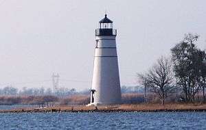
- ↑ Brenda Brown Finnegan, Lighthouse Digest.