Houma, Louisiana
| Houma | |
|---|---|
| City | |
| City of Houma | |
|
Terrebonne Parish Courthouse at Houma | |
 Houma  Houma | |
| Coordinates: 29°35′15″N 90°42′58″W / 29.58750°N 90.71611°WCoordinates: 29°35′15″N 90°42′58″W / 29.58750°N 90.71611°W | |
| Country |
|
| States |
|
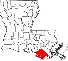
| Parish | Terrebonne |
| Founded | 1834 |
| Incorporated | 1848 |
| Reincorporated | 1898 |
| County seat | Terrebonne |
| Principal city | Houma–Bayou Cane–Thibodaux Metropolitan Statistical Area |
| Region |
Acadiana South Louisiana |
| Government | |
| • Type | Government |
| • Body | Consolidated City-Parish |
| • Parish President | Gordon Dove |
| Population (2010) | |
| • City | 33,727 |
| • Metro | 208,178 |
| Time zone | CST (UTC-6) |
| • Summer (DST) | CDT (UTC-5) |
| ZIP code | 70360, 70363-64 |
| Area code | 985 |
| Future Interstate |
|
| U.S. Highways |
|
| Airport | Houma–Terrebonne Airport |
| Rivers | Bayou Terrebonne Intracostal Waterway |
| Website |
houmatoday |

Houma (/ˈhoʊmə/ HO-ma)[1] is the only city in and the parish seat of Terrebonne Parish, Louisiana,[2] and the largest principal city of the Houma–Bayou Cane–Thibodaux Metropolitan Statistical Area. The city's powers of government have been absorbed by the parish, which is now run by the Terrebonne Parish Consolidated Government. The population was 33,727 at the 2010 census, an increase of 1,334 over the 2000 tabulation of 32,393.[3]
Many unincorporated areas are adjacent to the city of Houma; the largest, Bayou Cane, is an urbanized area commonly referred to by locals as being part of Houma. It is not included in the city's census counts, and is a separate census-designated place. If the populations of the urbanized census-designated places were included with that of the city of Houma, the total would exceed 60,000 residents. The city was named after the historic Native American tribe of Houma people, believed to be related to the Choctaw. The United Houma Nation Tribe is recognized by the state of Louisiana, although it has not achieved federal recognition.[4]
Houma was rated as an "Affordable" city by Demographia's International Housing Survey.[5]
History
Houma was founded by European Americans in 1834 at a former settlement of the Houma people, who historically occupied this area. The city was named after them. The city of Houma was incorporated in 1848. The United Houma Nation and two other Houma tribes have been recognized by the state. Houma is also rated as a medium size city.
The area was developed for plantations in the antebellum years, which were worked primarily by enslaved African Americans.
Since the late 19th century, the area has become more industrialized and developed for trade.
Civil War
In 1862, four Union soldiers en route by wagon from New Orleans to Houma were ambushed by several armed citizens. Two of the Union men were killed, and the other two were seriously wounded.
In retaliation, Union officers brought 400 troops into Houma, where they began a wholesale arrest of residents. In his 1963 book, the historian John D. Winters describes the events:
"The investigation of the murders lasted several days but failed to reveal the guilty parties. To frighten the citizens, the home of a Doctor Jennings was burned, two other houses were torn down, and the home and slave quarters of an outlying plantation were burned. The soldiers next began to seize sheep, cattle, mules, wagons, and saddle horses. Negroes began to desert their masters and to flock to the protection of the troops. The frightened citizens had no means of resistance, and many found it hard to stand by and see their country despoiled by a few hundred troops."[6]
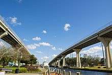
Geography
Houma is located at 29°35′15″N 90°42′58″W / 29.58750°N 90.71611°W (29.587614, -90.716108)[7] and has an elevation of 10 feet (3.0 m).[8] BY SQ
According to the United States Census Bureau, the city has a total area of 14.2 square miles (37 km2), of which 14.0 square miles (36 km2) is land and 0.2 square miles (0.52 km2) (0.92%) is water.
Demographics
| Historical population | |||
|---|---|---|---|
| Census | Pop. | %± | |
| 1860 | 429 | — | |
| 1870 | 593 | 38.2% | |
| 1880 | 1,084 | 82.8% | |
| 1890 | 1,280 | 18.1% | |
| 1900 | 3,212 | 150.9% | |
| 1910 | 5,024 | 56.4% | |
| 1920 | 5,160 | 2.7% | |
| 1930 | 6,531 | 26.6% | |
| 1940 | 9,052 | 38.6% | |
| 1950 | 11,505 | 27.1% | |
| 1960 | 22,561 | 96.1% | |
| 1970 | 30,922 | 37.1% | |
| 1980 | 32,602 | 5.4% | |
| 1990 | 30,495 | −6.5% | |
| 2000 | 32,393 | 6.2% | |
| 2010 | 33,727 | 4.1% | |
| Est. 2015 | 34,287 | [9] | 1.7% |
At the 2010 census,[11] there were 33,727 people, 10,634 households and 16,283 families residing in the city. The population density was 2,308.5 per square mile (891.4/km²). There were 12,514 housing units at an average density of 891.8 per square mile (344.4/km²). The racial make up of the city was 67.46% White, 20.62% Black, 5.45% Native American, 1.71% Asian, 0.12% Pacific Islander, 0.68% from other races, and 1.87% from two or more races. Hispanic or Latino of any race were 5.76% of the population.
2000 census
In 2000, there were 11,634 households of which 35.4% had children under the age of 18 living with them, 49.5% were married couples living together, 16.7% had a female householder with no husband present, and 28.8% were non-families. 24.1% of all households were made up of individuals and 10.3% had someone living alone who was 65 years of age or older. The average household size was 2.72 and the average family size was 3.24.
27.9% of the population were under the age of 18, 9.8% from 18 to 24, 29.2% from 25 to 44, 20.8% from 45 to 64, and 12.2% who were 65 years of age or older. The median age was 34 years. For every 100 females there were 94.8 males. For every 100 females age 18 and over, there were 92.2 males.
The median household income was $34,471 and the median family income was $40,679. Males had a median income of $35,897 and females $22,202. The per capita income was $17,720. About 16.4% of families and 20.8% of the population were below the poverty line, including 30.7% of those under age 18 and 17.3% of those age 65 or over.
Education
Terrebonne Parish School District operates public schools.
It is home to Louisiana's second-oldest high school, Terrebonne High School. Ellender Memorial High School is also in Houma.
Southdown High School (originally Houma Colored High School) had black students from 1946 to 1969.[12]
Culture
Houma and the surrounding communities are steeped in Cajun tradition and culture, a creolization of Native American, Acadian and African traditions. Downtown Houma has been listed as a significant historic district on the National Register of Historic Places. It offers a downtown walking tour and attractions such as the Bayou Terrebonne Waterlife Museum, the Folklife Culture Center, the Regional Military Museum, Southdown Plantation, the Houma-Terrebonne Civic Center, monuments to local armed forces, and local eateries.
Although Houma is quickly changing, many residents in the surrounding communities continue to make their living as their ancestors did. They are shrimpers, oystermen, crabbers, fishermen, and trappers, although more are beginning to work in occupations of the oil industry and ship building. Many long-standing traditions and lifestyles remain as part of the area's rich cultural history. Houma is also the headquarters of the Roman Catholic Diocese of Houma-Thibodaux.
In popular culture
- Houma and the surrounding area are the setting for the fictional Swamp Thing comic books, and the 1994 V. C. Andrews book Ruby. The Suicide Squad is based at Belle Reve in Houma, as well.
- The 1996 film The Apostle, starring Robert Duvall, was partially filmed in Terrebonne Parish.
- The 1999 films Crazy in Alabama, Fight Club and A Lesson Before Dying were partially filmed in Houma.
- Many wetlands shots in the IMAX production, Hurricane on the Bayou, were filmed in the area.
- The 2005 film The Skeleton Key is set in Houma and the nearby area of Bayou Gauche.[13]
- The HBO documentary, The Recruiter, followed the life of an Army recruiter and several of his recruits from Houma.
- Several scenes from the 2013 film, The Butler, starring Forest Whitaker and Oprah Winfrey, were filmed in downtown Houma.[14]
- In 1992, Unsolved Mysteries profiled the case of Adam John "AJ" Breaux, a resident of Houma, Louisiana, who went missing in 1991.
Mass media
The local newspaper is The Courier, founded in 1878 as Le Courrier de Houma by the French-born Lafayette Bernard Filhucan Bazet. He first published it in four-page, half-French half-English editions. Sold to The New York Times Company in 1980, it is now part of the New York Times Regional Newspaper Group.[15]
The Houma Times is located in Houma. The newspaper is a weekly publication with a website updated daily. It serves the Terrebonne, Lafourche and St. Mary parishes. In 2014, Houma-based Rushing Media merged with Guidry Group, Inc., which had owned the publication since its inception in 1997.[16]
The area's only local broadcast TV station KFOL-CD is located in Houma. KFOL, also known as HTV, produces a weeknight newscast, followed by local phone calls and guests. Other shows include Sportsman's Paradise and One on One. KFOL broadcasts in digital on channel 30.1. The statewide TV network LCN-TV produces original Louisiana programming which showcases Louisiana's entertainment, culture, talent and industry. LCN-TV is delivered to all media distributors. Debuted in 2007, LCN-TV continues to produce Louisiana TV shows for the U.S.
Transportation
Houma is served by Houma-Terrebonne Airport, located 3 miles southeast of the central business district.[17]
Good Earth Transit is Houma's parish bus system.[18] It has 5 major routes and services the surrounding suburban areas including the small, surrounding bayou communities and the city of Thibodaux.[19]
Houma relies mainly on its roads as its main form of transportation. The major roads in Houma are:
- US Route 90
- LA HWY 311
- Tunnel Blvd. (LA 3040)
- LA 24 (Locally Called West Park Ave.(Westbound) and Main St.(Eastbound))
- LA 182 (New Orleans Blvd.)
- South and North Hollywood Rd.
- St. Louis Canal Rd.
- Savanne Rd.
- Valhi Blvd.
Twin towns
 Cambrai, Nord, Hauts-de-France, France
 Datca, Turkey
 Bathurst, New Brunswick, Canada
- In June 2012, Terrebonne Parish signed a letter of intent to become a sister city with Weihai, China, for economic development purposes.[20]
Notable people
- George Arceneaux, Jr., U.S. District Court judge from 1979 until his death in office in 1993
- Tab Benoit, Blues musician and co-star of the IMAX movie feature Hurricane on the Bayou.
- Sherman A. Bernard, Louisiana insurance commissioner from 1972–88, graduated from Terrebonne High School in Houma.
- Elward Thomas Brady, Jr., state representative from Terrebonne Parish from 1972–76; businessman
- Wanda Brister, operatic mezzo-soprano, presently on the faculty at Florida State University.
- Joe Burks, professional athlete
- Leonard J. Chabert, member of both houses of Louisiana State Legislature from Terrebonne Parish; namesake of Leonard J. Chabert Medical Center in Houma
- Marty J. Chabert, former state senator from Terrebonne and Lafourche parishes
- Norby Chabert, current Republican member of the Louisiana State Senate from Terrebonne and Lafourche parishes
- Richie Cunningham, professional athlete[21]
- Gordon Dove, president of Terrebonne Parish and former state representative
- Claude B. Duval (1914–1986), former member of the Louisiana State Senate
- Allen J. Ellender (1890–1972), former president pro tempore and Democratic U.S. Senator
- Leon Gary (1912-2000), mayor of Houma from 1946 to 1962
- Skyler Green, gridiron football wide receiver and return specialist[22]
- Hal Haydel, professional athlete[23]
- Cyril and Libbye Hellier, operatic sopranos
- Brandon Jacobs, NFL running back
- Frank Lewis, professional athlete[24]
- Morris Lottinger, Jr., former state representative and retired circuit court judge from Houma
- Morris Lottinger, Sr., state representative from 1936–50, House Speaker from 1948-50, and state circuit court judge until his retirement in 1965
- Tanner Magee, District 53 state representative since 2016
- Jay Pennison, professional athlete[25]
- Lloyd Pitts, Hollywood and TV stuntman[26]
- Dax Riggs, frontman for Acid Bath, Deadboy and the Elephantmen, Agents of Oblivion, and various other solo/ collaborative works
- Quvenzhané Wallis, film actress (Beasts of the Southern Wild, 2012)
- J. Louis Watkins, Jr., judge of the Louisiana First Circuit Court of Appeal from 1979 to 1997; former attorney in Houma[27]
- Wally Whitehurst, MLB pitcher
- Tramon Williams, professional athlete[28]
- Jerome Zeringue, incoming state representative for Lafourche and Terrebonne parishes, effective 2016
Climate
The climate in this area is characterized by hot, humid summers and generally mild to cool winters. According to the Köppen Climate Classification system, Houma has a humid subtropical climate, abbreviated "Cfa" on climate maps.[29]
References
- ↑ Kenyon and Knott (Addenda); Webster's New Geographical Dictionary (1984).
- ↑ "Find a County". National Association of Counties. Retrieved 2011-06-07.
- ↑ "Houma (city), Louisiana". quickfacts.census.gov. Retrieved November 21, 2012.
- ↑
- ↑ "United States" (PDF). 9th Annual Demographia International Housing Affordability Survey: 2013 Ratings for Metropolitan Markets. Demographia. Retrieved 21 January 2013.
- ↑ John D. Winters, The Civil War in Louisiana, Baton Rouge: Louisiana State University Press, 1963; ISBN 0-8071-0834-0, pp. 150-151
- ↑ "US Gazetteer files: 2010, 2000, and 1990". United States Census Bureau. 2011-02-12. Retrieved 2011-04-23.
- ↑ "US Board on Geographic Names". United States Geological Survey. 2007-10-25. Retrieved 2008-01-31.
- ↑ "Annual Estimates of the Resident Population for Incorporated Places: April 1, 2010 to July 1, 2015". Census.gov. Retrieved July 2, 2016.
- ↑ "Census of Population and Housing". Census.gov. Retrieved June 4, 2015.
- ↑ "American FactFinder". United States Census Bureau. Retrieved 2008-01-31.
- ↑ Dishman, Jaime Lugibihl (2005-06-26). "Students of former Southdown High School gather for remembrance". Houma Today. Retrieved 2016-12-04.
- ↑ "The Skeleton Key (2005) : Filming Locations". IMDb.com. Retrieved 2016-11-21.
- ↑ "Some scenes from The Butler shot in Houma, Louisiana", Daily Comet, 15 August 2013; accessed August 21, 2014.
- ↑ "About the Courier", The Courier online edition (September 30. 2004); retrieved October 19, 2007.
- ↑ "Rushing Media buys T-PT, Gumbo Entertainment Guide | News". Houmatimes.com. 2014-08-26. Retrieved 2016-11-21.
- ↑ "Houma-Terrebonne Airport & Industrial Park | Airport Description". Houma-airport.com. Retrieved 2016-05-10.
- ↑ "Public Transit". Tpcg.org. Retrieved 2016-05-10.
- ↑ "Bus Schedule/Routes". Tpcg.org. Retrieved 2016-05-10.
- ↑ "Terrebonne parish establishes sister city with China". HoumaToday.com. Retrieved 2013-10-06.
- ↑ "Richie Cunningham profile". Pro-Football-Reference.Com. Retrieved November 23, 2012.
- ↑ "Skyler Green". Pro-Football-Reference.Com. Retrieved November 23, 2012.
- ↑ "Hal Haydel profile at". Baseball-Reference.Com. Retrieved November 23, 2012.
- ↑ "Frank Douglas Lewis". Pro-Football-Reference.Com. Retrieved November 23, 2012.
- ↑ "Jay Leslie Pennison". Pro-Football-Reference.Com. Retrieved November 23, 2012.
- ↑ "Lloyd Pitts". IMDb.com. Retrieved 2016-11-21.
- ↑ "Watkins to Watrous". Politicalgraveyard.com. Retrieved June 15, 2013.
- ↑ "Tramon Williams". Pro-Football-Reference.Com. Retrieved November 23, 2012.
- ↑ "Houma, Louisiana Köppen Climate Classification". Weatherbase.com. Retrieved 2016-11-21.
Bibliography
- Thomas Blum Cobb & Mara Currie, Houma, Arcadia Publishing, 2004; ISBN 978-0-7385-1631-8
External links
- Houma Today (website of The Courier newspaper)
- Terrebonne Economic Development Authority
- Houma Police Department
| Articles Relating to Houma | ||||||||||||||||||||||||||
|---|---|---|---|---|---|---|---|---|---|---|---|---|---|---|---|---|---|---|---|---|---|---|---|---|---|---|
| ||||||||||||||||||||||||||