Alexandria, Louisiana
| Alexandria, Louisiana | |
|---|---|
| City | |
|
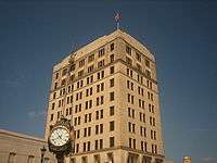
Wide View of Downtown Alexandria | |
| Nickname(s): Alex (typically pronounced Ellic) | |
 Alexandria, Louisiana  Alexandria, Louisiana Location of Alexandria in Louisiana | |
| Coordinates: 31°17′34″N 92°27′33″W / 31.29278°N 92.45917°WCoordinates: 31°17′34″N 92°27′33″W / 31.29278°N 92.45917°W | |
| Country | United States |
| State | Louisiana |
| Parish | Rapides |
| Incorporated | 1818 |
| City Charter | 1882 |
| Government | |
| • Mayor | Jacques Roy (D) |
| Area | |
| • City | 27.0 sq mi (70 km2) |
| • Land | 26.4 sq mi (68 km2) |
| • Water | 0.6 sq mi (2 km2) |
| Elevation | 75 ft (23 m) |
| Population (2010) | |
| • City | 47,723 |
| • Density | 1,800/sq mi (680/km2) |
| • Metro | 153,922 |
| Time zone | CST (UTC-6) |
| • Summer (DST) | CDT (UTC-5) |
| ZIP codes | 71301-03, 06–07, 09, 11, 15 |
| Area code(s) | 318 |
| Phone Number Prefixes | 201, 290, 308, 420, 427, 441–443, 445, 448, 449, 473, 483, 484, 487, 542, 561, 619, 767, 769, 787, 880 |
| Website |
www |


_with_Alexandria_City_Hall_in_background_IMG_4314.JPG)
Alexandria is a city in and the parish seat of Rapides Parish, Louisiana, United States.[1] It lies on the south bank of the Red River in almost the exact geographic center of the state. It is the principal city of the Alexandria metropolitan area (population 153,922) which encompasses all of Rapides and Grant parishes. Its neighboring city is Pineville. In 2010, the population was 47,723, an increase of 3 percent from the 2000 census.[2]
History
Located along the Red River, the city of Alexandria was originally home to a community which supported activities of the adjacent Spanish outpost of Post du Rapides. The area developed as an assemblage of traders and merchants in the agricultural lands bordering the mostly unsettled areas to the north and providing a link from the south to the El Camino Real and then larger settlement of Natchitoches, the oldest permanent settlement in the Louisiana Purchase.
Alexander Fulton, a businessman from Washington County, near Pittsburgh, Pennsylvania, received a land grant from Spain in 1785, and the first organized settlement was made at some point in the 1790s. In 1805, Fulton and business partner Thomas Harris Maddox laid out the town plan and named the town in Fulton's honor. The earliest deed that survives, for an Alexandria resident is from June 24, 1805 when a William Cochren who identifies himself as a "of the Town of Alexandria" sold a tract of land across the Red River to a William Murrey.[Louisiana State Land Office, Historical Records, Sales Documents, South Western District, Sales Letters, 39].
That same year Fulton was appointed coroner in Rapides Parish by territorial Governor William C.C. Claiborne.[3] Alexandria was incorporated as a town in 1819 and received a city charter in 1832.[4]
The Civil War in Alexandria
In the spring of 1863, Alexandria was occupied by Union forces under the command of Admiral David Dixon Porter and General Nathaniel P. Banks. Porter arrived with his gunboats on May 7. Later in the day Banks reached Alexandria with his cavalry, whose members had marched twenty-five miles to reach the city that day. According to the historian John D. Winters of Louisiana Tech University, Porter disliked Banks but nevertheless turned over Alexandria to him and then departed to rejoin General U.S. Grant at the ongoing siege of Vicksburg, Mississippi. Banks posted guards and declared martial law. Porter left behind the gunboat USS Lafayette in Alexandria and posted the USS Pittsburg on the Black River to the northeast.[5]
In 1864, Admiral Porter, back in the area, and General Banks quarreled over possession of cotton supplies. Porter seized three hundred bales of Confederate cotton from various warehouses in Alexandria and stamped it "U.S.N. prize", referring to the United States Navy. Porter sent his sailors into the country to search for unginned cotton. After the crop was located, it was brought to Alexandria to be ginned and baled. The sailors also seized molasses and wool. Winters writes that Porter "took all cotton wherever he found it, cotton belonging to the Confederate government, cotton belonging to the 'rebels,' and cotton belonging to 'loyal' citizens."[6]
Winters continues: "Banks was furious with Porter when he learned that the admiral was scouring the interior for cotton. Since he had no authority to stop Porter's speculative activities, Banks could only try to beat him to the remaining cotton. Army wagons were sent out in large numbers to collect the cotton. Thousands of bales were brought in by the troops and stored for future shipment. Jealous of the abundant transportation facilities of the army, unprincipled navy men stole army wagons and teams at night, repainted the wagons, and branded the mules with navy initials, and dove deep in the country in search of cotton. . . . "[7]
The federal army made itself as comfortable as possible during its long stay in Alexandria. Winters writes that "lumber and tools were foraged, and the men busied themselves by building wooden tent floors, benches, and furniture. . . . Alexandria [was enclosed] with a zigzag line of fortifications."[8] While Banks remained in Alexandria in the spring of 1864, Porter was temporarily trapped north of the city because of the low level of the Red River, four feet instead of the needed seven feet to accommodate gunboats.[9]
Confederate citizens as a whole were most fearful of the Union. According to Winters, "most [Confederates] had never before seen a Yankee soldier [and] expected the worse from the invader. . . . 'Some cried, some cursed, some whined; and some overcome with fear, hid themselves in the woods, leaving everything to the tender mercies of the army.' Negroes were responsible for much of the plunder and pillage. Negro camp followers and officers' servants roamed the plantations and small farms without hindrance, bringing in their booty to camps each afternoon. . . . "[10]
On May 13, 1864, when the Union decided to abandon Alexandria, the city was set afire despite General Banks' order to the contrary. Winters reports that "burning and plundering" by two Union corps, who set fire to a store on Front Street. Then "a strong wind spread the flames rapidly from one building to the next."[11] Banks later claimed that the fire "broke out in the attic of one of the buildings on the levee inhabited by either soldiers or refugees."[12] Winters reports that "pandemonium reigned; frightened cows bellowed and charged through the flaming streets; squawking chickens with scorched wings tried to fly out of danger. Hundreds of women, children, and old people ran through the streets, trying to carry a few of their belongings to safety. When the heat became unbearable, they dropped their loads and fled to the levee. Thieves ran from house to house and even along the levee taking whatever they wanted from the shocked people. By noon the most congested parts of town were destroyed. An attempt to blow up a church in the path of the fire only succeeded in helping to spread the flames. . . . "[12]
Alexandria faced the overwhelming task of rebuilding with a year of the war remaining. Prices became exorbitant; butter cost $10 a pound, bacon $5 a pound, flour $3 a pound, and a bushel of meal $10. Many of the helpless lived in the forest without food, shelter, or clothing, subsisting on blackberries. All clothing was homespun, and shoes were mostly made of cloth.[13] While Admiral Porter expressed sympathy for the suffering Alexandria residents, he declared the "burning of Alexandria a fit termination of the unfortunate Red River expedition."[12]
Geography and climate
Alexandria is located at 31°17′34″N 92°27′33″W / 31.29278°N 92.45917°W[14] and has an elevation of 75 feet (22.9 m).[15]
According to the United States Census Bureau, the city has a total area of 27.0 square miles (69.9 km2). 26.4 square miles (68.4 km²) of it is land and 0.6 square miles (1.5 km²) of it (2.15%) is water.


Alexandria is on a level plain in the center of the Louisiana Longleaf Pine forests, in which pine is interspersed with various hardwoods. A number of small bayous, such as Bayou Rapides, Bayou Robert, and Hynson Bayou, meander throughout the city. In the immediate vicinity of the city, cotton, sugar, alfalfa, and garden vegetables are cultivated.
The climate is humid subtropical with some continental influence in the winter. Summers are consistently hot and humid, whereas winters are mild, with occasional cold snaps. On average, the first freeze occurs in early to mid November and the last freeze occurs in early to mid March. The area receives plentiful rainfall year-round, with thunderstorms possible throughout the year. Some storms can be severe, especially during the spring months. According to 'Cities Ranked and Rated' (Bert Sperling and Peter Sander), Alexandria reports an average of 69 days per year with thunder reported. This is nearly double the national average. Snowfall is rare, with measurable snow having occurred 27 times since 1895. The heaviest snowfall event took place February 12–13, 1960 when 9.1" of snow fell.[16][17][18]
Tropical storms and hurricanes do impact Alexandria from time to time, but rarely cause severe damage, unlike areas closer to the coast. In September 2005 Hurricane Rita affected Alexandria and surrounding areas, causing widespread power outages and damaging the roofs of some structures. The most recent hurricane, Gustav, caused widespread flooding, knocked over trees and power lines leading to power outages, and damaged structures. Some low-lying Alexandria neighborhoods experienced substantial flooding from Gustav with several feet of water in houses.
| Climate data for Alexandria, Louisiana, 1981–2010 normals | |||||||||||||
|---|---|---|---|---|---|---|---|---|---|---|---|---|---|
| Month | Jan | Feb | Mar | Apr | May | Jun | Jul | Aug | Sep | Oct | Nov | Dec | Year |
| Record high °F (°C) | 87 (31) |
88 (31) |
93 (34) |
98 (37) |
99 (37) |
106 (41) |
109 (43) |
108 (42) |
109 (43) |
98 (37) |
89 (32) |
85 (29) |
109 (43) |
| Average high °F (°C) | 59.0 (15) |
62.7 (17.1) |
70.0 (21.1) |
77.3 (25.2) |
84.5 (29.2) |
90.2 (32.3) |
92.8 (33.8) |
93.3 (34.1) |
88.6 (31.4) |
79.6 (26.4) |
69.6 (20.9) |
60.7 (15.9) |
77.36 (25.2) |
| Daily mean °F (°C) | 48.5 (9.2) |
52.1 (11.2) |
59.3 (15.2) |
66.4 (19.1) |
74.5 (23.6) |
80.7 (27.1) |
83.2 (28.4) |
83.2 (28.4) |
78.0 (25.6) |
68.0 (20) |
58.6 (14.8) |
50.2 (10.1) |
66.9 (19.4) |
| Average low °F (°C) | 38.1 (3.4) |
41.6 (5.3) |
48.6 (9.2) |
55.5 (13.1) |
64.4 (18) |
71.1 (21.7) |
73.6 (23.1) |
73.1 (22.8) |
67.4 (19.7) |
56.4 (13.6) |
47.5 (8.6) |
39.9 (4.4) |
56.4 (13.6) |
| Record low °F (°C) | 4 (−16) |
3 (−16) |
22 (−6) |
31 (−1) |
38 (3) |
50 (10) |
57 (14) |
55 (13) |
40 (4) |
27 (−3) |
20 (−7) |
7 (−14) |
3 (−16) |
| Average precipitation inches (mm) | 5.44 (138.2) |
5.21 (132.3) |
5.30 (134.6) |
4.55 (115.6) |
4.72 (119.9) |
5.14 (130.6) |
4.39 (111.5) |
4.11 (104.4) |
3.93 (99.8) |
5.26 (133.6) |
6.19 (157.2) |
6.24 (158.5) |
60.37 (1,533.4) |
| Average precipitation days (≥ 0.01 in) | 9.6 | 8.6 | 8.1 | 6.1 | 7.8 | 9.6 | 8.6 | 8.3 | 6.9 | 7.1 | 7.6 | 9.3 | 97.6 |
| Source: NOAA[19] NOAA[20] | |||||||||||||
Demographics
| Historical population | |||
|---|---|---|---|
| Census | Pop. | %± | |
| 1840 | 814 | — | |
| 1850 | 672 | −17.4% | |
| 1860 | 1,461 | 117.4% | |
| 1870 | 1,218 | −16.6% | |
| 1880 | 1,800 | 47.8% | |
| 1890 | 2,861 | 58.9% | |
| 1900 | 5,648 | 97.4% | |
| 1910 | 11,213 | 98.5% | |
| 1920 | 17,510 | 56.2% | |
| 1930 | 23,025 | 31.5% | |
| 1940 | 27,066 | 17.6% | |
| 1950 | 34,913 | 29.0% | |
| 1960 | 40,279 | 15.4% | |
| 1970 | 41,811 | 3.8% | |
| 1980 | 51,648 | 23.5% | |
| 1990 | 49,188 | −4.8% | |
| 2000 | 46,342 | −5.8% | |
| 2010 | 47,723 | 3.0% | |
| Est. 2015 | 47,889 | [21] | 0.3% |
| U.S. Decennial Census | |||
As of the census[22] of 2010, there were 47,723 people, 17,816 households, and 11,722 families residing in the city. The population density was 1,754.6/sq mi(677.5/km²). There were 19,806 housing units at an average density of 749.9 per square mile(289.6/km²). The racial makeup of the city was 50.75% White, 40.60% Black, 1.25% Native American, 1.85% Asian, 0.14% Pacific Islander, 1.03% from other races, and 1.09% from two or more races. 6.98% of the population were Hispanic or Latino of any race.
There were 17,816 households out of which 31.9% had children under the age of 18 living with them, 38.5% were married couples living together, 23.2% had a female householder with no husband present, and 34.2% were non-families. 30.4% of all households were made up of individuals and 12.1% had someone living alone who was 65 years of age or older. The average household size was 2.50 and the average family size was 3.13.
In the city the population was spread out with 28.1% under the age of 18, 9.2% from 18 to 24, 26.2% from 25 to 44, 21.4% from 45 to 64, and 15.1% who were 65 years of age or older. The median age was 36 years. For every 100 females there were 83.5 males. For every 100 females age 18 and over, there were 77.7 males.
The median income for a household in the city was $26,097, and the median income for a family was $31,978. Males had a median income of $29,456 versus $20,154 for females. The per capita income for the city was $16,242. About 23.2% of families and 27.4% of the population were below the poverty line, including 37.7% of those under age 18 and 18.5% of those age 65 or over.
Religion


Like many other southern cities, the largest single church denomination in the Alexandria area is Southern Baptist. Large congregations include Emmanuel Baptist Church downtown on Jackson Street and Calvary Baptist off Jackson Street Extension. Alexandria is headquarters too of the Louisiana Baptist Convention. A significant Roman Catholic population is also present,[23] a result of the large Catholic Acadian French population which resides in and around Alexandria, many from neighboring Avoyelles Parish. Alexandria is the headquarters for the Diocese of Alexandria, Louisiana, which is headed by Bishop Ronald Herzog
Alexandria also has a significant number of Methodists, Presbyterians, and Episcopalians. There is a large number of Pentecostals too. Alexandria has a small, though active Jewish community which dates back to the mid-19th century. Jews have consistently been leaders in government, civic organizations, education, and medicine. The long-time Alexandria City Council member, Harry B. Silver, is Jewish. From 1973 to 1977, another Jew, Arnold Jack Rosenthal, was the last commissioner of finance and utilities under the previous commission form of municipal government. At one time, many large businesses in the downtown werer Jewish-owned, with stores including: Wellan's, Caplan's, Bialy's, Weiss & Goldring, and Schwartzberg's. The Jewish community in Alexandria maintains two synagogues, which are approximately two blocks apart: Congregation Gemiluth Chassodim (Reform) and B'nai Israel Traditional Synagogue (Conservative).
Annual cultural events and festivals
Mardi Gras
As Alexandria is at the cusp of Cajun culture's extension to the north, the city recognizes Mardi Gras as an official holiday. The annual Mardi Gras Krewes Parade – occurring on the Sunday before Mardi Gras – on Texas Avenue is a major cultural festivity in the area. Boasted as a true family oriented event, parade goers can enjoy over 20 New Orleans style floats, high school and college marching bands, as well as appearances by local celebrities. In addition to the main Sunday parade, the College Cheerleaders & Classic Cars Parade, which recently was established in 2008, takes place downtown on the Friday before Mardi Gras, the Children's Parade as well takes place downtown on the Saturday before Mardi Gras, and the Krewe of Provine Parade which occurs on Fat Tuesday itself down Coliseum Boulevard. All the events are organized by the Alexandria Mardi Gras Association. The Krewe Parade can attract from 120,000 to 150,000; the Children's parade, up to 40,000 to 50,000, and the College Cheerleaders & Classic Cars, about 5,000 to 15,000 people.[24]
Cenlabration
Begun in the late 1980s, Cenlabration[25] was one of the largest festivals in Central Louisiana (Cenla). The name comes from Central Louisiana ("LA") Celebration, and reflects local culture and heritage, as well as serving as a means of celebrating Labor Day as the end of summer.
As many as three stages support a particular type of music, including Cajun and zydeco, blues and jazz, and Country music. In addition there are arts and crafts booths for local artists to sell their wares. In the Children's Village, children can participate in arts and crafts, listen to storytellers, play games with clowns, or watch a play. The festival has plenty of carnival rides available as well. Cenlabration ends with a large fireworks display.
RiverFest
In 2002, representatives of local government, businesses, organizations, and community formed the nonprofit organization River Cities Cultural Alliance, Inc. to promote tourism and the arts through a celebration of Central Louisiana’s diverse cultural heritage. The nonprofit served to organize and put on RiverFest: Heritage and Arts on the Red. More than ten thousand festival-goers attending the event.
RiverFest was held in downtown Alexandria and on the Alexandria and Pineville levees. The festival features the work of visual artists from across the South, food booths exemplifying southern cuisine, a variety of children’s activities, three outdoor stages with a wide range of music, dance, and theatrical performances, and a literary component with readings and panel discussions by Louisiana authors and scholars.
RiverFest was canceled in 2007.
Museums
_in_Alexandria%2C_LA_IMG_4277.JPG)
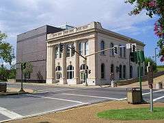
The Alexandria Museum of Art was founded in 1977 and occupies an historic Rapides Bank Building on the banks of the Red River. The building was constructed built c. 1898 and is listed on the National Historic Register. It opened to the public in March 1998. In 1998, the Alexandria Museum of Art expanded and constructed its grand foyer and offices as an annex to the Rapides Bank Building. In 1999, the Alexandria Museum of Art was honored as an Outstanding Arts Organization in the Louisiana Governor's Arts Awards. In 2007, the Alexandria Museum of Art entered into a collaborative endeavor agreement with Louisiana State University of Alexandria (LSUA). The Alexandria Museum of Art now also serves as a downtown campus for LSUA classes, and is host to multidisciplinary community events, including concerts and recitals, lectures, yoga classes, Second Saturday Markets, and Museum Afterhours.
The Louisiana History Museum is located downtown on the bottom floor of the former library. A small facility, it showcases the history of all Louisiana, with emphasis on the central portion of the state, Rapides Parish, and Alexandria. Major exhibit areas concern Native Americans, Louisiana geography, politics, health care, farming, and the impact of war.
The T.R.E.E. House Children's Museum and Arna Bontemps African American Museum are located within the Cultural Arts District.
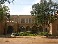
The Kent Plantation House in Alexandria, completed by 1800, was located on a Spanish land grant. It is the oldest standing structure in Central Louisiana, one of only two buildings in the city to survive the burning of 1864 by Union troops fleeing after having been defeated at the Battle of Mansfield in DeSoto Parish. The house has been moved from its original location but still stands on part of the first land grant. It is open for tours daily except Sundays at 9, 10, and 11 a.m. and 1, 2, and 3 p.m. The tour is led by costumed docents and includes the house furnished in period pieces, some belonging to the original family, and all nine outbuildings, including an 1840-50s sugar mill, blacksmith shop, barn, two slave cabins, open-hearth kitchen, and milk house.
Performing arts
The performing arts are centered in the Alexandria Cultural Arts District in the downtowna. Located within a few blocks of each other are three performance venues: Coughlin-Saunders Performing Arts Center, the Hearn Stage, and the Riverfront Amphitheater.
The Coughlin-Saunders Performing Arts Center is the home of the Rapides Symphony Orchestra, which has performed in Alexandria since 1968. The center hosts the Performing Arts Series of the Arts Council of Central Louisiana, the Red River Chorale (an auditioned community chorus), and presentations of numerous local theater groups. The land for the center was donated by The Alexandria Town Talk newspaper, owned by the Gannett Company of McLean, Virginia.
Businesswoman Jacqueline Seagall Caplan (1935-2016) was the president of the Arts Council of Central Louisiana and the chairman of the group's executive committee when the Coughlin-Saunders Performing Arts Center opened in 2004. She predicted that Coughlin-Saunders would in time "provide a place people can point to and say it's theirs. ... [Until now], we've never had a performing arts center where every type of performing art can come."[26]
The Hearn Stage is a black box theater for smaller productions. The Arts Council provides day-to-day management of both the Coughlin-Saunders Center and the Hearn Stage.[27]
The Riverfront Aamphitheater hosts each April a "azz on the River"music festival, sponsored by the Arna Bontemps African American Museum. The Rapides Symphony holds an annual fall Pops concert in the amphitheater. In recent years, the amphitheater has welcomed musical guests in conjunction with the springtime Dragonboat Races sponsored by the Alexandria Museum of Art.
The spring and fall seasons also feature Downtown Rocks, a free outdoor concert series in nearby Fulton Park.
Sports


Alexandria is home to the Alexandria Aces, a summer college league team. The Aces were champions in various leagues in 1997, 1998, 2006, and 2007. They play their home games at Bringhurst Field. The remaining games of the 2013 season were cancelled in mid-July because of low attendance, which averaged fewer than two hundred per game.[28]
Alexandria is also home to the Cenla Derby Dames, a roller derby team that operates under the Women's Flat Track Derby Association. The Dames play their home games at the Rapides Parish Coliseum.
Nearby is Bringhurst Golf Course, popularly known as "the nation's oldest par three course." A full-scale renovation was completed in mid-2010. In addition to Bringhurst, named for the late industrialist R.W. Bringhurst, Alexandria is home to four other golf courses: Oak Wing, The Links on the Bayou, at LSUA, and Alexandria Golf and Country Club.
Alexandria once had a minor league ice hockey team, the Alexandria Warthogs. They played their home games at the Rapides Parish Coliseum.
There was also a semi-pro football team, the Louisiana Rapides Rangers, who played their home games at the Rapides Parish Coliseum. They played in the Central District of the Southern American Football League, and the Southern Conference of the National Indoor Football League (NIFL). The team was owned by a Lafayette business group before moving in 2003 to Beaumont, Texas.
In 1974, a Little League team from Alexandria won the Louisiana state championship.
Alexandria is also home to the U-14 Crossroads Pride soccer team. They won the 2012 Louisiana Soccer Association State Cup.
Notable people
- Anna Margaret — singer, actress
- Morris N. Abrams — educator
- Emmanuel Arceneaux - Canadian football player for the B.C. Lions
- Jay Aldrich — Major League Baseball player
- John Ardoin — music critic for The Dallas Morning News
- Louis Berry — first African-American to practice law in Alexandria; civil rights advocate
- Al Bolton — television and radio meteorologist from Shreveport; born and reared in Alexandria
- George Washington Bolton — businessman, banker, politician, Southern Baptist figure, patriarch of the Bolton family
- James W. Bolton — banker and politician; namesake of Bolton High School
- James Calderwood Bolton — banker; library at Louisiana State University in Alexandria bears his name
- Peggy Bolton — civic and community leader
- Robert H. Bolton — banker and civic figure
- Arna Bontemps — African American poet and member of Harlem Renaissance
- W. George Bowdon, Jr. — mayor from 1953 to 1969
- Thomas "Bud" Brady — state representative (1976-1988) from La Salle Parish; thereafter a real estate appraiser in Alexandria[29]
- Bubby Brister — Quarterback Pittsburgh Steelers, Philadelphia Eagles, New York Jets, Denver Broncos, and Minnesota Vikings[30]
- Markel Brown - guard for Brooklyn Nets
- George A. Burton - Republican Party pioneer, last finance commissioner in Shreveport; spent boyhood years in Alexandria[31]
- Edgar Cason — businessman and philanthropist, former Alexandria resident
- Carl B. Close — state representative (1944-1947) and mayor of Alexandria (1947-1953)
- Luther F. Cole — associate justice of the Louisiana Supreme Court from 1986 to 1992, former state representative from East Baton Rouge Parish; born in Alexandria[32]
- Clifford Ann Creed — golfer; winner of eleven LPGA Tour events
- William F. Cotton — once one of the oldest US World War I veterans
- Ed Cullen — Baton Rouge Morning Advocate columnist, National Public Radio essayist and author
- Robert C. Culpepper - state senator for Jackson and Ouachita parishes, 1908-1912; judge of the Alexandria-based 9th Judicial District Court, 1924 to 1942
- William A. Culpepper - Judge for one term on the 9th Judicial District Court and twenty-two years on the Louisiana Court of Appeal for the Third Circuit, Alexandria native who spent later years in Little Rock, Arkansas[33]
- Israel "Bo" Curtis - African-American Democrat member of the Louisiana House of Representatives from District 26 from 1992 to 2008[34]
- Paul M. Davis, Jr. — orthopedic surgeon and real estate developer
- Nelder Dawson — newspaper executive
- Cleveland Dear — U.S. representative from 1933 to 1937, district attorney, and state district court judge
- Virginia deGravelles — Republican national committee member
- Helen Derr — journalist, co-founder of Friendship House of Alexandria
- Herbert B. Dixon - member of the Louisiana House of Representatives from District 26 (2008-2014) and member of the Rapides Parish School Board from District D (1992-2008)
- C. H. "Sammy" Downs - attorney and politician
- Jam Downs — retiring district attorney of the Louisiana 9th Judicial District, son of C. H. Downs
- Samuel Dunbar - businessman[35]
- B.G. Dyess — Minister and state senator from 1996 to 2000
- Sue Eakin — historian, professor, journalist
- Mike Edmonson — superintendent of the Louisiana State Police since 2008
- James R. Eubank - Alexandria lawyer; member of the Louisiana House of Representatives for Rapides Parish in 1952; died in office at the age of thirty-seven[36]
- Jimmy Faircloth - lawyer in Alexandria-Pineville, former executive counsel to Governor Bobby Jindal[37]
- George M. Foote — Alexandria city judge from 1955 to 1985
- Eugene Wilton Frémaux — businessman
- Howard B. Gist, Jr. — city attorney under three mayoral administrations prior to 1973
- H. N. Goff - state representative from Rapides Parish, 1952-1956; insurance agent in Alexandria
- R. W. "Buzzy" Graham — state representative from Rapides Parish, 1968-1972; insurance agent in Alexandria[38]
- Camille F. Gravel, Jr. — attorney and politician
- Lawrence Preston Joseph Graves — Roman Catholic bishop of Alexandria from 1973 to 1982
- Charles Pasquale Greco — Roman Catholic bishop of Alexandria from 1946 to 1973
- Jeff Hall - state representative for District 26 in Rapides Parish since 2015
- Lance Harris — District 25 state representative
- Malcolm Hebert — last Alexandria streets and parks commissioner from 1973 to 1977[39]
- Charles R. Herring - former Alexandria chiropractor who served in the Louisiana House of Representatives from Rapides Parish from 1988 to 1992[40]
- Gary Lee Jones - Rapides Parish school superintendent, 2003-2012; member of the Louisiana Board of Elementary and Secondary Education since 2016; Alexandria resident
- Ed Karst — Alexandria mayor from 1969 to 1973
- Catherine D. Kimball — former Chief Justice of the Louisiana Supreme Court
- Maxie Lambright - football coach for Louisiana Tech University, 1967-1978; coached at Bolton High School in Alexandria, 1955 to 1958[41]
- Carroll E. Lanier — mayor of Alexandria from 1977 to 1982
- Swords Lee, timber owner from Pollock; resided in Alexandria, 1904 until his death in 1929; former Grant Parish assessor and state representative[42]
- F.A. Little, Jr. — retired judge of the United States District Court for the Western District of Louisiana
- George S. Long — former U.S. representative
- Gillis William Long — former U.S. representative
- Bobby Lowther - only two-sport (basketball and track and field) All-America team player at Louisiana State University; resided in Alexandria[43]
- Jay Luneau - lawyer and state senator, effective January 2016
- Gerald Archie Mangun — late pastor of the Pentecostal Church, the largest congregation in Alexandria
- Roy O. Martin, Jr. — timber businessman and philanthropist[44]
- Rod Masterson — actor[45]
- Patrick McCauley — journalist, born in Alexandria in 1927; edited The Huntsville Times in Huntsville, Alabama, 1966-1994[46]
- James M. McLemore — wealthy cattleman and auction barn owner who ran for governor in both 1952 and 1956; Alexandria resident and native of Coushatta in Red River Parish
- DeWitt T. Methvin, Jr. — Alexandria attorney from 1950 until his death in 2005, Alexandria native reared in Castor in Bienville Parish
- Mildred Methvin — former United States Magistrate Judge of the Western District of Louisiana, based in Lafayette; native of Alexandria
- Myrtis Methvin — mayor of Castor from 1933 to 1955, second woman mayor in Louisiana; Alexandria resident in the 1920s
- Warren Morris — Major League Baseball player
- Craig Nall — National Football League player
- John Travis Nixon - Journalist in Alexandria c. 1890 who later was publisher of what became The Monroe News-Star and The Crowley Post Signal[47]
- J. Tinsley Oden — mathematician
- Ethma Odum — pioneer woman television personality at KALB-TV[48]
- Larry Parker - state representative for Rapides Parish from 1964 to 1968; coin merchant in Alexandria[49]
- Leverne Perry (1932-2016), host of KALB-TV's Leverne Perry and the Little Wranglers from 1960 to 1966, owner of an Alexandria shoe store, member and former president of the Rapides Parish Police Jury, rodeo enthusiast, and the executive director of the Louisiana Quarter Horse Breeders Association, a post which he assumed in 1987.[50]
- Juan Pierre — Major League Baseball player
- Elton C. Pody — President of the Central Louisiana Chamber of Commerce, 1991 until his death in 2011; former mayor of Ruston, Louisiana
- Ed Rand — state representative from 1960 to 1964
- Ned Randolph — state representative from 1972 to 1976; state senator from 1976 to 1984; mayor from 1986 to 2006
- Francis Xavier Ransdell — Louisiana 6th Judicial District Court judge, 1900-1936
- Joseph E. Ransdell — U.S. Senator from Louisiana, 1913-1931
- Donald Rawson — historian at Northwestern State University; relocated to Alexandria in last year of his life
- Sterling Ridge — Arizona legislator
- Arnold Jack Rosenthal — last city commissioner of finance and utilities
- Jacques Roy — mayor of Alexandria since 2006
- Alvin Benjamin Rubin — federal judge, 1966-1991
- Bill Schroll — National Football League player
- Jock Scott — state representative, attorney, professor
- William Tecumseh Sherman — first superintendent; Louisiana State Seminary of Learning & Military Academy (later to become LSU)
- Don Shows — former football coach at Alexandria Senior High School
- Russ Springer — Major League Baseball player for 18 years
- John K. Snyder — mayor from 1973 to 1977; 1982 to 1986
- David Theophilus Stafford — Rapides Parish sheriff from 1888 to 1904
- Grove Stafford, Sr. — Alexandria lawyer and state senator from 1940 to 1948
- Leroy Augustus Stafford — planter and Confederate brigadier general mortally wounded in the Battle of the Wilderness in 1864
- Ed Tarpley — attorney and politician
- Lloyd George Teekell — state representative from 1953-1960 and 9th Judicial District Court judge from 1979 to 1990
- Jeff R. Thompson — former state representative for Bossier Parish; judge of the 26th Judicial District Court since 2015; born in Alexandria in 1965
- Morgan W. Walker, Sr. — head of the southern division of Continental Trailways
- Regnal Wallace, Louisiana farm broadcaster of radio and television, was a sportscaster at KALB-TV in Alexandria from 1962 to 1969.[51]
- Ed Ware - District attorney for Rapides Parish, 1967-1984[52]
- Muse Watson — actor
- James Madison Wells — 19th century governor of Louisiana
- Joanne Lyles White — humanitarian, philanthropist; founder and first president of the Louisiana Speech League
- J. Robert Wooley — Louisiana insurance commissioner from 2000 to 2006, was reared in Alexandria, where his father was a principal at the Louisiana Special Education Center there.[53]
Media
Newspapers

Established March 17, 1883, The Alexandria Town Talk is a daily newspaper for Alexandria-Pineville and the thirteen parishes which comprise central Louisiana. The newspaper was owned by the family of the late Jane Wilson Smith and Joe D. Smith, Jr., until March 1996, when it was sold to Central Newspapers. In August 2000, the Gannett Company acquired the Central Newspapers properties, including The Town Talk. The name of the paper on its inaugural issue was the Alexandria Daily Town Talk. Although it has since been shorted to the current The Town Talk, it is still frequently referred to by long-time residents as the Daily Town Talk.
Key officers include: Publisher William "Ed" Humphrey; Executive Editor Paul V. Carty; Advertising Director William "Bill" Heirtzler; and Assistant Managing Editors John Marcase and Richard Powell Sharkey.
Television
Alexandria is served by local television stations KALB-TV (NBC / CBS), WNTZ (Fox), KLAX-TV (ABC), KLPA (PBS/LPB), and KBCA (The CW). KALB is the oldest television station in central Louisiana.
Alexandria is the location of the pawn shop in the show Cajun Pawn Stars on the History Channel.
Radio
Local radio stations
AM broadcasting
FM broadcasting
- KAYT 88.1 - Urban adult contemporary
- KLXA 89.9 - Christian contemporary / K-LOVE
- KLSA 90.7 - Public radio / Red River Radio
- KAPM 91.7 - American Family Radio
- KQID-FM 93.1 - Top 40/CHR
- KMXH 93.9 - Urban adult contemporary
- KZMZ 96.9 - Classic rock
- KKST 98.7 - Urban contemporary
- KRRV-FM 100.3 - Mainstream country
- KBCE 102.3 - Rhythmic contemporary
- KLAA-FM 103.5 - Mainstream country
- KEZP 104.3 - Christian adult contemporary
- KBKK 105.5 - Classic country
- KEDG 106.9 - Adult contemporary
Translate broadcasting
Low-power broadcasting
Digital broadcasting
Parks and outdoor attractions
_Zoo_Picture_299.jpg)
Alexandria Zoological Park
The Alexandria Zoological Park is a 33-acre (13 ha) zoo first opened to the public in 1926. Owned by the City of Alexandria and operated by the Division of Public Works, it is home to about 500 animals and includes an award-winning Louisiana Habitat exhibit. Much of the credit for the quality of the zoo has been given to Robert Leslie Whitt (1951–2008), who served as director for 34 years prior to his death. Whitt was hired in 1974 by then Streets and Parks Commissioner Malcolm Hebert. The zoo is accredited by the Association of Zoos and Aquariums (AZA) and takes part in about 20 Species Survival Plans (SSP) as part of its conservation efforts.
Cotile Lake Recreation Area
Cotile Lake is a man-made impoundment located in the uplands approximately 15 miles (24 km) west-northwest of Alexandria, Louisiana. The lake is approximately 1,775 acres (7 km2) in size and was completed in October 1965. The Louisiana Wild Life and Fisheries Commission stocked this impoundment with the proper species and number of game fish in 1965–66 shortly after its completion date. The recreational facilities include a large area cleared and zoned for swimming with complete bath house facilities nearby. There is a water skiing area that is cleared and snagged for safety of the skiers. The picnic and camping areas are modern and complete. There is also space available for campers.
Indian Creek Lake and Recreation Area
Encompasses a 2,250-acre (9 km2) lake, 100 acres (0.4 km2) of developed recreation facilities and a 250 acres (1.0 km2) primitive camping area all within the Alexander State Forest. The lake, located in central Louisiana, was constructed as a joint venture of the Louisiana Forestry Commission, the Rapides Parish Police Jury, and the Lower West Red River Soil and Water Conservation District as a reservoir for agricultural irrigation in times of need and for recreation purposes.
The recreation area camping area contains 109 campsites with conventional full utility hookups, 3 beaches for swimming, bath houses, a boat launch, and 75 picnic sites. A covered pavilion within the developed area provides for groups up to 100 people. The recreation area is open year round and operates on user fees.
Kisatchie National Forest
Alexandria sits in the middle of the Kisatchie National Forest. Ranger districts are north, northwest, west and southwest of the city. An abundance of large timberlands and forest nurseries, as well as lake and recreation areas, are within a short driving distance.
Other points of interest


- Alexandria Memorial Gardens – large cemetery on U.S. Highway 165 south. Other cemeteries are also available in Pineville.
- Alexandria Levee Park – a park located downtown, adjacent to the Red River, that serves as the grounds for some local festivals. It contains an amphitheatre that is used for concerts.
- Alexandria Mall – the local shopping mall located on Masonic Drive, established 1973
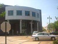
- Alexandria Riverfront Center – convention center located downtown
- Bringhurst Field – home of the Alexandria Aces
- Bringhurst Park – contains the Alexandria Zoo, Bringhurst Field, a playground, a golf course and tennis courts
- Inglewood Plantation – plantation located south of Alexandria
- Kent Plantation House – French colonial plantation house
- Masonic Home – a now defunct orphanage in south Alexandria completed in 1924.
- Rapides Parish Coliseum – a multi-purpose arena used for sporting events, conventions and other events
- Turner Street YMCA - With two pools, a full-size gymnasium, and a workout room, the Turner Street YMCA opened in 1967. On March 31, 2014, the facility closed indefinitely because of a lack of donations, including the loss of $4,000 per month from the United Way of America. A YMCA branch at Alexandria City Park remains open with an after-school program. A third YMCA facility on Scott Street downtown closed in November 2013.[54] On June 8, 2014, it was disclosed that YMCA will take possession of the YMCA and re-open the facility.[55]
Military
Louisiana National Guard
Alexandria is home to both Headquarters and Company B of the 199th Brigade Support Battalion (BSB). The 199th BSB is the logistical component of the 256th Infantry Brigade that served in Operation Iraqi Freedom from October 2004 until September 2005. The 199th BSB provides supply and transportation (Company A), medical (Company C) and maintenance (Company B) support and services that keep the 256th Brigade operational. The battalion also has units located in Jonesboro, Winnfield, Colfax, and St. Martinville, Louisiana.
England Air Force Base
Alexandria served as the home of England Air Force Base from its origins as an emergency airstrip for Esler Regional Airport until its closure. England AFB was officially closed on December 15, 1992, pursuant to the Defense Base Closure and Realignment Act (Public Law 101-510) and recommendations of the Defense Secretary's Commission on Base Realignment and Closure.[56] The base now serves as Alexandria International Airport (see below).
Economy
At the time of the 2000 census, the per capita income in Alexandria was $16,242, compared with $21,587 nationally. The Alexandria workforce consists of about 55,000 residents.[57] Union Tank Car Company has recently located a plant northwest of Alexandria near the airport creating hundreds of jobs. Expansions at the Procter & Gamble plant and the construction of a PlastiPak plant in nearby Pineville have also created a number of new jobs for the area. Sundrop Fuels Inc., a Colorado-based biofuels start-up, plans to construct an over 1,200 acre plant just northwest of Alexandria in Rapides Station area. The facility will serve as the headquarters for the company because aside from the plant itself, Sundrop has also bought Cowboy Town, an abandon entertainment venue that sits inside the surrounding land that was purchased, to house their offices and their maintenance and fabrication operations.[58]
In 2007, Inc. Magazine rated Alexandria as the 77th best place in which to conduct business out of the 393 U.S. cities ranked, a significant increase from its ranking as No. 276 in 2006. Among other Louisiana cities, Alexandria ranked second, following only Baton Rouge, which ranked 59th nationally.[59]
Healthcare


Alexandria is home to two major hospitals: Rapides Regional Medical Center, a former Baptist hospital is located downtown. Christus St. Frances Cabrini Hospital was opened in 1950 and is located at the corner of Masonic Drive and Texas Avenue. Both hospitals have undergone expansion.
Additionally, located just across the Red River in Pineville, the Veteran's Affairs Medical Center at Alexandria serves central Louisiana and surrounding areas.
Meanwhile, in 2013, the state allocated $15 million to move the medical services long provided at no or minimal charge at the Huey P. Long Medical Center in Pineville to the former hospital at England Park at the site of the closed England Air Force Base.[60]
Port of Alexandria
In the early 19th century, the Port of Alexandria brought goods to the area and shipped cotton and other local products to the rest of the country. A ferry connected the cities of Alexandria and Pineville until a bridge was built across the Red in 1900.
Today, Port facilities include: a 40-ton crane for off-loading, a 15,000-square-foot (1,400 m2) warehouse, 13,600-ton bulk fertilizer warehouse, a 3,400-ton bulk fertilizer dome structure and a 5,000-ton dome which was added in January 2005.
The petroleum off-loading facility includes two 55,000 bbl (8,700 m3) tanks, one 15,000 bbl (2,400 m3) tank capable of handling two barges and five truck off-loading simultaneously. There is also a general cargo dock with access to rail and a hopper barge unloading dock with conveyor system.
Today's modern facilities and the Port's central location with its connection to the Mississippi River provide excellent opportunities for importers and exporters.
Alexandria International Airport
Alexandria International Airport (AEX) is a regional airport, providing flights to Atlanta,Dallas/Ft. Worth, and Houston.[61] In 2006 a new-state-of-the-art passenger terminal was dedicated. Alexandria is served by American, United, and Delta.
Current military use
Formerly known as England AFB until 1992, Alexandria International Airport additionally has numerous international charter airlines use the airport in the transport of military personnel attached to the United States Army base at Fort Polk. A new military personnel terminal opened in 2007.
Neighborhoods
Downtown
Downtown Alexandria, including the Alexandria Cultural Arts District, is currently in the process of revitalization. It is home to five museums, three performance venues, and several galleries. In recent years, several bars, cafes, and restaurants have opened.
Hotel Bentley
_IMG_4301.JPG)
Across the street from the venues is the Hotel Bentley. The Bentley was built in 1908 by lumberman and local eccentric Joseph A. Bentley. The Bentley's heyday was during the 1940s and 1950s, when senior military officials, including General Dwight D. Eisenhower, stayed for extended periods. The Bentley, which was closed on December 12, 2004, was once one of only two four-star hotels in Louisiana. The hotel was set to reopen in August 2007, in time for the 100th anniversary of its construction, but was prevented by funding issues. The current owner, Michael Jenkins, purchased the Bentley for $3.4 million. His plan is to keep the older portion of the building to remain a hotel and turn the 7-storey tower portion into luxury condominiums, and also to reopen Bentley's restaurant and Mirror Room lounge. The hotel and all of its components were to have been opened by the summer of 2013,[62] but the hotel remained unfinished as of November 2014.
Central Alexandria
Central Alexandria is bounded by MacArthur Drive, Masonic Drive, Mason Street, the Alexandria-Pineville Expressway, and the Red River.
- Downtown - location of the Alexandria Cultural Arts District.
- West End
- Garden District – contains many large historical homes and brick roads. Many of the homes in this neighborhood have been renovated and are in a variety of architectural styles. Houses range from modest bungalows to mansions.
- Poplar Grove
- Hillcrest
- Kent Addition
- Petrus Heights
- Mimosa Place
- Shirley Park
- City Park area – location of Bringhurst Field and Alexandria Zoological Park
Northwestern Alexandria
Northwestern Alexandria comprises the area north of Louisiana Highway 28 West and MacArthur Drive and south of the Red River.
- Sycamore Place
- Wooddale Park – large public housing development
- North Park Village
- "Kellyland"
- Walnut Grove
- England Airpark
- Rue Left Bank
- Bonaire
- Grundy Cooper – older middle class subdivision behind the Rapides Parish Coliseum
- Cloverdale
- Westwind
- St. Andrew's Links Estates – a subdivision being developed around the golf course Links on the Bayou
Western Alexandria
Western Alexandria is the area south of Highway 28 West, west of MacArthur Drive, and north of Versailles Boulevard and Metro Drive
- The Lakes District – subdivision under development that contains small lakes and long walking trails and is bounded by a nature preserve
- Briarwood
- L. E. Deselle
- Castle Village
- Wilshire Park
- Charles Park – large development of upscale homes primarily built from the late 1960s to the early 1980s
- Hunter's Grove
- Highpoint
- The Centre – a commercial development at Jackson and Dorchester streets near MacArthur Drive contains numerous businesses. A five-story office building was built in the late 1970s which houses Red River Bank. An 87.5-foot (30 m) tall, six-story high-rise houses Regions Bank and private executive offices.
Alexandria real estate broker Robert Andrew Wolf, Jr. (1930-2016), designed The Centre and other local and regional developments, including the Walmart SuperCenter on Louisiana Highway 28 West, the Melrose Plantation in Natchitoches Parish with partner John Wasson, at which once lived the author Francois Mignon and the painter Clementine Hunter, and the site of what became the Union Tank Car Company near England Airpark, formerly part of England Air Force Base. In 1967, he and Wasson designed the Wedgewood subdivision in Alexandria; in 1970, they sold Melrose. Wolf was a past president of the Alexandria-Pineville Board of Realtors and in 1984 was named "Realtor of the Year".[63][64]
Southwestern Alexandria
Southwestern Alexandria comprises the area west of Masonic Drive and south of Versailles Boulevard and Metro Drive.
- Plantation Acres
- Clermont Estates
- Fairfield - consists of only a few streets; same size/quality homes as neighboring but older 'Good Earth' subdivision
- Good Earth – large middle class development built in the late 1970s and early 1980s
- Lebanon
- Cherokee Village – tree-shaded neighborhood of large older homes
- Four Leaf Village
- West Pointe on the Bayou – large upper-middle-class neighborhood under development since the early 1990s, adjacent to Bayou Roberts
- Bocage
- Crossgates – gated community of patio homes
- Landmark – one of Alexandria's most affluent subdivisions
- Tennyson Oaks – an upper-class neighborhood being developed next to Landmark adjacent to Bayou Roberts
Southern Alexandria
Southern Alexandria is located east of Masonic Drive and south of MacArthur Drive
- Courtland Place
- Bayou Robert – affluent cul-de-sac bordered by Bayou Robert
- Shenandoah
- Horseshoe Gardens
- Deerfield – middle class development built in the 1970s
- Martin Park – combination of middle to upper-class houses built from the 1960s to 1970s. Lisa Street connects the Martin Park and Airview Terrace neighborhoods.
- Collins Estates
- Airview Terrace
- Trail Ridge
- Willow Glen
- Ransville
Southeastern Alexandria
Southeastern Alexandria contains the area northeast of MacArthur Drive, south of Masonic Drive, Mason Street, and Alexandria-Pineville Expressway, and bordered by the Red River.
- Alexandria Mall area – retail center of Alexandria
- Southwood Terrance
- Wedgewood Downs
- Bacon Place
- Sonia Quarters
- Samtown
- Woodside
- Parkway
- Lower Third
- Riverbend
- Acadian Village
- Alsace Lorraine
Surrounding cities and towns
Government and politics
Local government
History
Following the Civil War, all public records in Alexandria had been destroyed. On September 29, 1868, the city was granted a new charter with a government consisting of a Mayor, Treasurer, and Justice of the Peace. Nine aldermen represented the four wards of the city – two from each ward and one elected at-large.
In 1912, the Lawrason Act established Alexandria municipal government in a strong mayor format, where the mayor was also the Commissioner of Public Health and Safety (Police, Fire, Sanitation). There were separate Commissioners of Streets and Parks and Finance and Utilities, elected citywide. The last to hold those positions, which ended in 1977, were Mayor John K. Snyder (1922–1993), Malcolm P. Hebert, Sr. (1926–2006), and Arnold Jack Rosenthal (1923–2010), respectively.
Today
Alexandria has a mayoral-council system of government. The Mayor serves as the executive branch of the local government. The current Mayor – Jacques Roy – was elected to office in November 2006, succeeding long-time mayor Edward Gordon "Ned" Randolph, Jr. Randolph had succeeded John K. Snyder.
The City Council serves as the legislative branch. The five districts of the city are represented on the Council; in addition there are two council members elected to serve as at-large representatives of the city.
The Alexandria Court has a limited jurisdiction, consisting of the citizens of Wards 1, 2 and 8 in Rapides Parish. Within those boundaries the court has the power to hear and decide both criminal and civil cases, rule in civil cases and hand down judgment for punishment in criminal cases.
Area politics
Overall, the people of the Alexandria area tend to be conservative. Even though the majority typically elects Republicans in national elections, they vote for Democrats in local elections, many of which are not contested by the GOP.
United States Congressional district
From 1913 to 1993, Alexandria served as the seat of Louisiana's Eighth Congressional district. A Democratic seat, it was held by the Long family for nearly half of its existence, from 1953 to 1987, broken only by the two terms of Harold B. McSween and three terms of Republican Clyde Holloway of Forest Hill. The seat was removed after the 1990 census indicated Louisiana no longer had the population to support it. The district was split among the Fourth, Fifth and Sixth Congressional districts. Alexandria is now in the Fifth district and was represented from 2003 to 2013 by Rodney Alexander, a Democrat-turned-Republican. From November 2013 to January 2015 the representative is Vance McAllister of Ouachita Parish.
Education
Colleges and universities


Situated south of the city, Louisiana State University at Alexandria (or LSUA) is a regional campus of the state's flagship university system, Louisiana State University. From its establishment in 1959, the campus offered only two-year degrees; students seeking baccalaureate degrees had to commute or move to the main campus in Baton Rouge in order to gain a four-year degree. After 1976, students could either commute or telecommute in order to attend upper level courses, including graduate classes. In 2002, following approval by the Louisiana State University Board of Supervisors and the Louisiana Board of Regents the Louisiana Legislature passed legislation allowing LSUA to offer baccalaureate degrees.
A four-year degree is also attainable through Southern Baptist-affiliated Louisiana College in Pineville, founded in 1906.
Alexandria also has one of the Region 6 Louisiana Technical College campuses.
Primary and secondary schools


Rapides Parish School Board operates public schools.
Alexandria has three public high schools: Bolton High School, Alexandria Senior High School, and Peabody Magnet High School. In addition, there are two private high schools: the Roman Catholic Holy Savior Menard Central High School, and Grace Christian.
The Renaissance Home for Youth west of Alexandria is a haven for youthful offenders who live in a group-home setting as an alternative to reform school or adult jail. Since the facility opened in 1973, nearly 12 thousand young people have lived at the home in search of rehabilitation.[65]
Alfred Booker Junior Academy proudly follows faith- centered education for all students Pre-Kindergarten through eighth grade.
Transportation
Roads
Alexandria serves as the crossroads of Louisiana. To reach either Shreveport or Monroe from the southern portion of the state, the easiest method of travel takes the driver through Alexandria. Likewise, if a visitor is to head from the northern portion of the state to the Cajun portions of the state (Lake Charles and Lafayette), or the greater metropolitan areas of either Baton Rouge or New Orleans, the easiest method of travel involves driving down Interstate 49 through Alexandria.
In addition to I-49, travelers can follow Louisiana 1 up to Alexandria from Baton Rouge and points south. Also, Highway 167 could be taken from Opelousas north to Monroe, crossing through Alexandria at one of the few bridges over the Red River in central Louisiana. Highways 165 and 71 also link Alexandria and points south with the northern portion of the state via the OK Allen bridge.
There are possible plans for a 50-mile, 4 lane beltway to encircle Alexandria and Pineville. As of now, it is only in the planning stages of development.[66]
Bridges
Three road bridges cross the Red River in the Alexandria area. They are:
- The Purple Heart Memorial Bridge. Part of the Alexandria-Pineville Expressway (also referred to as the Cottingham Expressway), it connects Interstate 49 to Highway 167 by crossing the Red River from downtown Alexandria to Pineville. It replaced the Fulton Street Bridge and has six lanes of traffic. Designed by the Louisiana Department of Transportation and Development (LADOTD), the bridge cost $15.9 million in federal and state funds. The northbound portion was completed in 1995, the southbound in 1998.

- The U.S. 165 Business Bridge (alternatively, the Gillis Long Bridge, the Red River Bridge or the Jackson Street Bridge) connecting downtown Pineville with the business district in Alexandria. It is a two-lane vertical-lift bridge with a sidewalk/bikepath on either side. The bridge is named after U.S. Representative Gillis Long, who represented Louisiana's Eighth Congressional District. It was built in 1985 to replace the Murray Street Bridge.
- The Oscar K. Allen Bridge connecting Highway 165/71 on both sides of the Red River. It is a two-lane K-truss type bridge, named after Governor Oscar K. Allen. It was built in 1936 to connect Alexandria to the (former) Fort Buhlow. A new four-lane (two lanes in each direction) bridge is being built beside the aging OK Allen Bridge (appropriately named the Fort Buhlow Bridge) and should be open in mid-2013. At that time US 165 will be completely four-laned for most of its traverse of Louisiana.
Former bridges include:
- The Murray Street Bridge. One of the first bridges in Alexandria. A two-lane steel truss swing bridge, it decayed over time, finally being demolished in 1983. The approach on the Alexandria side was turned into a river overlook as part of the Alexandria Levee Park.
- The Fulton Street Bridge. Named after Fulton Street which it connected with Highway 167. Technically part of the Alexandria-Pineville Expressway, it was a four-lane steel vertical-lift bridge. It was demolished in 1994 to make way for the Purple Heart Memorial Bridge.
There are two railroad bridges over the Red River in Alexandria. One is located near the Buhlow area north of the OK Allen bridge. The other is south of the Purple Heart Memorial Bridge.
Mass transit
Regional mass transit is handled by ATRANS (Alexandria Transportation Authority).
For those leaving or arriving at the city by bus, Greyhound Lines has a terminal downtown.
Airports
Alexandria is served by the Alexandria International Airport and the Esler Regional Airport in Pineville.
Rail
Alexandria does not have Amtrak service, nor a commuter rail system. The Kansas City Southern and the Missouri Pacific (since absorbed by Union Pacific) operated train stations in the area in the early part of the 20th century but these have since closed.
Gallery
-

Scenic view of the Red River of the South taken from levee in Alexandria
-
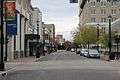
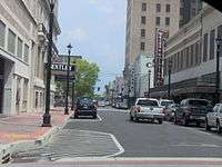
Another view of Third Street in Alexandria
-
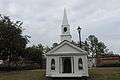
Christmas chapel is a seasonal exhibit near Alexandria City Hall.
-
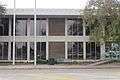
Louisiana State Office Building in Alexandria
-

Human Services in Alexandria occupies a former financial institution building at 429 Murray Street downtown.
-

Chase Bank in Alexandria absorbed the former Rapides Bank and Trust Company location at 400 Murray Street.
-
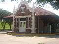
Former Missouri Pacific Railroad depot in downtown historic district
-
_IMG_1142.JPG)
Lower view of Rapides Parish Courthouse in Alexandria
References
- ↑ "Find a County". National Association of Counties. Archived from the original on May 31, 2011. Retrieved 2011-06-07.
- ↑ "2010 Census". quickfacts.census.gov. Retrieved April 27, 2012.
- ↑ "Fulton, Alexander". lahistory.org (Louisiana Historical Association). Retrieved October 9, 2010.
- ↑ Community Archived January 5, 2010, at the Wayback Machine.
- ↑ John D. Winters, The Civil War in Louisiana, Baton Rouge: Louisiana State University Press, 1963, ISBN 0-8071-0834-0, p. 235
- ↑ Winters, p. 331
- ↑ Winters, pp. 331-332
- ↑ Winters, pp. 366-367
- ↑ Winters, pp. 367-369
- ↑ Winters, p. 236
- ↑ Winters, pp. 373-374
- 1 2 3 Winters, p. 374
- ↑ Winters, pp. 386-387
- ↑ "US Gazetteer files: 2010, 2000, and 1990". United States Census Bureau. 2011-02-12. Retrieved 2011-04-23.
- ↑ "US Board on Geographic Names". United States Geological Survey. 2007-10-25. Retrieved 2008-01-31.
- ↑ http://www.srh.noaa.gov/lch/?n=climate
- ↑ http://www.srh.noaa.gov/lch/?n=snowclimo
- ↑ http://www.srh.noaa.gov/lch/?n=e0124-2814
- ↑ "NowData - NOAA Online Weather Data". National Oceanic and Atmospheric Administration. Retrieved 2013-11-16.
- ↑ "Summary of Monthly Normals 1981-2010". National Oceanic and Atmospheric Administration. Retrieved 2011-11-16.
- ↑ "Annual Estimates of the Resident Population for Incorporated Places: April 1, 2010 to July 1, 2015". Retrieved July 2, 2016.
- ↑ "American FactFinder". United States Census Bureau. Archived from the original on September 11, 2013. Retrieved 2008-01-31.
- ↑ The Association of Religion Data Archives | Maps & Reports
- ↑ "Alexandria Mardi Gras". Alexandria Daily Town Talk. Retrieved February 11, 2013.
- ↑ "Alexandria Pineville Area Convention & Visitors Bureau" (notes), webpage: LAfromhere-pparty. Archived October 30, 2006, at the Wayback Machine.
- ↑ "Alexandria's Jacque Caplan dies at 81". The Alexandria Town Talk. July 31, 2016. Retrieved August 4, 2016.
- ↑ "Venue". Arts Council of Central Louisiana. Retrieved January 19, 2013.
- ↑ "Bob Tompkins, "Tompkins: Pro baseball's demise triggers Aces nostalgia"". The Town Talk. Retrieved July 22, 2013.
- ↑ "Thomas "Bud" Brady". ourcampaigns.com. Retrieved July 5, 2013.
- ↑ "Bubby Brister". databaseFootball.com. Retrieved November 26, 2012.
- ↑ "George A. Burton, Jr. obituary". Shreveport Times. Retrieved June 15, 2014.
- ↑ "Luther Francis Cole". Baton Rouge Morning Advocate. Retrieved July 28, 2013.
- ↑ "Judge William Albright Culpepper". The Alexandria Town Talk. October 7, 2015. Retrieved October 8, 2015.
- ↑ "Israel "Bo" Curtis obituary". The Alexandria Town Talk. February 24, 2012. Retrieved December 12, 2014.
- ↑ Richard P. Sharkey (September 3, 2014). "Alexandria businessman Dunbar left legacy of success". The Alexandria Town Talk. Retrieved September 21, 2014.
- ↑ "James Rowland Eubank". Baton Rouge Advocate. November 10, 1952. Retrieved December 28, 2014.
- ↑ "Jimmy Faircloth (JD '90), executive counsel to Louisiana governor, to speak April 7". gsu.edu. April 2, 2009. Retrieved July 20, 2015.
- ↑ "R. W. "Buzzy" Graham". The Alexandria Town Talk. Retrieved December 20, 2014.
- ↑ "Malcolm Paul Hebert, September 24, 2006". The Alexandria Town Talk. Retrieved June 7, 2014.
- ↑ "About Dr. Charles Herring". charlesrherring.com. Retrieved December 27, 2014.
- ↑ "Lions Slate Lambright", Minden Press-Herald, August 8, 1977, p. 1
- ↑ "Col. Stephen R. Lee of Alexandria Dies at His Home Feb. 13: Industrial and Political Leader, Descendant of Famous Lees". Winnfield, Louisiana: Winnfield News-American. February 22, 1929. Retrieved May 23, 2015.
- ↑ Bob Tompkins (Sports editor). "Bobby Lowther, LSU's lone two-sport All-American, dies". The Alexandria Town Talk. Retrieved March 24, 2015.
- ↑ "Roy O. Martin, Jr. obituary". The Shreveport Times. March 24, 2007. Retrieved July 27, 2014.
- ↑ "Rod Masterson". Internet Movie Data Base. Retrieved September 15, 2013.
- ↑ "Patrick McCauley". Alexandria Town Talk. April 16, 2015. Retrieved May 17, 2015.
- ↑ "Nixon, John Travis". Louisiana Historical Association. Retrieved April 21, 2015.
- ↑ "Ethma Ewing Odum, March 22, 2009". Alexandria Town Talk. Retrieved June 2, 2014.
- ↑ "Larry Parker (1922-1996)". Baton Rouge Morning Advocate. September 20, 1996. Retrieved September 11, 2014.
- ↑ "Leverne Perry". The Alexandria Town Talk. Retrieved March 29, 2016.
- ↑ Greg Hilburn (April 15, 2016). "La.'s original 'Voice of Agriculture' dies". The Monroe News-Star. Retrieved May 10, 2016.
- ↑ "Louisiana: Edwin O. Ware, III", Who's Who in American Politics, 2007-2008 (Marquis Who's Who: New Providence, New Jersey, 2007), pp. 674-675
- ↑ "Mike Hasten, "Louisiana insurance commissioner's race Wooley turns temporary job into a mission", November 7, 2003". capitolwatch.reallouisiana.com. Retrieved June 18, 2013.
- ↑ "Jeff Matthews, Funding shortage closes Turner Street YMCA in Alexandria". Alexandria Town Talk. Retrieved April 1, 2014.
- ↑ "YWCA set to reopen former Turner Street YMCA". The Alexandria Town Talk. Retrieved June 9, 2014.
- ↑ England Industrial Airpark
- ↑ Alexandria, Louisiana LA, city profile (Rapides Parish) – hotels, festivals, genealogy, newspapers – ePodunk
- ↑ "Sundrop Fuels buys 1,213 acres for Alexandria-area biofuels plant". The Town Talk. March 1, 2013. Retrieved March 1, 2013.
- ↑ Small Business Resources for the Entrepreneur from Inc.com
- ↑ "$15 million allocated to move health services at Huey P. Long to England Airpark". The Town Talk. Retrieved June 23, 2013.
- ↑ Alexandria Airport | AEX Airport Alexandria, LA United States - Flights, Airport Parking, & More!
- ↑ "Buyer hopes to reopen Alexandria's Hotel Bentley this summer". March 8, 2013. Retrieved March 9, 2013.
- ↑ Richard P. Sharkey (April 14, 2016). "Alexandria Realtor Robert Wolf dies at age of 85". The Alexandria Town Talk. Retrieved April 16, 2016.
- ↑ "Robert Andrew Wolf". The Alexandria Town Talk. April 15, 2016. Retrieved April 16, 2016.
- ↑ "Renaissance: Our History". renaissancehome.org. Retrieved March 25, 2010.
- ↑ "Beltway to Loop Cenla Could Be On Its way". KALB-TV News Channel 5. May 5, 2011. Retrieved October 25, 2012.
External links
| Wikivoyage has a travel guide for Alexandria (Louisiana). |
| Wikimedia Commons has media related to Alexandria, Louisiana. |
| Wikisource has the text of a 1911 Encyclopædia Britannica article about Alexandria, Louisiana. |
- City of Alexandria : Government and community services.
- The Town Talk : Alexandria's Local Daily Newspaper.
- KALB-TV : Alexandria's local NBC and CBS station.
- KLAX-TV : Alexandria's local ABC station.
- Visit Alexandria : Business Directory.
- The Alexandria Retrospective: Alexandria photos, postcards, history, artifacts.
- The Historic Bentley : Memories of the elegant past of the Hotel Bentley: history, artifacts, photographs, postcards.
- River Fest
Municipalities and communities of Rapides Parish, Louisiana, United States | ||
|---|---|---|
| Cities | 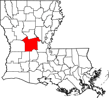 | |
| Towns | ||
| Villages | ||
| CDP | ||
| Other unincorporated communities | ||