Jubb al-Safa
| Jubb Safa جب الصفا Jeb Safa | |
|---|---|
| Village | |
 Jubb Safa | |
| Coordinates: 33°13′56″N 36°18′53″E / 33.23222°N 36.31472°E | |
| Country |
|
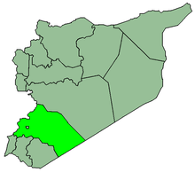
| Governorate | Rif Dimashq Governorate |
| District | Markaz Rif Dimashq |
| Nahiya | Al-Kiswah |
| Elevation | 676 m (2,217 ft) |
| Population (2004)[1] | |
| • Total | 2,499 |
| Time zone | EET (UTC+3) |
| • Summer (DST) | EEST (UTC+2) |
Jubb al-Safa (Arabic: جب الصفا; also spelled Jeb Safa) is a village in southern Syria, administratively part of the Markaz Rif Dimashq District of the Rif Dimashq Governorate, located just east of Damascus. Nearby localities include al-Buwaydah to the southeast, al-Masmiyah to the south, Ghabaghib to the southwest, Kanakir to the west, Khan Dannun to the northwest, Deir Ali to the north and Khirbet al-Ward to the northeast. According to the Syria Central Bureau of Statistics (CBS), Beit Sawa had a population of 2,499 in the 2004 census.[1]
References
- 1 2 General Census of Population and Housing 2004. Syria Central Bureau of Statistics (CBS). Rif Dimashq Governorate. (Arabic)
External links
- Map of town, Google Maps
This article is issued from Wikipedia - version of the 7/31/2015. The text is available under the Creative Commons Attribution/Share Alike but additional terms may apply for the media files.