Al-Bahariyah
| Al-Bahariyah البحارية | |
|---|---|
 Al-Bahariyah | |
| Coordinates: 33°31′48″N 36°31′33″E / 33.53000°N 36.52583°E | |
| Country |
|
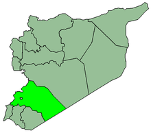
| Governorate | Rif Dimashq Governorate |
| District | Douma District |
| Time zone | EET (UTC+2) |
| • Summer (DST) | EEST (UTC+3) |
Al-Bahariyah (Arabic: البحارية) is a village in eastern Ghouta, 20 kilometers (12 mi) east of Damascus city center. The village is administratively a part of the Douma District in the Rif Dimashq Governorate. Damascus International Airport is located 13 kilometers (8.1 mi) south of Al-Bahariyah.[1]
References
- ↑ "Al-Bahariyah - Wikimapia". Wikimapia.
This article is issued from Wikipedia - version of the 1/16/2015. The text is available under the Creative Commons Attribution/Share Alike but additional terms may apply for the media files.