Qara, Syria
| Qara قارة Qārā, Kara | |
|---|---|
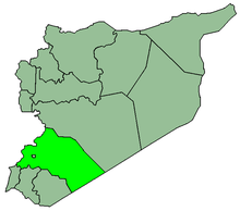
 Qara Location in Syria | |
| Coordinates: 34°09′15″N 36°44′39″E / 34.15417°N 36.74417°ECoordinates: 34°09′15″N 36°44′39″E / 34.15417°N 36.74417°E | |
| Country |
|
| Governorate | Rif Dimashq Governorate |
| District | An-Nabek District |
| Nahiyah | Qara |
| Elevation | 1,280 m (4,200 ft) |
| Population (2004 census)[1] | |
| • Total | 12,508 |
Qara or Kara (Arabic: قارة) is a Syrian city in the An-Nabek District of the Rif Dimashq Governorate. It is located between the Qalamoun Mountains and the Eastern Lebanon mountains range, 95 kilometres (59 mi) north of the capital Damascus on the road to the city of Homs. According to the Syria Central Bureau of Statistics (CBS), Qara had a population of 12,508 in the 2004 census.[1] Its inhabitants are mostly Sunni Muslims and Greek Orthodox and Catholic Christians.[2]
History
It was the southern-most town in the Jund Hims military district of Greater Syria during the Umayyad Caliphate.[3] Abu'l-Fida described it in his Geography of 1321 as "a large village half way between Damascus and Homs. It is a waystation for the caravans. Most of its inhabitants are Christians. It lies 1½ marches from Homs and 2 marches from Damascus."[4] Since the 14th century Qara has been eclipsed by an-Nabek its neighbor to the south.
The Sufi scholar Abd al-Ghani al-Nabulsi visited Qara in 1690, remarking that the village's houses were "very small", confusing this along with the encountered unfriendliness of the inhabitants as a sign of hostility to outsiders. However, the conditions of Qara were common in villages located in the lawless regions of the Levant at that time. While Qara's population had originally been Christian, by the 17th century it was a mixed Muslim-Christian village.[5]
References
- 1 2 General Census of Population and Housing 2004. Syria Central Bureau of Statistics (CBS). Rif Dimashq Governorate. (Arabic)
- ↑ Smith, 1841, p. 173.
- ↑ Yaqut al-Hamawi as cited in le Strange, Guy (1890). Palestine Under the Moslems: A Description of Syria and the Holy Land from A.D. 650 to 1500. London: Alexander P. Watt for the Committee of the Palestine Exploration Fund. p. 36. OCLC 1004386. Retrieved 14 September 2010.
- ↑ Quoted at le Strange, Guy (1890). Palestine Under the Moslems: A Description of Syria and the Holy Land from A.D. 650 to 1500. London: Alexander P. Watt for the Committee of the Palestine Exploration Fund. p. 478. OCLC 1004386. Retrieved 14 September 2010.
- ↑ Sirriyeh, Elizabeth (2005), Sufi Visionary of Ottoman Damascus: ʻAbd Al-Ghanī Al-Nābulusī, 1641-1731, Psychology Press, p. 98, ISBN 9780415341653
Bibliography
- Smith, Eli; Robinson, Edward (1841). Biblical Researches in Palestine, Mount Sinai and Arabia Petraea: A Journal of Travels in the Year 1838. 3. Crocker and Brewster.
External links
- "Photograph of Qara street" Flickr.com
- MSN Map