Jesmond Dene, California
| Jesmond Dene | |
|---|---|
| Unincorporated community | |
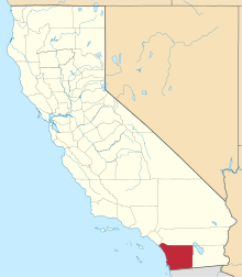
 Jesmond Dene Location within the state of California | |
| Coordinates: 33°10′49″N 117°6′30″W / 33.18028°N 117.10833°WCoordinates: 33°10′49″N 117°6′30″W / 33.18028°N 117.10833°W | |
| Country | United States |
| State | California |
| County | San Diego |
| Elevation | 900 ft (300 m) |
| Time zone | Pacific (PST) (UTC-8) |
| • Summer (DST) | PDT (UTC-7) |
| ZIP codes | 92026 |
| Area codes | 442/760 |
| FIPS code | 06-37330 |
| GNIS feature ID | 1660813 |
Jesmond Dene, an unincorporated community neighboring Escondido in San Diego County, California, lies just east of Interstate 15 north of Escondido and has a zip code of 92026 (as assigned to Escondido). The community is inside area code 760.
It is located at 33°10′49″N 117°6′30″W / 33.18028°N 117.10833°W (33.18028, -117.10833)[1] at an elevation of 900 ft.
References
- ↑ "US Gazetteer files: 2010, 2000, and 1990". United States Census Bureau. 2011-02-12. Retrieved 2011-04-23.
- The Insiders' Guide to San Diego, 1st Edition - Area Overview - Regions "Someone living in the tiny northern town of Jesmond Dene, for example, would say 'I live in Jesmond Dene, a little town in San Diego, in the North County.' "
- Weekend Driver: Golfing Through the Dene
- San Diego Reader: Roam-O-Rama: August 12, 1999 - Traverse the hills of north Escondido and Jesmond Dene on this 10-mile bicycle loop.
This article is issued from Wikipedia - version of the 5/22/2015. The text is available under the Creative Commons Attribution/Share Alike but additional terms may apply for the media files.