Guatay, California
| Guatay | |
|---|---|
| Unincorporated community | |
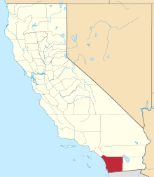
 Guatay Location within the state of California | |
| Coordinates: 32°50′56″N 116°33′26″W / 32.84889°N 116.55722°WCoordinates: 32°50′56″N 116°33′26″W / 32.84889°N 116.55722°W | |
| Country | United States |
| State | California |
| County | San Diego |
| Elevation | 3,999 ft (1,219 m) |
| Time zone | Pacific (PST) (UTC-8) |
| • Summer (DST) | PDT (UTC-7) |
| ZIP codes | 91931 |
| GNIS feature ID | 1656536[1] |
Guatay is an unincorporated community in the Cuyamaca Mountains, in the Mountain Empire area of southeastern San Diego County, California.
Geography
The town's elevation is 3,999 feet (1,219 m).[1] Although Guatay is unincorporated, it has a post office, with the ZIP code of 91931.[2]
It was the location of a 19th-century stagecoach station on the San Antonio-San Diego Mail Line.
Nearby Guatay Mountain, a peak of the Cuyamaca Mountains, is home to a grove of the rare endemic Tecate Cypress (Cupressus forbesii).
References
This article is issued from Wikipedia - version of the 8/21/2016. The text is available under the Creative Commons Attribution/Share Alike but additional terms may apply for the media files.