Lemon Grove, California
| Lemon Grove, California | |
|---|---|
| City | |
| City of Lemon Grove | |
|
Lemon Grove Monument | |
| Motto: Best Climate on Earth | |
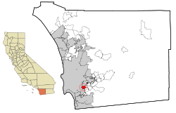 Location within San Diego County | |
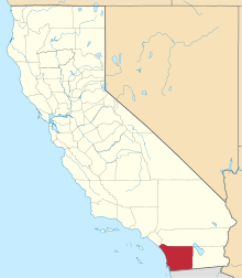
 Lemon Grove, California Location in the United States | |
| Coordinates: 32°44′29″N 117°01′54″W / 32.74139°N 117.03167°WCoordinates: 32°44′29″N 117°01′54″W / 32.74139°N 117.03167°W | |
| Country |
|
| State |
|
| County | San Diego |
| Incorporated | July 1, 1977[1] |
| Government | |
| • Type | Council–manager |
| • Mayor | Mary Sessom[2] |
| • City manager | Graham Mitchell[3] |
| Area[4] | |
| • Total | 3.880 sq mi (10.050 km2) |
| • Land | 3.880 sq mi (10.050 km2) |
| • Water | 0 sq mi (0 km2) 0% |
| Elevation[5] | 446 ft (136 m) |
| Population (2010) | |
| • Total | 25,320 |
| • Density | 6,500/sq mi (2,500/km2) |
| Time zone | Pacific (UTC-8) |
| • Summer (DST) | PDT (UTC-7) |
| ZIP code | 91945 |
| Area code | 619 |
| FIPS code | 06-41124 |
| GNIS feature IDs | 1660902, 2410818 |
| Website |
www |

Lemon Grove is a city in San Diego County, California. The population was 25,320 at the 2010 census, up from 24,918 as of the 2000 census. The large monument of a lemon pictured here has been its symbol since 1963.
History
The area that eventually became Lemon Grove was part of Mission San Diego de Alcalá, one of the Spanish missions in California. After Mexico became independent from Spain, the Californios (residents of Alta California) ranched on various land grants. The area that now includes Lemon Grove was granted to Santiago Argüello, who received more than 59,000 acres.[6]
The first proprietor of Lemon Grove, Robert Allison, arrived in the region in 1850, coming from Sacramento. He purchased thousands of acres from Santiago Argüello's heirs; this land eventually became Lemon Grove, La Mesa, Encanto, and part of Spring Valley. Allison became a director and stockholder of the San Diego and Cuyamaca Railroad in 1886, and built the Allison Flume.[6] Allison's son Joseph filed subdivision maps for "Lemon Grove" in 1892. The name is attributed to Joseph's mother, Tempa Waterman Allison. The climate was suitable for the cultivation of subtropical fruits and vegetables, and farmers from the East and Midwest flocked to the region.[6] The Lemon Grove Fruit Growers Association was formed in 1893; in 1894, the San Diego Union newspaper referred to Lemon Grove as "a sea of lemon trees."[6]
Joseph and Anton Sones, immigrants from Bohemia, moved to Lemon Grove after stints in Seguin, Texas, and San Diego. The brothers opened a well-known general store, A. Sones and Son. Anthony "Tony" F. Sones, the eldest son of Anton Sones and his German American wife Anna Klein Sones, was also a local notable. He was a key supporter of the huge lemon that became the town's symbol and landmark.[6] Sones and a committee of local ranchers hired local architect Alberto Treganza to build the huge lemon to "make the ultimate statement about the town's purpose, prosperity, and optimism."[6]
In the Lemon Grove Incident in 1931, Mexican American parents in Lemon Grove pursued a successful judicial challenge against the decision of the local school board to build a separate school for Mexican American pupils. The decision of the Superior Court for San Diego County in Alvarez v. Lemon Grove was the first successful lawsuit against school segregation.[7][8]
By World War II, most of the citrus groves had disappeared and suburbanization had begun.[6] There had been four elections on incorporation from the 1950s to the 1970s; the issue caused heated debate in the town. The city was finally incorporated on July 1, 1977, became California's 414th city.[6] Lemon Grove was incorporated as a general-law city;[9] however, it continues to receive law enforcement services, via contract, from the San Diego County Sheriff's Department.[10]
Geography
Lemon Grove is located at 32°44′0″N 117°2′1″W / 32.73333°N 117.03361°W (32.733451, −117.033702).[11]
According to the United States Census Bureau, the city has a total area of 3.9 square miles (10 km2), all land.
Demographics
| Historical population | |||
|---|---|---|---|
| Census | Pop. | %± | |
| 1960 | 19,348 | — | |
| 1970 | 19,690 | 1.8% | |
| 1980 | 20,780 | 5.5% | |
| 1990 | 23,984 | 15.4% | |
| 2000 | 24,918 | 3.9% | |
| 2010 | 25,320 | 1.6% | |
| Est. 2015 | 26,709 | [12] | 5.5% |
2010
The 2010 United States Census[14] reported that Lemon Grove had a population of 25,320. The population density was 6,525.3 people per square mile (2,519.4/km²). The racial makeup of Lemon Grove was 13,072 (51.6%) White, 3,495 (13.8%) African American, 225 (0.9%) Native American, 1,624 (6.4%) Asian, 275 (1.1%) Pacific Islander, 4,828 (19.1%) from other races, and 1,801 (7.1%) from two or more races. Hispanic or Latino of any race were 10,435 persons (41.2%).
The Census reported that 24,974 people (98.6% of the population) lived in households, 200 (0.8%) lived in non-institutionalized group quarters, and 146 (0.6%) were institutionalized.
There were 8,434 households, out of which 3,295 (39.1%) had children under the age of 18 living in them, 3,863 (45.8%) were opposite-sex married couples living together, 1,419 (16.8%) had a female householder with no husband present, 601 (7.1%) had a male householder with no wife present. There were 516 (6.1%) unmarried opposite-sex partnerships, and 94 (1.1%) same-sex married couples or partnerships. 1,928 households (22.9%) were made up of individuals and 734 (8.7%) had someone living alone who was 65 years of age or older. The average household size was 2.96. There were 5,883 families (69.8% of all households); the average family size was 3.51.
The population was spread out with 6,458 people (25.5%) under the age of 18, 2,583 people (10.2%) aged 18 to 24, 6,900 people (27.3%) aged 25 to 44, 6,550 people (25.9%) aged 45 to 64, and 2,829 people (11.2%) who were 65 years of age or older. The median age was 35.0 years. For every 100 females there were 95.3 males. For every 100 females age 18 and over, there were 93.6 males.
There were 8,868 housing units at an average density of 2,285.4 per square mile (882.4/km²), of which 4,609 (54.6%) were owner-occupied, and 3,825 (45.4%) were occupied by renters. The homeowner vacancy rate was 2.0%; the rental vacancy rate was 5.0%. 13,984 people (55.2% of the population) lived in owner-occupied housing units and 10,990 people (43.4%) lived in rental housing units.
2000
As of the census[15] of 2000, there were 24,918 people, 8,488 households, and 5,958 families residing in the city. The population density was 6,557.3 inhabitants per square mile (2,531.8/km²). There were 8,722 housing units at an average density of 2,295.2 per square mile (886.2/km²). The racial makeup of the city was 59.63% White, 12.08% African American, 1.10% Native American, 5.75% Asian, 0.84% Pacific Islander, 13.50% from other races, and 7.10% from two or more races. Hispanic or Latino of any race were 28.52% of the population.
There were 8,488 households out of which 36.4% had children under the age of 18 living with them, 49.0% were married couples living together, 15.6% had a female householder with no husband present, and 29.8% were non-families. 22.4% of all households were made up of individuals and 8.9% had someone living alone who was 65 years of age or older. The average household size was 2.87 and the average family size was 3.36.
In the city the population was spread out with 27.6% under the age of 18, 9.0% from 18 to 24, 30.9% from 25 to 44, 20.5% from 45 to 64, and 12.0% who were 65 years of age or older. The median age was 35 years. For every 100 females there were 93.9 males. For every 100 females age 18 and over, there were 91.0 males.
The median income for a household in the city was $39,823, and the median income for a family was $45,844. Males had a median income of $35,042 versus $28,509 for females. The per capita income for the city was $17,002. About 9.2% of families and 13.7% of the population were below the poverty line, including 18.0% of those under age 18 and 5.9% of those age 65 or over.
Current estimates
According to estimates by the San Diego Association of Governments, the median household income of Lemon Grove in 2005 was $55,436 (not adjusted for inflation). When adjusted for inflation (1999 dollars; comparable to Census data above), the median household income was $45,016.
Government
The City Council includes Mayor Theresa Sessom, and Councilmembers Jerry Jones, Racquel Vasquez, George Gastil, and Jennifer Mendoza.[16]
In the California State Legislature, Lemon Grove is in the 38th Senate District, represented by Republican Joel Anderson, and in the 79th Assembly District, represented by Democrat Shirley Weber.[17]
In the United States House of Representatives, Lemon Grove is in California's 53rd congressional district, represented by Democrat Susan Davis.[18]
Notable residents
- Rob Crow, American musician
- John Forester cycling activist, author and cycling transportation engineer[19]
- Actor Dennis Hopper, around age 13.[20]
- Speed Martin former Major League Baseball player
- Boyd Rice, American musician
- Abdussattar Shaikh,[21] Cofounder of San Diego's Islamic Center
- Bobby Sones, American musician and poet
- Alberto O. Treganza, American architect
- John R. Woodward, motion picture production executive, birth to age 21
"The World's Biggest Lemon"
Weighing some 3000 pounds, and approximately 10 feet long and six feet wide, the lemon sculpture—affectionately known as the World's Biggest Lemon—sits on a concrete base at the corner of Broadway and Lemon Grove Avenue, adjacent to 3361 Main Street. It lies before a small lemon grove beside the Orange Line Trolley tracks near the local trolley station and downtown bus stop. Written across the base of this monument are the words "Best Climate On Earth". Designed by Lemon Grove architect Alberto Treganza, the lemon was originally built as a parade float for the 1928 Fourth of July Fiesta de San Diego parade, carrying the town's first Miss Lemon Grove, Amorita Treganza, Alberto's 16-year-old daughter. In 1930, the float was plastered to create a permanent sculpture and displayed near its current location.
Education
Public primary education in the city is provided by the Lemon Grove School District. Grossmont Union High School District provides secondary and adult education.
High schools
Eligible students are sent outside the town for secondary education.
Middle schools
- Lemon Grove Academy of Science and Humanities 7–8[22]
Elementary schools
- Lemon Grove Academy PK–6[23]
- Monterey Heights Elementary School
- Mount Vernon Elementary School
- San Altos Elementary School
- San Miguel Elementary School
See also
-
 San Diego County portal
References
- ↑ "California Cities by Incorporation Date" (Word). California Association of Local Agency Formation Commissions. Retrieved August 25, 2014.
- ↑ "Mayor & Council". City of Lemon Grove. Retrieved February 24, 2015.
- ↑ "City Manager". City of Lemon Grove. Retrieved February 24, 2015.
- ↑ "2010 Census U.S. Gazetteer Files – Places – California". United States Census Bureau.
- ↑ "Lemon Grove". Geographic Names Information System. United States Geological Survey. Retrieved February 24, 2015.
- 1 2 3 4 5 6 7 8 Helen M. Ofield & Pete Smith, Images of America: Lemon Grove, Lemon Grove Historical Society (Arcadia: 2010).
- ↑ Matt S. Meier & Margo Gutiérrez, The Mexican American Experience: An Encyclopedia (Greenwood, 2003), p. 215.
- ↑ Mike Madrid, "The Lemon Grove Desegregation Case: A Matter of Neglected History" in Latino Civil Rights in Education: La Lucha Sigue (Routledge, 2016: eds. Anaida Colón-Muñiz & Magaly Lavadenz), pp. 52–57.
- ↑ "General law" means under the provisions established by the legislature, as opposed to a charter city which would have more local-government options. UCB Institute for Governmental Studies
- ↑ San Diego County Sheriff's Lemon Grove Station
- ↑ "US Gazetteer files: 2010, 2000, and 1990". United States Census Bureau. 2011-02-12. Retrieved 2011-04-23.
- ↑ "Annual Estimates of the Resident Population for Incorporated Places: April 1, 2010 to July 1, 2015". Retrieved July 2, 2016.
- ↑ "Census of Population and Housing". Census.gov. Retrieved June 4, 2015.
- ↑ "2010 Census Interactive Population Search: CA - Lemon Grove city". U.S. Census Bureau. Retrieved July 12, 2014.
- ↑ "American FactFinder". United States Census Bureau. Retrieved 2008-01-31.
- ↑ "Current Lemon Grove City Council". City of Lemon Grove. Retrieved 14 November 2014.
- ↑ "Statewide Database". UC Regents. Retrieved November 24, 2014.
- ↑ "California's 53rd Congressional District - Representatives & District Map". Civic Impulse, LLC.
- ↑ John Forester's website with Lemon Grove address
- ↑ San Diego Reader, July 5, 2001
- ↑ ABDUSSATTAR SHAIKH
- ↑ Lemon Grove Academy of Science and Humanities 7-8
- ↑ Lemon Grove Academy PK-6
External links
| Counties | ||
|---|---|---|
| Major city | ||
| Cities 100k - 250k | ||
| Cities and towns 20k - 99k | ||
| CDPs 20k+ | ||
| Bodies of water | ||
| Regions | ||
| Parks and Monuments | ||