Alpine, California
| Alpine | |
|---|---|
| Census-designated place | |
|
| |
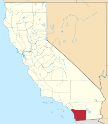
 Location in San Diego County and the state of California | |
 Alpine Location in the United States | |
| Coordinates: 32°50′4″N 116°46′14″W / 32.83444°N 116.77056°WCoordinates: 32°50′4″N 116°46′14″W / 32.83444°N 116.77056°W | |
| Country |
|
| State |
|
| County | San Diego |
| Area[1] | |
| • Total | 26.785 sq mi (69.373 km2) |
| • Land | 26.781 sq mi (69.363 km2) |
| • Water | 0.004 sq mi (0.010 km2) 0.01% |
| Elevation[2] | 1,834 ft (559 m) |
| Population (2010) | |
| • Total | 14,236 |
| • Density | 530/sq mi (210/km2) |
| Time zone | PST (UTC-8) |
| • Summer (DST) | PDT (UTC-7) |
| ZIP codes | 91901, 91903 |
| Area code | 619 |
| FIPS code | 06-01192 |
| GNIS feature IDs | 1660247, 2407726 |
.jpg)
Alpine is a census-designated place (CDP) in the Cuyamaca Mountains of San Diego County, California. Alpine had a population of 14,236 at the 2010 census, up from 13,143 at the 2000 census.
History
The community's name was suggested by a resident of the area in the 1880s who believed that the environment was similar to her native home in Switzerland.[3]
Geography
The location of Alpine is not precisely defined since it is an unincorporated area. According to the United States Geological Survey, it is at 32°50′6″N 116°45′59″W / 32.83500°N 116.76639°W (32.8350521, -116.7664109),[4] which is near the intersection of Alpine Boulevard and Tavern Road. That is approximately where most maps place Alpine. Kumeyaay tribes are indigenous to the area, and the Ewiiaapaayp Band and Viejas Band of Kumeyaay Indians both have headquarters in Alpine.[5]
According to the United States Census Bureau, it is at 32°50′4″N 116°46′14″W / 32.83444°N 116.77056°W (32.834563, -116.770615).[6] That is approximately 1,200 feet (370 m) west of the USGS location. According to the United States Census Bureau, the CDP has a total area of 26.8 square miles (69 km2), 99.99% land and 0.01% water.
Climate
According to the Köppen Climate Classification system, Alpine has a warm-summer Mediterranean climate, abbreviated "Csa" on climate maps.[7]
Demographics
2010
The 2010 United States Census[8] reported that Alpine had a population of 14,236. The population density was 531.5 people per square mile (205.2/km²). The racial makeup of Alpine was 12,424 (87.3%) White, 167 (1.2%) African American, 222 (1.6%) Native American, 319 (2.2%) Asian, 39 (0.3%) Pacific Islander, 576 (4.0%) from other races, and 489 (3.4%) from two or more races. Hispanic or Latino of any race were 2,081 persons (14.6%).
The Census reported that 14,098 people (99.0% of the population) lived in households, 136 (1.0%) lived in non-institutionalized group quarters, and 2 (0%) were institutionalized.
There were 5,248 households, out of which 1,932 (36.8%) had children under the age of 18 living in them, 3,120 (59.5%) were opposite-sex married couples living together, 515 (9.8%) had a female householder with no husband present, 268 (5.1%) had a male householder with no wife present. There were 283 (5.4%) unmarried opposite-sex partnerships, and 39 (0.7%) same-sex married couples or partnerships. 1,048 households (20.0%) were made up of individuals and 433 (8.3%) had someone living alone who was 65 years of age or older. The average household size was 2.69. There were 3,903 families (74.4% of all households); the average family size was 3.09.
The population was spread out with 3,403 people (23.9%) under the age of 18, 1,164 people (8.2%) aged 18 to 24, 3,133 people (22.0%) aged 25 to 44, 4,583 people (32.2%) aged 45 to 64, and 1,953 people (13.7%) who were 65 years of age or older. The median age was 41.9 years. For every 100 females there were 97.8 males. For every 100 females age 18 and over, there were 94.6 males.
There were 5,536 housing units at an average density of 206.7 per square mile (79.8/km²), of which 3,597 (68.5%) were owner-occupied, and 1,651 (31.5%) were occupied by renters. The homeowner vacancy rate was 2.0%; the rental vacancy rate was 6.3%. 9,935 people (69.8% of the population) lived in owner-occupied housing units and 4,163 people (29.2%) lived in rental housing units.
2000
As of the census[9] of 2000, there were 13,143 people, 4,775 households, and 3,652 families residing in the CDP. The population density was 489.1 inhabitants per square mile (188.9/km²). There were 4,958 housing units at an average density of 184.5 per square mile (71.2/km²). The racial makeup of the CDP was 90.8% White, 0.8% African American, 1.2% Native American, 2.0% Asian, 0.2% Pacific Islander, 2.9% from other races, and 2.2% from two or more races. 10.2% of the population were Hispanic (U.S. Census) or Latino of any race.
There were 4,775 households out of which 36.5% had children under the age of 18 living with them, 63.5% were married couples living together, 8.5% had a female householder with no husband present, and 23.5% were non-families. 17.3% of all households were made up of individuals and 7.0% had someone living alone who was 65 years of age or older. The average household size was 2.72 and the average family size was 3.06.
In the CDP the population was spread out with 26.0% under the age of 18, 7.0% from 18 to 24, 29.3% from 25 to 44, 26.6% from 45 to 64, and 11.1% who were 65 years of age or older. The median age was 38 years. For every 100 females there were 99.9 males. For every 100 females age 18 and over, there were 97.6 males.
The median income for a household in the CDP was $61,832, and the median income for a family was $69,821. Males had a median income of $51,444 versus $31,891 for females. The per capita income for the CDP was $29,523. About 4.9% of families and 6.6% of the population were below the poverty line, including 9.6% of those under age 18 and 4.3% of those age 65 or over.
Government
In the California State Legislature Alpine is in the 38th Senate District, represented by Republican Joel Anderson, and in the 71st Assembly District, represented by Republican Randy Voepel.[10]
In the United States House of Representatives, Alpine is in California's 50th congressional district, represented by Republican Duncan D. Hunter.[11]
Notable people
- Being as an Ocean, Melodic hardcore band
- Sheldon Creed, off-road racing driver
- Marcus Giles, former Major League Baseball second baseman
- Mark Grant, former Major league baseball pitcher and current San Diego Padres announcer
- Duncan Hunter, former United States Representative
- Cole Whitt, NASCAR driver
References
- ↑ "2010 Census U.S. Gazetteer Files – Places – California". United States Census Bureau.
- ↑ "Alpine". Geographic Names Information System. United States Geological Survey. Retrieved October 18, 2014.
- ↑ William Bright; Erwin Gustav Gudde (November 30, 1998). 1500 California place names: their origin and meaning. University of California Press. p. 14. ISBN 978-0-520-21271-8. Retrieved January 20, 2012.
- ↑ "Geographic Names Information System". United States Geological Survey. Retrieved 2008-01-31.
- ↑ "Tribal Governments by Area." National Congress of American Indians. (retrieved 5 June 2010)
- ↑ "US Gazetteer files: 2010, 2000, and 1990". United States Census Bureau. 2011-02-12. Retrieved 2011-04-23.
- ↑ Climate Summary for Alpine, California
- ↑ "2010 Census Interactive Population Search: CA - Alpine CDP". U.S. Census Bureau. Retrieved July 12, 2014.
- ↑ "American FactFinder". United States Census Bureau. Archived from the original on September 11, 2013. Retrieved 2008-01-31.
- ↑ "Statewide Database". UC Regents. Retrieved December 8, 2014.
- ↑ "California's 50th Congressional District - Representatives & District Map". Civic Impulse, LLC.
External links
| Wikimedia Commons has media related to Alpine, California. |
- Alpine Mountain Empire Chamber of Commerce
- The Alpine Sun - local newspaper