Pauma Valley, California
| Pauma Valley | |
|---|---|
| Unincorporated community | |
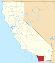
 Pauma Valley  Pauma Valley Location within the state of California | |
| Coordinates: 33°18′12″N 116°58′53″W / 33.30333°N 116.98139°WCoordinates: 33°18′12″N 116°58′53″W / 33.30333°N 116.98139°W | |
| Country | United States |
| State | California |
| County | San Diego |
| Community services district established | 1961[1] |
| Time zone | Pacific (PST) (UTC-8) |
| • Summer (DST) | PDT (UTC-7) |
| Area code(s) | 760, 442 |
Pauma Valley is a geographic valley, and an unincorporated community between Valley Center and Palomar Mountain in San Diego County, California. The name also refers to the agricultural region comprising citrus and avocado groves, and location of several Indian Reservations, a country club, and tribal casinos.[2][3][4]
California Route 76 crosses the length of the Pauma Valley and through the community of Pauma Valley, on its route between the coast in Oceanside and County Route 371 near Warner Springs. The valley is at the western base of the Palomar Mountains
The headquarters of the Pauma Band of Luiseno Mission Indians and La Jolla Band of Luiseno Indians are located in Pauma Valley.[5]
See also
External links
References
- ↑ Directory of Special Districts in San Diego County. San Diego Local Agency Formation Commission. 2011.
- ↑ "Pauma Valley". San Diego Daily Transcript.
- ↑ Tom Gorman (1991-01-27). "Valley's Eclectic Devotees Farmers, Indians, Even a Snazzy Club Call It Home". Los Angeles Times.
- ↑ "Pauma Valley". San Diego Daily Transcript.
- ↑ "2010-2011 Council Members." La Jolla Band of Luiseño Indians. (retrieved 8 May 2011)
This article is issued from Wikipedia - version of the 7/4/2016. The text is available under the Creative Commons Attribution/Share Alike but additional terms may apply for the media files.