Solana Beach, California
| Solana Beach, California | |||
|---|---|---|---|
| City | |||
| City of Solana Beach | |||
|
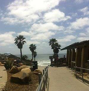
Fletcher Cove Community Park Beach Access, California in June 2013 | |||
| |||
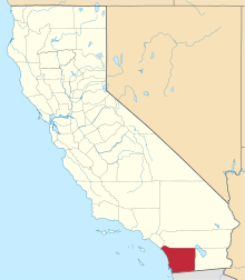
 Location of Solana Beach within San Diego County, California. | |||
 Solana Beach, California Location in the United States | |||
| Coordinates: 32°59′43″N 117°15′37″W / 32.99528°N 117.26028°WCoordinates: 32°59′43″N 117°15′37″W / 32.99528°N 117.26028°W | |||
| Country |
| ||
| State |
| ||
| County |
| ||
| Incorporated | July 1, 1986[1] | ||
| Government | |||
| • Mayor | David Zito[2] | ||
| Area[3] | |||
| • City | 3.624 sq mi (9.386 km2) | ||
| • Land | 3.520 sq mi (9.115 km2) | ||
| • Water | 0.104 sq mi (0.270 km2) 2.88% | ||
| Elevation[4] | 72 ft (22 m) | ||
| Population (2010) | |||
| • City | 12,867 | ||
| • Density | 3,600/sq mi (1,400/km2) | ||
| • Metro | SD-TJ: 5,105,768 | ||
| Time zone | PST (UTC-8) | ||
| • Summer (DST) | PDT (UTC-7) | ||
| ZIP code | 92075 | ||
| Area code(s) | 858 | ||
| FIPS code | 06-72506 | ||
| GNIS feature IDs | 1656633, 2411923 | ||
| Website |
www | ||


Solana Beach, officially the City of Solana Beach, is a coastal city in San Diego County, California. The population was 12,867 at the 2010 U.S. Census.
Geography
Solana Beach is located at 32°59′43″N 117°15′37″W / 32.99528°N 117.26028°W (32.992937,-117.271135).[5]
According to the United States Census Bureau, the city has a total area of 3.6 square miles (9.3 km2). 3.5 square miles (9.1 km2) of it is land and 0.1 square miles (0.26 km2) of it (2.88%) is water.
Over 12,000 residents call this small beach community their home. The Pacific Ocean is to the west; the community of Cardiff-by-the-Sea to the north, and the City of Del Mar to the south. The unincorporated village of Rancho Santa Fe is located on the east side.
History
The area was first settled by the San Dieguitos, early Holocene inhabitants of the area. During the Spanish colonial era, trails heading north near Solana Beach crossed inland to avoid the marshes and inlets of the area. The George H. Jones family were the first settlers in the area now known as Solana Beach, arriving in 1886. Until 1923, the main area known as Solana Beach had been called Lockwood Mesa. When Lake Hodges Dam was built in 1917-18, the area encompassing Solana Beach began to develop rapidly. The creation of the 12,000-acre (49 km2) Santa Fe Irrigation District in 1918 ensured that the area from Rancho Santa Fe through Solana Beach would prosper and expand. The coastline from Solana Beach to Oceanside began to boom in the early 1920s. In 1922 Colonel Ed Fletcher, an early community leader and developer, purchased 140 acres (0.57 km2) at $20 per acre from farmer George H. Jones to develop the town of Solana Beach, with the help of his brother-in-law Eugene Batchelder. To provide access to the beach for the development, hydraulic water pressure was used to erode away tons of earth and create the Fletcher Cove entry and beach. This took one man three months with a fire hose, using water that was coming over the spillway at Lake Hodges Dam. The beach was opened with great fanfare including horse races on the beach on July 4, 1925.[6]
The community grew slowly, but steadily throughout the rest of the century, with particular booms occurring in the decade after World War II and a real estate boom in the last quarter of the 20th century. In 1986 the community officially incorporated as the city of Solana Beach. That year, the city hosted the final funeral services for Desi Arnaz, who had died in Del Mar. Arnaz's funeral was held at St. James Roman Catholic Church, the only Catholic church in the city and part of the Diocese of San Diego.
The city received national news in 2003 upon becoming the first city in the Continental United States to enact a smoking ban on its public beaches, a trend which has continued as many other coastal Californian towns have followed suit in banning smoking on their beaches. Solana Beach was the last coastal community in North San Diego County to ban alcohol on the beach, doing so for at least a year in an action unanimously approved by the City Council.
On April 25, 2008, retired veterinarian and 38-year resident Dr. David Martin, 66 years old, suffered a fatal injury from an extremely rare great white shark bite while swimming with a group approximately 150 yards (140 m) off shore near Solana Beach's Fletcher Cove.[7] The group of swimmers reportedly began their swim at Tide Beach Park to the north. Surfers in the area of Fletcher Cover noted harbor seals in the water and a wounded seal on the beach at Fletcher Cove just before the attack, the latter being a typical sign of sharks feeding in the area. Recent increases in the seal population along the Southern California coast — and the seals' tendency to swim in close proximity to human swimmers — is suspected to be contributing factors in the attack.[8]
Eden Gardens
The neighborhood of La Colonia de Eden Gardens, also known as La Colonia and Eden Gardens, is one of the oldest residential areas of Solana Beach. It is a community formed in the 1920s by Mexican farmers who were hired by the owners of large ranches in adjacent Rancho Santa Fe. These farmers wanted their families nearby, hence the formation of La Colonia (the colony). The name Eden Gardens came later from a land developer as a marketing tool. Many residents still refer to the area as La Colonia. Famous residents include Chicano rapper Lil Rob and comedian Rene Sandoval, who were born and raised in the community.
Demographics
| Historical population | |||
|---|---|---|---|
| Census | Pop. | %± | |
| 1970 | 5,023 | — | |
| 1980 | 13,047 | 159.7% | |
| 1990 | 12,962 | −0.7% | |
| 2000 | 12,979 | 0.1% | |
| 2010 | 12,867 | −0.9% | |
| Est. 2015 | 13,449 | [9] | 4.5% |
2010
The 2010 United States Census[11] reported that Solana Beach had a population of 12,867. The population density was 3,550.7 people per square mile (1,370.9/km²). The racial makeup of Solana Beach was 11,039 (85.8%) White, 60 (0.5%) African American, 62 (0.5%) Native American, 513 (4.0%) Asian, 19 (0.1%) Pacific Islander, 738 (5.7%) from other races, and 436 (3.4%) from two or more races. Hispanic or Latino of any race were 2,048 persons (15.9%).
The Census reported that 12,867 people (100% of the population) lived in households, 0 (0%) lived in non-institutionalized group quarters, and 0 (0%) were institutionalized.
There were 5,650 households, out of which 1,323 (23.4%) had children under the age of 18 living in them, 2,730 (48.3%) were opposite-sex married couples living together, 360 (6.4%) had a female householder with no husband present, 193 (3.4%) had a male householder with no wife present. There were 325 (5.8%) unmarried opposite-sex partnerships, and 42 (0.7%) same-sex married couples or partnerships. 1,745 households (30.9%) were made up of individuals and 647 (11.5%) had someone living alone who was 65 years of age or older. The average household size was 2.28. There were 3,283 families (58.1% of all households); the average family size was 2.85.
The population was spread out with 2,378 people (18.5%) under the age of 18, 738 people (5.7%) aged 18 to 24, 3,518 people (27.3%) aged 25 to 44, 3,829 people (29.8%) aged 45 to 64, and 2,404 people (18.7%) who were 65 years of age or older. The median age was 43.7 years. For every 100 females there were 97.5 males. For every 100 females age 18 and over, there were 95.3 males.
There were 6,540 housing units at an average density of 1,804.7 per square mile (696.8/km²), of which 3,401 (60.2%) were owner-occupied, and 2,249 (39.8%) were occupied by renters. The homeowner vacancy rate was 1.4%; the rental vacancy rate was 6.3%. 7,919 people (61.5% of the population) lived in owner-occupied housing units and 4,948 people (38.5%) lived in rental housing units.
2000
As of the census[12] of 2000, there were 12,979 people, 5,754 households, and 3,279 families residing in the city. The population density was 3,678.7 inhabitants per square mile (1,419.6/km²). There were 6,456 housing units at an average density of 1,829.9 per square mile (706.1/km²). The racial makeup of the city was 87.01% White, 0.50% African American, 0.42% Native American, 3.46% Asian, 0.14% Pacific Islander, 5.59% from other races, and 2.89% from two or more races. Hispanic or Latino of any race were 14.81% of the population.
There were 5,754 households out of which 20.8% had children under the age of 18 living with them, 47.3% were married couples living together, 6.8% had a female head of household, and 43.0% were non-families. 31.5% of all households were made up of individuals and 10.4% had someone living alone who was 65 years of age or older. The average household size was 2.25 and the average family size was 2.83.
In the city the population was spread out with 17.9% under the age of 18, 6.5% from 18 to 24, 30.9% from 25 to 44, 27.4% from 45 to 64, and 17.3% who were 65 years of age or older. The median age was 42 years. For every 100 females there were 97.1 males. For every 100 females age 18 and over, there were 94.5 males.
The median income for a household in the city was $71,774, and the median income for a family was $96,652. Males had a median income of $72,028 versus $41,186 for females. The per capita income for the city was $48,547. About 3.4% of families and 6.7% of the population were below the poverty line, including 7.5% of those under age 18 and 5.2% of those age 65 or over.
Current estimates
According to estimates by the San Diego Association of Governments, the median household income of Solana Beach in 2005 was $101,122 (not adjusted for inflation). When adjusted for inflation (1999 dollars; comparable to Census data above), the median household income was $82,114.
Politics and government
Solana Beach is a General law city operated by a Council/Manager form of government. The City Council serves as a legislative body and consists of five Council members, one of whom is chosen to act as Mayor for a one-year term on a rotating basis.[13]
In the state legislature, Solana Beach is located in:
- 39th California State Senate District, represented by Democrat Marty Block.
- 78th California State Assembly District, represented by Democrat Toni Atkins.
In the United States House of Representatives, Solana Beach is in California's 49th congressional district, represented by Republican Darrell Issa.[14] The district has a Cook Partisan Voting Index of R+4.
Economy
The Cedros Design District is located in Solana Beach, and consists of more than 85 art galleries, import and antique stores, boutiques and cafes.[15][16] The Design District is also home to the Solana Beach Farmers Market, which operates every Sunday from 1pm to 5pm[17] and offers locally grown fresh cut flowers, organic produce and veggies.[18] Another prominent venue on Cedros Avenue is the Belly Up, a live music space operating since 1974.[19]
Education
Solana Beach is served by the Solana Beach School District and the San Dieguito Union High School District.
High schools
Public high schools serving the area are Canyon Crest Academy, San Dieguito Academy, and Torrey Pines High School. Santa Fe Christian Schools is a private school serving ages K-12.
Middle school
Elementary schools
Notable people
- George Brent, actor.
- Jim Dennis, Hall of Fame harness racing driver.
- Patrick J. Hannifin, American Navy Vice admiral.
- Patti Page, singer.
References
- ↑ "California Cities by Incorporation Date" (Word). California Association of Local Agency Formation Commissions. Retrieved August 25, 2014.
- ↑ "City Council". City of Solana Beach, California. Retrieved January 8, 2015.
- ↑ "2010 Census U.S. Gazetteer Files – Places – California". United States Census Bureau.
- ↑ "Solana Beach". Geographic Names Information System. United States Geological Survey. Retrieved January 8, 2014.
- ↑ "US Gazetteer files: 2010, 2000, and 1990". United States Census Bureau. 2011-02-12. Retrieved 2011-04-23.
- ↑ "The History of Solana Beach". Archived from the original on August 18, 2013. Retrieved June 16, 2008.
- ↑ Dolmetsch, Chris (April 25, 2008). "Great White Shark Attack Kills Triathlete off California Coast". Bloomberg News. Archived from the original on June 19, 2014. Retrieved June 19, 2014.
- ↑ Nott, Laura; H.G. Reza; Molly Hennessy-Fiske (April 26, 2008). "A strike from beneath, and a triathlete is gone". Los Angeles Times. Archived from the original on June 19, 2014. Retrieved June 19, 2014.
- ↑ "Annual Estimates of the Resident Population for Incorporated Places: April 1, 2010 to July 1, 2015". Retrieved July 2, 2016.
- ↑ "Census of Population and Housing". Census.gov. Retrieved June 4, 2015.
- ↑ "2010 Census Interactive Population Search: CA - Solana Beach city". U.S. Census Bureau. Retrieved July 12, 2014.
- ↑ "American FactFinder". United States Census Bureau. Retrieved 2008-01-31.
- ↑ Avants, Maggie (April 29, 2015). "Solana Beach announces new city manager". Seaside Courier.
- ↑ "California's 49th Congressional District - Representatives & District Map". Civic Impulse, LLC.
- ↑ Stirdivant, Marc (25 August 2016). "Learning why Solana Beach just might be the friendliest beach city in Southern California". Los Angeles Times. Retrieved 28 August 2016.
- ↑ "Cedros Avenue Design District". Solana Beach Chamber of Commerce. Retrieved September 17, 2012.
- ↑ "About Us".
- ↑ "Solana Beach Farmers Market".
- ↑ "Belly Up".
External links
| Wikimedia Commons has media related to Solana Beach, California. |
| Counties | ||
|---|---|---|
| Major city | ||
| Cities 100k - 250k | ||
| Cities and towns 20k - 99k | ||
| CDPs 20k+ | ||
| Bodies of water | ||
| Regions | ||
| Parks and Monuments | ||