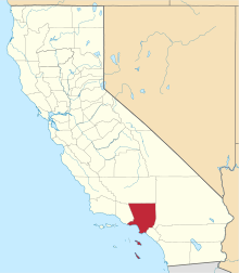
Cornell, Los Angeles County, California
| Cornell | |
|---|---|
| Unincorporated community | |
 Cornell Location in California | |
| Coordinates: 34°06′52″N 118°46′40″W / 34.11444°N 118.77778°WCoordinates: 34°06′52″N 118°46′40″W / 34.11444°N 118.77778°W | |
| Country |
|
| State |
|
| County | Los Angeles |
| Region | Santa Monica Mountains |
| Elevation | 240 m (787 ft) |
Cornell is an unincorporated community in the Santa Monica Mountains, within western Los Angeles County, California.[1] It is located 5 miles (8.0 km) west of Agoura Hills and around 2.5 miles (4.0 km) east of Malibu.[1][2]
Geography
Cornell is a unique, picturesque neighborhood of homes along the scenic Mulholland Highway Corridor and in the rural mountain area near Malibou Lake It is largely surrounded by open space parks within the NPS Santa Monica Mountains National Recreation Area, including Paramount Ranch and Peter Strauss Ranch parks. The former Paramount Studios property was a movie ranch, still with 'Old Western' sets used in filming movies and television series. [3] Cornell is notable for its "tall trees" atmosphere among old-growth oak and pine, and for the many peacocks that roam the neighborhoods, and perch on residents rooftops and balconies. Many homeowners have acreage and stables with horses, and ride on the numerous horse and hiking trails into the surrounding parklands.
Cornell can be reached most easily via Kanan Dume Road, from either the Pacific Coast Highway southwest in Malibu, or the Ventura Freeway (101) northeast in Agoura Hills.
Cable TV and refuse pickup are served from Malibu; while their water and electricity are served from Agoura Hills. The town uses the Agoura Hills Zip code 91301.
Features
A post office operated at Cornell from 1884 to 1904. The former post office was later turned into The Old Place Restaurant, now famous for its steaks, game, and charming, rustic-chic atmosphere. The Old Place Restaurant was originally owned by Tom and Barbara Runyon, and frequented by Steve McQueen, Ali MacGraw and Jason Robards in the late 1960s. [4]
Nearby the restaurant is the popular Cornell Winery and Tasting Room, as well as a French Antiques store. There is another wine tasting room, Sip It, half a mile away. The infamous Rock Store is also located in Cornell, over a mile down Mulholland Hwy. from the residential area.
The Tour of California bicycle race passes through Cornell on Mulholland Highway.
See also
- Populated places in the Santa Monica Mountains
- Natural history of the Santa Monica Mountains
References
- 1 2 U.S. Geological Survey Geographic Names Information System: Cornell, Los Angeles County, California
- ↑ Durham, David L. (1998). California's Geographic Names: A Gazetteer of Historic and Modern Names of the State. Clovis, Calif.: Word Dancer Press. p. 367. ISBN 1-884995-14-4.
- ↑ David W. Kean, Wide Places in the California Roads: The encyclopedia of California's small towns and the roads that lead to them (Volume 1 of 4: Southern California Counties), p. 49
- ↑ Oldplacecornell.com: History of he Old Place Restaurant
