Ventura Freeway
| ||||
|---|---|---|---|---|
 | ||||
| Route information | ||||
| Maintained by Caltrans | ||||
| Component highways: |
| |||
| Major junctions | ||||
| West end: |
| |||
|
| ||||
| East end: |
| |||
| Highway system | ||||
| ||||
.svg.png)

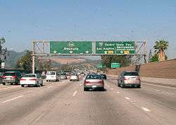
The Ventura Freeway is a freeway in southern California, United States, running from the Santa Barbara/Ventura county line[1] to Pasadena. It is the principal east-west route (designated north-south) through Ventura County and in the southern San Fernando Valley in Los Angeles County. From the Santa Barbara County line to its intersection with the Hollywood Freeway in the southeastern San Fernando Valley in Los Angeles (the Hollywood Split), it is signed as U.S. Route 101, which was built in the late 1950s and opened on April 5, 1960.[2] East of the Hollywood Freeway intersection, it is signed as State Route 134 (SR 134) which was built by 1971. The entire Ventura Freeway is not built to freeway standards, however; the segment that runs through the coastal communities of La Conchita and Mussel Shoals in western Ventura County still remains an expressway.
Prior to the construction of a new alignment in 1971, the portion east of the Golden State Freeway was known as the Colorado Freeway in reference to nearby Colorado Boulevard, a historic thoroughfare in Pasadena and northeastern Los Angeles.
Route description
The Ventura Freeway begins at the Santa Barbara/Ventura county line at the Bates Road exit of U.S. 101 (Exit 83), west of La Conchita. The road alternates between a freeway and an expressway up to the seashore community of Mussel Shoals, when it becomes a freeway for the rest of its length. The freeway travels eastward through the citrus orchards and strawberry fields of the Oxnard Plain before ascending the short, steep Conejo Grade into the Conejo Valley. Continuing eastward through the northern Santa Monica Mountains, it crosses the Ventura/Los Angeles county line before entering the San Fernando Valley. The freeway continues eastward along the valley's southern rim, crossing the 405 and 5 freeways and the Los Angeles River. After passing through Downtown Glendale south of the Verdugo Mountains, it continues along the southern slope of the San Rafael Hills between Glendale and Eagle Rock before entering Pasadena near the Arroyo Seco and terminating at the Foothill Freeway.
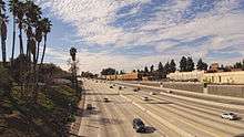
The Ventura Freeway suffers from severe congestion. Its intersection with the San Diego Freeway, in Sherman Oaks, is consistently rated as one of the five most congested interchanges in the nation.[3] Where it meets the Hollywood Freeway at the Hollywood Split junction, it is also notably congested. During events at the Rose Bowl, the freeway's eastern portions often resemble a parking lot.
The east-west geographical alignment of the Ventura Freeway and the overall north-south (Washington-to-California) designation of U.S. 101 on freeway signs can be confusing to visitors; the same freeway entrance can often be signed as "101 North" and "101 West"; this is most common in the San Fernando Valley.[4]
California State Route 134
State Route 134 is part of the California Freeway and Expressway System.[5]
The road is the main connector from the San Fernando Valley and points north to the San Gabriel Valley and points east. The future Interstate 710 dead-ends at California Blvd and is signed as State Route 710. Residents of South Pasadena have blocked efforts to extend Interstate 710 north to California Boulevard from its current end at Valley Boulevard north of Interstate 10 near the Alhambra/Los Angeles city limit. Signs on SR 134 and I-210 refer to the SR 710 stub in Pasadena as TO State Route 110, because exiting left from the Route 710 stub onto California Blvd and turning right on Arroyo Parkway will take you directly to SR 110, which is Pasadena's only direct freeway link to Downtown Los Angeles.
The Interstate 5 offramp at Colorado St. is old SR 134, and there are still mileposts that refer to it as such. Old SR 134 followed Colorado St. through Glendale and Colorado Boulevard in Eagle Rock to the ramp connecting Colorado Boulevard and Figueroa Street to the Ventura Freeway. Old SR 134 continued onto the ramp and then onto what is now the Ventura Freeway to Orange Grove Boulevard in Pasadena. The Colorado Boulevard/Figueroa Street ramps and the segment of freeway between the ramps and just east of Orange Grove Boulevard used to be known as the Colorado Freeway.
Legal definition

The Ventura Freeway is Routes 101 and 134 from Route 5 to the Santa Barbara County line.[1] This does not include the portion of Route 134 between Route 5 and Route 210 even though local usage extends the name over this portion of freeway. At the freeway's eastern terminus with Interstate 210 in Pasadena, highway signs still indicate "Ventura" as the destination for Route 134.
Assembly Concurrent Resolution 54, Chapter 85 in 2003 also designated Route 101 in Ventura County as the "Screaming Eagles Highway".[6] This honors the 101st Airborne Division of the United States Army, which formed on July 23, 1918 and has been involved in every major war that the United States has participated in since then.[7]
Exit list
This exit list proceeds from east to west, since the majority of the freeway is the north-south US 101. Except where prefixed with a letter, postmiles were measured on the road as it was in 1964, based on the alignment that existed at the time, and do not necessarily reflect current mileage. R reflects a realignment in the route since then, M indicates a second realignment, L refers an overlap due to a correction or change, and T indicates postmiles classified as temporary (for a full list of prefixes, see the list of postmile definitions).[8] Segments that remain unconstructed or have been relinquished to local control may be omitted. The numbers reset at county lines; the start and end postmiles in each county are given in the county column.
| County | Location | Postmile [8][9][10] | Exit [11][12] | Destinations | Notes |
|---|---|---|---|---|---|
| Los Angeles LA R13.34-0.00 11.75-38.19 | Pasadena | R13.34 | Eastbound exit and westbound entrance; east end of SR 134/Ventura Fwy; I-210 west exit 26A | ||
| | Fair Oaks Avenue, Marengo Avenue | Eastbound exit and westbound entrance | |||
| R13.34 | 13B | Eastbound exit and westbound entrance; I-210 east exit 25B | |||
| R13.34 | 13B | ||||
| R12.97 | 13A | Colorado Boulevard, Orange Grove Boulevard | Former SR 248 | ||
| R12.36 | 12 | San Rafael Avenue, Linda Vista Avenue | Linda Vista Avenue was former SR 159 north | ||
| Los Angeles | R11.44 | 11 | Figueroa Street, Colorado Boulevard | Figueroa Street was former SR 159 south; Colorado Boulevard was former SR 248 east; westbound exit and eastbound entrance for Colorado Boulevard only | |
| Glendale | R8.96 | 9B | Signed as exit 9A eastbound; SR 2 east exits 17A-B, west exit 17B | ||
| R8.81 | 9A | Harvey Drive | Signed as exit 9B eastbound | ||
| R7.87 | 8 | Glendale Avenue | |||
| R6.96– R7.13 | 7B | Central Avenue, Brand Boulevard | |||
| R6.57 | 7A | Pacific Avenue | |||
| R6.18 | 6 | San Fernando Road | Former US 6 / US 99 | ||
| Los Angeles | R5.47 | 5 | Westbound exit and eastbound entrance; I-5 south exit 144 | ||
| R5.47 | 5B | Signed as exit 5 westbound; I-5 north exit 144A-B | |||
| 4.81 | 5A | Eastbound exit and westbound entrance | |||
| 3.81 | 4 | Forest Lawn Drive | |||
| Burbank | 2.90 | 3 | Bob Hope Drive, Buena Vista Street | ||
| 2.11 | 2 | Hollywood Way | No eastbound exit | ||
| 1.82 | 2 | Pass Avenue – Burbank | Eastbound exit only | ||
| Los Angeles | 0.86 | 1D | Cahuenga Boulevard – Hollywood | Signed as exit 1 eastbound; no westbound entrance | |
| 0.51 | 1C | Lankershim Boulevard – North Hollywood | Westbound exit and eastbound entrance | ||
| 0.35 | Vineland Avenue | No westbound exit | |||
| 0.00 | 1B | West/northbound exit and east/southbound entrance; signed as exit 13 on US 101 north; SR 170 south exit 5B | |||
| 0.00 11.75 | West/north end of SR 134; east/south end of US 101 overlap; signed as exit 1A on SR 134 westbound | ||||
| 11.75 | East/southbound exit and west/northbound entrance | ||||
| 11.83 | 13A | Tujunga Avenue | Southbound exit and northbound entrance | ||
| 12.85 | 14 | Laurel Canyon Boulevard – Studio City | |||
| 13.88 | 15 | Coldwater Canyon Avenue | |||
| 14.89 | 16 | Woodman Avenue | |||
| 15.91 | 17 | Van Nuys Boulevard | |||
| 16.94 | 18 | Sepulveda Boulevard | Northbound exit and southbound entrance | ||
| 17.17 | 19A | I-405 exit 63B | |||
| 17.50 | 19B | Haskell Avenue | No southbound entrance | ||
| 18.61 | 20 | Hayvenhurst Avenue | Northbound exit and southbound entrance | ||
| 19.22 | 21 | Balboa Boulevard – Encino | |||
| 20.23 | 22 | White Oak Avenue | |||
| 21.25 | 23 | Reseda Boulevard | |||
| 22.25 | 24 | Tampa Avenue | |||
| 23.26 | 25 | Winnetka Avenue – Woodland Hills | |||
| 24.31 | 26A | De Soto Avenue, Serrania Avenue | Signed as exit 26 southbound | ||
| 24.85 | 26B | Canoga Avenue | Northbound exit and southbound entrance | ||
| 25.34 | 27 | Signed as exits 27A (north) and 27B (south) northbound | |||
| 25.76 | 27C | Shoup Avenue | Northbound exit and southbound entrance | ||
| 26.45 | 28 | Fallbrook Avenue | Southbound exit only | ||
| 26.86 | 28 | Woodlake Avenue | Northbound exit and entrance | ||
| 27.36 | 29 | Mulholland Drive, Valley Circle Boulevard | |||
| Calabasas | 28.29 | 30 | Parkway Calabasas | ||
| 31.06 | 32 | Las Virgenes Road – Malibu Canyon | |||
| 31.92 | 33 | Lost Hills Road | |||
| Agoura Hills | 32.79 | 34 | Liberty Canyon Road | ||
| 33.69 | 35 | Chesebro Road – Agoura Hills | |||
| 35.04 | 36 | Kanan Road | |||
| 36.18 | 38 | Reyes Adobe Road | |||
| Westlake Village | 37.54 | 39 | Lindero Canyon Road | ||
| Ventura VEN 0.00-R43.62 | Thousand Oaks | 0.70 | 40 | South end of SR 23 overlap | |
| 1.62 | 41 | Hampshire Road | |||
| 3.02 | 43A | Rancho Road | Signed as exit 43B northbound | ||
| 3.11 | 43B | North end of SR 23 overlap; signed as exit 43A northbound; SR 23 south exits 12A-B | |||
| 4.06 | 44 | Moorpark Road – Thousand Oaks | |||
| 5.05 | 45 | Lynn Road | |||
| 6.19 | 46 | Ventu Park Road – Newbury Park | |||
| 7.02 | 47A | Rancho Conejo Boulevard, Borchard Road | Signed as exits 47A (Rancho Conejo Boulevard) and 47B (Borchard Road) northbound | ||
| 7.89 | 47B | Wendy Drive – Newbury Park | Signed as exit 47C northbound | ||
| Camarillo | 10.74 | 50 | Camarillo Springs Road – Camarillo Grove County Park | ||
| 12.30 | 52 | Santa Rosa Road, Pleasant Valley Road | |||
| 13.75 | 53A | Flynn Road, Dawson Drive | |||
| 13.85 | 53B | ||||
| 14.80 | 54 | Carmen Drive – Camarillo | |||
| 15.89 | 55 | Las Posas Road | |||
| | 56 | Springville Drive | |||
| 17.75 | 57 | Central Avenue | |||
| Oxnard | 19.17 | 59 | Del Norte Boulevard | ||
| 20.08 | 60 | Santa Clara Avenue, Rice Avenue | |||
| 21.01 | 61 | Rose Avenue | |||
| 22.01 | 62A | ||||
| 22.73 | 62B | Oxnard Boulevard (SR 1) | South end of SR 1 overlap | ||
| | 63A | Ventura Road | Southbound exit only | ||
| Ventura | R23.45 | 63B | Johnson Drive – Montalvo | Signed as exit 63 northbound | |
| R24.65 | 64 | Victoria Avenue – Channel Islands Harbor | |||
| 25.97 | 65 | Telephone Road | Northbound entrance is via Main St | ||
| 26.39 | 66A | Signed as exit 66 southbound; no southbound entrance; SR 126 west exit 1A | |||
| 26.72 | 66B | Main Street (US 101 Bus. north) – Ventura | No southbound exit | ||
| 28.45 | 68 | Seaward Avenue | |||
| 29.45 | 69 | Vista del Mar Drive, Sanjon Road | Northbound exit and southbound entrance | ||
| 30.15 | 70A | California Street, Ventura Avenue | |||
| 30.91 | 70B | ||||
| 31.50 | 71 | Main Street (US 101 Bus. south) – Ventura | Southbound exit and northbound entrance | ||
| | R32.70 | 72 | North end of SR 1 overlap; northbound exit and southbound entrance | ||
| | R38.98 | 78 | South end of SR 1 overlap | ||
| | R43.57 | 83 | Bates Road | ||
| Ventura–Santa Barbara county line | | R43.62 | none | Continuation into Santa Barbara County | |
1.000 mi = 1.609 km; 1.000 km = 0.621 mi
| |||||
See also
References
- 1 2 3 2007 Named Freeways, Highways, Structures and Other Appurtenances in California (PDF). Caltrans. p. 78. Retrieved 2007-03-28.
- ↑ Kevin Starr, Golden Dreams: California in an Age of Abundance, 1950-1963 (New York: Oxford University Press, 2009), p. 3.
- ↑ Infoplease, Quoting the" American Highway Users Alliance, Unclogging America’s Arteries, 1999–2004 rates 101-405 as the Worst Highway Bottleneck
- ↑ Total Traffic LA 101 NORTH (WEST) AT WINNETKA IN WOODLAND HILLS CLOSED DUE TO AN OVERTURNED SUV (note 101 NORTH (WEST))
- ↑ CA Codes (shc:250-257)
- ↑ Ib. at 76
- ↑ "California Highways (www.cahighways.org): Routes 97 through 104". www.cahighways.org. Retrieved 2012-11-07.
- 1 2 California Department of Transportation. "State Truck Route List". Sacramento: California Department of Transportation. Archived from the original (XLS file) on June 30, 2015. Retrieved June 30, 2015.
- ↑ California Department of Transportation, Log of Bridges on State Highways, July 2007
- ↑ California Department of Transportation, All Traffic Volumes on CSHS, 2005 and 2006
- ↑ California Department of Transportation, California Numbered Exit Uniform System, US-101 Northbound and US-101 Southbound. Retrieved February 2008.
- ↑ California Department of Transportation, California Numbered Exit Uniform System, SR-134 Eastbound and SR-134 Westbound. Retrieved February 2008.
External links
| Wikimedia Commons has media related to Ventura Freeway. |
- California @ AARoads — State Route 134
- Caltrans: Route 134 highway conditions
- California Highways: SR 134
- Colorado Freeway History