Baldwin Park, California
| Baldwin Park, California | |
|---|---|
| City | |
| City of Baldwin Park | |
| Motto: The Hub of the San Gabriel Valley | |
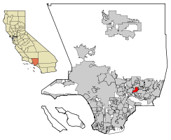 Location of Baldwin Park in California | |
 Baldwin Park, California Location in the United States | |
| Coordinates: 34°4′58″N 117°58′18″W / 34.08278°N 117.97167°W | |
| Country |
|
| State |
|
| County |
|
| Incorporated | January 25, 1956[1] |
| Government | |
| • Mayor | Manuel Lozano[2] |
| • City Council[2] |
Susan Rubio Cruz Baca Ricardo Pacheco Monica Garcia |
| Area[3] | |
| • Total | 6.786 sq mi (17.575 km2) |
| • Land | 6.631 sq mi (17.174 km2) |
| • Water | 0.155 sq mi (0.400 km2) 2.28% |
| Elevation[4] | 374 ft (114 m) |
| Population (2010) | |
| • Total | 75,390 |
| • Density | 11,000/sq mi (4,300/km2) |
| Time zone | PST (UTC-8) |
| • Summer (DST) | PDT (UTC-7) |
| ZIP Code | 91706[5] |
| Area code(s) | 626[6] |
| FIPS code | 06-03666 |
| GNIS feature IDs | 1652669, 2409777 |
| Website |
www |
Baldwin Park is a city located in the central San Gabriel Valley region of Los Angeles County, California, United States. As of the 2010 census, the population was 75,390, down from 75,837 at the 2000 census.
History
Baldwin Park began as part of cattle grazing land belonging to the San Gabriel Mission. It eventually became part of the Rancho Azusa de Dalton and the Rancho La Puente properties. The community became known as Vineland in 1860. By 1906 it changed to Baldwin Park. It was named after Elias J. "Lucky" Baldwin. In 1956 Baldwin Park became the 47th incorporated city in the State of California. Currently the city is pushing to revitalize its economic base. There are six active Project Redevelopment Areas located in strategic areas of the city.
Projects within these redevelopment areas are as diverse, including high-quality senior housing, Home Depot, Starbucks, Harley Davidson, a transit oriented district (TOD) near the Metrolink Train Station and various other thriving businesses.
Baldwin Park is home to the first In-N-Out burger stand, opened on October 22, 1948. It was the first drive-thru in California[7] and was replaced in November 2004 with a new building. The new In-N-Out University and company store opened in 2006 on Francisquito Avenue. Also, the company's first meatpacking plant is located down the street from the locations at the company headquarters on Hamburger Lane. In/N/Out now has a second meat processing plant in Texas to serve their Texas restaurants.
As of September 1882, the first school house was built on the southeast corner of North Maine and Los Angeles Avenues in 1884. It contained two rows of double seats, a central aisle leading to the teacher's desk, and a heating stove at the north end. Mr. Frazier was the first teacher. In April 1888, The Vineland School District was established according to county records.
The first Board of Trustees took office on July 1, 1888, and elected Miss Jessie Washburn to teach the district school that fall. The building was sold in 1890 and moved to another site for a private residence. The district built the second school in 1890 and hired two teachers, Miss Ellen Lang and Miss Venna O. Finney. The second school house was relegated to the past in 1912. It later became a private Japanese school and stood as a landmark until it caught fire on September 5, 1936, and burned to the ground. Today, the Baldwin Park Unified School District lies contiguously with the city's borders. There are 23 schools within this district. The budget is well over $100 million. Currently the district is building new school structures to accommodate growth. The district is adopting data driven strategies to help students achieve better scores in the API tests. There is an active push by the district to hire new teachers while providing retirement incentives for teachers who wish to retire.
In the 1950s Vias Turkey Ranch was about one mile (1.6 km) from the now 10 Freeway just off of Frazier Avenue. This huge commercial turkey ranch was famous in the Valley for a huge outdoor aviary with a unique selection of birds. The ranch had two or three types of deer species. When the value of the land escalated, the property was sold and the Ranch moved to Apple Valley.
The McMullan Dairy was on Frazier where area schools brought students on field trips.
Popular pastimes in the 1950s included riding at the horse stables across the bridge of the San Gabriel River, which was an open sand and rock river bed, and ride one hour for the sum of $1.00, a hefty price at that time considering that the minimum wage was fifty cents an hour.
In summer 2005, Save Our State, an anti-illegal immigration group based in Ventura, launched a series of protests against the Danzas Indigenas, art at the Baldwin Park Metrolink station designed for the MTA in 1993 by artist Judy Baca. The monument bears several engraved statements whose origins are not attributed. At issue was one particular inscription--It was better before they came—that Save Our State claimed was directed against Anglo whites. In fact, according to Baca, that sentence was uttered by an Anglo white Baldwin Park resident in the 1950s; he was lamenting the influx of persons of Mexican ancestry into the San Gabriel Valley following World War II. Save Our State continued the protests, which drew counter-protesters and required city expenditure on crowd control and riot police. Save Our State stopped protesting towards the end of the summer and has not made any further appearances in the city.
Climate
Baldwin Park experiences a mild winter and warm to hot summer. The highest record temperature ever is 112 °F and the coldest being 21 °F.
| Climate data for Baldwin Park, California | |||||||||||||
|---|---|---|---|---|---|---|---|---|---|---|---|---|---|
| Month | Jan | Feb | Mar | Apr | May | Jun | Jul | Aug | Sep | Oct | Nov | Dec | Year |
| Average high °F (°C) | 70 (21) |
71 (22) |
72 (22) |
77 (25) |
79 (26) |
84 (29) |
89 (32) |
90 (32) |
88 (31) |
83 (28) |
76 (24) |
71 (22) |
79.2 (26.2) |
| Average low °F (°C) | 43 (6) |
45 (7) |
47 (8) |
50 (10) |
55 (13) |
59 (15) |
62 (17) |
63 (17) |
61 (16) |
55 (13) |
46 (8) |
42 (6) |
52.3 (11.3) |
| Source: weather.com[8] | |||||||||||||
Geography
According to the United States Census Bureau, the city has a total area of 17.6 km² (6.8 mi²). 17.2 km² (6.6 mi²) of it is land and 0.4 km² (0.2 mi²) of it (2.28%) is water.
Demographics
| Historical population | |||
|---|---|---|---|
| Census | Pop. | %± | |
| 1960 | 33,951 | — | |
| 1970 | 47,285 | 39.3% | |
| 1980 | 50,554 | 6.9% | |
| 1990 | 69,330 | 37.1% | |
| 2000 | 75,837 | 9.4% | |
| 2010 | 75,390 | −0.6% | |
| Est. 2015 | 77,071 | [9] | 2.2% |
2010
The 2010 United States Census[11] reported that Baldwin Park had a population of 75,390. The population density was 11,110.3 people per square mile (4,289.7/km²). The racial makeup of Baldwin Park was 33,119 (43.9%) White, (4.3% Non-Hispanic White),[12] 913 (1.2%) African American, 674 (0.9%) Native American, 10,696 (14.2%) Asian, 85 (0.1%) Pacific Islander, 27,079 (35.9%) from other races, and 2,824 (3.7%) from two or more races. Hispanic or Latino of any race were 60,403 persons (80.1%).
The Census reported that 74,984 people (99.5% of the population) lived in households, 88 (0.1%) lived in non-institutionalized group quarters, and 318 (0.4%) were institutionalized.
There were 17,189 households, out of which 10,027 (58.3%) had children under the age of 18 living in them, 10,097 (58.7%) were opposite-sex married couples living together, 3,358 (19.5%) had a female householder with no husband present, 1,700 (9.9%) had a male householder with no wife present. There were 1,093 (6.4%) unmarried opposite-sex partnerships, and 103 (0.6%) same-sex married couples or partnerships. 1,474 households (8.6%) were made up of individuals and 648 (3.8%) had someone living alone who was 65 years of age or older. The average household size was 4.36. There were 15,155 families (88.2% of all households); the average family size was 4.45.
The population was spread out with 22,571 people (29.9%) under the age of 18, 8,849 people (11.7%) aged 18 to 24, 21,588 people (28.6%) aged 25 to 44, 16,323 people (21.7%) aged 45 to 64, and 6,059 people (8.0%) who were 65 years of age or older. The median age was 30.5 years. For every 100 females there were 98.5 males. For every 100 females age 18 and over, there were 96.0 males.
There were 17,736 housing units at an average density of 2,613.8 per square mile (1,009.2/km²), of which 10,353 (60.2%) were owner-occupied, and 6,836 (39.8%) were occupied by renters. The homeowner vacancy rate was 1.3%; the rental vacancy rate was 3.3%. 45,844 people (60.8% of the population) lived in owner-occupied housing units and 29,140 people (38.7%) lived in rental housing units.
According to the 2010 United States Census, Baldwin Park had a median household income of $51,153, with 17.5% of the population living below the federal poverty line. [12]
2000
As of the census[13] of 2000, there were 75,837 people, 16,961 households, and 15,061 families residing in the city. The population density was 4,396.5/km² (11,379.2/mi²). There were 17,430 housing units at an average density of 1,010.5/km² (2,615.3/mi². The racial makeup of the city was 40.18% White, 1.61% Black or African American, 1.45% Native American, 11.64% Asian, 0.15% Pacific Islander, 40.51% from other races, and 4.48% from two or more races. 78.67% of the population were Hispanic or Latino of any race.
There were 16,961 households out of which 55.9% had children under the age of 18 living with them, 62.8% were married couples living together, 17.5% had a female householder with no husband present, and 11.2% were non-families. 8.1% of all households were made up of individuals and 3.9% had someone living alone who was 65 years of age or older. The average household size was 4.44 and the average family size was 4.53.
In the city the population was spread out with 34.9% under the age of 18, 11.9% from 18 to 24, 30.6% from 25 to 44, 16.4% from 45 to 64, and 6.2% who were 65 years of age or older. The median age was 27 years. For every 100 females there were 100.0 males. For every 100 females age 18 and over, there were 97.3 males.
The median income for a household in the city was $41,629, and the median income for a family was $41,256. Males had a median income of $26,873 versus $22,186 for females. The per capita income for the city was $11,562. About 15.4% of families and 18.2% of the population were below the poverty line, including 21.8% of those under age 18 and 12.8% of those age 65 or over.
Government
In the California State Legislature, Baldwin Park is in the 22nd Senate District, represented by Democrat Ed Hernandez, and in the 48th Assembly District, represented by Democrat Blanca Rubio.[14]
In the United States House of Representatives, Baldwin Park is in California's 32nd congressional district, represented by Democrat Grace Napolitano.[15]
The Los Angeles County Department of Health Services operates the Monrovia Health Center in Monrovia, serving Baldwin Park.[16]
Baldwin Park has a city police department of its own, but contracts for fire and rescue with the Los Angeles County Fire Department.
Economy
Top employers
According to the City's 2009 Comprehensive Annual Financial Report,[17](incorrect source cited) the top employers in the city are:
| # | Employer | # of Employees |
|---|---|---|
| 1 | Kaiser Permanente | 1,483 |
| 2 | United Parcel Service | 1,099 |
| 3 | Wal-Mart | 490 |
| 4 | The Home Depot | 236 |
| 5 | Universal Plastic Mold | 168 |
| 6 | Target | 165 |
| 7 | Vallarta Supermarkets | 150 |
| 8 | Philips | 149 |
| 9 | Helix Medical | 144 |
| 10 | Touchdown Technologies | 130 |
References
- ↑ "California Cities by Incorporation Date". California Association of Local Agency Formation Commissions. Archived from the original (Word) on November 3, 2014. Retrieved August 25, 2014.
- 1 2 "City Elected Officials". City of Baldwin Park. Retrieved October 20, 2014.
- ↑ "2010 Census U.S. Gazetteer Files – Places – California". United States Census Bureau.
- ↑ "Baldwin Park". Geographic Names Information System. United States Geological Survey. Retrieved October 19, 2014.
- ↑ "USPS - ZIP Code Lookup - Find a ZIP+ 4 Code By City Results". Retrieved 2007-01-17.
- ↑ "Number Administration System - NPA and City/Town Search Results". Archived from the original on September 29, 2007. Retrieved 2007-01-18.
- ↑ John Rogers (2010-07-03). Associated Press https://web.archive.org/web/20100707000728/http://www.sfgate.com/cgi-bin/article.cgi?f=/n/a/2010/07/03/national/a082241D08.DTL. Archived from the original on July 7, 2010. Missing or empty
|title=(help) - ↑ "WeatherAverages: Weather for Baldwin Park, California, United States of America". Retrieved 2007-06-19.
- ↑ "Annual Estimates of the Resident Population for Incorporated Places: April 1, 2010 to July 1, 2015". Retrieved July 2, 2016.
- ↑ "Census of Population and Housing". Census.gov. Archived from the original on May 11, 2015. Retrieved June 4, 2015.
- ↑ "2010 Census Interactive Population Search: CA - Baldwin Park city". U.S. Census Bureau. Retrieved July 12, 2014.
- 1 2 http://quickfacts.census.gov/qfd/states/06/0603666.html. Missing or empty
|title=(help) - ↑ "American FactFinder". United States Census Bureau. Archived from the original on September 11, 2013. Retrieved 2008-01-31.
- ↑ "Statewide Database". UC Regents. Retrieved December 10, 2014.
- ↑ "California's 32nd Congressional District - Representatives & District Map". Civic Impulse, LLC.
- ↑ "Monrovia Health Center." Los Angeles County Department of Health Services. Retrieved on March 27, 2010.
- ↑ City of Livermore CAFR
External links
| Wikivoyage has a travel guide for Baldwin Park. |
- Official website
- Baldwin Park Unified School District website
- Danzas Indigenas info and photos
- Danzas Indigenas monument controversy at SPARC site
 |
Santa Fe Dam Recreation Area | San Gabriel River & Irwindale | Irwindale | |
| El Monte | |
Covina | ||
| ||||
| | ||||
| South El Monte & Industry | La Puente | West Covina |
