Rolling Hills, California
| Rolling Hills, California | ||
|---|---|---|
| General law city[1] | ||
| City of Rolling Hills | ||
| ||
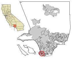 Location of Rolling Hills in Los Angeles County, California | ||
 Rolling Hills, California Location in the United States | ||
| Coordinates: 33°45′34″N 118°20′30″W / 33.75944°N 118.34167°WCoordinates: 33°45′34″N 118°20′30″W / 33.75944°N 118.34167°W | ||
| Country |
| |
| State |
| |
| County |
| |
| Incorporated | January 24, 1957[2] | |
| Government | ||
| • Type | Council-Manager[1] | |
| • Mayor | Jeff Pieper[3] | |
| Area[4] | ||
| • Total | 2.991 sq mi (7.746 km2) | |
| • Land | 2.991 sq mi (7.746 km2) | |
| • Water | 0 sq mi (0 km2) 0% | |
| Elevation[5] | 1,276 ft (389 m) | |
| Population (2010) | ||
| • Total | 1,860 | |
| • Density | 620/sq mi (240/km2) | |
| Time zone | Pacific (UTC-8) | |
| • Summer (DST) | PDT (UTC-7) | |
| ZIP code | 90274 | |
| Area codes | 310/424 | |
| FIPS code | 06-62602 | |
| GNIS feature IDs | 1661325, 2410986 | |
| Website |
www | |

Rolling Hills is an affluent city on the Palos Verdes Peninsula, in Los Angeles County, California. In 2016, the city of Rolling Hills was distinguished as "The Richest Town in California" according to 247wallst.com[6] In the same year, consumeraffairs.com cited Rolling Hills as one of the top ten "Safest Cities in California".[7] Back in 1996, Worth Magazine named Rolling Hills as "The Richest Town in America".[8]
As of the 2010 census, the city population was 1,860, down from 1,871 at the 2000 census. Rolling Hills consists of a single 24 hour guard-gated community with private roads. Residents work, shop, attend school, and obtain other services in the other towns on the Palos Verdes Peninsula. The community was developed by A.E. Hanson, who also developed Hidden Hills. Incorporated in 1957, Rolling Hills maintains a rural and equestrian character, with no traffic lights, multi-acre lots with ample space between homes, and wide equestrian paths along streets and property lines.[9] Homes are one-story 19th century California ranch or Spanish haciendas exemplified by architect Wallace Neff and are required to have white exterior paint.[9] Homeowners are also required to maintain horse property on their lots, or at minimum keep land where stalls could be built.[9] Rolling Hills has the third highest median house value in the United States.[10]
The city borders Rolling Hills Estates to the north and Rancho Palos Verdes on all other sides (including the empty Portuguese Bend landslide area to the south).
Geography
Rolling Hills is located at 33°45′34″N 118°20′30″W / 33.75944°N 118.34167°W (33.759350, −118.341550).[11]
According to the United States Census Bureau, the city has a total area of 3.0 square miles (7.8 km2), all land.
Demographics
| Historical population | |||
|---|---|---|---|
| Census | Pop. | %± | |
| 1960 | 1,664 | — | |
| 1970 | 2,050 | 23.2% | |
| 1980 | 2,049 | 0.0% | |
| 1990 | 1,871 | −8.7% | |
| 2000 | 1,871 | 0.0% | |
| 2010 | 1,860 | −0.6% | |
| Est. 2015 | 1,893 | [12] | 1.8% |
At the 2000 census, Rolling Hills was the 21st richest place in the United States (based upon per capita income), and 4th richest for places with a population of at least 1,000.
2010
The 2010 United States Census[14] reported that Rolling Hills had a population of 1,860. The population density was 622.0 people per square mile (240.1/km²). The racial makeup of Rolling Hills was 1,437 (77.3%) White (74.1% Non-Hispanic White),[15] 29 (1.6%) African American, 5 (0.3%) Native American, 303 (16.3%) Asian, 2 (0.1%) Pacific Islander, 24 (1.3%) from other races, and 60 (3.2%) from two or more races. Hispanic or Latino of any race were 102 persons (5.5%).
The Census reported that 1,860 people (100% of the population) lived in households, 0 (0%) lived in non-institutionalized group quarters, and 0 (0%) were institutionalized.
There were 663 households, out of which 199 (30.0%) had children under the age of 18 living in them, 491 (74.1%) were opposite-sex married couples living together, 27 (4.1%) had a female householder with no husband present, 21 (3.2%) had a male householder with no wife present. There were 11 (1.7%) unmarried opposite-sex partnerships, and 9 (1.4%) same-sex married couples or partnerships. 98 households (14.8%) were made up of individuals and 66 (10.0%) had someone living alone who was 65 years of age or older. The average household size was 2.81. There were 539 families (81.3% of all households); the average family size was 3.08.
The population was spread out with 404 people (21.7%) under the age of 18, 109 people (5.9%) aged 18 to 24, 191 people (10.3%) aged 25 to 44, 643 people (34.6%) aged 45 to 64, and 513 people (27.6%) who were 65 years of age or older. The median age was 51.7 years. For every 100 females there were 91.8 males. For every 100 females age 18 and over, there were 91.1 males.
There were 663 occupied housing units at an average density of 239.4 per square mile (92.4/km²), of which 635 were owner-occupied, and 28 were occupied by renters. The homeowner vacancy rate was 1.4%; the rental vacancy rate was 3.4%. 1,778 people (95.6% of the population) lived in owner-occupied housing units and 82 people (4.4%) lived in rental housing units.
2000
As of the census[16] of 2000, there were 1,871 people, 645 households, and 554 families residing in the city. The population density was 607.7 inhabitants per square mile (234.5/km²). There were 682 housing units at an average density of 221.5 per square mile (85.5/km²). The racial makeup of the city was 79.8% White, 2.0% African American, 14.0% Asian, 0.5% Pacific Islander, 1.2% from other races, and 2.5% from two or more races. Hispanic or Latino of any race were 4.5% of the population.
There were 645 households out of which 33.8% had children under the age of 18 living with them, 80.6% were married couples living together, 3.4% had a female householder with no husband present, and 14.1% were non-families. 12.4% of all households were made up of individuals and 8.1% had someone living alone who was 65 years of age or older. The average household size was 2.90 and the average family size was 3.11.
In the city the population was spread out with 25.9% under the age of 18, 4.1% from 18 to 24, 15.1% from 25 to 44, 32.8% from 45 to 64, and 22.1% who were 65 years of age or older. The median age was 48 years. For every 100 females there were 96.1 males. For every 100 females age 18 and over, there were 92.5 males.
The median income for a household in the city was in excess of $200,000, as is the median income for a family. Males have a median income in excess of $100,000 versus $52,500 for females. The per capita income for the city was $111,031. None of the families and 1.3% of the population were below the poverty line. No one under 18 or older than 65 was living below the poverty line.
Education
The city is served by Palos Verdes Peninsula Unified School District. PVPUSD schools have constantly ranked among the best in California and the nation. Since 2013, the Washington Post has consistently recognized Palos Verdes Peninsula High School in the publication's list of "America's Most Challenging Schools" and once listed it as the 8th best public or private high school in the nation.[17] School data website, niche.com ranked Palos Verdes Peninsula High School #9 of California's best public high schools of 2016.[18] The prestigious Chadwick School is an independent 45 acre, K-12 private school that also serves the area. According to Business Insider, in 2014 niche.com named Chadwick as one of the top private high schools in America.[19]
Politics
Rolling Hills has the third highest percentage of registered Republicans of any city in California, with 61.3% of its 1,441 registered voters registered as Republicans. 19.4% of voters are registered Democrats, and 16.3% "decline to state."[20]
Government
Rolling Hills was incorporated in 1957. It has a council-manager form of government. The city council consists of five members, one of whom is appointed mayor on an annual basis.[3]
State and federal representation
In the California State Legislature, Rolling Hills is in the 26th Senate District, represented by Democrat Ben Allen, and in the 66th Assembly District, represented by Democrat Al Muratsuchi.[21]
In the United States House of Representatives, Rolling Hills is in California's 33rd congressional district, represented by Democrat Ted Lieu.[22]
Services
The Los Angeles County Sheriff's Department (LASD) operates the Lomita Station in Lomita, serving Rolling Hills.[23]
The Los Angeles County Department of Health Services operates the Torrance Health Center in Harbor Gateway, Los Angeles, near Torrance and serving Rolling Hills.[24]
Notable residents
- Gregory Popovich - Owner Castle Rock Winery
.Michael Beaver Schoettle, 1952 Olympic Champion in Sailing.
- Steve Sarkisian, former University of Southern California head football coach [25]
- Pete Carroll, head coach for the Seattle Seahawks and former University of Southern California head football coach [26]
- Tracy Austin, former world #1 tennis player and two-time US Open winner[27]
- Colin Baxter, professional football player[28]
- Mike Mentzer (1951–2001), professional bodybuilder and 1979 Mr. Olympia heavyweight champion[29]
- Greg Miller, owner of the Normandie Casino
- John Z. Blazevich, CEO of Viva Food Group[30]
- Alex McLeod, TV personality and host of Trading Spaces
- Frank Robinson, founder of Robinson Helicopter Company[31]
- John Tu, co-founder of Kingston Technology,[32] an American, privately held, multinational computer technology corporation.
References
- 1 2 "City Manager". City of Rolling Hills. Retrieved February 16, 2015.
- ↑ "California Cities by Incorporation Date" (Word). California Association of Local Agency Formation Commissions. Retrieved August 25, 2014.
- 1 2 "City Council". Rolling Hills, CA. Retrieved March 30, 2015.
- ↑ "2010 Census Gazetteer Files – Places – California". US Census Bureau. Retrieved March 26, 2015.
- ↑ "Rolling Hills". Geographic Names Information System. United States Geological Survey. Retrieved November 11, 2014.
- ↑ "The Richest Towns in America". 247wallst.com.
- ↑ "Top 10 Safest Cities in California". DailyBreeze.
- ↑ "Worth Magazine" (PDF). haciendadelapaz.com.
- 1 2 3 "History of Palos Verdes Real Estate in Rolling Hills". PVBrokers.net. Retrieved March 25, 2015.
- ↑ "Top 100 cities with highest median house value". city-data.com. Retrieved March 25, 2015.
- ↑ "US Gazetteer files: 2010, 2000, and 1990". US Census Bureau. 2011-02-12. Retrieved 2011-04-23.
- ↑ "Annual Estimates of the Resident Population for Incorporated Places: April 1, 2010 to July 1, 2015". Retrieved July 2, 2016.
- ↑ "Census of Population and Housing". Census.gov. Retrieved June 4, 2015.
- ↑ "2010 Census Interactive Population Search: CA - Rolling Hills city". US Census Bureau. Retrieved July 12, 2014.
- ↑ "Profile of General Population and Housing Characteristics: 2010". Census.gov. US Census Bureau, US Dept. of Commerce. Retrieved March 25, 2015.
- ↑ "American FactFinder". US Census Bureau. Retrieved 2008-01-31.
- ↑ "Palos Verdes Peninsula High School Ranking". Washington Post.
- ↑ "California's Best Public High Schools 2016". niche.com.
- ↑ "Best Private High Schools in America 2014". Business Insider.
- ↑ "Registration by Political Subdivision by County" (PDF). California Secretary of State. May 4, 2009. pp. 103–190. Archived from the original (PDF) on March 29, 2012. Retrieved March 27, 2015.
- ↑ "Statewide Database". UC Regents. Retrieved February 11, 2015.
- ↑ "California's 33rd Congressional District - Representatives & District Map". Civic Impulse, LLC.
- ↑ "Lomita Station." Los Angeles County Sheriff's Department. Retrieved on January 21, 2010.
- ↑ "Torrance Health Center." Los Angeles County Department of Health Services. Retrieved on March 18, 2010.
- ↑ "
- ↑ "Pete Carroll's House". virtualglobetrotting.com.
- ↑ "
- ↑ Armstrong, Kevin; Mehta, Manish (September 20, 2011). "Nick Mangold out two-to-three weeks with high ankle sprain, Jets turn to reserve center Colin Baxter". Daily News. New York. Retrieved December 21, 2013.
- ↑ "Mike and Ray Mentzer Found Dead". Fitwise.com. Rolling Hills Estates, California. Associated Press. June 25, 2001. Retrieved March 26, 2015.
- ↑ "Hacienda De La Paz". curbed.com.
- ↑ "Frank Robinson". Blockshopper.com.
- ↑ "John Tu". forbes.com.
External links
- Official website
- Lomita Sheriff Station, LA County Disaster Communications Service (DCS)
