Azusa, California
| Azusa, California | |||
|---|---|---|---|
| City | |||
|
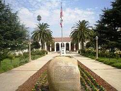
Azusa City Hall | |||
| |||
| Nickname(s): "The Canyon City" | |||
 Location of Azusa in Los Angeles County, California | |||
 Azusa  Azusa Location in the United States | |||
| Coordinates: 34°7′50″N 117°54′25″W / 34.13056°N 117.90694°WCoordinates: 34°7′50″N 117°54′25″W / 34.13056°N 117.90694°W | |||
| Country |
| ||
| State |
| ||
| County |
| ||
| Founded | 1887[1] | ||
| Incorporated | December 29, 1898[2] | ||
| Government | |||
| • Mayor | Joseph Rocha[3] | ||
| Area[4] | |||
| • Total | 9.669 sq mi (25.042 km2) | ||
| • Land | 9.656 sq mi (25.010 km2) | ||
| • Water | 0.013 sq mi (0.032 km2) 0.13% | ||
| Elevation[5] | 610 ft (186 m) | ||
| Population (April 1, 2010)[6] | |||
| • Total | 46,361 | ||
| • Estimate (2013)[6] | 47,842 | ||
| • Density | 4,800/sq mi (1,900/km2) | ||
| Time zone | Pacific (UTC−8) | ||
| • Summer (DST) | PDT (UTC−7) | ||
| ZIP code | 91702 | ||
| Area code(s) | 626 | ||
| FIPS code | 06-03386 | ||
| GNIS feature IDs | 1652667, 2409768 | ||
| Website |
www | ||


Azusa is a city in the San Gabriel Valley, at the foot of the San Gabriel Mountains in Los Angeles County, California, United States.
The A on the San Gabriel Mountains represents the city of Azusa, and can be seen within a 30-mile radius. The population was 46,361 at the 2010 census, up from 44,712 at the 2000 census. Azusa is located along historic Route 66, which passes through the city on Foothill Boulevard and Alosta Avenue.
History
"Azusa stands for everything from A to Z in the U.S.A." has been a phrase used to promote the town by boosters such as the Chamber of Commerce for many years.[7][8][9] The place name "Azusa" actually dates to the Mexican Alta California era in the 19th century when Azusa was used to refer to the San Gabriel Valley and the San Gabriel River. It appears to have been derived from the Tongva place name Asuksagna.[10] The area was part of the Tongva peoples (Gabrieleño Indians) homeland since at least 55 CE.[11]
The first Mexican settlement in Azusa was at the Rancho el Susa in 1841, a Mexican land grant from the Alta California Governor Juan Bautista Alvarado to Luis Arenas. In 1844 Arenas sold the rancho's land to Henry Dalton, an English immigrant and wealthy merchant from the Pueblo of Los Angeles, for $7,000. He renamed it Rancho Azusa de Dalton, and had built a winery, distillery, vinegar house, meat smokehouse, and flour mill. Also, a vineyard was planted. Dalton built a house here on a place known as Dalton Hill, near 6th Street and Cerritos Avenue in Azusa.
Dalton was also the owner of the adjacent and large Rancho San Francisquito and Rancho Santa Anita properties. In the end Dalton owned an unbroken expanse of land from the present day San Dimas to the eastern edge of Pasadena.[12] A portion of Azusa west of the San Gabriel River was within adjacent Rancho Azusa de Duarte
With the cession of California to the United States following the Mexican-American War, the 1848 Treaty of Guadalupe Hidalgo provided that the land grants would be honored. As required by the Land Act of 1851, a claim for Rancho San Francisquito was filed with the Public Land Commission in 1852, confirmed by the Commission in 1853, but rejected by the US District Court in 1855, on the grounds that Henry Dalton was not, at the time of the grant, a citizen of Mexico.[13] The decree was reversed by the US Supreme Court,[14] and the grant was patented to Henry Dalton in 1867.[15]
The 1870 US Census listed the area as the township of Azusa - El Monte Township and 1880 US Census listed the area as the township of San Josi and Azusa. There were a few corrections to cross out the San Josi name on most of the census pages, but this was done sporadically and there remain many index errors in the online census due to these errors.
Dalton had borrowed money from Los Angeles banker Jonathan S. Slauson to fund 24 years of litigation, and had to sign the land over to him in 1880. Slauson laid out the plan for the city in 1887 and the city was officially incorporated in 1898.[16]
The completion of the Los Angeles and San Gabriel Valley Railroad in January 1887, later sold to the Santa Fe railroad, brought new people looking for homes and investment opportunities in Azusa. The Gold Line Foothill light rail line is being built on the old rail right-of-way.[17][18][19] Part of this land boom was the short lived (1887-1905) town of Gladstone, now part of Azusa.[20]
Geography
The city is located at the entrance to the San Gabriel Canyon, giving the city its nickname "The Canyon City." It is on the east side of the San Gabriel River.
According to the United States Census Bureau, the city has a total area of 9.7 square miles (25 km2), over 99% of it is land.
Azusa is located at 34°7′50″N 117°54′25″W / 34.13056°N 117.90694°W.[21]
- Sister cities
Azusa has one sister city:[22]
Climate
This region experiences warm (but not hot) and dry summers, with no average monthly temperatures above 71.6 °F (22.0 °C). According to the Köppen Climate Classification system, Azusa has a warm-summer Mediterranean climate, abbreviated "Csb" on climate maps.[23]
Demographics
| Historical population | |||
|---|---|---|---|
| Census | Pop. | %± | |
| 1860 | 363 | — | |
| 1870 | 320 | −11.8% | |
| 1900 | 863 | — | |
| 1910 | 1,477 | 71.1% | |
| 1920 | 2,460 | 66.6% | |
| 1930 | 4,808 | 95.4% | |
| 1940 | 5,209 | 8.3% | |
| 1950 | 11,042 | 112.0% | |
| 1960 | 20,497 | 85.6% | |
| 1970 | 25,217 | 23.0% | |
| 1980 | 29,380 | 16.5% | |
| 1990 | 41,333 | 40.7% | |
| 2000 | 44,712 | 8.2% | |
| 2010 | 46,361 | 3.7% | |
| Est. 2015 | 49,690 | [24] | 7.2% |
2010
The 2010 United States Census[26] reported that Azusa had a population of 46,361. The population density was 4,794.9 people per square mile (1,851.3/km²). The racial makeup of Azusa was 26,715 (57.6%) White (19.3% Non-Hispanic White),[27] 1,499 (3.2%) African American, 562 (1.2%) Native American, 4,054 (8.7%) Asian, 87 (0.2%) Pacific Islander, 11,270 (24.3%) from other races, and 2,174 (4.7%) from two or more races. Hispanic or Latino of any race were 31,328 persons (67.6%).
The Census reported that 43,559 people (94.0% of the population) lived in households, 2,691 (5.8%) lived in non-institutionalized group quarters, and 111 (0.2%) were institutionalized.
There were 12,716 households, out of which 5,955 (46.8%) had children under the age of 18 living in them, 6,310 (49.6%) were opposite-sex married couples living together, 2,275 (17.9%) had a female householder with no husband present, 1,014 (8.0%) had a male householder with no wife present. There were 891 (7.0%) unmarried opposite-sex partnerships, and 104 (0.8%) same-sex married couples or partnerships. 2,238 households (17.6%) were made up of individuals and 761 (6.0%) had someone living alone who was 65 years of age or older. The average household size was 3.43. There were 9,599 families (75.5% of all households); the average family size was 3.85.
The population was spread out with 12,407 people (26.8%) under the age of 18, 7,724 people (16.7%) aged 18 to 24, 13,185 people (28.4%) aged 25 to 44, 9,469 people (20.4%) aged 45 to 64, and 3,576 people (7.7%) who were 65 years of age or older. The median age was 29.3 years. For every 100 females there were 96.0 males. For every 100 females age 18 and over, there were 92.8 males.
There were 13,386 housing units at an average density of 1,384.4 per square mile (534.5/km²), of which 6,802 (53.5%) were owner-occupied, and 5,914 (46.5%) were occupied by renters. The homeowner vacancy rate was 1.4%; the rental vacancy rate was 6.6%. 22,805 people (49.2% of the population) lived in owner-occupied housing units and 20,754 people (44.8%) lived in rental housing units.
During 2009–2013, Azusa had a median household income of $52,001, with 20.1% of the population living below the federal poverty line.[27]
2000
As of the census[28] of 2000, there were 44,712 people, 12,549 households, and 9,298 families residing in the city. The population density was 5,023.7 inhabitants per square mile (1,939.7/km²). There were 13,013 housing units at an average density of 1,462.1 per square mile (564.5/km²). The racial makeup of the city was 52.35% White, 3.78% Black or African American, 1.31% Native American, 6.14% Asian, 0.17% Pacific Islander, 30.52% from other races, and 5.73% from two or more races. 63.79% of the population were Hispanic or Latino of any race.
There were 12,549 households out of which 43.5% had children under the age of 18 living with them, 49.7% were married couples living together, 17.1% had a female householder with no husband present, and 25.9% were non-families. 18.7% of all households were made up of individuals and 6.2% had someone living alone who was 65 years of age or older. The average household size was 3.41 and the average family size was 3.90.
In the city the population was spread out with 30.8% under the age of 18, 15.5% from 18 to 24, 31.5% from 25 to 44, 15.3% from 45 to 64, and 6.9% who were 65 years of age or older. The median age was 27 years. For every 100 females there were 97.5 males. For every 100 females age 18 and over, there were 93.6 males.
The median income for a household in the city was $39,191, and the median income for a family was $40,918. Males had a median income of $30,845 versus $26,565 for females. The per capita income for the city was $13,412. About 15.1% of families and 18.8% of the population were below the poverty line, including 23.9% of those under age 18 and 10.4% of those age 65 or over.
Economy
According to the City of Azusa's FY 2014-15 Comprehensive Annual Financial Report - Please refer to reference 29 below for link,[29] the top employers in the city are:
| # | Employer | # of Employees | ||||||||||||||||||||||||
|---|---|---|---|---|---|---|---|---|---|---|---|---|---|---|---|---|---|---|---|---|---|---|---|---|---|---|
| 1 | Azusa Pacific University | 1,433 | ||||||||||||||||||||||||
| 2 | Azusa Unified School District | 1,250 | ||||||||||||||||||||||||
| 3 | Northrop Grumman | 859 | ||||||||||||||||||||||||
| 4 | City of Azusa | 383 | ||||||||||||||||||||||||
| 5 | Costco Wholesale Corporation | 295 | ||||||||||||||||||||||||
| 6 | S&S Foods LLC | 285 | ||||||||||||||||||||||||
| 7 | Hanson Distributing Company | 195 | ||||||||||||||||||||||||
| 8 | Buena Vista Food Products | 186 | ||||||||||||||||||||||||
| 9 | Target Corporation | 142 | ||||||||||||||||||||||||
| 10 | Artisian Screen | 140 | ||||||||||||||||||||||||
Azusa was the former home of the Lucky Lager brewery and its successor, General Brewing. Built in 1949, the facility was purchased and converted to production by Miller Brewery in May 1966. A decade later, Miller relocated its operations to the nearby city of Irwindale and the Azusa facility ceased production in 1980 and was eventually demolished.
- Professional sports teams
| Club | Sport | Founded | League | Venue |
|---|---|---|---|---|
| SoCal Legends | Basketball | 2005 | Continental Basketball Association | Azusa Pacific University |
Superfundsite
Aerojet, the rocket engine manufacturer, had a plant in Azusa from World War II to 2001. In 1980, it was determined that under Aerojet's facility there was TCE water contamination in the groundwater, whose plume was entering the aquifer under the city and of the San Gabriel Valley groundwater basin.[30] The San Gabriel Valley aquifer is very valuable, providing most of the drinking water in the area at a fraction of the cost of water imported by aqueducts.[30] In 1985, the U.S. EPA declared it a Superfund Site.[30]
In 1997, additional chemical contamination, mostly NDMA and ammonium perchlorate, was found in the site's groundwater. Aerojet was named the Responsible Party for the groundwater remediation (cleanup) work and expenses.[31] Aerojet sold the property in 2001 to Northrop Grumman Corporation, but remained the Responsible Party for the pollution.
In a 2002 court decision, Aerojet and seven other San Gabriel Valley groundwater polluters agreed to provide funding to build and operate six water-treatment facilities.[32] One of the main contaminants is perchlorate, a carcinogenic component of rocket fuels produced by Aerojet.[32]
Government and infrastructure
In the California State Legislature, Azusa is in the 22nd Senate District, represented by Democrat Ed Hernandez, and in the 48th Assembly District, represented by Democrat Blanca Rubio.[33]
In the United States House of Representatives, Azusa is in California's 32nd congressional district, represented by Democrat Grace Napolitano.[34]
The city mayor is Joseph Rocha.
On March 9, 2011, Azusa voters approved an agreement between Azusa Rock, Inc. and the City to address environmental issues associated with hillside mining in the area.[35] The benefits of the proposed agreement has been questioned by several groups.[36]
The Los Angeles County Department of Health Services operates the Monrovia Health Center in Monrovia, serving Azusa.[37]
Public safety
The City of Azusa has its own Police Department, and maintained its own fire department until 1982. The city fire department merged with Los Angeles County Fire Department after a city election where the citizens approved an advisory measure to merge the fire department with the County in order to obtain paramedic and EMT services for the city. The LA County Consolidated Fire Department services Azusa from Fire Station 32 (605 N Alameda) and Fire Station 97 (Sierra Madre Blvd along the foothills), with backup assistance from Fire Station 152, 153, and 154 (Covina), Fire Station 29 (Baldwin Park), Station 44 (Duarte), and Station 48 (Irwindale). Fire Station 32, which was Azusa's own fire station, houses 1 front line paramedic squad with an average of 12.29 calls per 24-hour shift, and 1 front line engine with an average of 7.05 calls per 24-hour shift. Fire Station 32 also houses a reserve engine (E-532), an urban search and rescue trailer, and MA-32.
Fire Station 97 houses 1 front line engine, and 1 front line patrol. Fire Station 32 is also home to Explorer Post 16, a youth program for 15- to 21-year-olds that are interested in a career in the fire service. The Post meets on the 1st and 3rd Saturday of every month. The program is a joint with the Boy Scouts of America. Once becoming certified, the Explorer is then allowed to "Ride-Along," with different fire stations throughout the county.
The Azusa Police Department was the recipient of the very first Chevrolet Camaro "police special" patrol car produced. It was manufactured at the GM Assembly Plant in Van Nuys, with a custom turbocharging system donated by race-car legend Gale Banks. Azusa's patrol car inspired the California Highway Patrol and the Michigan State Police to order several Camaro "police specials" for their fleets. The Azusa Camaro was retired from active service in 2000. At that time it was the last Camaro "police special" from the original mid-1980s design remaining in service in California.
Education
- Public schools
Azusa is served by the Azusa Unified School District. Its schools include:
- Eleven traditional elementary schools: Dalton, Ellington, Gladstone Street, Hodge, Lee, Magnolia, Mountain View, Murray, Paramount, Powell, and Valleydale
- Three intermediate schools: Center, Foothill, and Slauson
- One Kindergarten-only elementary school: Longfellow
- One elementary-intermediate combo school (grades K-8): Ellington (traditional elementary school) will become a combo in 2015-2016.
- Azusa High School
- Gladstone High School
- Sierra (Continuation) High School — a model continuation school
- Azusa Adult School
- Private schools
- St. Frances of Rome Elementary School (grades k-8) — part of St. Frances of Rome Catholic Church, in the Los Angeles Archdiocese.
- Azusa Pacific University — a private Christian university and
- Dhammakaya Open University — a private Buddhist university.
Transportation
Azusa lies along the Foothill Freeway (I-210) between the San Gabriel River Freeway (I-605) and the Orange Freeway (State Route 57). Azusa Avenue (State Route 39) extends from the Angeles National Forest starting at San Gabriel Canyon Road/Sierra Madre Avenue south through Orange County.
Metro Gold Line light rail service stops at Azusa Downtown station adjacent to Azusa city hall and the line terminates at Azusa Pacific University/Citrus College station at the eastern border of Downtown Azusa. On March 5, 2016, Azusa became the eastern terminus of the first phase of the Foothill Extension which previously operated between Los Angeles Union Station and Sierra Madre Villa station in eastern Pasadena.[38]
The Gold Line operates along former Atchison, Topeka & Santa Fe Railway right-of-way purchased by the Metropolitan Transportation Authority in 1993.[39] MTA is currently pre-constructing and planning to extend the line to the end of its reserved right-of-way in Montclair, just across the San Bernardino County line. In October 2009, the MTA Board unanimously voted to include the Foothill Extension in its long-range plan, and approved funding for the construction and operation of the Foothill Extension's first phase to Azusa. This phase of the extension broke ground in June 2010.
The Metrolink San Bernardino Line stops nearby at Covina station and Baldwin Park station several times each day. There is no passenger rail service to Azusa but The Jack Benny Program which aired from the 1930s to the 1950s had a running joke where a train announcer (Mel Blanc) would announce the next train for Anaheim, Azusa, and Cucamonga, all three then small towns without rail service.
- Principal streets
Azusa's main arterial streets are:
- Azusa Avenue (State Route 39) — begins in the Angeles National Forest, proceeds down from the San Gabriel Mountains and south crossing the Foothill Freeway (I-210) and I-10, and continues through Orange County to the Pacific Coast Highway.
- Foothill Boulevard — this section begins at the San Gabriel River crossing into Irwindale, and enters Azusa, passes Azusa Pacific University, and jogs north at Citrus Avenue. Continuing straight past Citrus, the street becomes Alosta Avenue, where at Amelia Avenue, it turns back into Foothill Boulevard. Irwindale and turns into Alosta Avenue and travels in front of Azusa Pacific University. The Azusa section of Foothill Boulevard was on historic U.S. Route 66.
- San Gabriel Avenue — begins at Sierra Madre Avenue, and travels south, connecting into Azusa Avenue. San Gabriel Avenue is used for the annual Azusa Golden Days Parade.
In popular culture
A popular running gag on the long-running radio comedy The Jack Benny Program involved a character voiced by Mel Blanc announcing the arrival or departure of a train to or from "Anaheim, Azusa, and Cuc-a-monga."
The city's name appeared in the title of the Jan and Dean song, "Anaheim, Azusa, & Cucamonga Sewing Circle, Book Review And Timing Association" in 1964.
In 1971 Life magazine ran a cover story on teen pregnancy featuring a unique program for pregnant high school teens. The story focused on teenage mothers attending Citrus High School in Azusa. At a time when many pregnant teens were shunned by their schools and families, Citrus High School sought to help the teen mothers continue their studies while pregnant.[40]
Notable residents
- Hank Aguirre, major league baseball pitcher[41]
- Rocky Dennis, born with craniodiaphyseal dysplasia and subject of the motion picture Mask
- Shinya Kimura, motorcycle builder
- Adore Delano, Season 7 American Idol semi-finalist, Season 6 RuPaul's Drag Race finalist, Season 2 RuPaul's Drag Race All Stars contestant, YouTube personality
- Zack Padilla, world champion boxer[42]
- Anthony Robbins, life coach and author
- Lizette Salas, professional golfer
- Judson Scott, actor
- Greggy Soriano, cake designer and reality TV personality
- Ruth Wysocki, track athlete, 1978 U.S. champion in 800 meters
See also
References
- ↑ "Azusa History". Azusa, CA. Retrieved March 13, 2015.
- ↑ "California Cities by Incorporation Date". California Association of Local Agency Formation Commissions. Archived from the original (Word) on November 3, 2014. Retrieved August 25, 2014.
- ↑ "City Council". Azusa, CA. Retrieved October 20, 2014.
- ↑ "2010 Census U.S. Gazetteer Files – Places – California". United States Census Bureau.
- ↑ "Azusa". Geographic Names Information System. United States Geological Survey. Retrieved March 13, 2015.
- 1 2 "Azusa (city) QuickFacts". United States Census Bureau. Retrieved March 13, 2015.
- ↑ Ward, Mike (September 20, 1987). "COLD WAR IN AZUSA : City Hall Turns Frosty After Council Says Mayor Raided Fridge". Los Angeles Times.
- ↑ Cole, Rick. "Creating a 'Real' Place: Azusa Faces the 21st Century". Terrain.org. Retrieved 19 May 2015.
- ↑ Remington, Frank L. (Sep 8, 1969). "Take a Good Look at the US Map. Towns Have the Craziest Names". The Milwaukee Journal. Retrieved 18 May 2015.
This one writer seems to have conflated Reno with Azusa to come up with the "best town from A to Z in the USA." Note the date of article and that no other sources for "best town" can be found.
- ↑ Rasmussen, Cecilia (June 3, 2007). "What's in a name? Clues to a city's past". Los Angeles Times. Archived from the original on 2007-12-22. Retrieved 2007-08-15.
- ↑ Sutton, M. Q. (2009). "People and language: Defining the Takic expansion into southern California" (PDF). Pacific Coast Archaeological Society Quarterly. 41 (1–2): 31–93. Retrieved 17 August 2013.
- ↑ Henry Dalton biography
- ↑ United States. District Court (California : Southern District) Land Case 22 SD
- ↑ Henry Dalton v. The United States, US Supreme Court, 63 US 436, 22 Howard 436 (1859)
- ↑ Report of the Surveyor General 1844 - 1886
- ↑ "Azusa History." Azusa, California—Official Website. Retrieved on July 25, 2012.
- ↑ "The Los Angeles and San Gabriel Valley Railroad." by Hoyt, Franklyn., Pacific Historical Review 20 (August 1951): 227-239
- ↑ California History, VOLUME LXVII NO. 1-4 1988, CONTENTS, California Historical Society SAN FRANCISCO • LOS ANGELES • SAN MARINO, NUMBER 1— MARCH 1988
- ↑ History of Pomona Valley, California, with Biographical Sketches of The Leading Men and Women of the Valley Who Have Been Identified With Its Growth and Development from the Early Days to the Present, HISTORIC RECORD COMPANY ,LOS ANGELES, CAL. 1920
- ↑ Annual Publication of the Historical Society of Southern, Volume 8, Part 3, page 188, The Rise and Fall of Gladstone, by C.C. Baker]
- ↑ "US Gazetteer files: 2010, 2000, and 1990". United States Census Bureau. 2011-02-12. Retrieved 2011-04-23.
- ↑ http://azusasistercity.org/ Azusa - Sister Cities
- ↑ Climate Summary for Azusa, California
- ↑ "Annual Estimates of the Resident Population for Incorporated Places: April 1, 2010 to July 1, 2015". Retrieved July 2, 2016.
- ↑ "Census of Population and Housing". Census.gov. Archived from the original on May 11, 2015. Retrieved June 4, 2015.
- ↑ "2010 Census Interactive Population Search: CA - Azusa city". U.S. Census Bureau. Retrieved July 12, 2014.
- 1 2 http://quickfacts.census.gov/qfd/states/06/0603386.html. Missing or empty
|title=(help) - ↑ "American FactFinder". United States Census Bureau. Archived from the original on 2013-09-11. Retrieved 2008-01-31.
- ↑
- 1 2 3 LA Times: "Talks to Develop Aquifer Cleanup Plan Collapse" (8 June 2000). accessed 14 July 2014
- ↑ LA Times: "EPA Tells Aerojet, 18 Other Firms to Clean Up Aquifer" (1 July 2000). accessed 7.14.2014
- 1 2 LA Times: "$250-Million Deal OKd to Treat Basin's Water (10 May 2002 ); "Firms agree to build and run plants to remove pollution in the San Gabriel Valley." . accessed 14 July 2014
- ↑ "Statewide Database". UC Regents. Retrieved November 28, 2014.
- ↑ "California's 32nd Congressional District - Representatives & District Map". Civic Impulse, LLC.
- ↑ "Voters elect tried and true in San Gabriel Valley". Pasadena Star-News. Pasadena, CA. March 9, 2011. Retrieved 2011-03-10.
- ↑ "Save Our Canyon: What is the Extent of Expansion of the Azusa Rock Quarry Plan?". saveourcanyon.org. Retrieved 2010-11-29.
- ↑ "Monrovia Health Center." Los Angeles County Department of Health Services. Retrieved on March 27, 2010.
- ↑ Nelson, Laura J. (March 5, 2016). "San Gabriel commuters cheer as Gold Line rail extension officially opens". Los Angeles Times. Retrieved 7 March 2016.
- ↑ Stein, Mark A. and Perlman, Jeffrey A. (June 19, 1992) "Santa Fe, Transit Officials Reach Rail Deal : Commuting: The $500-million agreement for 336 miles of track means expanded O.C. passenger service." Los Angeles Times
- ↑ Life Magazine archives: "Fighting teen pregnancy, portrait of a radical high school program" (1971)
- ↑ Reichler, Joseph L., ed. (1979) [1969]. The Baseball Encyclopedia (4th ed.). New York: Macmillan Publishing. ISBN 0-02-578970-8.
- ↑ http://boxrec.com/media/index.php/Zack_Padilla
External links
| Wikimedia Commons has media related to Azusa, California. |
- Official website
- Aerojet General Corp. EPA Pacific Southwest, Region 9: Superfund, 26 October 2015, retrieved 23 December 2015.
- Azusa Chamber of Commerce
 |
Bradbury | San Gabriel Mountains & East Fork Road & San Gabriel River & R39 | San Gabriel Mountains | |
| San Gabriel River & Duarte | |
Glendora | ||
| ||||
| | ||||
| Santa Fe Dam & Irwindale | Covina | Covina |
