Wishek, North Dakota
| Wishek, North Dakota | |
|---|---|
| City | |
 | |
| Motto: "Explore the Outdoors"[1] | |
 Location of Wishek, North Dakota | |
| Coordinates: 46°15′27″N 99°33′25″W / 46.25750°N 99.55694°WCoordinates: 46°15′27″N 99°33′25″W / 46.25750°N 99.55694°W | |
| Country | United States |
| State | North Dakota |
| County | McIntosh |
| Government | |
| • Mayor | Les Otto |
| Area[2] | |
| • Total | 1.45 sq mi (3.76 km2) |
| • Land | 1.44 sq mi (3.73 km2) |
| • Water | 0.01 sq mi (0.03 km2) |
| Elevation | 2,034 ft (620 m) |
| Population (2010)[3] | |
| • Total | 1,002 |
| • Estimate (2015)[4] | 988 |
| • Density | 695.8/sq mi (268.6/km2) |
| Time zone | Central (CST) (UTC-6) |
| • Summer (DST) | CDT (UTC-5) |
| ZIP code | 58495 |
| Area code(s) | 701 |
| FIPS code | 38-87020 |
| GNIS feature ID | 1032855[5] |
| Highways | ND 3, ND 13 |
| Website | City of Wishek, North Dakota |
Wishek (/ˈwɪʃᵻk/ WISH-ik) is a city in McIntosh County, North Dakota, in the United States. The population was 1,002 at the 2010 census.[6]
History
Wishek was platted in 1898 when the railroad was extended to that point.[7] A post office has been in operation at Wishek since 1898.[8] The city was named in honor of John H. Wishek, Sr., a local cattleman.[9] Wishek was originally built up chiefly by Germans from Russia.[10]
Geography
Wishek is located at 46°15′27″N 99°33′25″W / 46.257606°N 99.557047°W.[11]
According to the United States Census Bureau, the city has a total area of 1.45 square miles (3.76 km2), of which, 1.44 square miles (3.73 km2) is land and 0.01 square miles (0.03 km2) is water.[2]
Demographics
| Historical population | |||
|---|---|---|---|
| Census | Pop. | %± | |
| 1910 | 432 | — | |
| 1920 | 1,003 | 132.2% | |
| 1930 | 1,146 | 14.3% | |
| 1940 | 1,112 | −3.0% | |
| 1950 | 1,241 | 11.6% | |
| 1960 | 1,290 | 3.9% | |
| 1970 | 1,275 | −1.2% | |
| 1980 | 1,345 | 5.5% | |
| 1990 | 1,171 | −12.9% | |
| 2000 | 1,122 | −4.2% | |
| 2010 | 1,002 | −10.7% | |
| Est. 2015 | 988 | [12] | −1.4% |
| U.S. Decennial Census[13] 2015 Estimate[4] | |||
2010 census
As of the census[3] of 2010, there were 1,002 people, 454 households, and 263 families residing in the city. The population density was 695.8 inhabitants per square mile (268.6/km2). There were 516 housing units at an average density of 358.3 per square mile (138.3/km2). The racial makeup of the city was 98.3% White, 0.9% Native American, 0.1% Asian, 0.4% from other races, and 0.3% from two or more races. Hispanic or Latino of any race were 3.1% of the population.
There were 454 households of which 20.0% had children under the age of 18 living with them, 52.4% were married couples living together, 3.7% had a female householder with no husband present, 1.8% had a male householder with no wife present, and 42.1% were non-families. 39.0% of all households were made up of individuals and 23.8% had someone living alone who was 65 years of age or older. The average household size was 2.08 and the average family size was 2.75.
The median age in the city was 51.5 years. 19.9% of residents were under the age of 18; 4.1% were between the ages of 18 and 24; 19.1% were from 25 to 44; 22.1% were from 45 to 64; and 34.9% were 65 years of age or older. The gender makeup of the city was 47.0% male and 53.0% female.
2000 census
As of the census of 2000, there were 1,122 people, 466 households, and 290 families residing in the city. The population density was 772.1 people per square mile (298.8/km2). There were 532 housing units at an average density of 366.1 per square mile (141.7/km2). The racial makeup of the city was 98.84% White, 0.18% Native American, 0.09% Pacific Islander, 0.09% from other races, and 0.80% from two or more races. Hispanic or Latino of any race were 1.52% of the population.
There were 466 households out of which 24.2% had children under the age of 18 living with them, 57.5% were married couples living together, 3.2% had a female householder with no husband present, and 37.6% were non-families. 35.0% of all households were made up of individuals and 23.0% had someone living alone who was 65 years of age or older. The average household size was 2.15 and the average family size was 2.77.
In the city the population was spread out with 18.2% under the age of 18, 5.0% from 18 to 24, 18.4% from 25 to 44, 19.8% from 45 to 64, and 38.6% who were 65 years of age or older. The median age was 54 years. For every 100 females there were 82.4 males. For every 100 females age 18 and over, there were 81.1 males.
The median income for a household in the city was $30,208, and the median income for a family was $36,696. Males had a median income of $25,441 versus $17,875 for females. The per capita income for the city was $17,111. About 4.4% of families and 6.4% of the population were below the poverty line, including 3.2% of those under age 18 and 10.9% of those age 65 or over.
Notable people
- Ted Mann, owner of the Mann Theatres
- Mark Pfeifle, top national security adviser and communicator for President George W. Bush
- George Just, Inventor for the recipe of the famous Wishek Sausage
Climate
This climatic region is typified by large seasonal temperature differences, with warm to hot (and often humid) summers and cold (sometimes severely cold) winters. According to the Köppen Climate Classification system, Wishek has a humid continental climate, abbreviated "Dfb" on climate maps.[14]
References
- ↑ "City of Wishek, North Dakota". City of Wishek, North Dakota. Retrieved August 16, 2012.
- 1 2 "US Gazetteer files 2010". United States Census Bureau. Retrieved 2012-06-14.
- 1 2 "American FactFinder". United States Census Bureau. Retrieved 2012-06-14.
- 1 2 "Population Estimates". United States Census Bureau. Retrieved June 24, 2016.
- ↑ "US Board on Geographic Names". United States Geological Survey. 2007-10-25. Retrieved 2008-01-31.
- ↑ "2010 Census Redistricting Data (Public Law 94-171) Summary File". American FactFinder. United States Census Bureau. Retrieved 2 May 2011.
- ↑ North Dakota Magazine: The State's Resources- - Agricultural, Industrial, & Commercial. Agricultural Department. 1906. p. 34.
- ↑ "McIntosh County". Jim Forte Postal History. Retrieved 22 October 2015.
- ↑ Olstad, Geneva Roth (2000). Main Street, North Dakota in Vintage Postcards. Arcadia Publishing. p. 121. ISBN 978-0-7385-0726-2.
- ↑ Federal Writers' Project (1938). North Dakota, a Guide to the Northern Prairie State,. WPA. p. 286. ISBN 978-1-62376-033-5.
- ↑ "US Gazetteer files: 2010, 2000, and 1990". United States Census Bureau. 2011-02-12. Retrieved 2011-04-23.
- ↑ "Annual Estimates of the Resident Population for Incorporated Places: April 1, 2010 to July 1, 2015". Retrieved July 2, 2016.
- ↑ United States Census Bureau. "Census of Population and Housing". Retrieved November 12, 2013.
- ↑ Climate Summary for Wishek, North Dakota
External links
Municipalities and communities of McIntosh County, North Dakota, United States | ||
|---|---|---|
| Cities | 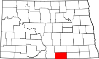 | |
| Township | ||
| Unorganized territory |
| |
| Unincorporated communities |
| |
| Footnotes | ‡This populated place also has portions in an adjacent county or counties | |