Beulah, North Dakota
| Beulah, North Dakota | |
|---|---|
| City | |
|
Post office in Beulah | |
| Motto: "Small Town Appeal...Big City Looks" | |
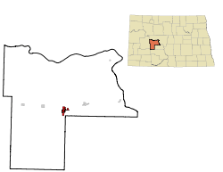 Location of Beulah, North Dakota | |
| Coordinates: 47°16′5″N 101°46′38″W / 47.26806°N 101.77722°WCoordinates: 47°16′5″N 101°46′38″W / 47.26806°N 101.77722°W | |
| Country | United States |
| State | North Dakota |
| County | Mercer |
| Government | |
| • Mayor | Darrell Bjerke |
| Area[1] | |
| • Total | 2.51 sq mi (6.50 km2) |
| • Land | 2.49 sq mi (6.45 km2) |
| • Water | 0.02 sq mi (0.05 km2) |
| Elevation | 1,785 ft (544 m) |
| Population (2010)[2] | |
| • Total | 3,121 |
| • Estimate (2015)[3] | 3,393 |
| • Density | 1,253.4/sq mi (483.9/km2) |
| Time zone | MST (UTC-7) |
| • Summer (DST) | MDT (UTC-6) |
| ZIP code | 58523 |
| Area code(s) | 701 |
| FIPS code | 38-06660 |
| GNIS feature ID | 1027971[4] |
| Highways | ND 49 |
| Website | http://www.beulahnd.org/ |

Beulah is a city in Mercer County, North Dakota, United States. The population was 3,121 at the 2010 census,[5] making it the sixteenth largest city in North Dakota.
Beulah is home to the Dakota Gasification Company.
History
Beulah was founded in 1914. It was named after Beulah Stinchcombe, the niece of a local land developer.[6]
Geography and climate
Beulah is located at 47°16′5″N 101°46′38″W / 47.26806°N 101.77722°W (47.268088, -101.777229).[7]
According to the United States Census Bureau, the city has a total area of 2.51 square miles (6.50 km2), of which, 2.49 square miles (6.45 km2) is land and 0.02 square miles (0.05 km2) is water.[1]
| Climate data for Beulah, North Dakota (1981–2010) | |||||||||||||
|---|---|---|---|---|---|---|---|---|---|---|---|---|---|
| Month | Jan | Feb | Mar | Apr | May | Jun | Jul | Aug | Sep | Oct | Nov | Dec | Year |
| Average high °F (°C) | 19.1 (−7.2) |
21.6 (−5.8) |
36.9 (2.7) |
55.5 (13.1) |
65.6 (18.7) |
74.0 (23.3) |
84.0 (28.9) |
82.7 (28.2) |
72.9 (22.7) |
56.0 (13.3) |
42.0 (5.6) |
18.2 (−7.7) |
52.4 (11.3) |
| Average low °F (°C) | 0.3 (−17.6) |
2.7 (−16.3) |
17.8 (−7.9) |
30.5 (−0.8) |
41.4 (5.2) |
50.2 (10.1) |
56.4 (13.6) |
54.4 (12.4) |
45.9 (7.7) |
33.1 (0.6) |
20.3 (−6.5) |
1.1 (−17.2) |
29.5 (−1.4) |
| Average precipitation inches (mm) | 0.66 (16.8) |
0.65 (16.5) |
0.89 (22.6) |
0.88 (22.4) |
2.75 (69.9) |
3.36 (85.3) |
1.93 (49) |
1.12 (28.4) |
2.18 (55.4) |
1.25 (31.8) |
0.51 (13) |
0.55 (14) |
16.73 (424.9) |
| Average snowfall inches (cm) | 12.6 (32) |
9.2 (23.4) |
14.5 (36.8) |
4.8 (12.2) |
3.4 (8.6) |
0.3 (0.8) |
0.0 (0) |
0.0 (0) |
0.3 (0.8) |
2.8 (7.1) |
4.3 (10.9) |
19.3 (49) |
71.3 (181.1) |
| Source: NOAA[8] | |||||||||||||
Demographics
| Historical population | |||
|---|---|---|---|
| Census | Pop. | %± | |
| 1920 | 552 | — | |
| 1930 | 913 | 65.4% | |
| 1940 | 942 | 3.2% | |
| 1950 | 1,501 | 59.3% | |
| 1960 | 1,318 | −12.2% | |
| 1970 | 1,344 | 2.0% | |
| 1980 | 2,908 | 116.4% | |
| 1990 | 3,363 | 15.6% | |
| 2000 | 3,152 | −6.3% | |
| 2010 | 3,121 | −1.0% | |
| Est. 2015 | 3,393 | [9] | 8.7% |
| U.S. Decennial Census[10] 2015 Estimate[3] | |||
2010 census
As of the census[2] of 2010, there were 3,121 people, 1,353 households, and 862 families residing in the city. The population density was 1,253.4 inhabitants per square mile (483.9/km2). There were 1,508 housing units at an average density of 605.6 per square mile (233.8/km2). The racial makeup of the city was 94.8% White, 0.2% African American, 2.3% Native American, 0.3% Asian, 0.3% Pacific Islander, 0.7% from other races, and 1.4% from two or more races. Hispanic or Latino of any race were 2.3% of the population.
There were 1,353 households of which 26.8% had children under the age of 18 living with them, 55.1% were married couples living together, 4.7% had a female householder with no husband present, 3.9% had a male householder with no wife present, and 36.3% were non-families. 31.9% of all households were made up of individuals and 12.1% had someone living alone who was 65 years of age or older. The average household size was 2.24 and the average family size was 2.81.
The median age in the city was 44.2 years. 22.3% of residents were under the age of 18; 6.4% were between the ages of 18 and 24; 22.1% were from 25 to 44; 34.3% were from 45 to 64; and 14.9% were 65 years of age or older. The gender makeup of the city was 51.3% male and 48.7% female.
2000 census
At the 2000 census, there were 3,152 people, 1,213 households, and 851 families residing in the city. The population density was 1,307.8 inhabitants per square mile (505.0/km²). There were 1,475 housing units at an average density of 612.0 per square mile (236.3/km²). The racial makeup of the city was 95.78% White, 0.03% African American, 1.68% Native American, 0.29% Asian, 0.63% Pacific Islander, 0.16% from other races, and 1.43% from two or more races. Hispanic or Latino of any race were 0.48% of the population.
The top 6 ancestry groups in the city are German (74.3%), Norwegian (12.3%), Irish (9.3%), Russian (7.7%), English (3.4%), Czech (2.3%).
There were 1,213 households of which 39.9% had children under the age of 18 living with them, 61.0% were married couples living together, 6.8% had a female householder with no husband present, and 29.8% were non-families. 27.8% of all households were made up of individuals and 12.9% had someone living alone who was 65 years of age or older. The average household size was 2.53 and the average family size was 3.09.
The median household income was $45,256 and the median family income was $54,700. Males had a median income of $50,870 versus $20,792 for females. The per capita income for the city was $18,614. About 5.3% of families and 7.8% of the population were below the poverty line, including 4.6% of those under age 18 and 30.0% of those age 65 or over.
Education
Beulah's educational system started with a one-room school house, located in an unused barn south of town. At its advent, only five local children attended the school. As its reputation grew, children from surrounding communities increased the school's attendance to over one hundred students. The school went on to receive several awards for educational excellence and was considered the pride of the town until a fire in 1934 destroyed the building.
Beulah has an elementary, middle, and high school. The sports teams are called the Miners. The American Legion baseball team is called the Cyclones.
References
- 1 2 "US Gazetteer files 2010". United States Census Bureau. Archived from the original on 2012-07-14. Retrieved 2012-06-14.
- 1 2 "American FactFinder". United States Census Bureau. Retrieved 2012-06-14.
- 1 2 "Population Estimates". United States Census Bureau. Retrieved June 2, 2016.
- ↑ "US Board on Geographic Names". United States Geological Survey. 2007-10-25. Retrieved 2008-01-31.
- ↑ "2010 Census Redistricting Data (Public Law 94-171) Summary File". American FactFinder. United States Census Bureau. Archived from the original on 21 July 2011. Retrieved 2 May 2011.
- ↑ "Profile for Beulah, North Dakota". ePodunk. Retrieved 2010-06-21.
- ↑ "US Gazetteer files: 2010, 2000, and 1990". United States Census Bureau. 2011-02-12. Retrieved 2011-04-23.
- ↑ "NOWData - NOAA Online Weather Data". National Oceanic and Atmospheric Administration. Retrieved May 4, 2013.
- ↑ "Annual Estimates of the Resident Population for Incorporated Places: April 1, 2010 to July 1, 2015". Retrieved July 2, 2016.
- ↑ "U.S. Decennial Census". Census.gov. Archived from the original on May 11, 2015. Retrieved June 1, 2013.
External links
-
 Beulah travel guide from Wikivoyage
 - City of Beulah official website
Municipalities and communities of Mercer County, North Dakota, United States | ||
|---|---|---|
| Cities | 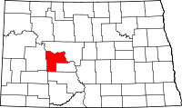 | |
| Unorganized territories |
| |
| Unincorporated community |
| |