Dickey County, North Dakota
| Dickey County, North Dakota | |
|---|---|
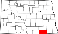 Location in the U.S. state of North Dakota | |
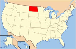 North Dakota's location in the U.S. | |
| Founded | August 18, 1882 |
| Named for | George H. Dickey |
| Seat | Ellendale |
| Largest city | Oakes |
| Area | |
| • Total | 1,142 sq mi (2,958 km2) |
| • Land | 1,131 sq mi (2,929 km2) |
| • Water | 11 sq mi (28 km2), 0.9% |
| Population (est.) | |
| • (2015) | 5,104 |
| • Density | 4.7/sq mi (2/km²) |
| Congressional district | At-large |
| Time zone | Central: UTC-6/-5 |
| Website |
www |
Dickey County is a county located in the U.S. state of North Dakota. As of the 2010 census, the population was 5,289.[1] Its county seat is Ellendale.[2] The legislature for the Dakota Territory authorized the formation of Dickey County in 1881, naming it for one of their members, George H. Dickey.[3] An organizing meeting was held on August 28, 1882, at Ellendale.[4][5]
Geography
According to the U.S. Census Bureau, the county has a total area of 1,142 square miles (2,960 km2), of which 1,131 square miles (2,930 km2) is land and 11 square miles (28 km2) (0.9%) is water.[6]
Adjacent counties
- LaMoure County (north)
- Ransom County (northeast)
- Sargent County (east)
- Brown County, South Dakota (south)
- McPherson County, South Dakota (southwest)
- McIntosh County (west)
Major highways
 U.S. Highway 281
 North Dakota Highway 1
 North Dakota Highway 11
 North Dakota Highway 56
National protected areas
Demographics
| Historical population | |||
|---|---|---|---|
| Census | Pop. | %± | |
| 1890 | 5,573 | — | |
| 1900 | 6,061 | 8.8% | |
| 1910 | 9,839 | 62.3% | |
| 1920 | 10,499 | 6.7% | |
| 1930 | 10,877 | 3.6% | |
| 1940 | 9,696 | −10.9% | |
| 1950 | 9,121 | −5.9% | |
| 1960 | 8,147 | −10.7% | |
| 1970 | 6,976 | −14.4% | |
| 1980 | 7,207 | 3.3% | |
| 1990 | 6,107 | −15.3% | |
| 2000 | 5,757 | −5.7% | |
| 2010 | 5,289 | −8.1% | |
| Est. 2015 | 5,104 | [7] | −3.5% |
| U.S. Decennial Census[8] 1790-1960[9] 1900-1990[10] 1990-2000[11] 2010-2015[1] | |||
2000 census
As of the census of 2000, there were 5,757 people, 2,283 households, and 1,499 families residing in the county. The population density was 5 people per square mile (2/km²). There were 2,656 housing units at an average density of 2 per square mile (1/km²). The racial makeup of the county was 97.78% White, 0.10% Black or African American, 0.35% Native American, 0.50% Asian, 0.56% from other races, and 0.71% from two or more races. 1.35% of the population were Hispanic or Latino of any race. 48.9% were of German, 14.7% Norwegian, 6.7% American and 6.0% Irish ancestry. 92.3% spoke English, 5.7% German and 1.5% Spanish as their first language.
There were 2,283 households out of which 27.90% had children under the age of 18 living with them, 58.00% were married couples living together, 4.90% had a female householder with no husband present, and 34.30% were non-families. 32.00% of all households were made up of individuals and 17.60% had someone living alone who was 65 years of age or older. The average household size was 2.36 and the average family size was 2.99.
In the county the population was spread out with 23.80% under the age of 18, 10.20% from 18 to 24, 22.50% from 25 to 44, 22.20% from 45 to 64, and 21.30% who were 65 years of age or older. The median age was 41 years. For every 100 females there were 97.20 males. For every 100 females age 18 and over, there were 92.50 males.
The median income for a household in the county was $29,231, and the median income for a family was $36,682. Males had a median income of $26,914 versus $15,668 for females. The per capita income for the county was $15,846. About 11.60% of families and 14.80% of the population were below the poverty line, including 20.40% of those under age 18 and 10.80% of those age 65 or over.
2010 census
As of the 2010 United States Census, there were 5,289 people, 2,180 households, and 1,379 families residing in the county.[12] The population density was 4.7 inhabitants per square mile (1.8/km2). There were 2,636 housing units at an average density of 2.3 per square mile (0.89/km2).[13] The racial makeup of the county was 96.5% white, 0.7% black or African American, 0.6% American Indian, 0.4% Asian, 0.5% from other races, and 1.2% from two or more races. Those of Hispanic or Latino origin made up 1.9% of the population.[12] In terms of ancestry, 56.3% were German, 16.9% were Norwegian, 11.4% were Irish, 7.4% were Swedish, 5.1% were Russian, and 1.1% were American.[14]
Of the 2,180 households, 26.5% had children under the age of 18 living with them, 56.0% were married couples living together, 4.4% had a female householder with no husband present, 36.7% were non-families, and 33.3% of all households were made up of individuals. The average household size was 2.29 and the average family size was 2.94. The median age was 43.0 years.[12]
The median income for a household in the county was $37,179 and the median income for a family was $53,333. Males had a median income of $36,029 versus $25,625 for females. The per capita income for the county was $21,824. About 6.8% of families and 11.0% of the population were below the poverty line, including 9.3% of those under age 18 and 18.2% of those age 65 or over.[15]
Communities
Cities
Townships
Unincorporated Communities
See also
References
- 1 2 "State & County QuickFacts". United States Census Bureau. Retrieved October 31, 2013.
- ↑ "Find a County". National Association of Counties. Retrieved 2011-06-07.
- ↑ Gannett, Henry (1905). The Origin of Certain Place Names in the United States. Govt. Print. Off. p. 106.
- ↑ "Dakota Territory, South Dakota, and North Dakota: Individual County Chronologies". Dakota Territory Atlas of Historical County Boundaries. The Newberry Library. 2006. Retrieved February 3, 2015.
- ↑ "County History". North Dakota.gov. The State of North Dakota. Retrieved February 3, 2015.
- ↑ "2010 Census Gazetteer Files". United States Census Bureau. August 22, 2012. Retrieved January 28, 2015.
- ↑ "County Totals Dataset: Population, Population Change and Estimated Components of Population Change: April 1, 2010 to July 1, 2015". Retrieved July 2, 2016.
- ↑ "U.S. Decennial Census". United States Census Bureau. Retrieved January 28, 2015.
- ↑ "Historical Census Browser". University of Virginia Library. Retrieved January 28, 2015.
- ↑ Forstall, Richard L., ed. (March 27, 1995). "Population of Counties by Decennial Census: 1900 to 1990". United States Census Bureau. Retrieved January 28, 2015.
- ↑ "Census 2000 PHC-T-4. Ranking Tables for Counties: 1990 and 2000" (PDF). United States Census Bureau. April 2, 2001. Retrieved January 28, 2015.
- 1 2 3 "DP-1 Profile of General Population and Housing Characteristics: 2010 Demographic Profile Data". United States Census Bureau. Retrieved 2016-03-14.
- ↑ "Population, Housing Units, Area, and Density: 2010 - County". United States Census Bureau. Retrieved 2016-03-14.
- ↑ "DP02 SELECTED SOCIAL CHARACTERISTICS IN THE UNITED STATES – 2006-2010 American Community Survey 5-Year Estimates". United States Census Bureau. Retrieved 2016-03-14.
- ↑ "DP03 SELECTED ECONOMIC CHARACTERISTICS – 2006-2010 American Community Survey 5-Year Estimates". United States Census Bureau. Retrieved 2016-03-14.
 |
LaMoure County | Ransom County | | |
| McIntosh County | |
Sargent County | ||
| ||||
| | ||||
| McPherson County, South Dakota | Brown County, South Dakota |
Municipalities and communities of Dickey County, North Dakota, United States | ||
|---|---|---|
| Cities | | |
| Townships | ||
| Unincorporated communities | ||
| Ghost town | ||
Coordinates: 46°07′N 98°29′W / 46.11°N 98.49°W