Hettinger, North Dakota
| Hettinger, North Dakota | |
|---|---|
| City | |
|
Hettinger | |
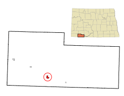 Location of Hettinger, North Dakota | |
| Coordinates: 46°0′3″N 102°38′0″W / 46.00083°N 102.63333°WCoordinates: 46°0′3″N 102°38′0″W / 46.00083°N 102.63333°W | |
| Country | United States |
| State | North Dakota |
| County | Adams |
| Founded | 1907 |
| Incorporated | 1908 |
| Area[1] | |
| • Total | 0.86 sq mi (2.23 km2) |
| • Land | 0.85 sq mi (2.20 km2) |
| • Water | 0.01 sq mi (0.03 km2) |
| Elevation | 2,697 ft (822 m) |
| Population (2010)[2] | |
| • Total | 1,226 |
| • Estimate (2015)[3] | 1,257 |
| • Density | 1,400/sq mi (550/km2) |
| Time zone | Mountain (MST) (UTC-7) |
| • Summer (DST) | MDT (UTC-6) |
| ZIP code | 58639 |
| Area code(s) | 701 |
| FIPS code | 38-37700 |
| GNIS feature ID | 1029423[4] |
| Highways | US 12, ND 8 |
| Website | hettingernd.com |
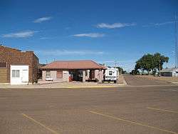
Hettinger (/ˈhɛtɪŋɡər/ HET-ing-gər) is a city in, and the county seat[5] of, Adams County, North Dakota, United States. The population was 1,226 at the 2010 census.[6]
North Dakota State University operates a livestock research station near Hettinger, which often partners with South Dakota State University's Antelope Range and Livestock Research Station for sheep research.[7]
History
Hettinger was founded in 1907 along the Milwaukee Road's transcontinental rail line known as the Pacific Extension. The city and its surrounding township were named by popular demand in recognition of Hettinger County, from which Adams County was created in 1907.[8]
Geography
According to the United States Census Bureau, the city has a total area of 0.86 square miles (2.23 km2), of which 0.85 square miles (2.20 km2) is land and 0.01 square miles (0.03 km2) is water.[1]
Climate
According to the Köppen Climate Classification system, Hettinger has a semi-arid climate, abbreviated "BSk" on climate maps.[9]
Demographics
| Historical population | |||
|---|---|---|---|
| Census | Pop. | %± | |
| 1910 | 766 | — | |
| 1920 | 817 | 6.7% | |
| 1930 | 1,292 | 58.1% | |
| 1940 | 1,138 | −11.9% | |
| 1950 | 1,762 | 54.8% | |
| 1960 | 1,769 | 0.4% | |
| 1970 | 1,655 | −6.4% | |
| 1980 | 1,739 | 5.1% | |
| 1990 | 1,574 | −9.5% | |
| 2000 | 1,307 | −17.0% | |
| 2010 | 1,226 | −6.2% | |
| Est. 2015 | 1,257 | [10] | 2.5% |
| U.S. Decennial Census[11] 2015 Estimate[3] | |||
2000 census
As of the census of 2000, there were 1,307 people, 584 households, and 345 families residing in the city. The population density was 1,556.6 people per square mile (600.8/km²). There were 720 housing units at an average density of 857.5 per square mile (330.9/km²). The racial makeup of the city was 98.78% White, 0.15% African American, 0.38% Native American, 0.15% Asian, 0.08% Pacific Islander, 0.23% from other races, and 0.23% from two or more races. Hispanic or Latino of any race were 0.38% of the population.
There were 584 households out of which 25.7% had children under the age of 18 living with them, 47.8% were married couples living together, 8.6% had a female householder with no husband present, and 40.8% were non-families. 38.0% of all households were made up of individuals and 22.6% had someone living alone who was 65 years of age or older. The average household size was 2.10 and the average family size was 2.76.
In the city the population was spread out with 21.7% under the age of 18, 4.8% from 18 to 24, 21.9% from 25 to 44, 23.2% from 45 to 64, and 28.5% who were 65 years of age or older. The median age was 46 years. For every 100 females there were 80.0 males. For every 100 females age 18 and over, there were 78.1 males.
The median income for a household in the city was $27,689, and the median income for a family was $32,917. Males had a median income of $26,172 versus $19,674 for females. The per capita income for the city was $21,148. About 5.4% of families and 8.1% of the population were below the poverty line, including 8.6% of those under age 18 and 13.7% of those age 65 or over.
2010 census
As of the census[2] of 2010, there were 1,226 people, 587 households, and 316 families residing in the city. The population density was 1,442.4 inhabitants per square mile (556.9/km2). There were 704 housing units at an average density of 828.2 per square mile (319.8/km2). The racial makeup of the city was 97.4% White, 0.2% African American, 0.7% Native American, 0.7% Asian, and 1.1% from two or more races. Hispanic or Latino of any race were 0.9% of the population.
There were 587 households of which 22.8% had children under the age of 18 living with them, 43.6% were married couples living together, 6.5% had a female householder with no husband present, 3.7% had a male householder with no wife present, and 46.2% were non-families. 42.9% of all households were made up of individuals and 20.6% had someone living alone who was 65 years of age or older. The average household size was 2.00 and the average family size was 2.70.
The median age in the city was 48 years. 19.5% of residents were under the age of 18; 6.4% were between the ages of 18 and 24; 19.6% were from 25 to 44; 29.3% were from 45 to 64; and 25.2% were 65 years of age or older. The gender makeup of the city was 43.2% male and 56.8% female.
Education
Media
- Radio Stations
KNDC and KNDH-FM are the two local stations in town.
Notable people
- Rick Berg, U.S. Congressman
- Patrick Daniel Norton, U.S. Congressman
- Steve Tomac, North Dakota state legislator
References
- 1 2 "US Gazetteer files 2010". United States Census Bureau. Retrieved 2012-06-14.
- 1 2 "American FactFinder". United States Census Bureau. Retrieved 2012-06-14.
- 1 2 "Population Estimates". United States Census Bureau. Retrieved June 9, 2016.
- ↑ "US Board on Geographic Names". United States Geological Survey. 2007-10-25. Retrieved 2008-01-31.
- ↑ "Find a County". National Association of Counties. Retrieved 2011-06-07.
- ↑ "2010 Census Redistricting Data (Public Law 94-171) Summary File". American FactFinder. United States Census Bureau. Retrieved 2 May 2011.
- ↑ "Antelope Range and Livestock Research Station". South Dakota State University. Retrieved 27 January 2015.
- ↑ Wick, Douglas A. "Hettinger (Adams County)". North Dakota Place Names. Retrieved 7 May 2011.
- ↑ Climate Summary for Hettinger, North Dakota
- ↑ "Annual Estimates of the Resident Population for Incorporated Places: April 1, 2010 to July 1, 2015". Retrieved July 2, 2016.
- ↑ United States Census Bureau. "Census of Population and Housing". Retrieved January 21, 2014.
External links
Municipalities and communities of Adams County, North Dakota, United States | ||
|---|---|---|
| Cities | 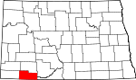 | |
| Townships | ||
| Unorganized territories | ||
| Unincorporated communities | ||