Stutsman County, North Dakota
| Stutsman County, North Dakota | |
|---|---|
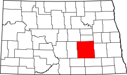 Location in the U.S. state of North Dakota | |
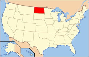 North Dakota's location in the U.S. | |
| Founded | June 20, 1873 |
| Named for | Enos Stutsman |
| Seat | Jamestown |
| Largest city | Jamestown |
| Area | |
| • Total | 2,298 sq mi (5,952 km2) |
| • Land | 2,222 sq mi (5,755 km2) |
| • Water | 76 sq mi (197 km2), 3.3% |
| Population (est.) | |
| • (2015) | 21,103 |
| • Density | 9.5/sq mi (4/km²) |
| Congressional district | At-large |
| Time zone | Central: UTC-6/-5 |
| Website |
www |
Stutsman County is a county located in the U.S. state of North Dakota. As of the 2010 census, the population was 21,100.[1] Its county seat is Jamestown.[2]
The Jamestown, ND Micropolitan Statistical Area includes all of Stutsman County.
Stutsman County was created by the 1872-73 territorial legislature and named for Enos Stutsman, who was born with Phocomelia (lacking arms or legs), but who nonetheless not only homesteaded, but became a powerful politician in the early days of the Dakota Territory. The county government was first organized on June 20, 1873.[3][4]
Geography
According to the U.S. Census Bureau, the county has a total area of 2,298 square miles (5,950 km2), of which 2,222 square miles (5,750 km2) is land and 76 square miles (200 km2) (3.3%) is water.[5] It is the second-largest county in North Dakota by land area and third-largest by total area.
Major highways
Adjacent counties
- Foster County (north)
- Griggs County (northeast)
- Barnes County (east)
- LaMoure County (southeast)
- Logan County (southwest)
- Kidder County (west)
- Wells County (northwest)
National protected areas
- Arrowwood National Wildlife Refuge (part)
- Chase Lake National Wildlife Refuge
- Halfway Lake National Wildlife Refuge
Demographics
| Historical population | |||
|---|---|---|---|
| Census | Pop. | %± | |
| 1880 | 1,007 | — | |
| 1890 | 5,266 | 422.9% | |
| 1900 | 9,143 | 73.6% | |
| 1910 | 18,189 | 98.9% | |
| 1920 | 24,575 | 35.1% | |
| 1930 | 26,100 | 6.2% | |
| 1940 | 23,495 | −10.0% | |
| 1950 | 24,158 | 2.8% | |
| 1960 | 25,137 | 4.1% | |
| 1970 | 23,550 | −6.3% | |
| 1980 | 24,154 | 2.6% | |
| 1990 | 22,241 | −7.9% | |
| 2000 | 21,908 | −1.5% | |
| 2010 | 21,100 | −3.7% | |
| Est. 2015 | 21,103 | [6] | 0.0% |
| U.S. Decennial Census[7] 1790-1960[8] 1900-1990[9] 1990-2000[10] 2010-2015[1] | |||
2000 census
As of the census of 2000, there were 21,908 people, 8,954 households, and 5,649 families residing in the county. The population density was 10 per square mile (4/km²). There were 9,817 housing units at an average density of 4 per square mile (2/km²). The racial makeup of the county was 97.53% White, 0.28% Black or African American, 0.94% Native American, 0.37% Asian, 0.04% Pacific Islander, 0.21% from other races, and 0.64% from two or more races. 0.93% of the population were Hispanic or Latino of any race. 52.3% were of German and 18.0% Norwegian ancestry.
There were 8,954 households out of which 28.80% had children under the age of 18 living with them, 52.50% were married couples living together, 7.50% had a female householder with no husband present, and 36.90% were non-families. 32.70% of all households were made up of individuals and 14.60% had someone living alone who was 65 years of age or older. The average household size was 2.28 and the average family size was 2.89.
In the county the population was spread out with 22.80% under the age of 18, 10.50% from 18 to 24, 25.70% from 25 to 44, 23.30% from 45 to 64, and 17.60% who were 65 years of age or older. The median age was 40 years. For every 100 females there were 96.50 males. For every 100 females age 18 and over, there were 93.20 males.
The median income for a household in the county was $33,848, and the median income for a family was $42,853. Males had a median income of $28,529 versus $20,397 for females. The per capita income for the county was $17,706. About 6.80% of families and 10.40% of the population were below the poverty line, including 13.00% of those under age 18 and 10.50% of those age 65 or over.
2010 census
As of the 2010 United States Census, there were 21,100 people, 8,931 households, and 5,255 families residing in the county.[11] The population density was 9.5 inhabitants per square mile (3.7/km2). There were 9,862 housing units at an average density of 4.4 per square mile (1.7/km2).[12] The racial makeup of the county was 95.6% white, 1.4% American Indian, 0.7% black or African American, 0.5% Asian, 0.1% Pacific islander, 0.5% from other races, and 1.3% from two or more races. Those of Hispanic or Latino origin made up 1.7% of the population.[11] In terms of ancestry, 56.5% were German, 27.6% were Norwegian, 7.2% were Irish, 6.0% were Russian, 5.2% were English, and 2.4% were American.[13]
Of the 8,931 households, 25.6% had children under the age of 18 living with them, 47.3% were married couples living together, 7.5% had a female householder with no husband present, 41.2% were non-families, and 35.3% of all households were made up of individuals. The average household size was 2.17 and the average family size was 2.79. The median age was 42.0 years.[11]
The median income for a household in the county was $44,620 and the median income for a family was $60,171. Males had a median income of $40,365 versus $27,549 for females. The per capita income for the county was $23,307. About 6.3% of families and 12.1% of the population were below the poverty line, including 14.5% of those under age 18 and 14.6% of those age 65 or over.[14]
Communities
Cities
Townships
- Alexander
- Ashland
- Bloom
- Bloomenfield
- Buchanan
- Chicago
- Conklin
- Corinne
- Corwin
- Courtenay
- Cusator
- Deer Lake
- Durham
- Edmunds
- Eldridge
- Flint
- Fried
- Gerber
- Germania
- Glacier
- Gray
- Griffin
- Hidden
- Homer
- Iosco
- Jim River Valley
- Kensal
- Lenton
- Lippert
- Lowery
- Lyon
- Manns
- Marstonmoor
- Midway
- Montpelier
- Moon Lake
- Newbury
- Nogosek
- Paris
- Peterson
- Pingree
- Pipestem Valley
- Plainview
- Rose
- Round Top
- St. Paul
- Severn
- Sharlow
- Sinclair
- Spiritwood
- Stirton
- Streeter
- Strong
- Sydney
- Valley Spring
- Wadsworth
- Walters
- Weld
- Windsor
- Winfield
- Woodbury
- Ypsilanti
Census-designated places
See also
References
- 1 2 "State & County QuickFacts". United States Census Bureau. Retrieved November 1, 2013.
- ↑ "Find a County". National Association of Counties. Retrieved 2011-06-07.
- ↑ "County History". Official Portal for North Dakota State Government. Retrieved 4 May 2011.
- ↑ "Dakota Territory, South Dakota, and North Dakota: Individual County Chronologies". Dakota Territory Atlas of Historical County Boundaries. The Newberry Library. 2006. Retrieved February 4, 2015.
- ↑ "2010 Census Gazetteer Files". United States Census Bureau. August 22, 2012. Retrieved February 1, 2015.
- ↑ "County Totals Dataset: Population, Population Change and Estimated Components of Population Change: April 1, 2010 to July 1, 2015". Retrieved July 2, 2016.
- ↑ "U.S. Decennial Census". United States Census Bureau. Retrieved February 1, 2015.
- ↑ "Historical Census Browser". University of Virginia Library. Retrieved February 1, 2015.
- ↑ Forstall, Richard L., ed. (April 20, 1995). "Population of Counties by Decennial Census: 1900 to 1990". United States Census Bureau. Retrieved February 1, 2015.
- ↑ "Census 2000 PHC-T-4. Ranking Tables for Counties: 1990 and 2000" (PDF). United States Census Bureau. April 2, 2001. Retrieved February 1, 2015.
- 1 2 3 "DP-1 Profile of General Population and Housing Characteristics: 2010 Demographic Profile Data". United States Census Bureau. Retrieved 2016-04-03.
- ↑ "Population, Housing Units, Area, and Density: 2010 - County". United States Census Bureau. Retrieved 2016-04-03.
- ↑ "DP02 SELECTED SOCIAL CHARACTERISTICS IN THE UNITED STATES – 2006-2010 American Community Survey 5-Year Estimates". United States Census Bureau. Retrieved 2016-04-03.
- ↑ "DP03 SELECTED ECONOMIC CHARACTERISTICS – 2006-2010 American Community Survey 5-Year Estimates". United States Census Bureau. Retrieved 2016-04-03.
External links
- Stutsman County official website
- Stutsman County in the world war : Jamestown, North Dakota (1919) from the Digital Horizons website
- Stutsman County North Dakota in the James River Valley : a Stutsman home, and herds on pasture (1925) from the Digital Horizons website
 |
Wells County | Foster County | Griggs County | |
| Kidder County | |
Barnes County | ||
| ||||
| | ||||
| Logan County | LaMoure County |
Municipalities and communities of Stutsman County, North Dakota, United States | ||
|---|---|---|
| Cities | | |
| Townships |
| |
| CDPs | ||
| Unorganized territories |
| |
| Unincorporated communities | ||
Coordinates: 46°59′N 98°58′W / 46.98°N 98.96°W