Mandan, North Dakota
| Mandan, North Dakota | |
|---|---|
| City | |
|
City Hall in Mandan | |
| Motto: "Where The West Begins" | |
 Location of Mandan, North Dakota | |
| Coordinates: 46°49′44″N 100°53′28″W / 46.82889°N 100.89111°WCoordinates: 46°49′44″N 100°53′28″W / 46.82889°N 100.89111°W[1] | |
| Country | United States |
| State | North Dakota |
| County | Morton |
| Founded | 1881 |
| Government | |
| • Mayor | Arlyn Van Beek |
| Area[2] | |
| • Total | 11.13 sq mi (28.83 km2) |
| • Land | 11.03 sq mi (28.57 km2) |
| • Water | 0.10 sq mi (0.26 km2) |
| Elevation | 1,647 ft (502 m) |
| Population (2010)[3] | |
| • Total | 18,331 |
| • Estimate (2015)[4] | 21,382 |
| • Density | 1,661.9/sq mi (641.7/km2) |
| Time zone | Central (CST) (UTC-6) |
| • Summer (DST) | CDT (UTC-5) |
| ZIP code | 58554 |
| Area code(s) | 701 |
| FIPS code | 38-49900 |
| GNIS feature ID | 1030076[5] |
| Highways | I-94 / I-94 Bus. / I-194 / ND 6 / ND 1806 |
| Website | cityofmandan.com |

Mandan is a city in Morton County and the eighth-largest city in North Dakota. Founded in 1879 on the west side of the upper Missouri River, it became the county seat of Morton County in 1881.[6] The U.S. Census Bureau measured the population at 18,331 in the 2010 census[7] and estimated the 2015 population at 21,382.[4] Located across the Missouri River from the state capital of Bismarck,[8] Mandan is a core city of the Bismarck-Mandan Metropolitan Statistical Area.
The city was named after the historic Mandan Indians of the area.[9] In 2013, Mandan was selected a finalist in Rand McNally Most Patriotic City competition.[10]
Geography
According to the United States Census Bureau, the city has a total area of 11.13 square miles (28.83 km2), of which 11.03 square miles (28.57 km2) is land and 0.10 square miles (0.26 km2) is water.[2]
Climate
This climatic region is typified by large seasonal temperature differences, with warm to hot (and often humid) summers and cold (sometimes severely cold) winters. According to the Köppen Climate Classification system, Mandan has a humid continental climate, abbreviated "Dfb" on climate maps.[11]
| Climate data for Mandan | |||||||||||||
|---|---|---|---|---|---|---|---|---|---|---|---|---|---|
| Month | Jan | Feb | Mar | Apr | May | Jun | Jul | Aug | Sep | Oct | Nov | Dec | Year |
| Record high °C (°F) | 17.2 (63) |
20.6 (69.1) |
27.2 (81) |
33.9 (93) |
35.6 (96.1) |
43.9 (111) |
44.4 (111.9) |
41.7 (107.1) |
40.6 (105.1) |
35.0 (95) |
23.9 (75) |
18.3 (64.9) |
44.4 (111.9) |
| Average high °C (°F) | −6.7 (19.9) |
−3.1 (26.4) |
3.4 (38.1) |
13.1 (55.6) |
20.0 (68) |
25.1 (77.2) |
29.2 (84.6) |
28.6 (83.5) |
22.2 (72) |
14.7 (58.5) |
4.2 (39.6) |
−3.4 (25.9) |
12.3 (54.1) |
| Daily mean °C (°F) | −12.6 (9.3) |
−8.9 (16) |
−2.3 (27.9) |
6.2 (43.2) |
12.9 (55.2) |
18.1 (64.6) |
21.5 (70.7) |
20.6 (69.1) |
14.4 (57.9) |
7.5 (45.5) |
−1.7 (28.9) |
−9.1 (15.6) |
5.6 (42.1) |
| Average low °C (°F) | −18.6 (−1.5) |
−14.8 (5.4) |
−8.1 (17.4) |
−0.7 (30.7) |
5.7 (42.3) |
11.0 (51.8) |
13.8 (56.8) |
12.7 (54.9) |
6.7 (44.1) |
0.3 (32.5) |
−7.6 (18.3) |
−14.9 (5.2) |
−1.2 (29.8) |
| Record low °C (°F) | −42.2 (−44) |
−41.7 (−43.1) |
−33.3 (−27.9) |
−24.4 (−11.9) |
−9.4 (15.1) |
−1.1 (30) |
1.7 (35.1) |
0.6 (33.1) |
−11.7 (10.9) |
−23.3 (−9.9) |
−34.4 (−29.9) |
−30.6 (−23.1) |
−42.2 (−44) |
| Source: [12] | |||||||||||||
Demographics
| Historical population | |||
|---|---|---|---|
| Census | Pop. | %± | |
| 1880 | 239 | — | |
| 1890 | 1,328 | 455.6% | |
| 1900 | 1,658 | 24.8% | |
| 1910 | 3,873 | 133.6% | |
| 1920 | 4,336 | 12.0% | |
| 1930 | 5,037 | 16.2% | |
| 1940 | 6,685 | 32.7% | |
| 1950 | 7,298 | 9.2% | |
| 1960 | 10,525 | 44.2% | |
| 1970 | 11,093 | 5.4% | |
| 1980 | 15,513 | 39.8% | |
| 1990 | 15,177 | −2.2% | |
| 2000 | 16,718 | 10.2% | |
| 2010 | 18,331 | 9.6% | |
| Est. 2015 | 21,382 | [13] | 16.6% |
| U.S. Decennial Census[14] 2015 Estimate[4] | |||
2010 census
As of the census[3] of 2010, there were 18,331 people, 7,632 households, and 4,921 families residing in the city. The population density was 1,661.9 inhabitants per square mile (641.7/km2). There were 7,950 housing units at an average density of 720.8 per square mile (278.3/km2). The racial makeup of the city was 91.7% White, 0.6% African American, 4.9% Native American, 0.2% Asian, 0.1% Pacific Islander, 0.5% from other races, and 2.0% from two or more races. Hispanic or Latino of any race were 1.8% of the population.
There were 7,632 households of which 31.6% had children under the age of 18 living with them, 48.4% were married couples living together, 11.5% had a female householder with no husband present, 4.6% had a male householder with no wife present, and 35.5% were non-families. 28.9% of all households were made up of individuals and 10.5% had someone living alone who was 65 years of age or older. The average household size was 2.35 and the average family size was 2.89.
The median age in the city was 37.2 years. 23.9% of residents were under the age of 18; 8.2% were between the ages of 18 and 24; 27.3% were from 25 to 44; 27.2% were from 45 to 64; and 13.2% were 65 years of age or older. The gender makeup of the city was 49.2% male and 50.8% female.
2000 census
As of the census of 2000, there were 16,718 people, 6,647 households, and 4,553 families residing in the city. The population density was 1,642.8 per square mile (634.3/km2). There were 6,958 housing units at an average density of 683.7 per square mile (264.0/km2). The racial makeup of the city was 94.98% White, 0.20% African American, 3.02% Native American, 0.33% Asian, 0.01% Pacific Islander, 0.15% from other races, and 1.30% from two or more races. Hispanic or Latino of any race were 0.78% of the population.
The top 6 ancestry groups in the city were German (61.3%), Norwegian (15.4%), Russian (13.1%), Irish (7.9%), English (4.2%), and Native American (3.02%).
There were 6,647 households out of which 35.7% had children under the age of 18 living with them, 54.1% were married couples living together, 10.6% had a female householder with no husband present, and 31.5% were non-families. 26.4% of all households were made up of individuals and 10.1% had someone living alone who was 65 years of age or older. The average household size was 2.48 and the average family size was 3.01.
In the city the population was spread out with 27.0% under the age of 18, 9.0% from 18 to 24, 29.7% from 25 to 44, 21.6% from 45 to 64, and 12.7% who were 65 years of age or older. The median age was 36 years. For every 100 females there were 97.0 males. For every 100 females age 18 and over, there were 93.6 males.
The median income for a household in the city was $38,182, and the median income for a family was $46,210. Males had a median income of $31,653 versus $21,400 for females. The per capita income for the city was $17,509. About 7.0% of families and 10.0% of the population were below the poverty line, including 12.2% of those under age 18 and 13.6% of those age 65 or over.
Industry
A Tesoro refinery north of Mandan began operations in 1954 and today has a capacity of 71,000 barrels per day (bpd). It processes primarily North Dakota sweet (low-sulfur) crude oil into gasoline, diesel fuel, jet fuel, heavy fuel oils and liquefied petroleum gas.[15]
Education
Mandan Public Schools operates Roosevelt Elementary School, Mary Stark Elementary School, Lewis & Clark Elementary School, Ft. Lincoln Elementary School, Custer Elementary School, Red Trail Elementary School, Mandan Middle School, and Mandan High School. There are two private schools: Christ the King School and St. Joseph School.
Bismarck State College offers a Mechanical Maintenance Technology program at its Mandan campus.
Hospitals
Triumph Hospital Central Dakotas is a 41-bed critical care hospital in Mandan.[16]
Local media
Mandan shares a print, radio, and television media market with nearby Bismarck.
Notable people
- Henry Waldo Coe, early state politician, close friend of Theodore Roosevelt
- Ron Erhardt, New England Patriots head coach
- Tom Huff, Washington State Representative
- Arthur Peterson, Jr., actor
- Heidi Heitkamp, United States Senator from North Dakota[17]
- A. R. Shaw, educator and politician[18]
See also
References
- ↑ "US Gazetteer files: 2010, 2000, and 1990". United States Census Bureau. 2011-02-12. Retrieved 2011-04-23.
- 1 2 "US Gazetteer files 2010". United States Census Bureau. Retrieved 2012-06-14.
- 1 2 "American FactFinder". United States Census Bureau. Retrieved 2012-06-14.
- 1 2 3 "Population Estimates". United States Census Bureau. Retrieved May 20, 2016.
- ↑ "US Board on Geographic Names". United States Geological Survey. 2007-10-25. Retrieved 2008-01-31.
- ↑ "Find a County". National Association of Counties. Retrieved 2011-06-07.
- ↑ "2010 Census Redistricting Data (Public Law 94-171) Summary File". American FactFinder. United States Census Bureau. Retrieved 2 May 2011.
- ↑ "City of Mandan", official website
- ↑ Gannett, Henry (1905). The Origin of Certain Place Names in the United States. U.S. Government Printing Office. p. 197.
- ↑ Eckroth, LeAnn (September 4, 2013). "Mandan garners the most patriotic votes online". The Bismarck Tribune. Lee Enterprises. Retrieved 25 October 2015.
- ↑ Climate Summary for Mandan, North Dakota
- ↑ "Mandan, North Dakota, Temperature Averages". Weatherbase. Retrieved 6 February 2015.
- ↑ "Annual Estimates of the Resident Population for Incorporated Places: April 1, 2010 to July 1, 2015". Retrieved July 2, 2016.
- ↑ United States Census Bureau. "Census of Population and Housing". Retrieved July 19, 2013.
- ↑ "Refining: Mandan, ND", TSO Corporation website
- ↑ "Triumph Hospital Central Dakotas". Hospitals Worldwide. MediLexicon International Ltd. Retrieved July 9, 2013.
- ↑ "How Heidi Works for North Dakotans". Heidi for North Dakota. Retrieved July 9, 2013.
- ↑ "Biographical Sketch of Arch Shaw," North Dakota Centennial Blue Book 1889-1989, Ben Meier (editor), North Dakota Legislative Assembly, p. 411
External links
| Wikivoyage has a travel guide for Mandan. |
Municipalities and communities of Morton County, North Dakota, United States | ||
|---|---|---|
| Cities | 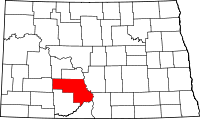 | |
| Township | ||
| CDP | ||
| Unorganized territories |
| |
| Unincorporated communities |
| |
| Counties | 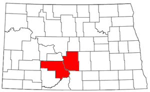 | |
|---|---|---|
| Core cities | ||
| Surrounding areas |
| |