Carrington, North Dakota
| Carrington, North Dakota | |
|---|---|
| City | |
|
Grain Elevator in Carrington | |
| Nickname(s): Central City | |
 Location of Carrington, North Dakota | |
| Coordinates: 47°27′0″N 99°7′26″W / 47.45000°N 99.12389°WCoordinates: 47°27′0″N 99°7′26″W / 47.45000°N 99.12389°W | |
| Country | United States |
| State | North Dakota |
| County | Foster |
| Government | |
| • Mayor | Neil Fandrich |
| Area[1] | |
| • Total | 2.11 sq mi (5.46 km2) |
| • Land | 2.11 sq mi (5.46 km2) |
| • Water | 0 sq mi (0 km2) |
| Elevation | 1,588 ft (484 m) |
| Population (2010)[2] | |
| • Total | 2,065 |
| • Estimate (2015)[3] | 2,072 |
| • Density | 978.7/sq mi (377.9/km2) |
| Time zone | Central (CST) (UTC-6) |
| • Summer (DST) | CDT (UTC-5) |
| ZIP code | 58421 |
| Area code(s) | 701 |
| FIPS code | 38-12340 |
| GNIS feature ID | 1028287[4] |
| Highways | US 52, US 281, ND 200 |
| Website | http://www.carringtonnd.com |

Carrington is a city in Foster County, North Dakota, United States. It is the county seat of Foster County.[5] The population was 2,065 at the 2010 census.[6] Carrington was founded in 1883.
Carrington is home to Dakota Growers Pasta Company, Inc.
History
Carrington was platted in 1882 by M. D. Carrington, and named for him.[7] Carrington has been the county seat since 1883.[8] A post office has been in operation at Carrington since 1883.[9]
Geography
According to the United States Census Bureau, the city has a total area of 2.11 square miles (5.46 km2), all of it land.[1] Carrington's zip code is 58421. The area code is 701 area code. Carrington has 5 local phone codes. 307, 649, 650, 652, and 653.
Demographics
| Historical population | |||
|---|---|---|---|
| Census | Pop. | %± | |
| 1910 | 1,217 | — | |
| 1920 | 1,420 | 16.7% | |
| 1930 | 1,717 | 20.9% | |
| 1940 | 1,850 | 7.7% | |
| 1950 | 2,101 | 13.6% | |
| 1960 | 2,438 | 16.0% | |
| 1970 | 2,491 | 2.2% | |
| 1980 | 2,641 | 6.0% | |
| 1990 | 2,267 | −14.2% | |
| 2000 | 2,268 | 0.0% | |
| 2010 | 2,065 | −9.0% | |
| Est. 2015 | 2,072 | [10] | 0.3% |
| U.S. Decennial Census[11] 2015 Estimate[3] | |||
2010 census
As of the census[2] of 2010, there were 2,065 people, 951 households, and 540 families residing in the city. The population density was 978.7 inhabitants per square mile (377.9/km2). There were 1,057 housing units at an average density of 500.9 per square mile (193.4/km2). The racial makeup of the city was 98.1% White, 0.1% African American, 0.7% Native American, 0.1% Asian, 0.1% from other races, and 0.8% from two or more races. Hispanic or Latino of any race were 0.7% of the population.
There were 951 households of which 22.5% had children under the age of 18 living with them, 47.3% were married couples living together, 6.3% had a female householder with no husband present, 3.2% had a male householder with no wife present, and 43.2% were non-families. 38.5% of all households were made up of individuals and 19.5% had someone living alone who was 65 years of age or older. The average household size was 2.11 and the average family size was 2.81.
The median age in the city was 46 years. 21.7% of residents were under the age of 18; 6.2% were between the ages of 18 and 24; 20.7% were from 25 to 44; 26.8% were from 45 to 64; and 24.8% were 65 years of age or older. The gender makeup of the city was 48.2% male and 51.8% female.
2000 census
As of the census of 2000, there were 2,268 people, 961 households, and 594 families residing in the city. The population density was 1,531.9 people per square mile (591.7/km²). There were 1,057 housing units at an average density of 713.9 per square mile (275.8/km²). The racial makeup of the city was 98.81% White, 0.18% African American, 0.49% Native American, 0.09% from other races, and 0.44% from two or more races. Hispanic or Latino of any race were 0.22% of the population.
There were 961 households out of which 31.0% had children under the age of 18 living with them, 50.8% were married couples living together, 8.4% had a female householder with no husband present, and 38.1% were non-families. 35.6% of all households were made up of individuals and 18.3% had someone living alone who was 65 years of age or older. The average household size was 2.27 and the average family size was 2.97.
In the city the population was spread out with 25.4% under the age of 18, 6.0% from 18 to 24, 26.8% from 25 to 44, 18.7% from 45 to 64, and 23.1% who were 65 years of age or older. The median age was 40 years. For every 100 females there were 90.6 males. For every 100 females age 18 and over, there were 87.3 males.
The median income for a household in the city was $31,197, and the median income for a family was $41,654. Males had a median income of $31,250 versus $19,722 for females. The per capita income for the city was $19,012. About 7.0% of families and 8.9% of the population were below the poverty line, including 10.8% of those under age 18 and 11.0% of those age 65 or over.
Local media
- Foster County Independent
AM Radio
| AM radio stations | |||||
|---|---|---|---|---|---|
| Frequency | Call sign | Name | Format | Owner | City |
| 1600 AM | KDAK | Dakota Country Radio | Full service (radio format)/Country | Ingstad Family Media | Carrington |
Television
Midcontinent Communications provides cable service to the city of Carrington[12][13] and New Rockford. Dakota Central Telecommunications provides cable service to Carrington, Jamestown, and other nearby communities.
Education
The city of Carrington is served by Carrington Elementary School and Carrington High School. Prairie View Adventist School is also in Carrington.
Transportation
Two federal highways pass through Carrington. U.S. 281 runs North and South through the area. U.S. 52 runs east and west co-signed with ND 200 and to U.S. 281 then runs northwest and southeast route. ND 200 runs east and west through the area.
Highways that run through Carrington include U.S. 52, U.S. 281, ND 200, and Foster County CR 1605. The city is also served by both the Canadian Pacific Railway and the Red River Valley and Western Railroad.
Major roads and streets
North and south
- 4th Avenue U.S. 281 (City Park, Crossroads Golf Course, residential, commercial, industrial)
- 11th Avenue (North of Main Street) (residential, commercial, industrial)
- 13th Avenue (South of Main Street) (residential, industrial)
- 14th Avenue (South of Main Street) (residential, industrial)
- 66th Avenue SE 19th Avenue (Old Hwy 281) ( Foster County Fairgrounds, industrial)
East and west
- 11th Street North (Dakota Growers, industrial)
- Highway 200 Carrington Airport, residential, commercial, industrial)
- Main Street (Carrington High School, residential, central business district, commercial, industrial)
- 3rd Street South (City Park, Stadium of 76, Foster County Fairgrounds, residential)
- 7th Street South (residential, industrial)
Notable people
- Evelyn Johnson Davis Culbertson, a professor and director of the music education program at Oral Roberts University in Tulsa, Oklahoma, 1965 to 1980; author of He Heard America Singing: Arthur Farwell, Composer and Crusading Music Educator, a study of the American composer Arthur Farwell; born in Carrington in 1915.[14]
- Laura J. Eisenhuth, North Dakota Superintendent of Public Instruction, 1893–1894; first woman elected to statewide office in the United States
- Jim Kleinsasser, tight end for the Minnesota Vikings
- Larry Woiwode, author and North Dakota poet laureate
Climate
This climatic region is typified by large seasonal temperature differences, with warm to hot (and often humid) summers and cold (sometimes severely cold) winters. According to the Köppen Climate Classification system, Carrington has a humid continental climate, abbreviated "Dfb" on climate maps.[15]
References
- 1 2 "US Gazetteer files 2010". United States Census Bureau. Archived from the original on 2012-07-14. Retrieved 2012-06-14.
- 1 2 "American FactFinder". United States Census Bureau. Retrieved 2012-06-14.
- 1 2 "Population Estimates". United States Census Bureau. Retrieved June 3, 2016.
- ↑ "US Board on Geographic Names". United States Geological Survey. 2007-10-25. Retrieved 2008-01-31.
- ↑ "Find a County". National Association of Counties. Archived from the original on 2011-05-31. Retrieved 2011-06-07.
- ↑ "2010 Census Redistricting Data (Public Law 94-171) Summary File". American FactFinder. United States Census Bureau. Archived from the original on 21 July 2011. Retrieved 2 May 2011.
- ↑ Federal Writers' Project (1938). North Dakota, a Guide to the Northern Prairie State. WPA. p. 205. ISBN 978-1-62376-033-5.
- ↑ Hellmann, Paul T. (May 13, 2013). Historical Gazetteer of the United States. Routledge. p. 834. Retrieved 30 November 2013.
- ↑ "Foster County". Jim Forte Postal History. Retrieved 15 October 2015.
- ↑ "Annual Estimates of the Resident Population for Incorporated Places: April 1, 2010 to July 1, 2015". Retrieved July 2, 2016.
- ↑ United States Census Bureau. "Census of Population and Housing". Archived from the original on May 11, 2015. Retrieved February 12, 2014.
- ↑ "Midcontinent Cable TV HD/Standard Channel Listings – Midcontinent Communications". midcocomm.com. Retrieved 21 September 2015.
- ↑ "Working QAM cable layout". mythtv.org. Archived from the original on 3 February 2016. Retrieved 21 September 2015.
- ↑ He Heard America Singing: Arthur Farwell, Composer and Crusading Music Educator. Scarecrow Press. 1992. pp. 885 total. ISBN 978-0810825802. Retrieved March 18, 2015.
- ↑ "Carrington, North Dakota Köppen Climate Classification (Weatherbase)". Weatherbase. Retrieved 21 September 2015.
External links
- Foster County Independent
- Carrington, North Dakota : community fact survey (1964) from the Digital Horizons website
- Carrington :prairie heartland, Carrington, North Dakota (1975) from the Digital Horizons website
- A History of Foster County (1983) from the Digital Horizons website
| Wikivoyage has a travel guide for Carrington (North Dakota). |
Municipalities and communities of Foster County, North Dakota, United States | ||
|---|---|---|
| Cities | 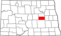 | |
| Townships |
| |
| Unincorporated communities | ||