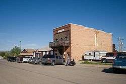
Burlington, North Dakota
| Burlington, North Dakota | |
|---|---|
| City | |
 | |
| Nickname(s): The Forks | |
| Motto: "Oldest City In Ward County" | |
 Location of Burlington, North Dakota | |
| Coordinates: 48°16′39″N 101°25′40″W / 48.27750°N 101.42778°WCoordinates: 48°16′39″N 101°25′40″W / 48.27750°N 101.42778°W | |
| Country | United States |
| State | North Dakota |
| County | Ward |
| Township | Burlington |
| Township | Kirkelie |
| Founded | 1883 |
| Incorporated | 1885 |
| Government | |
| • Mayor | Jerome Gruenberg |
| Area[1] | |
| • Total | 0.64 sq mi (1.66 km2) |
| • Land | 0.64 sq mi (1.66 km2) |
| • Water | 0 sq mi (0 km2) |
| Elevation | 1,608 ft (490 m) |
| Population (2010)[2] | |
| • Total | 1,060 |
| • Estimate (2015)[3] | 1,181 |
| • Density | 1,656.3/sq mi (639.5/km2) |
| Time zone | CST (UTC-6) |
| • Summer (DST) | CDT (UTC-5) |
| ZIP code | 58722 |
| Area code(s) | 701 |
| FIPS code | 38-10940 |
| GNIS feature ID | 1034752[4] |
| Highways | US 2, US 52 |
| Website | City website |
Burlington is a city in Ward County, North Dakota, United States. It was founded in 1883,[5] the third in a series that included two earlier settlements. Despite this, Burlington is still the oldest city in Ward County, as well as north-western and north central North Dakota. In 1885, as it was the only city in the then-newly formed Imperial Ward County (now split into Ward, Renville, Mountrail, and Burke counties), it was made the county seat, a position it held until 1888. The population was 1,060 at the 2010 census.[6] Burlington is part of the Minot Micropolitan Statistical Area.
History

Burlington and its former settlements were founded by James Johnson and James Colton (the men who also settled Larimore, North Dakota) in Dakota Territory in the late 1870s. Earlier settlements were The Forks, and later Colton (named after James Colton), which are considered forerunners of the city. Its current name was given to it by James Johnson during the creation of the post office, and was the name of his hometown of Burlington, Iowa. "The Forks" is used as a nickname for Burlington, both alluding to its heritage, as well as its geographic location at the confluence of the Des Lacs and Souris Rivers. One of the first buildings in Burlington was the first Ward County Courthouse, built by James Johnson, and used originally as a granary. It was moved to the North Dakota State Fair fairgrounds in the mid-20th century and now serves as one of the two buildings of the Ward County Historical Society's Fairgrounds Museum. In the early 1890s, the Burlington Reporter became the first newspaper in western North Dakota. It would in the future be renamed to the Minot Daily News. On June 24, 2011, the entire city was evacuated when floodwaters swept through the town.
Geography
Burlington is located on the Drift Prairie of north central North Dakota at 48°16′39″N 101°25′40″W / 48.277475°N 101.427694°W (48.277475, -101.427694),[7] directly next to the confluence of the Des Lacs and the Souris Rivers, in Burlington Township, North Dakota, and Kirkelie Township, North Dakota. According to the United States Census Bureau, the city has a total area of 0.64 square miles (1.66 km2), all of it land.[1]
Demographics
| Historical population | |||
|---|---|---|---|
| Census | Pop. | %± | |
| 1920 | 300 | — | |
| 1930 | 270 | −10.0% | |
| 1940 | 200 | −25.9% | |
| 1950 | 200 | 0.0% | |
| 1960 | 262 | 31.0% | |
| 1970 | 247 | −5.7% | |
| 1980 | 762 | 208.5% | |
| 1990 | 995 | 30.6% | |
| 2000 | 1,096 | 10.2% | |
| 2010 | 1,060 | −3.3% | |
| Est. 2015 | 1,181 | [8] | 11.4% |
| U.S. Decennial Census[9] 2015 Estimate[3] | |||
2010 census
As of the census[2] of 2010, there were 1,060 people, 399 households, and 293 families residing in the city. The population density was 1,656.3 inhabitants per square mile (639.5/km2). There were 410 housing units at an average density of 640.6 per square mile (247.3/km2). The racial makeup of the city was 94.2% White, 0.1% African American, 2.7% Native American, 0.2% Asian, 0.8% from other races, and 2.1% from two or more races. Hispanic or Latino of any race were 2.1% of the population.
There were 399 households of which 40.4% had children under the age of 18 living with them, 57.9% were married couples living together, 10.3% had a female householder with no husband present, 5.3% had a male householder with no wife present, and 26.6% were non-families. 21.6% of all households were made up of individuals and 8.3% had someone living alone who was 65 years of age or older. The average household size was 2.66 and the average family size was 3.11.
The median age in the city was 33 years. 28.8% of residents were under the age of 18; 8.3% were between the ages of 18 and 24; 27.4% were from 25 to 44; 27.6% were from 45 to 64; and 7.8% were 65 years of age or older. The gender makeup of the city was 49.2% male and 50.8% female.
2000 census
As of the census of 2000, there were 1,096 people, 369 households, and 298 families residing in the city. The population density was 1,737.5 people per square mile (671.7/km2). There were 388 housing units at an average density of 615.1 per square mile (237.8/km2). The racial makeup of the city was 96.08% White, 0.55% African American, 2.01% Native American, 0.18% Asian, and 1.19% from two or more races. Hispanic or Latino of any race were 0.91% of the population.
The top 6 ancestry groups in the city are German (48.8%), Norwegian (32.3%), Irish (7.5%), Swedish (4.9%), English (4.7%), French (3.6%).
There were 369 households out of which 51.8% had children under the age of 18 living with them, 65.6% were married couples living together, 11.7% had a female householder with no husband present, and 19.2% were non-families. 14.6% of all households were made up of individuals and 4.3% had someone living alone who was 65 years of age or older. The average household size was 2.97 and the average family size was 3.27.
In the city the population was spread out with 35.9% under the age of 18, 7.4% from 18 to 24, 33.7% from 25 to 44, 16.9% from 45 to 64, and 6.2% who were 65 years of age or older. The median age was 31 years. For every 100 females there were 93.6 males. For every 100 females age 18 and over, there were 93.7 males.
The median income for a household in the city was $40,078, and the median income for a family was $42,639. Males had a median income of $24,922 versus $19,179 for females. The per capita income for the city was $14,250. About 2.7% of families and 3.7% of the population were below the poverty line, including 3.0% of those under age 18 and 9.4% of those age 65 or over.
Education
Burlington's school district merged with Des Lacs' school district in the late 1960s to form United Public School District 7,[10] thus Des Lacs High School now serves students living Burlington, and Burlington School the Elementary. This means that it has since shared a school system with nearby Des Lacs. Children in grades kindergarten through eighth attend school in Burlington, while those in grades nine through twelve attend high school in Des Lacs. Before 2000, there was a lack of room for the possibility of the seventh and eighth grades being located in Burlington, as the room needed for those grades was not completed until that year in the form of a new junior high wing. Burlington-Des Lacs Elementary School had approximately 500 enrolled students as of the 2008 school year.
- North Dakota State Principal of the Year
- 2001 - Alton Nygaard - Des Lacs-Burlington High School
- North Dakota State Superintendent of the Year
- 2000 - Joe Lukach - United Public School District 7
- 2007 - Clark Ranum - United Public School District 7
Athletics
Statistics
- Runner-up
- State Class 'B' boys' basketball: 1992
- Women's softball: 1939, 1940, 1941, 1942, 1943, 1945, 1946, 1947
- State Class 'B' boys' baseball: 1991, 1992, 1998
- Region 16 Class 'B' boys' baseball: 1999, 2000, 2001, 2002, 2004, 2005, 2006, 2007
- ND Region 6 Legion baseball: 2002, 2003, 2004, 2005, 2006
- Championship
- State
- State Class 'B' volleyball: 2001
- State Class 'B' football: 1993
Media
Radio
- AM
- 910 KCJB - "91 Country" (classic country/talk)
- 1320 KHRT - "K-Heart" (gospel music)
- 1390 KRRZ - "Cars" (oldies)
- FM
- 88.9 KMPR - Prairie Public Radio (incl. NPR, PRI, APR)
- 91.1 K220GC - HBN Radio (Christian)
- 91.9 K216EE - K-LOVE (Christian)
- 93.7 KIZZ - "Z94" (Top 40/CHR)
- 94.9 KTZU - "The Zoo" (classic rock)
- 97.1 KYYX - "97 Kicks" (country)
- 98.1 KOWW-LP - "The Cowlip" (eclectic community broadcaster) (Burlington, North Dakota)
- 99.9 KMXA-FM - "Mix 99.9" (hot AC)
- 102.9 KWGO - "W-G-O" (adult contemporary) (Burlington, North Dakota)
- 104.1 KSAF-LP - Radio 74 (Christian)
- 105.3 KZPR - "The Fox" (mainstream rock)
- 106.9 KHRT - "K-Heart" (Christian)
Television
- Burlington Community Access Channel
- Burlington Retail Channel
Transportation
Railroads
The railroads remain in Burlington today, and are becoming more important to the local oil and gravel industries, though Great Northern is now part of the BNSF Railway and the Soo Line is run by the Canadian Pacific Railway.
Airports
There are three private airstrips and landing strips within a three-mile radius of Burlington. One, Pietschtree airstrip, is located directly next to Burlington to the north. Otherwise, major aerial transportation is through Minot International Airport.
Sites of interest
- Old Settlers Park and, next to it, the Burlington Project ("The Project"), consisting of a 'Northern Project' and 'Southern Project'
- Burlington Walking Path, which starts on U.S. Route 2 and 52 and goes on for more than eight miles until finally connecting with Minot
- Burlington Recreational Park and Burlington Recreational Baseball Diamond Complex
- Lake Darling, North Dakota and Souris National Wildlife Refuge
- Peace Lutheran Church, Burlington Cemetery
- Burlington Township Cemetery
- Art Relief
Notable residents
- Jeremy Horst - MLB pitcher for the Philadelphia Phillies
Climate
This climatic region is typified by large seasonal temperature differences, with warm to hot (and often humid) summers and cold (sometimes severely cold) winters. According to the Köppen Climate Classification system, Burlington has a humid continental climate, abbreviated "Dfb" on climate maps.[11]
References
- 1 2 "US Gazetteer files 2010". United States Census Bureau. Archived from the original on 2012-01-24. Retrieved 2012-06-14.
- 1 2 "American FactFinder". United States Census Bureau. Retrieved 2012-06-14.
- 1 2 "Population Estimates". United States Census Bureau. Retrieved June 9, 2016.
- ↑ "US Board on Geographic Names". United States Geological Survey. 2007-10-25. Retrieved 2008-01-31.
- ↑ Official city website
- ↑ "2010 Census Redistricting Data (Public Law 94-171) Summary File". American FactFinder. United States Census Bureau. Archived from the original on 21 July 2011. Retrieved 2 May 2011.
- ↑ "US Gazetteer files: 2010, 2000, and 1990". United States Census Bureau. 2011-02-12. Retrieved 2011-04-23.
- ↑ "Annual Estimates of the Resident Population for Incorporated Places: April 1, 2010 to July 1, 2015". Retrieved July 2, 2016.
- ↑ United States Census Bureau. "Census of Population and Housing". Archived from the original on May 11, 2015. Retrieved October 23, 2013.
- ↑ United Public School District 7
- ↑ Climate Summary for Burlington, North Dakota
External links
- City of Burlington
- Ward County Historical Society
- James and Ida Johnson's History of Burlington
- United Public School District 7
- Burlington Township information at Rootsweb
- Burlington placename history at webfamilytree.com
- Burlington at city-data.com
-
 Burlington, North Dakota travel guide from Wikivoyage
 - Burlington Centennial, 1883-1983 from the Digital Horizons website
Municipalities and communities of Ward County, North Dakota, United States | ||
|---|---|---|
| Cities | 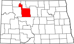 | |
| Townships |
| |
| CDPs | ||
| Unincorporated communities |
| |