Devils Lake, North Dakota
| Devils Lake, North Dakota | |
|---|---|
| City | |
|
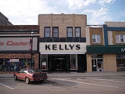
Downtown Devils Lake | |
 Location of Devils Lake, North Dakota | |
| Coordinates: 48°7′N 98°52′W / 48.117°N 98.867°WCoordinates: 48°7′N 98°52′W / 48.117°N 98.867°W | |
| Country | United States |
| State | North Dakota |
| County | Ramsey |
| Founded | 1882 |
| Incorporated (village) | 1884 |
| Incorporated (city) | 1887 |
| Government[1] | |
| • Mayor | Richard Johnson (mayor) |
| Area[2] | |
| • Total | 6.51 sq mi (16.86 km2) |
| • Land | 6.50 sq mi (16.83 km2) |
| • Water | 0.01 sq mi (0.03 km2) |
| Elevation | 1,447 ft (441 m) |
| Population (2010)[3] | |
| • Total | 7,141 |
| • Estimate (2015)[4] | 7,351 |
| • Density | 1,098.6/sq mi (424.2/km2) |
| Time zone | Central (CST) (UTC-6) |
| • Summer (DST) | CDT (UTC-5) |
| ZIP code | 58301 |
| Area code(s) | 701 |
| FIPS code | 38-19420 |
| GNIS feature ID | 1028672[5] |
| Highways | US 2, ND 19, ND 20 |
| Website | City of Devils Lake website |
Devils Lake is a city in Ramsey County, North Dakota, United States. It is the county seat of Ramsey County.[6] The population was 7,141 at the 2010 census.[7] It is named after the nearby body of water, Devils Lake. The first house in Devils Lake was built in 1882. It was surveyed in 1883 and named Creelsburg and later Creel City, after the surveyor, Heber M. Creel. In 1884 it was renamed Devils Lake.[8]
The local paper is the Devils Lake Journal. Devils Lake Municipal Airport serves the city. Devils Lake is home to Lake Region State College and the North Dakota School for the Deaf.
History
The present site of Devils Lake was historically territory of the Sioux or Lakota. The Sioux were relocated to the Spirit Lake Reservation. The name "Devils Lake" is a calque of the Sioux phrase mni wak’áŋ (literally: spirit water),[9] which is also reflected in the names of the Spirit Lake Tribe and the nearby town of Minnewaukan.
The Sioux called the lake mni wak’áŋ chante, which separately translate as mni (water), wak’áŋ (spirit), and chante (bad). Early European-American settlers thought this meant "Bad Spirit Lake", or "Devils Lake." The "bad" referred to the high salinity of the lake, making it unfit to drink, and "spirit" meant the mirages often seen across the water. The Christian concept of the devil was not present in the Sioux religion.[10]
The Hidatsa name is mirixubaash ("sacred water").[11]
The first post office was founded here November 15, 1882, and originally named Creelsburg.[8] It was founded by Lieutenant Heber M. Creel, a West Point graduate and topgraphical engineer stationed at nearby Fort Totten. After resigning from the U.S. Army, he surveyed and established the townsite.
The surrounding Creel Township is named for him. Its name was later changed to Creel City and expanded by the Great Northern Railway. When the village was incorporated in 1884, the name was changed to City of Devils Lake and then shortened to Devils Lake.[1][10]
A period of increased rainfall, beginning in the 1990s and unprecedented in the history of the state, caused the nearby lake, which has no natural outlet, to rise. The surface area has quadrupled, and the higher water has resulted in the moving or destruction of over 400 houses.[12]
Geography and climate
According to the United States Census Bureau, the city has a total area of 6.51 square miles (16.86 km2), of which, 6.50 square miles (16.83 km2) is land and 0.01 square miles (0.03 km2) is water.[2]
Like all of North Dakota, Devils Lake has a humid continental climate (Köppen Dfb) with very cold winters with frequent light snowfall, and warm to very warm, wetter summers with most rain from convective thunderstorms. During the 1936 North American cold wave, the town was one of the coldest places south of the Canada–US border, averaging −21 °F or −29.4 °C for the five weeks ending February 21, 1936[13] (though at a different site from that now in use). On average 53.4 nights fall to or below 0 °F or −17.8 °C, 104.1 days fail to top freezing, and 184.5 nights fall below 32 °F or 0 °C. In the winter, only 17.5 days on average top freezing, and in severe winters months can pass without even a minor thaw. Extreme heat is rare in summer, with only one day in three years topping 100 °F or 37.8 °C, and only 9.3 topping 90 °F or 32.2 °C.
| Climate data for Devils Lake, North Dakota (1971-2000, extremes 1948-2001) | |||||||||||||
|---|---|---|---|---|---|---|---|---|---|---|---|---|---|
| Month | Jan | Feb | Mar | Apr | May | Jun | Jul | Aug | Sep | Oct | Nov | Dec | Year |
| Record high °F (°C) | 53 (12) |
60 (16) |
72 (22) |
97 (36) |
96 (36) |
103 (39) |
103 (39) |
103 (39) |
100 (38) |
94 (34) |
77 (25) |
59 (15) |
103 (39) |
| Average high °F (°C) | 14.7 (−9.6) |
22.3 (−5.4) |
33.6 (0.9) |
52.1 (11.2) |
67.5 (19.7) |
75.3 (24.1) |
80.1 (26.7) |
79.1 (26.2) |
67.7 (19.8) |
53.9 (12.2) |
33.1 (0.6) |
19.4 (−7) |
49.9 (9.9) |
| Average low °F (°C) | −2.5 (−19.2) |
5.2 (−14.9) |
17.3 (−8.2) |
32.2 (0.1) |
44.9 (7.2) |
54.3 (12.4) |
58.6 (14.8) |
56.2 (13.4) |
46.5 (8.1) |
34.6 (1.4) |
18.4 (−7.6) |
3.6 (−15.8) |
30.8 (−0.7) |
| Record low °F (°C) | −36 (−38) |
−37 (−38) |
−28 (−33) |
−12 (−24) |
1 (−17) |
29 (−2) |
39 (4) |
33 (1) |
20 (−7) |
−2 (−19) |
−25 (−32) |
−37 (−38) |
−37 (−38) |
| Average precipitation inches (mm) | 0.58 (14.7) |
0.51 (13) |
0.80 (20.3) |
0.90 (22.9) |
2.14 (54.4) |
3.83 (97.3) |
3.29 (83.6) |
2.21 (56.1) |
1.80 (45.7) |
1.47 (37.3) |
0.83 (21.1) |
0.57 (14.5) |
18.93 (480.9) |
| Average snowfall inches (cm) | 6.3 (16) |
4.7 (11.9) |
6.3 (16) |
2.2 (5.6) |
0.3 (0.8) |
0.0 (0) |
0.0 (0) |
0.0 (0) |
0.0 (0) |
1.9 (4.8) |
5.4 (13.7) |
7.2 (18.3) |
34.3 (87.1) |
| Average precipitation days (≥ 0.01 inch) | 8.4 | 6.7 | 7.2 | 7.1 | 9.5 | 12.1 | 10.1 | 8.9 | 8.4 | 7.3 | 6.8 | 7.4 | 99.9 |
| Average snowy days (≥ 0.1 inch) | 6.2 | 3.7 | 3.8 | 1.1 | 0.1 | 0.0 | 0.0 | 0.0 | 0.1 | 0.7 | 3.1 | 4.8 | 23.6 |
| Source: NOAA[14] | |||||||||||||
Demographics
| Historical population | |||
|---|---|---|---|
| Census | Pop. | %± | |
| 1890 | 846 | — | |
| 1900 | 1,729 | 104.4% | |
| 1910 | 5,157 | 198.3% | |
| 1920 | 5,140 | −0.3% | |
| 1930 | 5,451 | 6.1% | |
| 1940 | 6,204 | 13.8% | |
| 1950 | 6,427 | 3.6% | |
| 1960 | 6,299 | −2.0% | |
| 1970 | 7,078 | 12.4% | |
| 1980 | 7,442 | 5.1% | |
| 1990 | 7,782 | 4.6% | |
| 2000 | 7,222 | −7.2% | |
| 2010 | 7,141 | −1.1% | |
| Est. 2015 | 7,351 | [15] | 2.9% |
| U.S. Decennial Census[16] 2015 Estimate[4] | |||
2010 census
As of the census[3] of 2010, there were 7,141 people, 3,229 households, and 1,712 families residing in the city. The population density was 1,098.6 inhabitants per square mile (424.2/km2). There were 3,481 housing units at an average density of 535.5 per square mile (206.8/km2). The racial makeup of the city was 82.9% White, 0.5% African American, 12.5% Native American, 0.4% Asian, 0.3% from other races, and 3.4% from two or more races. Hispanic or Latino of any race were 1.3% of the population.
There were 3,229 households of which 26.0% had children under the age of 18 living with them, 36.0% were married couples living together, 12.7% had a female householder with no husband present, 4.3% had a male householder with no wife present, and 47.0% were non-families. 41.8% of all households were made up of individuals and 17.3% had someone living alone who was 65 years of age or older. The average household size was 2.07 and the average family size was 2.80.
The median age in the city was 40.4 years. 21.6% of residents were under the age of 18; 10.9% were between the ages of 18 and 24; 22.3% were from 25 to 44; 26.1% were from 45 to 64; and 19.2% were 65 years of age or older. The gender makeup of the city was 48.1% male and 51.9% female.
2000 census
As of the 2000 Census, there were 7,222 people, 3,127 households, and 1,773 families residing in the city. The population density was 1,149.4 inhabitants per square mile (443.8/km2). There were 3,508 housing units at an average density of 558.3 per square mile (215.6/km2). The racial makeup of the city was 89.23% White, 0.22% African American, 7.84% Native American, 0.28% Asian, 0.21% from other races, and 2.23% from two or more races. Hispanic or Latino of any race were 0.55% of the population.
The top 6 ancestry groups in the city are German (43.9%), Norwegian (33.4%), Irish (7.6%), French (4.7%), Swedish (4.5%), English (2.7%).
There were 3,127 households out of which 27.5% had children under the age of 18 living with them, 41.2% were married couples living together, 11.3% had a female householder with no husband present, and 43.3% were non-families. 37.7% of all households were made up of individuals and 18.0% had someone living alone who was 65 years of age or older. The average household size was 2.18 and the average family size was 2.87.
In the city the population was spread out with 24.0% under the age of 18, 10.0% from 18 to 24, 25.6% from 25 to 44, 19.3% from 45 to 64, and 21.1% who were 65 years of age or older. The median age was 38 years. For every 100 females there were 89.8 males. For every 100 females age 18 and over, there were 85.0 males.
The median income for a household in the city was $31,250, and the median income for a family was $39,541. Males had a median income of $27,972 versus $18,000 for females. The per capita income for the city was $17,741. About 11.2% of families and 16.1% of the population were below the poverty line, including 22.7% of those under age 18 and 8.6% of those age 65 or over.
Education
K-12
The city of Devils Lake is served by Devils Lake Public Schools. This system operates Sweetwater Elementary School, Prairie View Elementary School, Minnie H Elementary School, Central Middle School, and Devils Lake High School. A private school, St. Joseph's Catholic School, is also located in Devils Lake.
Higher education
Sports
- Devils Lake Storm of North Dakota American Legion Baseball
- Devils Lake Firebirds
Media
Television
- 8 WDAZ (8.1 ABC, 8.2 The CW, 8.3 Weather) - digital only - licensed with news bureau in Devils Lake, but based in Grand Forks
- 25 KMDE (25.1 & 25.2 PBS/Prairie Public Television, 25.3 Minnesota Channel) - digital only
Radio
- FM
- 89.9 KDVI American Family Radio (Christian)
- 90.7 KABU (Tribal radio - Spirit Lake Indian Reservation)
- 91.7 KPPD Prairie Public Radio/NPR (Public/Classical/Jazz)
- 95.3 KKWZ (owned by De La Hunt Broadcasting)
- 96.7 KQZZ "The Mix" (Hot Adult Contemporary)
- 99.7 KDLR (Classic country)
- 102.5 KDVL "Cruiser 102" (Classic Hits)
- 103.5 KZZY "Double Z Country" (Country)
- 104.5 K283AM broadcast translator of KHRT-FM of Minot, ND (contemporary Christian music)
Transportation
Amtrak, the U.S. national passenger rail system, serves Devils Lake, operating its Empire Builder daily in both directions between Chicago and Seattle and Portland, Oregon. SkyWest Air Lines also operates two flights daily to the Devils Lake Municipal Airport from Denver International Airport.
Sites of interest
- Devils Lake Town and Country Club
- Devils Lake Basin Joint Water Resource Board http://www.dlbasin.com
Notable people
- Dwight Jon Zimmerman, author
- Phyllis Frelich, Tony Award-winning deaf actress
- William L. Guy, Governor of North Dakota
- Rick Helling, Pitcher with several Major League Baseball teams
- Ralph Maxwell, North Dakota state court judge and athlete
- Mary Wakefield, Administrator of Health Resources and Services Administration
- Christian Zimmerman, Chief Landscape Architect at Prospect Park Alliance in Brooklyn, NY[17]
In popular culture
- Devils Lake was a featured location in a fourth-season episode of the popular Syfy series Warehouse 13 titled "Personal Effects," though its establishing shot had little in common with town's actual topography and more closely resembled the North Dakota badlands.
- Devils Lake is the site of a youth camp for Evangelical Christians in the 2006 documentary Jesus Camp.
References
- 1 2 Wick, Douglas A. (1988). North Dakota Place Names. Bismarck, N.D.: Hedemarken Collectibles. p. 48. ISBN 0-9620968-0-6. OCLC 191277027.
- 1 2 "US Gazetteer files 2010". United States Census Bureau. Retrieved 2012-06-14.
- 1 2 "American FactFinder". United States Census Bureau. Retrieved 2012-06-14.
- 1 2 "Population Estimates". United States Census Bureau. Retrieved June 1, 2016.
- ↑ "US Board on Geographic Names". United States Geological Survey. 2007-10-25. Retrieved 2008-01-31.
- ↑ "Find a County". National Association of Counties. Retrieved 2011-06-07.
- ↑ "2010 Census Redistricting Data (Public Law 94-171) Summary File". American FactFinder. United States Census Bureau. Retrieved 2 May 2011.
- 1 2 Ramsey County History
- ↑ Buechel, Eugene. (1970) Lakota-English Dictionary. Pine Ridge, SD: Red Cloud Indian School.
- 1 2 Williams, Mary Ann (Barnes) (1966). Origins of North Dakota place names. Bismarck, North Dakota: Bismarck Tribune, 1966. pp. 20; 236. OCLC 431626.
- ↑ "Hidatsa Lessons Vocab". Hidatsa Language Program. Retrieved 2012-07-17.
- ↑ Dave Kolpack, "North Dakota lake swallows land and buildings", Denver Post, September 22, 2010.
- ↑ Kincer, J.B.; ‘Weather Cycle Changing: Present Hard Winter May Be a Foretaste of a Series of Colder and Wetter Years’; New York Times, February 21, 1936, p. E10
- ↑ "DEVILS LAKE KDLR (022329) – Climatography of the United States No. 20, 1971-2000" (PDF). National Oceanic and Atmospheric Administration. 2004. Retrieved on August 28, 2015.
- ↑ "Annual Estimates of the Resident Population for Incorporated Places: April 1, 2010 to July 1, 2015". Retrieved July 2, 2016.
- ↑ "U.S. Decennial Census". Census.gov. Retrieved June 1, 2013.
- ↑ https://www.prospectpark.org/news-events/news/ppa-profiles-christian-zimmerman/
External links
| Wikimedia Commons has media related to Devils Lake, North Dakota. |
| Wikivoyage has a travel guide for Devils Lake. |
- City of Devils Lake official website
- Devils Lake Chamber of Commerce
- Mother Nature In Charge: Devils Lake The Dilemma Documentary produced by Prairie Public Television
- A bicentennial history of Devils Lake, North Dakota (1976) from the Digital Horizons website
- Devils Lake's seventy-five years :official souvenir program (1957) from the Digital Horizons website
Municipalities and communities of Ramsey County, North Dakota, United States | ||
|---|---|---|
| Cities | 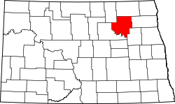 | |
| Townships |
| |
| Unincorporated communities | ||