Winsham
| Winsham | |
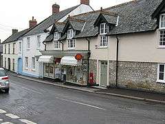 Winsham Post Office and Store |
|
 Winsham |
|
| Population | 748 (2011)[1] |
|---|---|
| OS grid reference | ST375062 |
| District | South Somerset |
| Shire county | Somerset |
| Region | South West |
| Country | England |
| Sovereign state | United Kingdom |
| Post town | CHARD |
| Postcode district | TA20 |
| Dialling code | 01460 |
| Police | Avon and Somerset |
| Fire | Devon and Somerset |
| Ambulance | South Western |
| EU Parliament | South West England |
| UK Parliament | Yeovil |
Coordinates: 50°51′13″N 2°53′24″W / 50.853560°N 2.889928°W
Winsham is a village and civil parish 4 miles (6 km) south-east of Chard, Somerset and 6 miles (10 km) from Crewkerne, in the South Somerset district of Somerset, England. The parish, which has a population of approximately 750, living in some 320 households,[2] includes the hamlets of Whatley,Bridge,Purtington and Ammerham and covers an area of approximately 12 square miles (3,100 ha).[3]
The village is on the southern border of Somerset, approximately 0.4 miles (0.64 km) from the Dorset border. Administratively it is in Area West, South Somerset District Council, and has a Parish Council elected by residents. The Winsham Parish Council was one of the first to be formed in 1894, shortly after the passing of the Local Government Act of the same year.[4]
History
The name Winsham means Wine's settlement.[5]
In Saxon times the manor formed part of the estate of Wells Cathedral.[5] The parish of Winsham was part of the Kilmersdon Hundred.[6]
With its roots in Saxon times, and its listing in the Domesday Book. Three estates had a major influence on Winsham's rural community Forde Abbey, Cricket St Thomas and Leigh House. The Fry family, the chocolate manufacturers from Bristol, who owned the Cricket St Thomas estate from 1897 until 1919, and the Hall family who followed them were particularly active in their support of the village.
The same is true of Leigh House where the Henley and Davies family also played an active part in village affairs. In the nineteenth century, the West of England Woollen Mill employed large numbers (said to be 600 at its peak).[7] During that time it is believed that the population of Winsham increased to over a thousand. This boom was over by 1850, when the mill closed, having lost its business to the north of England. At a later date, it continued on reduced scale processing jute until the early twentieth century.
Both the village Pub, ’The Bell’, and the village run general store and Post Office have been in continuous business since at least 1850. Also in the centre of the village is the village hall, a gift to the village from Lord Bridport in 1887 to celebrate the Golden Jubilee of Queen Victoria.[8] It is known as the Jubilee Hall.
The village school building dates back to 1818.[9]
A more recent structure is the Sports and Social Club, located on the larger of two recreation grounds near to the centre of the village. It hosts a strong village football club that has been active since the late 19th Century. The Parish of Winsham has good Broadband facilities (for a rural area), with most homes and businesses having access to a 6mbs service.
Governance
The parish council has responsibility for local issues, including setting an annual precept (local rate) to cover the council’s operating costs and producing annual accounts for public scrutiny. The parish council evaluates local planning applications and works with the local police, district council officers, and neighbourhood watch groups on matters of crime, security, and traffic. The parish council's role also includes initiating projects for the maintenance and repair of parish facilities, as well as consulting with the district council on the maintenance, repair, and improvement of highways, drainage, footpaths, public transport, and street cleaning. Conservation matters (including trees and listed buildings) and environmental issues are also the responsibility of the council.
The village falls within the Non-metropolitan district of South Somerset, which was formed on 1 April 1974 under the Local Government Act 1972, having previously been part of Chard Rural District.[10] The district council is responsible for local planning and building control, local roads, council housing, environmental health, markets and fairs, refuse collection and recycling, cemeteries and crematoria, leisure services, parks, and tourism.
Somerset County Council is responsible for running the largest and most expensive local services such as education, social services, libraries, main roads, public transport, policing and fire services, trading standards, waste disposal and strategic planning.
The village is in the 'Windwhistle' electoral ward. Winsham is the most populous area in the ward but this stretches east to West Crewkerne and north to Dowlish Wake. The total population of the ward taken from the 2011 census was 2,293.[11]
It is also part of the Yeovil county constituency represented in the House of Commons of the Parliament of the United Kingdom. It elects one Member of Parliament (MP) by the first past the post system of election, and part of the South West England constituency of the European Parliament which elects seven MEPs using the d'Hondt method of party-list proportional representation.
Religious sites

The Church of St Stephen originates from the 13th century, though mostly 15th century with 19th century restoration. Designated by English Heritage as a Grade II* listed building.[12] Because of the state of the stone and lead on the roofs the church has been added to the Heritage at Risk register.[13]
The United Reformed Church dates back to the early 19th Century.[14] Non-conformism has had a substantial following in the parish since the 17th Century.
References
- ↑ "Statistics for Wards, LSOAs and Parishes — SUMMARY Profiles" (Excel). Somerset Intelligence. Retrieved 4 January 2014.
- ↑ "Market Place". Winsham Parish. Retrieved 27 February 2013.
- ↑ Pulman, George P.R. "The book of the axe". Winsham Parish. Retrieved 27 February 2013.
- ↑ "Winsham Parish Council — Historical perspective". Winsham Web Museum. Retrieved 27 February 2013.
- 1 2 Bush, Robin (1994). Somerset: The Complete Guide. Dovecote Press. p. 198. ISBN 1-874336-26-1.
- ↑ "Somerset Hundreds". GENUKI. Retrieved 16 October 2011.
- ↑ "The "West of England Cloth" Factory". Winsham Web Museum. Retrieved 27 February 2013.
- ↑ "A history of Winsham, its historic buildings and Estates". Winsham Web Museum. Retrieved 27 February 2013.
- ↑ Samuel Lewis (editor) (1848). "Winnall — Winstone". A Topographical Dictionary of England. Institute of Historical Research. Retrieved 27 February 2013.
- ↑ "Chard RD". A vision of Britain Through Time. University of Portsmouth. Retrieved 4 January 2014.
- ↑ "Windwhistle ward 2011.Retrieved 5 March 2015".
- ↑ "Church of St Stephen". Images of England. Retrieved 2008-02-02.
- ↑ "Church of St Stephen, Church Street, Winsham - South Somerset". Heritage at Risk. English Heritage. Retrieved 19 October 2013.
- ↑ "Winsham Neighbourhood Plan". Yarlington Housing Group. Retrieved 27 February 2013.
External links
![]() Media related to Winsham at Wikimedia Commons
Media related to Winsham at Wikimedia Commons
