Henstridge
| Henstridge | |
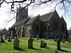 Church of St Nicholas |
|
 Henstridge |
|
| Population | 1,814 (2011)[1] |
|---|---|
| OS grid reference | ST725195 |
| District | South Somerset |
| Shire county | Somerset |
| Region | South West |
| Country | England |
| Sovereign state | United Kingdom |
| Post town | Templecombe |
| Postcode district | BA8 |
| Police | Avon and Somerset |
| Fire | Devon and Somerset |
| Ambulance | South Western |
| EU Parliament | South West England |
| UK Parliament | Somerton and Frome |
Coordinates: 50°58′27″N 2°23′35″W / 50.9742°N 2.3930°W
Henstridge is a village and civil parish in Somerset, England, situated 5 miles (8.0 km) east of Sherborne in the South Somerset district, near the border with Dorset. The parish includes the hamlet of Yenston. The village has a population of 1,814.[1]
History
The village name means the ridge where stallions are kept.[2]
The parish was part of the hundred of Horethorne.[3]
Yenston Priory was a 16th-century house of Benedictine monks.
Governance
The parish council has responsibility for local issues, including setting an annual precept (local rate) to cover the council's operating costs and producing annual accounts for public scrutiny. The parish council evaluates local planning applications and works with the local police, district council officers, and neighbourhood watch groups on matters of crime, security, and traffic. The parish council's role also includes initiating projects for the maintenance and repair of parish facilities, as well as consulting with the district council on the maintenance, repair, and improvement of highways, drainage, footpaths, public transport, and street cleaning. Conservation matters (including trees and listed buildings) and environmental issues are also the responsibility of the council.
The village falls within the Non-metropolitan district of South Somerset, which was formed on 1 April 1974 under the Local Government Act 1972, having previously been part of Wincanton Rural District.[4] The district council is responsible for local planning and building control, local roads, council housing, environmental health, markets and fairs, refuse collection and recycling, cemeteries and crematoria, leisure services, parks, and tourism.
Somerset County Council is responsible for running the largest and most expensive local services such as education, social services, libraries, main roads, public transport, policing and fire services, Trading Standards, waste disposal and strategic planning.
It is also part of the Somerton and Frome county constituency represented in the House of Commons of the Parliament of the United Kingdom. It elects one Member of Parliament (MP) by the first past the post system of election, and part of the South West England constituency of the European Parliament which elects seven MEPs using the d'Hondt method of party-list proportional representation.
Landmarks
Inwood house was built in 1881 by the Welsh industrialist Thomas Merthyr Guest on the site of an earlier house. The circular crenellated water tower was retained,[5] as was the small doric Temple of Laocoon[6] and an Oriental Summerhouse.[7][8]
Transport
The village is situated at the junction of the A30 and A357 roads. Henstridge railway station was on the former Somerset and Dorset Joint Railway, and is now the location of the Gartell Light Railway
Just east of the village is Henstridge Airfield (ICAO code – EGHS). It was built during World War II as a training base for the Fleet Air Arm, who commissioned it as HMS Dipper. Visitors can still see the concrete outline of an aircraft carrier deck embedded into its one surviving runway. The MOD sold the airfield in 1957 and today it is mainly used as a base for general aviation and is an active training centre for autogyros (gyrocopters). The airfield is the base for the Dorset and Somerset Air Ambulance.
Religious sites
The parish Church of St Nicholas dates from the 12th century, but was largely rebuilt in 1872–3 by J.M Allen.[9]
The former chapel in the High Street is now a private residence.
References
- 1 2 "Statistics for Wards, LSOAs and Parishes – SUMMARY Profiles" (Excel). Somerset Intelligence. Retrieved 4 January 2014.
- ↑ Bush, Robin (1994). Somerset: The Complete Guide. Dovecote Press. p. 114. ISBN 1-874336-26-1.
- ↑ "Somerset Hundreds". GENUKI. Retrieved 9 October 2011.
- ↑ "Wincanton RD". A vision of Britain Through Time. University of Portsmouth. Retrieved 4 January 2014.
- ↑ "Folly tower, 20 metres South of Stables complex". Images of England. English Heritage. Retrieved 11 January 2009.
- ↑ "Pavilion with sculpture, 10 metres South-East of stables complex". Images of England. English Heritage. Retrieved 11 January 2009.
- ↑ "The Summer House, 50 metres North-West of Inwood House". Images of England. English Heritage. Retrieved 11 January 2009.
- ↑ Holt, Jonathan (2007). Somerset Follies. Bath: Akeman Press. ISBN 978-0-9546138-7-7.
- ↑ "Church of St Nicholas". Images of England. English Heritage. Retrieved 11 January 2009.
External links
| Wikimedia Commons has media related to Henstridge. |
- Henstridge Parish Council
- Henstridge Airfield
- Henstridge Online, a non-profitmaking local community site for residents and visitors
