Beercrocombe
| Beercrocombe | |
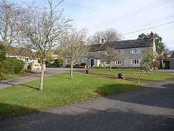 Near the main road junction |
|
 Railway bridge |
|
 Beercrocombe |
|
| Population | 134 (2011)[1] |
|---|---|
| OS grid reference | ST322204 |
| District | South Somerset |
| Shire county | Somerset |
| Region | South West |
| Country | England |
| Sovereign state | United Kingdom |
| Post town | TAUNTON |
| Postcode district | TA3 |
| Police | Avon and Somerset |
| Fire | Devon and Somerset |
| Ambulance | South Western |
| EU Parliament | South West England |
Coordinates: 50°58′47″N 2°57′57″W / 50.9796°N 2.9659°W
Beercrocombe (also known as Beer Crocombe) is a village and civil parish in Somerset, England, situated on the Fivehead River, a tributary of the River Isle, 1 mile (1.6 km) south of Curry Mallet and 7 miles (11.3 km) south-east of Taunton in the South Somerset district. The village has a population of 134.[1]
History
The village is included in the Domesday Book under its old name Bere, which is from the Old English for pasture or possibly grove. The second part of the name comes from Godfrey de Craucombe (of Crowcombe) who was the lord of the manor in 1227.[2]
From 1402 John Harwell was the Lord of the manor.[3]
Beer Crocombe was part of the hundred of Abdick and Bulstone.[4][5]
From 1746 to 1751 the preacher John Wesley was a frequent visitor to the village.[3]
Beer Farm in Beer Street dates from around 1600 and is grade II* listed.[6]
Governance
The parish council has responsibility for local issues, including setting an annual precept (local rate) to cover the council’s operating costs and producing annual accounts for public scrutiny. The parish council evaluates local planning applications and works with the local police, district council officers, and neighbourhood watch groups on matters of crime, security, and traffic. The parish council's role also includes initiating projects for the maintenance and repair of parish facilities, as well as consulting with the district council on the maintenance, repair, and improvement of highways, drainage, footpaths, public transport, and street cleaning. Conservation matters (including trees and listed buildings) and environmental issues are also the responsibility of the council.
The village falls within the Non-metropolitan district of South Somerset, which was formed on 1 April 1974 under the Local Government Act 1972, having previously been part of Langport Rural District.[7] The district council is responsible for local planning and building control, local roads, council housing, environmental health, markets and fairs, refuse collection and recycling, cemeteries and crematoria, leisure services, parks, and tourism.
Somerset County Council is responsible for running the largest and most expensive local services such as education, social services, libraries, main roads, public transport, policing and fire services, trading standards, waste disposal and strategic planning.
It is also part of a county constituency represented in the House of Commons of the Parliament of the United Kingdom. It elects one Member of Parliament (MP) by the first past the post system of election, and part of the South West England constituency of the European Parliament which elects seven MEPs using the d'Hondt method of party-list proportional representation.
Religious sites
The Anglican parish Church of St James dates from the 13th century but the current building is predominantly from the 15th. It was restored in the late 19th century. It has been designated as a Grade I listed building.[8] It includes window dedicated to the memory of Colonel John Rouse Merriott Chard (1847 – 1897) was an English soldier who won the Victoria Cross for his role in the defence of Rorke's Drift in 1879.
References
- 1 2 "Statistics for Wards, LSOAs and Parishes — SUMMARY Profiles" (Excel). Somerset Intelligence. Retrieved 4 January 2014.
- ↑ Bush, Robin (1994). Somerset: The complete guide. Wimbourne: Dovecote Press. p. 34. ISBN 1-874336-26-1.
- 1 2 "Church History". Beercrocombe village web site. Archived from the original on 5 December 2010. Retrieved 9 November 2010.
- ↑ "Abdick and Bulstone Hundred Through Time". A Vision of Britain Through Time. Retrieved 9 September 2011.
- ↑ "Abdick and Bulstone in South Somerset". A Vision Britain Through Time. Retrieved 9 September 2011.
- ↑ "Manor Farmhouse (previously listed as Beer Farmhouse)". Images of England. English Heritage. Retrieved 25 November 2008.
- ↑ "Langport RD". A vision of Britain Through Time. University of Portsmouth. Retrieved 4 January 2014.
- ↑ "Church of St James". Images of England. English Heritage. Retrieved 25 November 2008.
External links
| Wikimedia Commons has media related to Beercrocombe. |
