Wingate, Indiana
| Wingate, Indiana | |
|---|---|
| Town | |
 | |
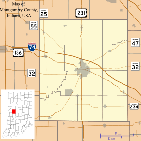 Wingate, Indiana Wingate's location in Montgomery County | |
| Coordinates: 40°10′22″N 87°4′25″W / 40.17278°N 87.07361°WCoordinates: 40°10′22″N 87°4′25″W / 40.17278°N 87.07361°W | |
| Country | United States |
| State | Indiana |
| County | Montgomery |
| Township | Coal Creek |
| Area[1] | |
| • Total | 0.22 sq mi (0.57 km2) |
| • Land | 0.22 sq mi (0.57 km2) |
| • Water | 0 sq mi (0 km2) |
| Elevation | 778 ft (237 m) |
| Population (2010)[2] | |
| • Total | 263 |
| • Estimate (2012[3]) | 264 |
| • Density | 1,195.5/sq mi (461.6/km2) |
| Time zone | Eastern (EST) (UTC-5) |
| • Summer (DST) | EDT (UTC-4) |
| ZIP code | 47994 |
| Area code(s) | 765 |
| FIPS code | 18-84914[4] |
| GNIS feature ID | 0446183[5] |
Wingate, formerly known as Pleasant Hill,[6] is a town in Coal Creek Township, Montgomery County, Indiana, United States. The population was 263 at the 2010 census.
History
Wingate was platted, (as Pleasant Hill), by Christian Bever in 1832.[7] Citizens renamed the town in honor of prominent townsperson, John C. Wingate.
Sports heritage
Signage on the north and south ends of town (shown right) along Indiana State Road 25 boast that, following the first Indiana State Basketball Championships that were held in 1911, the Wingate team was the first to win back-to-back championships in 1913 and 1914.[8] The same sign also mentions that Wingate produced four Indiana Basketball Hall of Fame inductees—Homer Stonebraker,[9] Jesse Wood,[10] Lee Thorn[11] and Alonzo Goldsberry[12]—and two football hall of famers. The Basketball Hall of Fame inducted a fifth player, Forest Crane, in 2013.[13] Wingate was the site of the first electric basketball scoreboard; it was invented in 1935 by two local men, Lee Haxton and Roy Meharry.[14]
Geography

Wingate is located at the intersection of Indiana State Road 25 and Indiana State Road 55 in the northwest corner of Montgomery County, approximately 10 miles (16 km) northwest of the county seat of Crawfordsville. Wingate is the southern terminus of State Road 55, which runs northwest out of town.
According to the 2010 census, Wingate has a total area of 0.21 square miles (0.54 km2), all land.[1]
Government
Currently the town utilizes a three-member town board and a town clerk. These are elected positions. The town appoints a maintenance superintendent and a town marshal. The maintenance person is responsible for signage, road condition, sewers, and water. The town marshal is charged with enforcing town ordinance, state and local law.
Demographics
| Historical population | |||
|---|---|---|---|
| Census | Pop. | %± | |
| 1900 | 457 | — | |
| 1910 | 446 | −2.4% | |
| 1920 | 464 | 4.0% | |
| 1930 | 408 | −12.1% | |
| 1940 | 380 | −6.9% | |
| 1950 | 400 | 5.3% | |
| 1960 | 431 | 7.8% | |
| 1970 | 437 | 1.4% | |
| 1980 | 373 | −14.6% | |
| 1990 | 275 | −26.3% | |
| 2000 | 299 | 8.7% | |
| 2010 | 263 | −12.0% | |
| Est. 2015 | 263 | [15] | 0.0% |
2010 census
As of the census[2] of 2010, there were 263 people, 114 households, and 76 families residing in the town. The population density was 1,195.5 inhabitants per square mile (461.6/km2). There were 128 housing units at an average density of 581.8 per square mile (224.6/km2). The racial makeup of the town was 100.0% White.
There were 114 households of which 31.6% had children under the age of 18 living with them, 50.9% were married couples living together, 8.8% had a female householder with no husband present, 7.0% had a male householder with no wife present, and 33.3% were non-families. 32.5% of all households were made up of individuals and 16.7% had someone living alone who was 65 years of age or older. The average household size was 2.31 and the average family size was 2.84.
The median age in the town was 44.4 years. 21.7% of residents were under the age of 18; 5.6% were between the ages of 18 and 24; 24% were from 25 to 44; 29.6% were from 45 to 64; and 19% were 65 years of age or older. The gender makeup of the town was 49.8% male and 50.2% female.
2000 census
As of the census[4] of 2000, there were 299 people, 126 households, and 82 families residing in the town. The population density was 1,086.0 people per square mile (412.3/km²). There were 146 housing units at an average density of 530.3 per square mile (201.3/km²). The racial makeup of the town was 99.67% White and 0.33% Asian. Hispanic or Latino of any race were 0.33% of the population.
There were 126 households out of which 27.8% had children under the age of 18 living with them, 53.2% were married couples living together, 5.6% had a female householder with no husband present, and 34.9% were non-families. 31.0% of all households were made up of individuals and 17.5% had someone living alone who was 65 years of age or older. The average household size was 2.37 and the average family size was 2.95.
In the town the population was spread out with 26.1% under the age of 18, 4.3% from 18 to 24, 29.4% from 25 to 44, 19.4% from 45 to 64, and 20.7% who were 65 years of age or older. The median age was 40 years. For every 100 females there were 92.9 males. For every 100 females age 18 and over, there were 90.5 males.
The median income for a household in the town was $28,750, and the median income for a family was $42,500. Males had a median income of $41,250 versus $21,250 for females. The per capita income for the town was $14,123. About 15.9% of families and 22.2% of the population were below the poverty line, including 30.7% of those under the age of eighteen and 23.7% of those sixty five or over.
Education
North Montgomery School Corporation serves Wingate.[17] Secondary school students attend Northridge Middle School and North Montgomery High School.
Gallery
 The Wingate town hall and water tower
 The historic 1898 calaboose
 Buildings along Vine Street
 The water works
References
- 1 2 "G001 - Geographic Identifiers - 2010 Census Summary File 1". United States Census Bureau. Retrieved 2015-07-25.
- 1 2 "American FactFinder". United States Census Bureau. Retrieved 2012-12-11.
- ↑ "Population Estimates". United States Census Bureau. Retrieved 2013-06-25.
- 1 2 "American FactFinder". United States Census Bureau. Retrieved 2008-01-31.
- ↑ "US Board on Geographic Names". United States Geological Survey. 2007-10-25. Retrieved 2008-01-31.
- ↑ Andreas, Alfred Theodore (1876). "Montgomery County". Illustrated Historical Atlas of the State of Indiana. Chicago: Baskin, Forster & Company.
- ↑ History of Montgomery County, Indiana : with personal sketches of representative citizens. pg 505
- ↑ "IHSAA Boys Basketball State Champions". www.ihsaa.org. Retrieved 2015-12-03.
- ↑ "Homer Stonebraker". Indiana Basketball Hall of Fame. Retrieved January 10, 2015.
- ↑ "Jesse Wood". Indiana Basketball Hall of Fame. Retrieved January 10, 2015.
- ↑ "Lee Thorn". Indiana Basketball Hall of Fame. Retrieved January 10, 2015.
- ↑ "Alonzo Goldsberry". Indiana Basketball Hall of Fame. Retrieved January 10, 2015.
- ↑ "John Forest "Crainie" Crane". Indiana Basketball Hall of Fame. Retrieved January 10, 2015.
- ↑ "The Indiana Basketball Heritage Trail: Where Hoosier Hysteria Began". Basketball Heritage Project. Retrieved January 10, 2015.
- ↑ "Annual Estimates of the Resident Population for Incorporated Places: April 1, 2010 to July 1, 2015". Retrieved July 2, 2016.
- ↑ "Census of Population and Housing". Census.gov. Retrieved June 4, 2015.
- ↑ "SCHOOL DISTRICT REFERENCE MAP (2010 CENSUS): Montgomery County, IN." U.S. Census Bureau. Retrieved on November 26, 2016.
External links
Municipalities and communities of Montgomery County, Indiana, United States | ||
|---|---|---|
| City | ||
| Towns | ||
| Townships | ||
| CDP | ||
| Other unincorporated communities |
| |