New Richmond, Indiana
| New Richmond, Indiana | |
|---|---|
| Town | |
|
The corner of Wabash and Washington streets | |
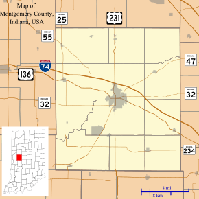 New Richmond, Indiana New Richmond's location in Montgomery County | |
| Coordinates: 40°11′42″N 86°58′43″W / 40.19500°N 86.97861°WCoordinates: 40°11′42″N 86°58′43″W / 40.19500°N 86.97861°W | |
| Country | United States |
| State | Indiana |
| County | Montgomery |
| Township | Coal Creek |
| Area[1] | |
| • Total | 0.20 sq mi (0.52 km2) |
| • Land | 0.20 sq mi (0.52 km2) |
| • Water | 0 sq mi (0 km2) |
| Elevation | 781 ft (238 m) |
| Population (2010)[2] | |
| • Total | 333 |
| • Estimate (2012[3]) | 335 |
| • Density | 1,665.0/sq mi (642.9/km2) |
| Time zone | Eastern (EST) (UTC-5) |
| • Summer (DST) | EDT (UTC-4) |
| ZIP code | 47967 |
| Area code(s) | 765 |
| FIPS code | 18-53532[4] |
| GNIS feature ID | 0440105[5] |
New Richmond is a town in Coal Creek Township, Montgomery County, Indiana, United States. The population was 333 at the 2010 census.
History
New Richmond was platted by Samuel Kincaid in 1836.[6]
Geography
New Richmond is located at 40°11′42″N 86°58′43″W / 40.19500°N 86.97861°W (40.194872, -86.978530).[7]
According to the 2010 census, New Richmond has a total area of 0.2 square miles (0.52 km2), all land.[1]
Demographics
| Historical population | |||
|---|---|---|---|
| Census | Pop. | %± | |
| 1880 | 72 | — | |
| 1900 | 357 | — | |
| 1910 | 464 | 30.0% | |
| 1920 | 436 | −6.0% | |
| 1930 | 391 | −10.3% | |
| 1940 | 368 | −5.9% | |
| 1950 | 391 | 6.3% | |
| 1960 | 394 | 0.8% | |
| 1970 | 381 | −3.3% | |
| 1980 | 403 | 5.8% | |
| 1990 | 312 | −22.6% | |
| 2000 | 349 | 11.9% | |
| 2010 | 333 | −4.6% | |
| Est. 2015 | 334 | [8] | 0.3% |
2010 census
As of the census[2] of 2010, there were 333 people, 134 households, and 93 families residing in the town. The population density was 1,665.0 inhabitants per square mile (642.9/km2). There were 148 housing units at an average density of 740.0 per square mile (285.7/km2). The racial makeup of the town was 97.0% White, 0.3% Asian, and 2.7% from two or more races. Hispanic or Latino of any race were 0.6% of the population.
There were 134 households of which 35.8% had children under the age of 18 living with them, 50.7% were married couples living together, 9.7% had a female householder with no husband present, 9.0% had a male householder with no wife present, and 30.6% were non-families. 25.4% of all households were made up of individuals and 8.2% had someone living alone who was 65 years of age or older. The average household size was 2.49 and the average family size was 2.89.
The median age in the town was 37.8 years. 26.7% of residents were under the age of 18; 8.7% were between the ages of 18 and 24; 26.1% were from 25 to 44; 26.1% were from 45 to 64; and 12.3% were 65 years of age or older. The gender makeup of the town was 49.8% male and 50.2% female.
2000 census
As of the census[4] of 2000, there were 349 people, 132 households, and 100 families residing in the town. The population density was 1,950.0 people per square mile (748.6/km²). There were 145 housing units at an average density of 810.2 per square mile (311.0/km²). The racial makeup of the town was 98.85% White, 0.57% African American, and 0.57% from two or more races. Hispanic or Latino of any race were 0.29% of the population.
There were 132 households out of which 39.4% had children under the age of 18 living with them, 66.7% were married couples living together, 7.6% had a female householder with no husband present, and 23.5% were non-families. 22.0% of all households were made up of individuals and 6.8% had someone living alone who was 65 years of age or older. The average household size was 2.64 and the average family size was 3.08.
In the town the population was spread out with 29.2% under the age of 18, 7.7% from 18 to 24, 32.1% from 25 to 44, 19.8% from 45 to 64, and 11.2% who were 65 years of age or older. The median age was 33 years. For every 100 females there were 99.4 males. For every 100 females age 18 and over, there were 83.0 males.
The median income for a household in the town was $43,438, and the median income for a family was $50,268. Males had a median income of $32,917 versus $24,375 for females. The per capita income for the town was $17,001. None of the families and 3.8% of the population were living below the poverty line, including no under eighteens and 16.7% of those over 64.
Education
North Montgomery School Corporation serves New Richmond.[10] Secondary school students attend Northridge Middle School and North Montgomery High School.
Miscellaneous
In 1985, New Richmond was turned into Hickory, Indiana for the filming of the motion picture Hoosiers, starring Gene Hackman, Barbara Hershey, and Dennis Hopper. Signs on the roads leading into town recall the community's role in the film.
The town is also famous for its annual Fourth of July celebration held every year at the town's park. Numerous vendors set up and there is an all-day car show. The Masonic Lodge serves breakfast until 11:00 am. At dusk, those wishing to watch the fireworks gather around the park's pond and spread blankets for the hour-long show. Cars will be also be lined up for a 1/2 mile on all roads leading into the town,with people sitting in their lawn chairs along the road to watch the show. Forman's Blasters,of New Richmond, are in charge of setting off the fireworks.
Gallery
 The town's water tower.
 Looking north along Wabash Street.
 The post office for New Richmond and "Hickory"
 A house in New Richmond.
 The downtown area
References
- 1 2 "G001 - Geographic Identifiers - 2010 Census Summary File 1". United States Census Bureau. Retrieved 2015-07-17.
- 1 2 "American FactFinder". United States Census Bureau. Retrieved 2012-12-11.
- ↑ "Population Estimates". United States Census Bureau. Retrieved 2013-06-25.
- 1 2 "American FactFinder". United States Census Bureau. Retrieved 2008-01-31.
- ↑ "US Board on Geographic Names". United States Geological Survey. 2007-10-25. Retrieved 2008-01-31.
- ↑ History of Montgomery County, Indiana : with personal sketches of representative citizens. pg 504
- ↑ "US Gazetteer files: 2010, 2000, and 1990". United States Census Bureau. 2011-02-12. Retrieved 2011-04-23.
- ↑ "Annual Estimates of the Resident Population for Incorporated Places: April 1, 2010 to July 1, 2015". Retrieved July 2, 2016.
- ↑ "Census of Population and Housing". Census.gov. Retrieved June 4, 2015.
- ↑ "SCHOOL DISTRICT REFERENCE MAP (2010 CENSUS): Montgomery County, IN." U.S. Census Bureau. Retrieved on November 26, 2016.
Municipalities and communities of Montgomery County, Indiana, United States | ||
|---|---|---|
| City | ||
| Towns | ||
| Townships | ||
| CDP | ||
| Other unincorporated communities |
| |