Sugar Creek Township, Montgomery County, Indiana
| Sugar Creek Township | |
|---|---|
| Township | |
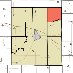 Location in Montgomery County | |
| Coordinates: 40°10′44″N 86°45′42″W / 40.17889°N 86.76167°WCoordinates: 40°10′44″N 86°45′42″W / 40.17889°N 86.76167°W | |
| Country |
|
| State |
|
| County | Montgomery |
| Government | |
| • Type | Indiana township |
| Area | |
| • Total | 33.83 sq mi (87.6 km2) |
| • Land | 33.83 sq mi (87.6 km2) |
| • Water | 0 sq mi (0 km2) 0% |
| Elevation | 801 ft (244 m) |
| Population (2010) | |
| • Total | 448 |
| • Density | 13.2/sq mi (5.1/km2) |
| ZIP codes | 46035, 47930, 47933, 47940, 47955 |
| GNIS feature ID | 0453883 |
Sugar Creek Township is one of eleven townships in Montgomery County, Indiana, United States. As of the 2010 census, its population was 448 and it contained 167 housing units.[1]
History
William Fisher Polygonal Barn was listed on the National Register of Historic Places in 1993.[2]
Geography
According to the 2010 census, the township has a total area of 33.83 square miles (87.6 km2), all land.[1]
Unincorporated towns
Cemeteries
The township contains these four cemeteries: Bowers, Clouser, Peterson and Rice.
School districts
- North Montgomery Community School Corporation
Political districts
- Indiana's 4th congressional district
- State House District 41
- State Senate District 23
References
- "Sugar Creek Township, Montgomery County, Indiana". Geographic Names Information System. United States Geological Survey. Retrieved 2009-09-27.
- United States Census Bureau 2008 TIGER/Line Shapefiles
- IndianaMap
- 1 2 "Population, Housing Units, Area, and Density: 2010 - County -- County Subdivision and Place -- 2010 Census Summary File 1". United States Census. Retrieved 2013-05-10.
- ↑ National Park Service (2010-07-09). "National Register Information System". National Register of Historic Places. National Park Service.
External links
- Indiana Township Association
- United Township Association of Indiana
- City-Data.com page for Sugar Creek Township
 |
Lauramie Township, Tippecanoe County | | ||
| Madison Township | |
Perry Township, Clinton County | ||
| ||||
| | ||||
| Union Township | Franklin Township |
Municipalities and communities of Montgomery County, Indiana, United States | ||
|---|---|---|
| City | ||
| Towns | ||
| Townships | ||
| CDP | ||
| Other unincorporated communities |
| |
This article is issued from Wikipedia - version of the 5/30/2016. The text is available under the Creative Commons Attribution/Share Alike but additional terms may apply for the media files.