Sugarloaf Township, Luzerne County, Pennsylvania
| Sugarloaf Township, Luzerne County, Pennsylvania | |
|---|---|
| Township | |
 Map of Luzerne County, Pennsylvania Highlighting Sugarloaf Township | |
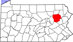 Map of Luzerne County, Pennsylvania | |
| Country | United States |
| State | Pennsylvania |
| County | Luzerne |
| Area | |
| • Total | 22.5 sq mi (58.2 km2) |
| • Land | 22.5 sq mi (58.2 km2) |
| • Water | 0 sq mi (0 km2) |
| Population (2010) | |
| • Total | 4,211 |
| • Density | 190/sq mi (72/km2) |
| Time zone | Eastern (EST) (UTC-5) |
| • Summer (DST) | EDT (UTC-4) |
Sugarloaf Township is a township in Luzerne County, Pennsylvania, United States. The population was 4,211 at the 2010 census.[1]
Geography
According to the United States Census Bureau, the township has a total area of 22.5 square miles (58.2 km2), of which 22.5 square miles (58.2 km2) is land and 0.07% is water.
The township is drained by the Susquehanna River and Nescopeck Mountain forms its natural northern boundary. Its unincorporated communities include Black Ridge, Council Crest, Sybertsville, and Tomhicken. Route 93 serves the township and interchanges with Interstate 80 in the township. Interstate 81 crosses the southeastern corner of Sugarloaf, where it interchanges with 93 in Black Ridge.
Neighboring municipalities
- West Hazleton (south)
- Hazle Township (south)
- Black Creek Township (west)
- Nescopeck Township (northwest)
- Hollenback Township (north)
- Butler Township (east)
Sugarloaf Township encircles the borough of Conyngham.
Demographics
As of the census[2] of 2000, there were 3,652 people, 1,222 households, and 944 families residing in the township. The population density was 166.6 people per square mile (64.4/km2). There were 1,302 housing units at an average density of 59.4/sq mi (22.9/km2). The racial makeup of the township was 98.03% White, 0.27% African American, 0.11% Native American, 1.01% Asian, 0.22% from other races, and 0.36% from two or more races. Hispanic or Latino of any race were 0.71% of the population.
There were 1,222 households, out of which 30.4% had children under the age of 18 living with them, 67.3% were married couples living together, 6.6% had a female householder with no husband present, and 22.7% were non-families. 19.6% of all households were made up of individuals, and 10.1% had someone living alone who was 65 years of age or older. The average household size was 2.60 and the average family size was 2.98.
In the township the population was spread out, with 19.9% under the age of 18, 17.3% from 18 to 24, 23.5% from 25 to 44, 25.9% from 45 to 64, and 13.3% who were 65 years of age or older. The median age was 38 years. For every 100 females there were 105.9 males. For every 100 females age 18 and over, there were 102.8 males.
The median income for a household in the township was $53,611, and the median income for a family was $62,256. Males had a median income of $39,911 versus $25,234 for females. The per capita income for the township was $22,444. About 2.7% of families and 5.6% of the population were below the poverty line, including 4.3% of those under age 18 and 13.8% of those age 65 or over.
Education
The Hazleton Area School District operates public schools, including the Valley Elementary-Middle School in Sugarloaf. All McAdoo residents are zoned to the Hazleton Area High School in Hazle Township.[3] Penn State Hazleton is located in the township near Black Ridge.
References
- ↑ "Profile of General Population and Housing Characteristics: 2010 Demographic Profile Data (DP-1): Sugarloaf township, Luzerne County, Pennsylvania". U.S. Census Bureau, American Factfinder. Retrieved April 19, 2012.
- ↑ "American FactFinder". United States Census Bureau. Retrieved 2008-01-31.
- ↑ "Locate Us." Hazleton Area School District. Retrieved on July 18, 2016.
Municipalities and communities of Luzerne County, Pennsylvania, United States | ||
|---|---|---|
| Cities | | |
| Boroughs |
| |
| Townships | ||
| CDPs | ||
| Unincorporated communities |
| |
| Footnotes | ‡This populated place also has portions in an adjacent county or counties | |
Coordinates: 41°01′00″N 76°07′35″W / 41.01667°N 76.12639°W