Plymouth Township, Luzerne County, Pennsylvania
| Plymouth Township, Luzerne County, Pennsylvania | |
|---|---|
| Township | |
|
Scenery of Plymouth Township | |
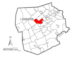 Map of Luzerne County, Pennsylvania Highlighting Plymouth Township | |
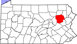 Map of Luzerne County, Pennsylvania | |
| Country | United States |
| State | Pennsylvania |
| County | Luzerne |
| Area | |
| • Total | 16.4 sq mi (42.5 km2) |
| • Land | 15.9 sq mi (41.2 km2) |
| • Water | 0.5 sq mi (1.3 km2) |
| Population (2010) | |
| • Total | 1,812 |
| • Density | 110/sq mi (43/km2) |
| Time zone | Eastern (EST) (UTC-5) |
| • Summer (DST) | EDT (UTC-4) |

Plymouth Township is located in Luzerne County, Pennsylvania, United States. The population was 1,812 at the 2010 census.[1]
History
On September 6, 1869, a mine fire killed 110 people in Avondale, an unincorporated community in Plymouth Township.[2]
Recreation
Moon Lake Park is in Plymouth Township.
Geography
According to the United States Census Bureau, the township has a total area of 16.4 square miles (42.5 km2), of which 15.9 square miles (41.2 km2) is land and 0.50 square miles (1.3 km2), or 3.06%, is water. It is drained by the Susquehanna River, which forms its natural southern boundary. Its villages include Avondale, Ceasetown (also in Jackson Township), and West Nanticoke. Its numbered roads are U.S. Route 11 and Pennsylvania Route 29. While US-11 follows the right (northwest) bank of the river, PA-29 comes down from Wyoming County through the gorge of Harveys Creek to West Nanticoke, where it follows US-11 upriver to just before Avondale, where PA-29 splits off for Interstate 81 and becomes the South Cross Valley Expressway.
Neighboring municipalities
- Plymouth (southeast)
- Hanover Township (south)
- Nanticoke (south)
- Newport Township (southwest)
- Hunlock Township (west)
- Lehman Township (northeast)
- Jackson Township (north)
- Larksville (east)
Township officers
Supervisors:
- Gale Conrad
- Christine Kachurak
- Wayne Wolfe
Former officers
- Joseph Yudichak
- John Rinehimer
- Ed Brennan
- Michael Manley
- Harry J Stone
- Nevin I Ballet
- Albert W Partington
Demographics
The 2010 census[3] indicates that the township population consists of 1,812 people, 780 total households, and 530 families. The racial makeup of the township was 98.6% White, 0.4% African American, 0.1% American Indian and Alaskan Native, 0.7% from other races, and 0.3% from two or more races. Hispanic or Latino of any race made up 0.9% of the population.
There were 780 households, out of which 38.1% had children under the age of 18 living with them, 404 were husband-wife families married couples living together, and 82 females owned homes with no husband present. The average household size was 2.32 and the average family size was 2.80.
In the township, the population was spread out, with 20.0% under the age of 20, 4.7% from 20 to 24, 23.9% from 25 to 44, 32.4% from 45 to 64, and 18.7% who were 65 years of age or older. The median age was 40 years. For every 100 females there were 101.1 males. For every 100 females age 18 and over, there were 98.7 males.
References
- ↑ "Profile of General Population and Housing Characteristics: 2010 Demographic Profile Data (DP-1): Plymouth township, Luzerne County, Pennsylvania". U.S. Census Bureau, American Factfinder. Retrieved April 18, 2012.
- ↑ BrainyHistory September 6 in History
- ↑ "American FactFinder". United States Census Bureau. Retrieved 2008-01-31.
Municipalities and communities of Luzerne County, Pennsylvania, United States | ||
|---|---|---|
| Cities | | |
| Boroughs |
| |
| Townships | ||
| CDPs | ||
| Unincorporated communities |
| |
| Footnotes | ‡This populated place also has portions in an adjacent county or counties | |
Coordinates: 41°15′30″N 75°57′59″W / 41.25833°N 75.96639°W