Butler Township, Luzerne County, Pennsylvania
| Butler Township, Luzerne County, Pennsylvania | |
|---|---|
| Township | |
|
St. John's Lutheran Church on St. John's Road | |
 Map of Luzerne County, Pennsylvania Highlighting Butler Township | |
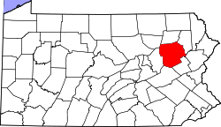 Map of Luzerne County, Pennsylvania | |
| Country | United States |
| State | Pennsylvania |
| County | Luzerne |
| Area | |
| • Total | 33.6 sq mi (87.1 km2) |
| • Land | 33.4 sq mi (86.4 km2) |
| • Water | 0.3 sq mi (0.7 km2) |
| Population (2010) | |
| • Total | 9,221 |
| • Density | 270/sq mi (110/km2) |
| Time zone | Eastern (EST) (UTC-5) |
| • Summer (DST) | EDT (UTC-4) |
| Website |
butler-township |

Butler Township is a township in Luzerne County, Pennsylvania, United States. The population was 9,221 at the 2010 census.[1]
History
The Luzerne County Fresh Air Camp was listed on the National Register of Historic Places in 2004.[2]
Geography
According to the United States Census Bureau, the township has a total area of 33.6 square miles (87.1 km2), of which 33.4 square miles (86.4 km2) is land and 0.27 square miles (0.7 km2), or 0.75%, is water.[3] It is drained by Nescopeck Creek westward into the Susquehanna River. It is located mainly in the Sugarloaf Valley between Nescopeck Mountain to the north and Buck Mountain to the south. Its villages include Beech Mountain Lakes, Drums, Edgewood, Kis-Lyn, Nescopeck Pass (also in Dorrance Township), St. Johns, and Sand Spring.
Neighboring municipalities
- Dennison Township (east)
- Foster Township (east)
- Hazle Township (south)
- Sugarloaf Township (west)
- Hollenback Township (northwest)
- Dorrance Township (north)
- Wright Township (tangent to the northeast)
Demographics

As of the census[4] of 2000, there were 7,166 people, 2,523 households, and 1,899 families residing in the township. The population density was 215.2 people per square mile (83.1/km2). There were 2,747 housing units at an average density of 82.5/sq mi (31.9/km2). The racial makeup of the township was 92.69% White, 5.67% African American, 0.15% Native American, 0.50% Asian, 0.01% Pacific Islander, 0.39% from other races, and 0.59% from two or more races. Hispanic or Latino of any race were 1.79% of the population.
There were 2,523 households, out of which 32.1% had children under the age of 18 living with them, 64.4% were married couples living together, 7.2% had a female householder with no husband present, and 24.7% were non-families. 20.6% of all households were made up of individuals, and 8.9% had someone living alone who was 65 years of age or older. The average household size was 2.54 and the average family size was 2.93.
In the township the population was spread out, with 23.5% under the age of 18, 9.1% from 18 to 24, 27.3% from 25 to 44, 25.5% from 45 to 64, and 14.6% who were 65 years of age or older. The median age was 39 years. For every 100 females there were 100.1 males. For every 100 females age 18 and over, there were 97.5 males.
The median income for a household in the township was $46,783, and the median income for a family was $53,958. Males had a median income of $38,926 versus $23,299 for females. The per capita income for the township was $21,020. About 3.2% of families and 10.3% of the population were below the poverty line, including 2.7% of those under age 18 and 6.1% of those age 65 or over.
Notable residents
Butler Township's most notable resident of recent times was the actor Jack Palance, who maintained and lived on the 150-acre (0.61 km2) Holly-Brooke Farm in an 1850s farm house.
Weather
2005 Butler Township weather summary
- Highest recorded temperature: 98 on 8/13/05.
- Lowest recorded temperature: -8 on 12/14/05.
- Yearly precipitation (rain & melted snow): 42.78 inches.
2006 weather summary
- Highest recorded temperature: 94 on 8/1, 8/2, & 8/3/06.
- Lowest recorded temperature: 6 on 2/19/06
- Yearly precipitation (rain & melted snow): 55.98 inches (12.31 for the month of June alone)
2007 weather summary
- Highest recorded temperature: 94 on 8/2 & 8/25/07
- Lowest recorded temperature: -1 on 2/5/07
- Yearly precipitation (rain & melted snow): 43.96 inches
Education
The Hazleton Area School District operates public schools in the township. They include:[5]
- Drums Elementary-Middle School
- Hazleton Area Academy of Sciences in Drums
The Hazleton Area High School in Hazle Township is the zoned high school for all Butler Township residents.
References
- ↑ "Profile of General Population and Housing Characteristics: 2010 Demographic Profile Data (DP-1): Butler township, Luzerne County, Pennsylvania". U.S. Census Bureau, American Factfinder. Archived from the original on September 11, 2013. Retrieved April 13, 2012.
- ↑ National Park Service (2010-07-09). "National Register Information System". National Register of Historic Places. National Park Service.
- ↑ "Geographic Identifiers: 2010 Demographic Profile Data (G001): Butler township, Luzerne County, Pennsylvania". U.S. Census Bureau, American Factfinder. Archived from the original on September 11, 2013. Retrieved April 13, 2012.
- ↑ "American FactFinder". United States Census Bureau. Archived from the original on 2013-09-11. Retrieved 2008-01-31.
- ↑ "Locate Us." Hazleton Area School District. Retrieved on July 18, 2016.
External links
Municipalities and communities of Luzerne County, Pennsylvania, United States | ||
|---|---|---|
| Cities | | |
| Boroughs |
| |
| Townships | ||
| CDPs | ||
| Unincorporated communities |
| |
| Footnotes | ‡This populated place also has portions in an adjacent county or counties | |
Coordinates: 40°59′30″N 75°59′29″W / 40.99167°N 75.99139°W