Nescopeck Township, Luzerne County, Pennsylvania
| Nescopeck Township, Pennsylvania | |
|---|---|
| Township | |
|
Scenery of Nescopeck Township | |
 Map of Luzerne County, Pennsylvania Highlighting Nescopeck Township | |
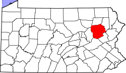 Map of Luzerne County, Pennsylvania | |
| Country | United States |
| State | Pennsylvania |
| County | Luzerne |
| Area | |
| • Total | 18.6 sq mi (48.3 km2) |
| • Land | 18.0 sq mi (46.6 km2) |
| • Water | 0.7 sq mi (1.7 km2) |
| Population (2010) | |
| • Total | 1,155 |
| • Density | 62/sq mi (24/km2) |
| Time zone | Eastern (EST) (UTC-5) |
| • Summer (DST) | EDT (UTC-4) |

Nescopeck Township is a township in Luzerne County, Pennsylvania, in the United States. As of the 2010 census, the township population was 1,155.[1]
Geography
According to the United States Census Bureau, the township has a total area of 18.6 square miles (48.3 km2), of which 18.0 square miles (46.6 km2) is land and 0.66 square miles (1.7 km2), or 3.62%, is water. The majority of the land is woodlands or farmland.
Government information
Nescopeck Township is governed by a board of supervisors. It lies within Pennsylvania's 11 Congressional District and 117th Legislative District. Public schools are managed by the Berwick Area School District. Township residents may use the Berwick Public Library.
The township started building a new municipal building with five garages to house maintenance equipment in 2007.
Demographics
As of the census[2] of 2000, there were 1,096 people, 414 households, and 337 families residing in the township. The population density was 60.6 people per square mile (23.4/km2). There were 459 housing units at an average density of 25.4/sq mi (9.8/km2). The racial makeup of the township was 98.18% White, 0.18% Native American, 0.18% Asian, 0.36% Pacific Islander, 0.46% from other races, and 0.64% from two or more races. Hispanic or Latino of any race were 0.46% of the population.
There were 414 households, out of which 33.6% had children under the age of 18 living with them, 71.3% were married couples living together, 5.1% had a female householder with no husband present, and 18.4% were non-families. 15.7% of all households were made up of individuals, and 6.3% had someone living alone who was 65 years of age or older. The average household size was 2.65 and the average family size was 2.94.
In the township the population was spread out, with 24.0% under the age of 18, 5.9% from 18 to 24, 29.7% from 25 to 44, 26.8% from 45 to 64, and 13.5% who were 65 years of age or older. The median age was 40 years. For every 100 females there were 98.2 males. For every 100 females age 18 and over, there were 100.2 males.
The median income for a household in the township was $43,125, and the median income for a family was $45,655. Males had a median income of $32,250 versus $21,800 for females. The per capita income for the township was $17,918. About 6.2% of families and 8.8% of the population were below the poverty line, including 13.1% of those under age 18 and 13.0% of those age 65 or over.
Climate
On average, the warmest month is July. The highest recorded temperature was 103°F in 1988 and 2006. On average, the coldest month is January. The lowest recorded temperature was -18°F in 1984 and 2008. The most precipitation on average occurs in June. The township has a humid continental climate (Dfa/Dfb).
Events
The Briggs Farm Festival is held in Nescopeck Township every summer, usually in the beginning of July. The festival grows larger every year and attracts people from miles away.
An annual consignment sale is held at the township firehall every year in April to help raise money for the fire department.
References
- ↑ "Profile of General Population and Housing Characteristics: 2010 Demographic Profile Data (DP-1): Nescopeck township, Luzerne County, Pennsylvania". U.S. Census Bureau, American Factfinder. Retrieved April 18, 2012.
- ↑ "American FactFinder". United States Census Bureau. Retrieved 2008-01-31.
Municipalities and communities of Luzerne County, Pennsylvania, United States | ||
|---|---|---|
| Cities | | |
| Boroughs |
| |
| Townships | ||
| CDPs | ||
| Unincorporated communities |
| |
| Footnotes | ‡This populated place also has portions in an adjacent county or counties | |
Coordinates: 41°02′00″N 76°09′59″W / 41.03333°N 76.16639°W