Pardeesville, Pennsylvania
| Pardeesville, Pennsylvania | |
|---|---|
| Census-designated place | |
 Pardeesville, Pennsylvania Location within the state of Pennsylvania | |
| Coordinates: 41°0′11″N 75°57′46″W / 41.00306°N 75.96278°WCoordinates: 41°0′11″N 75°57′46″W / 41.00306°N 75.96278°W | |
| Country | United States |
| State | Pennsylvania |
| County | Luzerne |
| Township | Hazle Township |
| Area | |
| • Total | 0.7 sq mi (1.7 km2) |
| • Land | 0.7 sq mi (1.7 km2) |
| • Water | 0 sq mi (0 km2) |
| Population (2010) | |
| • Total | 572 |
| • Density | 870/sq mi (340/km2) |
| Time zone | Eastern (EST) (UTC-5) |
| • Summer (DST) | EDT (UTC-4) |
| Area code(s) | 570 |
Pardeesville is a census-designated place (CDP) in Hazle Township, Luzerne County, Pennsylvania, United States. The population was 572 at the 2010 census.[1]
Geography
Pardeesville is located at 41°0′11″N 75°57′46″W / 41.00306°N 75.96278°W.[2]
According to the United States Census Bureau, the CDP has a total area of 0.66 square miles (1.7 km2), all of it land.[3] Its altitude is 1,670 feet (510 m) above sea level, and it is located just east of Pennsylvania Route 309 along the crest of Buck Mountain. It uses the Hazleton zip code of 18202.
 |
Kis-Lyn, Drums | Edgewood | Freeland, Upper Lehigh | |
| Hollywood, Milnesville | |
Drifton | ||
| ||||
| | ||||
| Harleigh, Lattimer, Hazleton | Ebervale | Oakdale |
References
- ↑ "Profile of General Population and Housing Characteristics: 2010 Demographic Profile Data (DP-1): Pardeesville CDP, Pennsylvania". U.S. Census Bureau, American Factfinder. Retrieved April 27, 2012.
- ↑ "US Gazetteer files: 2010, 2000, and 1990". United States Census Bureau. 2011-02-12. Retrieved 2011-04-23.
- ↑ "Geographic Identifiers: 2010 Demographic Profile Data (G001): Pardeesville CDP, Pennsylvania". U.S. Census Bureau, American Factfinder. Retrieved April 27, 2012.
Municipalities and communities of Luzerne County, Pennsylvania, United States | ||
|---|---|---|
| Cities | 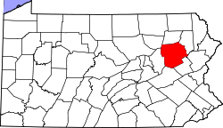 | |
| Boroughs |
| |
| Townships | ||
| CDPs | ||
| Unincorporated communities |
| |
| Footnotes | ‡This populated place also has portions in an adjacent county or counties | |
This article is issued from Wikipedia - version of the 9/4/2016. The text is available under the Creative Commons Attribution/Share Alike but additional terms may apply for the media files.