Freeland, Pennsylvania
| Freeland, Pennsylvania | |
|---|---|
| Borough | |
|
Borough building | |
 Freeland | |
| Coordinates: 41°01′11″N 75°53′45″W / 41.01972°N 75.89583°WCoordinates: 41°01′11″N 75°53′45″W / 41.01972°N 75.89583°W | |
| Country | United States |
| State | Pennsylvania |
| County | Luzerne |
| Settled | 1844 |
| Incorporated | 1876 |
| Government | |
| • Type | Borough Council |
| • Mayor | Ed Appleman |
| • Councilwoman | Lynn Falatko |
| • Tax Collector | Cynthia Zabretsky |
| Area | |
| • Total | 0.7 sq mi (1.7 km2) |
| • Land | 0.7 sq mi (1.7 km2) |
| • Water | 0 sq mi (0 km2) |
| Elevation | 1,943 ft (592 m) |
| Population (2010) | |
| • Total | 3,531 |
| • Density | 5,400/sq mi (2,100/km2) |
| Time zone | Eastern (EST) (UTC-5) |
| • Summer (DST) | EDT (UTC-4) |
| ZIP code | 18224 |
| Area code(s) | 570 |
| Website | Freeland Borough |

Freeland, originally called Birbeckville after founder Joseph Birkbeck, then South Heberton, is a borough in Luzerne County, Pennsylvania, United States. It is located 18 miles (29 km) south of Wilkes-Barre and 10 miles (16 km) northeast of Hazleton in an agricultural region. Freeland was officially incorporated as a borough on September 11, 1876. Coal-mining was a chief industry in the late 19th and early 20th centuries. At the 2010 census, the population was 3,531.[1] As of April 2014, the current Mayor of Freeland is Mr. Ed Appleman, who beat out the former Mayor of Freeland, Ms. Tami Martin. Freeland is located at 1,942 feet (592 m) above sea level.
History
Pre-incorporation
Joseph Birkbeck, the founder of Birbeckville (not an actual name for the town of Freeland), was born near Brough under Stainmore, in the county of Westmorland, England, on May 2, 1802. He and his wife Elizabeth came to America in 1844. After acquiring land from Edward Lynch the same year of his arrival, Birkbeck built a log cabin in the region that is the small valley between Freeland and Upper Lehigh. The next settler, Nathan Howey, purchased land from Birkbeck and built a frame house just west of Birkbeck's log cabin.
Developing coal mines in the nearby region created a steep increase in population and a demand for building lots. This led Birkbeck to survey the region for the town of South Heberton. South Heberton has long since lost its identity and is now simply a cluster of houses along Schwabe Street which is now part of Freeland. Birkbeck's sawmill is at the turn of the road just east of Upper Lehigh, and what was mainly South Heberton is now known as Schwabe Street in Freeland which sits south of Upper Lehigh, a small mining town once owned by the Upper Lehigh company.[2]

Between 1845 and 1846, Birkbeck cut the road now known as Buck Mountain Road through the woods from South Heberton through Eckley Miners' Village to Buck Mountain. Eckley was then known as Shingletown, as the chief industry there was the production of shingles.
The first child born at South Heberton was Elizabeth Birkbeck, the daughter of founder Joseph Birkbeck and his wife Elizabeth, in 1845. The first death at this place was that of William, the son of Joseph and Elizabeth Birkbeck, which occurred February 11, 1846. He was four years old at the time.[3] The first store at South Heberton was kept by a man named Feist, which was just west of Birkbeck's cabin. Soon afterward another small store was run by a Mr. Mining. The first tavern was founded by N. Howey, the second settler of the region. Previous to the opening of Howey's tavern, Birkbeck accommodated parties who were prospecting in this region for anthracite deposits in his own home. A frame school was built in 1878, and by 1880 the population numbered 500.
Freeland was incorporated as a borough in 1876.[4]
Post-incorporation
In 1883, the first Slovak Lutheran Church in America was organized in Freeland.[5]
The population steadily grew due to the coal mining popularity and European immigration up until the mid-20th century. During the last few decades, Freeland's population has been declining while the median age has been rising and is now 42 years, four years higher than Pennsylvania's median age.[6] This is mainly due to the decline of the coal industry, which was the sole appeal to new immigrants in the early 20th century.
Saint Mary's Ruthenian Catholic Church, in Freeland, is the mother parish of Byzantine-Ruthenian Catholic Churches in the United States.
For a detailed look at Freeland's history, visit the History of Freeland website: http://www.andrew.cmu.edu/user/ct0u/freeland.html
Present Day
As of 2014, Freeland has a YMCA Program, a community park, and a remodeled Little League field. Also, there is a football/baseball field named "Della Croce Field" after Gene Della Croce, former Director of the Freeland YMCA. Along with the several parks and fields, several restaurants still remain in Freeland including The Other Side, Sorrento's Pizza, The Garlic Knot, and Garden Chen Chinese Food. A CVS Pharmacy is also located in the central part of Freeland.
Customs
Since a large demographic of people in Freeland are of Irish descent, every year, there is a St. Patrick's Day parade through downtown followed by a dinner. There are also annual events for Memorial Day and Veterans Day, due to the large amount of retired and active duty soldiers living in the surrounding areas. (Especially with the VFW and American Legion buildings being nearby). As part of the Memorial Day celebration, an annual Pub Run takes place, in which participants run a course with bars along the way. Participants must stop and finish a drink at each bar before continuing the race. The race usually consists of 9 bars throughout the borough, as well as some that do not technically fall within the municipal entity.
Notable people
- Basil Schott, Byzantine Catholic bishop
Government and politics
The former mayor of Freeland was the late Tim Martin,[7] a Democrat. Martin died on 2 September 2010.[8] He was elected in 2001, defeating Republican candidate and Former Mayor George Barna.[9] After Tim Martin's death, his wife Tami Martin took office for several years. The current mayor of Freeland is Ed Appleman. The borough government consists of the mayor and borough council, consisting of 7 members.[10]
In 2008, Freeland, which usually votes strongly Republican, as a whole voted for John McCain for President, preferring the Republican candidate, John McCain by 4 votes of approximately 1,200 cast. Freeland residents also voted overwhelmingly for Hazleton mayor Lou Barletta for Congress.[11]
The primary election for 2013 was held on 21 May 2013.[12] The current Mayor Tami Martin is not seeking reelection. Republican mayoral primary hopefuls included Ed Appleman and John W. Budda.[13] According to Luzerne County's unofficial candidates list for the 2013 primary election, no Democratic Party member was listed as seeking to run for the office of Mayor.[13] Borough resident Ed Appleman secured the Republican nomination for the mayoral election in a tight primary race.[12]
Republican Party members seeking election to Borough Council included: George J. Barna, Sr.; Joseph Palko; Raymond Shelley; and Daniel P. Bobby.[13] The vote tallies for the May 2013 Republican primary were as follows: Raymond Shelley, 120; Daniel Bobby, 119; Joseph Palko, 118, and George Barna Sr., 88.[12] Democratic Party members seeking election to Borough Council included: Mary E. Feissner; David Mahon; Lynn Falatko; and Michael Hester.[13] Vote tallies for the May 2013 Democratic primary were as follows: Lynn Falatko, 195; Mary E. Feissner, 190; David Mahon, 182, and Michael Hester, 128.[12]
Geography
Freeland is located at 41°1′11″N 75°53′45″W / 41.01972°N 75.89583°W (41.019634, -75.895830).[14]
According to the United States Census Bureau, the borough has a total area of 0.66 square miles (1.7 km2), all of it land.
Climate
The Köppen Climate Classification subtype for this climate is "Dfb" (Warm Summer Continental Climate).[15]
| Climate data for Freeland, Pennsylvania | |||||||||||||
|---|---|---|---|---|---|---|---|---|---|---|---|---|---|
| Month | Jan | Feb | Mar | Apr | May | Jun | Jul | Aug | Sep | Oct | Nov | Dec | Year |
| Average high °C (°F) | 0 (32) |
0 (32) |
5 (41) |
12 (53) |
19 (66) |
23 (73) |
26 (78) |
24 (75) |
21 (69) |
15 (59) |
7 (44) |
1 (33) |
12 (53) |
| Average low °C (°F) | −9 (15) |
−8 (17) |
−4 (24) |
1 (33) |
7 (44) |
12 (53) |
15 (59) |
14 (57) |
10 (50) |
4 (39) |
0 (32) |
−6 (21) |
3 (37) |
| Average precipitation cm (inches) | 8 (3) |
7.4 (2.9) |
8.9 (3.5) |
10.4 (4.1) |
11.2 (4.4) |
11.7 (4.6) |
13 (5) |
10.9 (4.3) |
10 (4) |
9.4 (3.7) |
10 (4) |
8.9 (3.5) |
119.6 (47.1) |
| Source: Weatherbase[16] | |||||||||||||
Demographics
| Historical population | |||
|---|---|---|---|
| Census | Pop. | %± | |
| 1880 | 624 | — | |
| 1890 | 1,730 | 177.2% | |
| 1900 | 5,254 | 203.7% | |
| 1910 | 6,197 | 17.9% | |
| 1920 | 6,666 | 7.6% | |
| 1930 | 7,098 | 6.5% | |
| 1940 | 6,593 | −7.1% | |
| 1950 | 5,909 | −10.4% | |
| 1960 | 5,068 | −14.2% | |
| 1970 | 4,784 | −5.6% | |
| 1980 | 4,285 | −10.4% | |
| 1990 | 3,909 | −8.8% | |
| 2000 | 3,643 | −6.8% | |
| 2010 | 3,531 | −3.1% | |
| Est. 2015 | 3,460 | [17] | −2.0% |
| Sources:[18][19][20] | |||
As of the census of 2010,[21] there were 3,531 people residing in the borough, a decrease of 3.3% since the 2000 census. There were 1,760 housing units. The racial makeup of the borough was 95.78% White, 0.59% African American, 0.11% Native American, 0.54% Asian American, 1.53% from other races, and 1.44% mixed race. Hispanic or Latino Americans of any race were 5.81% of the population.
The main ancestries reported by white Freeland residents on the 2000 Census were Italian (17.5%), Polish (13.0%), Irish (12.3%), German (7.7%), and Slovak (6.6%).
There were 1,611 households, as of the 2000 Census, out of which 23.6% had children under the age of 18 living with them, 42.5% were married couples living together, 12.5% had a female householder with no husband present, and 39.9% were non-families. 37.1% of all households were made up of individuals, and 20.6% had someone living alone who was 65 years of age or older. The average household size in 2000 was 2.26 and the average family size was 2.96.
As of the 2010 Census, the population was spread out, with 23.22% under the age of 18, 5.83% from 20 to 24, 12.55% from 25 to 34, 19.12% from 35 to 49, 18.38% from 50 to 64, and 18.75% who were 65 years of age or older. The median age in 2000 was 42 years. As of 2010, for every 100 females there were 92.95 males. In 2000, for every 100 females age 18 and over, there were 82.7 males.
According to the Census of 2000, the median income for a household in the borough was $31,891, and the median income for a family was $40,863. Males had a median income of $31,631 versus $21,471 for females. The per capita income for the borough was $15,701. About 11.3% of families and 13.0% of the population were below the poverty line, including 18.6% of those under age 18 and 17.0% of those age 65 or over.
Education
The Hazleton Area School District operates public schools serving the borough. Elementary and middle school students attend Freeland Elementary/Middle School. The Hazleton Area High School in Hazle Township is the zoned high school for all borough residents.[22]
References
- ↑ http://2010.census.gov/2010census/popmap/ipmtext.php?fl=42
- ↑ Foster Township, Luzerne Co., Pa
- ↑ Freeland: First Settlers
- ↑ Columbia Lippincott Gazeteer, p. 641
- ↑ Article on Slovaks in America, see religion subsection
- ↑ Freeland, Pennsylvania (PA) Detailed Profile - relocation, real estate, travel, jobs, hospitals, schools, crime, news, sex offenders
- ↑ "Freeland Borough". Retrieved 2009-01-22.
- ↑ "Freeland:Mayor". Retrieved 2009-01-22.
- ↑ "Martin Leads Dems to Sweep in Freeland". The Times Leader. November 7, 2001. Retrieved 2009-07-16.
- ↑ Sunderman, Marion (February 2, 2004). "Freeland Borough Council Minutes – Regular Meeting February 2, 2004" (PDF). Retrieved 2009-07-16.
- ↑ 2008 General Election Results by Precinct
- 1 2 3 4 Standard Speaker
- 1 2 3 4 2013 Primary Luzerne County Unofficial Candidates List
- ↑ "US Gazetteer files: 2010, 2000, and 1990". United States Census Bureau. 2011-02-12. Retrieved 2011-04-23.
- ↑ Climate Summary for Freeland, Pennsylvania
- ↑ "Weatherbase.com". Weatherbase. 2013. Retrieved on August 19, 2013.
- ↑ "Annual Estimates of the Resident Population for Incorporated Places: April 1, 2010 to July 1, 2015". Retrieved July 2, 2016.
- ↑ "Census of Population and Housing". U.S. Census Bureau. Archived from the original on 11 May 2015. Retrieved 11 December 2013.
- ↑ "American FactFinder". United States Census Bureau. Archived from the original on 2013-09-11. Retrieved 2008-01-31.
- ↑ "Incorporated Places and Minor Civil Divisions Datasets: Subcounty Resident Population Estimates: April 1, 2010 to July 1, 2012". Population Estimates. U.S. Census Bureau. Archived from the original on 17 June 2013. Retrieved 11 December 2013.
- ↑ "2010 Census Interactive Population Search - Pennsylvania". Retrieved 2012-09-13.
- ↑ "Locate Us." Hazleton Area School District. Retrieved on July 18, 2016.
Municipalities and communities of Luzerne County, Pennsylvania, United States | ||
|---|---|---|
| Cities | 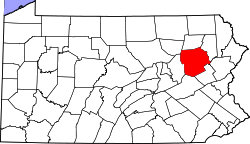 | |
| Boroughs |
| |
| Townships | ||
| CDPs | ||
| Unincorporated communities |
| |
| Footnotes | ‡This populated place also has portions in an adjacent county or counties | |