Hanover Township, Luzerne County, Pennsylvania
| Hanover Township, Luzerne County, Pennsylvania | |
|---|---|
| Township | |
|
Huber Breaker in Ashley Borough, as viewed from a farm in Hanover Township | |
 Map of Luzerne County, Pennsylvania Highlighting Hanover Township | |
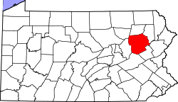 Map of Luzerne County, Pennsylvania | |
| Country | United States |
| State | Pennsylvania |
| County | Luzerne |
| Settled | 1772 |
| Incorporated | 1790 |
| Area | |
| • Total | 19.2 sq mi (49.8 km2) |
| • Land | 18.9 sq mi (48.9 km2) |
| • Water | 0.3 sq mi (0.9 km2) |
| Population (2010) | |
| • Total | 11,076 |
| • Density | 580/sq mi (220/km2) |
| Time zone | Eastern (EST) (UTC-5) |
| • Summer (DST) | EDT (UTC-4) |

Hanover Township is a township in Luzerne County, Pennsylvania, United States. The population was 11,076 at the 2010 census.[1]
History
Ashley Planes was listed on the National Register of Historic Places in 1980.[2]
Geography
According to the United States Census Bureau, the township has a total area of 19.2 square miles (49.8 km2), of which 18.9 square miles (48.9 km2) is land and 0.35 square miles (0.9 km2), or 1.82%, is water. The Susquehanna River drains it and separates it from Plymouth and Plymouth Township. The north side toward the river is mainly low-lying (500 to 650 ft or 150 to 200 m above sea level) and the south side is mountainous, rising to 2,148 feet (655 m) at the summit of Haystack Mountain on the southeast border. The township lies directly between the cities of Wilkes-Barre and Nanticoke.
The main thoroughfares in Hanover Township are the South Cross Valley Expressway (Route 29), the four-lane Sans Souci Parkway (locally pronounced "San Suey",) and the two-lane South Main Street/Middle Road. The former connects Interstate 81 in the southeast with Route 11 in West Nanticoke, while the latter two connect Wilkes-Barre and Nanticoke. 81 and Route 309 provide access to the Hazleton area, Wilkes-Barre Township, and Scranton. The villages of Hanover include Askam, Breslau, Buttonwood, Hanover Green, Iona, Korn Krest, Lee Park, Lower Askam, Newtown, and Preston.
Neighboring municipalities
- Wilkes-Barre (northeast)
- Larksville (north)
- Plymouth (north)
- Plymouth Township (northwest)
- Nanticoke (west)
- Newport Township (southwest)
- Nuangola (southwest)
- Rice Township (south)
- Fairview Township (southeast)
- Bear Creek Township (southeast)
- Laurel Run (east)
- Wilkes-Barre Township (east)
The boroughs of Ashley, Sugar Notch, and Warrior Run are surrounded by Hanover Township. The latter two also border each other.
Demographics
As of the census[3] of 2000, there were 11,488 people, 4,951 households, and 3,153 families residing in the township. The population density was 610.5 people per square mile (235.7/km2). There were 5,338 housing units at an average density of 283.7/sq mi (109.5/km2). The racial makeup of the township was 98.08% White, 0.96% African American, 0.02% Native American, 0.17% Asian, 0.12% from other races, and 0.64% from two or more races. Hispanic or Latino of any race were 0.60% of the population.
There were 4,951 households, out of which 27.2% had children under the age of 18 living with them, 44.6% were married couples living together, 14.6% had a female householder with no husband present, and 36.3% were non-families. 32.4% of all households were made up of individuals, and 17.4% had someone living alone who was 65 years of age or older. The average household size was 2.29, and the average family size was 2.90.
In the township the population was spread out, with 22.0% under the age of 18, 7.9% from 18 to 24, 26.5% from 25 to 44, 23.0% from 45 to 64, and 20.7% who were 65 years of age or older. The median age was 40 years. For every 100 females, there were 86.2 males. For every 100 females age 18 and over, there were 82.1 males.
The median income for a household in the township was $30,043, and the median income for a family was $37,883. Males had a median income of $29,679, versus $21,691 for females. The per capita income for the township was $16,181. About 12.2% of families and 15.3% of the population were below the poverty line, including 23.0% of those under age 18 and 13.9% of those age 65 or over.
Famous residents
- Tom Woodeshick, professional football player
- Nichole Priestman Kanney, professional Author
References
- ↑ "Profile of General Population and Housing Characteristics: 2010 Demographic Profile Data (DP-1): Hanover township, Luzerne County, Pennsylvania". U.S. Census Bureau, American Factfinder. Retrieved April 17, 2012.
- ↑ National Park Service (2010-07-09). "National Register Information System". National Register of Historic Places. National Park Service.
- ↑ "American FactFinder". United States Census Bureau. Retrieved 2008-01-31.
Municipalities and communities of Luzerne County, Pennsylvania, United States | ||
|---|---|---|
| Cities | | |
| Boroughs |
| |
| Townships | ||
| CDPs | ||
| Unincorporated communities |
| |
| Footnotes | ‡This populated place also has portions in an adjacent county or counties | |
Coordinates: 41°12′00″N 75°52′28″W / 41.20000°N 75.87444°W