Sorbiers, Loire
| Sorbiers | ||
|---|---|---|
|
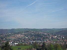
A view of Sorbiers | ||
| ||
 Sorbiers | ||
|
Location within Auvergne-Rhône-Alpes region  Sorbiers | ||
| Coordinates: 45°29′19″N 4°27′03″E / 45.4886°N 4.4508°ECoordinates: 45°29′19″N 4°27′03″E / 45.4886°N 4.4508°E | ||
| Country | France | |
| Region | Auvergne-Rhône-Alpes | |
| Department | Loire | |
| Arrondissement | Saint-Étienne | |
| Canton | Saint-Héand | |
| Intercommunality | Communauté d'agglomération Saint-Étienne Métropole | |
| Government | ||
| • Mayor (2008–2014) | Raymond Joassard | |
| Area1 | 12.19 km2 (4.71 sq mi) | |
| Population (2006)2 | 7,556 | |
| • Density | 620/km2 (1,600/sq mi) | |
| Time zone | CET (UTC+1) | |
| • Summer (DST) | CEST (UTC+2) | |
| INSEE/Postal code | 42302 / 42290 | |
| Elevation |
435–822 m (1,427–2,697 ft) (avg. 520 m or 1,710 ft) | |
|
1 French Land Register data, which excludes lakes, ponds, glaciers > 1 km² (0.386 sq mi or 247 acres) and river estuaries. 2 Population without double counting: residents of multiple communes (e.g., students and military personnel) only counted once. | ||

Sorbiers is a commune in the Loire department in central France.
Twin towns — Sister cities
Sorbiers is twinned with:
-
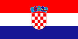 Senj, Croatia
 -
 Novi Ligure, Italy
See also
| Wikimedia Commons has media related to Sorbiers (Loire). |
This article is issued from Wikipedia - version of the 10/28/2016. The text is available under the Creative Commons Attribution/Share Alike but additional terms may apply for the media files.