Le Bessat
| Le Bessat | |
|---|---|
|
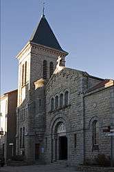
The church in Le Bessat | |
 Le Bessat | |
|
Location within Auvergne-Rhône-Alpes region  Le Bessat | |
| Coordinates: 45°22′11″N 4°30′56″E / 45.3697°N 4.5156°ECoordinates: 45°22′11″N 4°30′56″E / 45.3697°N 4.5156°E | |
| Country | France |
| Region | Auvergne-Rhône-Alpes |
| Department | Loire |
| Arrondissement | Saint-Étienne |
| Canton | Saint-Genest-Malifaux |
| Intercommunality | Monts du Pilat |
| Government | |
| • Mayor (2008–2014) | Robert Tardy |
| Area1 | 10.06 km2 (3.88 sq mi) |
| Population (2009)2 | 436 |
| • Density | 43/km2 (110/sq mi) |
| Time zone | CET (UTC+1) |
| • Summer (DST) | CEST (UTC+2) |
| INSEE/Postal code | 42017 / 42660 |
| Elevation |
700–1,308 m (2,297–4,291 ft) (avg. 1,170 m or 3,840 ft) |
|
1 French Land Register data, which excludes lakes, ponds, glaciers > 1 km² (0.386 sq mi or 247 acres) and river estuaries. 2 Population without double counting: residents of multiple communes (e.g., students and military personnel) only counted once. | |
Le Bessat is a commune in the Loire department in central France.
Population
| Historical population | ||
|---|---|---|
| Year | Pop. | ±% |
| 1962 | 190 | — |
| 1968 | 192 | +1.1% |
| 1975 | 206 | +7.3% |
| 1982 | 211 | +2.4% |
| 1990 | 250 | +18.5% |
| 1999 | 414 | +65.6% |
| 2006 | 439 | +6.0% |
| 2009 | 436 | −0.7% |
See also
References
| Wikimedia Commons has media related to Le Bessat. |
This article is issued from Wikipedia - version of the 3/15/2016. The text is available under the Creative Commons Attribution/Share Alike but additional terms may apply for the media files.