Noirétable
| Noirétable | ||
|---|---|---|
|
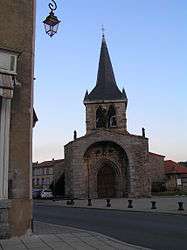
The church in Noirétable | ||
| ||
 Noirétable | ||
|
Location within Auvergne-Rhône-Alpes region  Noirétable | ||
| Coordinates: 45°49′05″N 3°45′56″E / 45.8181°N 3.7656°ECoordinates: 45°49′05″N 3°45′56″E / 45.8181°N 3.7656°E | ||
| Country | France | |
| Region | Auvergne-Rhône-Alpes | |
| Department | Loire | |
| Arrondissement | Montbrison | |
| Canton |
Noirétable (chef-lieu) | |
| Intercommunality | Communauté de communes des Montagnes du Haut Forez | |
| Government | ||
| • Mayor (2008–2014) | Denis Tamain | |
| Area1 | 40.34 km2 (15.58 sq mi) | |
| Population (1999)2 | 1,637 | |
| • Density | 41/km2 (110/sq mi) | |
| Time zone | CET (UTC+1) | |
| • Summer (DST) | CEST (UTC+2) | |
| INSEE/Postal code | 42159 / 42440 | |
| Elevation |
656–1,351 m (2,152–4,432 ft) (avg. 727 m or 2,385 ft) | |
|
1 French Land Register data, which excludes lakes, ponds, glaciers > 1 km² (0.386 sq mi or 247 acres) and river estuaries. 2 Population without double counting: residents of multiple communes (e.g., students and military personnel) only counted once. | ||
.svg.png)
Noirétable is a commune in the Loire department in central France.
See also
| Wikimedia Commons has media related to Noirétable. |
This article is issued from Wikipedia - version of the 10/28/2016. The text is available under the Creative Commons Attribution/Share Alike but additional terms may apply for the media files.