Snowy Mountains Highway
| Snowy Mountains Highway New South Wales | |||
|---|---|---|---|
 | |||
| Snowy Mountains Highway highlighted in green | |||
| General information | |||
| Type | Highway | ||
| Length |
287 km (178 mi)[1] 333 km (207 mi) including intervening roadway.[1] | ||
| Route number(s) |
| ||
| Major junctions | |||
| |||
| East end |
| ||
| |||
| West end |
| ||
| |||
| East end |
| ||
| |||
| West end |
| ||
|
| |||
| Location(s) | |||
| Major settlements | Adelong, Tumut, Adaminaby, Cooma | ||
| Restrictions | |||
| General | Within Kosciuszko National Park, it is recommended that two-wheel drive vehicles carry snow chains during winter.[2] | ||
| Highway system | |||
|
Highways in Australia National Highway • Freeways in Australia Highways in New South Wales | |||
| |||
The Snowy Mountains Highway is a 333-kilometre-long (207 mi)[1] state highway located in New South Wales, Australia. Its two sections connect the New South Wales South Coast to the Monaro region, and the Monaro to the South West Slopes via the Snowy Mountains. The higher altitude regions of this road are subject to snow over the winter months, and the road also provides access to many parts of the Snowy Mountains Scheme. The highway bears the B72 shield along its entire length.
The highway originally bore then name Monaro Highway until 1958, when it received its current name. It originally ran from Tathra to Wagga Wagga but has been shortened to run from the Princes Highway to the Hume Highway instead. Part of the roadway was reallocated to what is now known as the Monaro Highway in 1955. Reservoirs created as a result of dams built in the 1950s and 1960s as part of the Snowy Mountains Scheme required the creation of major realignments to avoid submerged areas. Previous to New South Wales' conversion to alphanumeric route markers, it was signed as National Route 18.
Route description


.jpg)
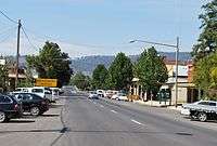
The Snowy Mountains Highway begins at a T-intersection with the Princes Highway at Stony Creek, north of Bega. It heads roughly west through hilly terrain, the terrain smooths eventually and the road crosses the Bemboka River at Morans Crossing. A short distance further, the road passes through Bemboka; taking on the name Loftus Street within the urban area. West of Bemboka, the road follows the southern bank of the Bemboka River, before crossing the Nunnock River near its confluence with the Bemboka River at the base of the Great Dividing Range escarpment. Up until this point the immediate landscape surrounding the road has so far consisted of farmland. From the base of the range the road enters South East Forest National Park and follows a steep and winding alignment up the range from about 250 m (820 ft) above sea level, to over 1,100 m (3,600 ft). At the top of the range the road then enters Glenbog State Forest before once again traversing farmland for a short distance until it meets the Monaro Highway at Steeple Flat, south of Nimmitabel. This intersection is a T-intersection, through traffic continues north on the Monaro Highway, while traffic heading to the south from either direction must turn. To reach the western section of the Snowy Mountains Highway the Monaro Highway must be taken north towards Cooma at this point.[1][3][4]
The western section begins at the Bombala and Sharp Street roundabout in Cooma. The highway takes on the name Sharp Street from this intersection as it heads west within Cooma urban area. Upon leaving Cooma, the road heads west via farmland to the village of Pine Valley. Here the road meets a T-intersection, with through traffic taking Kosciuszko Road southwest towards Jindabyne. The highway turns to continue on its westerly heading. The roadway then makes its way through undulating terrain for some distance before it passes through Adaminaby, and on into Kosciuszko National Park. The road winds through mountainous terrain as it climbs towards the abandoned mining settlement of Kiandra, situated at an altitude of around 1,400 m (4,600 ft). The landscape becomes open grassland at this point and remains relatively flat as the road continues relatively gently up an alpine valley created by the Eucumbene River and its numerous tributaries. At the top of the valley the road reaches its highest point a little below 1,500 m (4,900 ft). The road then descends into part of a similar valley created by the Murrumbidgee River as it passes by the access roads for Yarrangobilly Caves. The highway then veers northwest back into forested terrain and continues along the same rough heading through hilly terrain for some distance before a mountainous descent from 900 to 400 m (3,000 to 1,300 ft), near the town of Talbingo which is located a few kilometres west of the highway. Continuing on, the roadway passes by Jounama Dam and then roughly parallels the eastern side of Blowering Reservoir (created by Blowering Dam further downstream). It then leaves the National Park descending into farmland on the Tumut Plains, roughly 300 m (980 ft) above sea level.[1][3][4]
From here the highway then crosses the Tumut River and heads into the town of Tumut itself, taking on the names Blowering Street, Fitzroy Street, and Adelong Street within the urban area. West of Tumut the road crosses a large valley created by Gilmore Creek and Deep Creek, before a small climb through Adelong Gap into the town of Adelong, taking on the names Tumut Street, Inglis Street, and Lynch Street within the urban area. Beyond Adelong, the road continues northeast through undulating terrain before crossing Hillas Creek and then following it for the last few kilometres until the Snowy Mountains Highway's western terminus at the Hume Highway, located roughly halfway between Gundagai and Tarcutta.[1][3][4]

High altitude sections subject to snow and ice have yellow lane markings and red reflector posts (which are sometimes double or triple height); in contrast to the white lines and posts generally seen elsewhere around Australia. It is recommended that snow chains are carried for all two-wheel drive vehicles travelling on this highway within Kosciuszko National Park during the winter months.[1][5][6]
History

The Snowy Mountains Highway was listed as a State Highway by the New South Wales Main Roads Board (MRB) in their 1928 annual report. The following year, the MRB's hierarchical system which supported this listing was proclaimed with the passing of the Main Roads (Amendment) Act, April 1929. The highway was classified as State Highway 4, and originally known as the Monaro Highway. It ran from Tathra, via Bega, Cooma, Tumut, and various other towns and villages, to Wagga Wagga.[7][8][9] In 1933, the Department of Main Roads (DMR) which had succeeded the MRB in the previous year; proclaimed the portion of the Snowy Mountains Highway between Wagga Wagga and the Hume Highway at Lower Tarcutta to be part of the Sturt Highway. The Snowy Mountains Highway then terminated at its own junction with the Hume Highway instead.[9][10]
When the Snowy Mountains Scheme commenced in 1949, the road began to increase in importance. Roadworks to increase the standard of the road were undertaken, and were often paid for by the Snowy Mountains Hydro-Electric Authority.[9] In 1955, it was decided that what was still then known as the Monaro Highway would be renamed as the Snowy Mountains Highway. This was done as only a relatively small portion of the road was actually within the Monaro region. The section of road between Cooma and Nimmitabel was also reclassified as part of State Highway 19, which at that time ran from Canberra, to the Victorian border west of Delegate. The various roads classified as State Highway 19, were then named as the Monaro Highway in 1958. In contrast with the Snowy Mountains Highway, the entire length of that highway is within the Monaro region.[9][11][12]
Over the years further changes to the alignment have occurred. The eastern section of the highway no longer runs west to Nimittabel, instead meeting the Monaro Highway to the south; the old section has been renamed as Old Bega Road. It also no longer runs east to the coast at Tathra, and now terminates where it meets the Princes Highway; the section from Bega to Tathra has been renamed as Tathra Road.[3][9] The western section has also seen some major changes with the highway being realigned to avoid Lake Eucumbene near Adaminaby due to the construction of Eucumbene Dam in the 1950s.[13] Similarly realignment was required to avoid the Jounama Pondage and Blowering Reservoir near Talbingo due to the construction of Jounama and Blowering Dams in the 1960s.[14]
Route markers

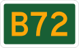
Route markers were first introduced in Australia in late 1954. Over the following decades they were progressively rolled out to the various highways around the nation, under a nationwide route numbering scheme.[15] Previous to the NSW conversion to alphanumeric routes in 2013, the highway was signed as National Route 18 shield along its entire length. In addition to this, the section of the Monaro Highway between Cooma and Steeple Flat was also signed the National Route 18 shield in addition to the National Route 23 route marker used along the remainder of its length within NSW; this kind of arrangement is known as a duplex or concurrency. This allowed one route to cover the highway from end to end.[1][16] The Snowy Mountains Highway was allocated the alphanumeric route B72 as part of New South Wales' 2013 conversion. The route duplex along the Monaro Highway remains intact with B72 used in addition to B23 between Cooma and Steeple Flat.[6][17]
Junction list
| LGA | Location[3] | km[1] | mi | Destinations[3][1] | Notes[1] | ||
|---|---|---|---|---|---|---|---|
| Bega Valley | Coopers Gully | 0 | 0.0 | East end of B72 route; Eastern highway terminus; Road continues north and south as the | |||
| Bemboka River | 20 | 12 | Bridge over the river (Bridge name unknown) | ||||
| Bega Valley | Bemboka | 26 | 16 | Mogilla Road [south] – Candelo | Road also listed in schedule as "Wolumla - Bemboka Road" | ||
| 47 | 29 | Old Bega Road [north] | Former alignment | ||||
| Snowy Monaro Regional | Steeple Flat | 59 | 37 | Eastern highway section terminus; South end of B23/B72 duplex; T-intersection | |||
| Gap in highway | |||||||
| Maclaughlin River | 63 | 39 | Bridge over the river (Bridge name unknown) | ||||
| Snowy Monaro Regional | Cooma | 105 | 65 | Northern highway section terminus; North end of B23/B72 duplex; Four way roundabout | |||
| Pine Valley | 112 | 70 | Kosciuszko Road [southwest] – Jindabyne | Westbound traffic turns northwest, eastbound traffic turns northeast | |||
| Dargans Flat | 132 | 82 | Middlingbank Road [southwest] – Middlingbank, Berridale | ||||
| Eucumbene River | 191 | 119 | Bridge over the river (Bridge name unknown) | ||||
| Eucumbene River | 202 | 126 | Bridge over the river (Bridge name unknown) | ||||
| Snowy Valleys | Yarrangobilly | 209 | 130 | Yarrangobilly Caves Exit Road [west] | One way road – Exit only | ||
| 215 | 134 | Yarrangobilly Caves Entry Road [south] – Yarrangobilly Caves | One way road – Entry only | ||||
| Tumut River | 277 | 172 | Bridge over the river (Bridge name unknown) | ||||
| Snowy Valleys | Tumut | 286 | 178 | Wee Jasper Road [northeast] – Wee Jasper, Lacmalac, Tumut Airport | |||
| 287 | 178 | Gocup Road [north] – Gundagai Capper Street [south] | |||||
| Gilmore | 294 | 183 | Batlow Road [south] – Batlow, Tumbarumba Gilmore Mill Road north | ||||
| Adelong | 305 | 190 | Tumut Street [east] – Batlow, Tumbarumba (both via Wondalga Road) | Westbound traffic turns west, eastbound traffic turns north | |||
| 306 | 190 | Quartz Street / Grahamstown Road [north] – Grahamstown, Tumblong | Westbound traffic turns south, eastbound traffic turns east | ||||
| Gundagai | Mundarlo–Mount Adrah boundary | 333 | 207 | Partial Y-interchange, no northbound to eastbound ramp (access to eastbound carriageway provided by U-turn bay on Hume Highway). Western terminus of B72 route; Western highway terminus; Road continues east and west as the | |||
1.000 mi = 1.609 km; 1.000 km = 0.621 mi
Listing includes: Terminii, declared roads, former alignments, and intersections where a turn is required to remain on the highway, and minor roads at these intersections. | |||||||
See also
References
- 1 2 3 4 5 6 7 8 9 10 11 Google (27 July 2013). "Snowy Mountains Highway" (Map). Google Maps. Google. Retrieved 27 July 2013.
- ↑ "Driving in the snow". NSW Government - Office of Environment and Heritage. 19 July 2011. Retrieved 27 July 2013.
- 1 2 3 4 5 6 SIX Maps (Map). Cartography by NSW Department of Finance and Services, Sinclair Knight Merz, and Astrium GEO-Information Services. NSW Government - Land and Property Information. Retrieved 29 June 2013.
- 1 2 3 "Schedule of Classified Roads and Unclassified Regional Roads" (PDF). NSW Roads and Maritime Services. August 2013. Retrieved 22 September 2013.
- ↑ "Snow driving". NSW Government - Transport for New South Wales. 4 July 2013. Retrieved 28 July 2013.
- 1 2 "NSW Route B72". Photos of route B72 - Bega to Tumblong. Ozroads. 27 July 2013. Retrieved 28 July 2013.
- ↑ Kass, Terry (February 2006). "RTA Thematic History" (PDF) (2nd ed.). Roads and Traffic Authority. p. 37. Retrieved 23 July 2013.
- ↑ "The New Roads Policy". The Canberra Times. 2 October 1928. p. 2. Retrieved 23 July 2013.
- 1 2 3 4 5 "Snowy Mountains Highway" (PDF). Main Roads. NSW Department of Main Roads. December 1955. pp. 44, 51. Retrieved 23 July 2013.
- ↑ Kass, Terry (February 2006). "RTA Thematic History" (PDF) (2nd ed.). Roads and Traffic Authority. p. 84. Retrieved 23 July 2013.
- ↑ "Monaro Highway" (PDF). Main Roads. NSW Department of Main Roads. December 1959. p. 49. Retrieved 25 July 2013.
- ↑ "Monaro Highway New Name For Cooma Road.". The Canberra Times. 21 October 1958. p. 3. Retrieved 25 July 2013.
- ↑ "Adaminaby Road Closures.". The Canberra Times. 19 July 1957. p. 2. Retrieved 27 July 2013.
- ↑ "Road conditions for Christmas tourists.". The Canberra Times. 20 December 1966. p. 28. Retrieved 27 July 2013.
- ↑ "It will be 'Highway 31'.". The Argus. Melbourne, Victoria. 13 August 1954. p. 5. Retrieved 28 July 2013.
- ↑ "National Route 18". Photos of the Snowy Mountains Highway. Ozroads. Retrieved 27 July 2013.
- ↑ "Alpha numeric route number maps - Southern NSW" (PDF). NSW Government - Roads and Maritime Services. April 2013. Retrieved 27 July 2013.
| Townships and Villages | |
|---|---|
| Localities and rural places |
|
| National parks and other natural features | |
| Rivers and other watercourses | |
| Dams and/or associated reservoirs |
|
| Mountain ranges |
|
| Attractions | |
Main Article: Local government areas of New South Wales | |