Thunderbolts Way
| Thunderbolts Way New South Wales | |
|---|---|
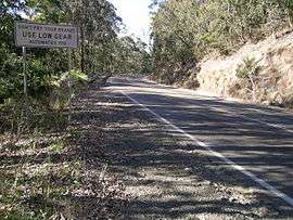 | |
| Warning sign on Thunderbolts Way | |
| General information | |
| Type | Road |
| Length | 290 km (180 mi)[1] |
| Major junctions | |
| NNW end |
16 km (10 mi) south of |
| SSE end | Bucketts Way, Gloucester, New South Wales |
| Location(s) | |
| Major suburbs | Uralla, Walcha, Rookhurst, Barrington |
| |


The Thunderbolts Way is a 290-kilometre (180 mi)[1] country road located in the Northern Tablelands region of New South Wales, Australia. The road links Gloucester to Walcha (where it crosses the Oxley Highway), Uralla, where it very briefly joins the New England Highway and, to Copes Creek, 16 km (10 mi) south of the Gwydir Highway intersection at Inverell.[2][3] The road is fully sealed and passes through thickly forested mountain areas with many nearby national parks and nature reserves.
It is named after a local bushranger, Frederick Ward, alias Captain Thunderbolt, who roamed these parts in the 19th century.
History
Eric Carson (1913–99), a Gloucester sawmiller and road builder, carved the first road through the ranges to bring out the magnificent hardwood from the forests on the Great Divide. After Carson spent many years trying to persuade local politicians that a road should be built across the Divide from Gloucester to Nowendoc, he went ahead and built it. Carving the 32 km (20 mi) route out of some of the steepest and most rugged countryside in the state was fraught with danger, but by 1961 it was complete.[4] Carson's Lookout, which commemorates his work is between Gloucester and Nowendoc, is a stop off point for the enjoyment of panoramic views.
Route
At a total length of about 290 kilometres (180 mi) (from Gloucester to Inverell), it is very hilly and winding as it passes across the Great Dividing Range. It is very popular with tourists, including motorcyclists, as it offers many pristine picnic and fishing spots. Riverside camping spots are available at Gloryvale Reserve and Bretti Reserve. There is also a picnic area, with toilets, near the Barrington River bridge.
Occasionally a dingo, koala or wombat may be among the animals to be spotted on this route. Bellbirds are frequently heard shortly after beginning the ascent up the mountain.
The only villages between Gloucester and Walcha are Barrington and Nowendoc, which is slightly north of this road. There is a public school and church at the hamlet of Rookhurst. After passing through Walcha, Dangar's Lagoon is situated close to Uralla where a statue of Captain Thunderbolt on horseback is located on the intersection of the New England Highway and Thunderbolts Way.
After passing Uralla the Mount Yarrowyck Nature Reserve is near the junction of the Armidale Road and Thunderbolts Way. This site protects an Aboriginal cave painting site and much of the natural environment of Mount Yarrowyck.
A new bridge constructed in 2015 crosses the Gwydir River shortly before reaching the Kingstown Road intersection and then the village of Bundarra. Once again the Gwydir River is crossed, this time by the Bundarra Bridge, a five-span iron lattice truss bridge, that was constructed in 1881. This bridge is 204 metres (669 ft) long and 5.6 metres (18 ft) wide between kerbs. It has been listed on the Register of the National Estate, being of state significance due to its design, historical value and aesthetic appearance.[5] The next village encountered is Gilgai which is situated about 10 km (6 mi) south of Inverell.
Major junctions
| LGA | Location | km[1] | mi | Destinations | Notes | |
|---|---|---|---|---|---|---|
| Inverell | Howell | 0 | 0.0 | Bundarra Road – Inverell to | North-northwestern terminus; road continues north as the Bundarra Road | |
| Gwydir River | 29 | 18 | Bridge over the river (Bridge name not known) | |||
| Uralla | Bundarra | 31 | 19 | Gwydir River Road – Tamworth | Y-intersection; Thunderbolts Way continues south-southeast | |
| Gwydir River | 32 | 20 | Bundarra Bridge[5] | |||
| Rocky River | 94 | 58 | Bridge over the river (Bridge name not known) | |||
| Uralla | Uralla | 102 | 63 | 4-way intersection; northern concurrency terminus with Road continues north/south as the | ||
| 4-way intersection; southern concurrency terminus with Thunderbolts Way continues southeast | ||||||
| Walcha | Walcha | 143 | 89 | |||
| Barnard River | 251 | 156 | Bridge over the river (Bridge name not known) | |||
| Manning River | 255 | 158 | Bridge over the river (Bridge name not known) | |||
| Manning River | 262 | 163 | Bridge over the river (Bridge name not known) | |||
| Manning River | 266 | 165 | Bridge over the river (Bridge name not known) | |||
| Bowman River | 276 | 171 | Bridge over the river (Bridge name not known) | |||
| Gloucester | Barrington | 281 | 175 | Scone Road – Scone to | T-intersection | |
| Barrington River | 282 | 175 | Bridge over the river (Bridge name not known) | |||
| Gloucester River | 288 | 179 | Bridge over the river (Bridge name not known) | |||
| Gloucester | Gloucester | 290 | 180 | Bucketts Way – Nabiac, Stroud to | Roundabout; road continues east and south as the Buckets Way | |
1.000 mi = 1.609 km; 1.000 km = 0.621 mi
| ||||||
See also
References
- 1 2 3 2917 Thunderbolts Way, Howell NSW 2360 to 30 Church Street, Gloucester NSW 2422 (Map). Google Maps. 2016. Retrieved 14 November 2016.
- ↑ 1:100000 topographic maps 9138 Inverell, 9137 Bundarra, 9136 Bendemeer, 9236 Armidale, 9235 Yarrowitch, 9234 Upper Manning and 9233 Gloucester. Retrieved 19 April 2010
- ↑ "Gilgai". Land and Property Management Authority - Spatial Information eXchange. New South Wales Land and Property Information. Retrieved 19 April 2010.
- ↑ Meacham, Steve (13 November 2008). "Roads less travelled". The Sydney Morning Herald. Retrieved 18 August 2009.
- 1 2 "Bridge over Gwydir River at Bundarra". Roads and Traffic Authority (NSW). 30 March 2004. Retrieved 18 August 2009.
External links
| Wikimedia Commons has media related to Thunderbolts Way. |
- Evans, Gary (17 January 2007). "Short cut is long on appeal". news.com.au. Retrieved 18 August 2009.
- Map of Thunderbolts Way (PDF) (Map). Cartoscope Pty Limited. Retrieved 14 November 2012.