Barton Highway
| Barton Highway New South Wales–Australian Capital Territory | |
|---|---|
| General information | |
| Type | Highway |
| Length | 52 km (32 mi) |
| Route number(s) |
|
| Former route number |
|
| Major junctions | |
| North end |
Yass, New South Wales |
| for full list see major intersections | |
| South end |
|
| Location(s) | |
| Major settlements | Murrumbateman |
| Highway system | |
|
Highways in Australia National Highway • Freeways in Australia Highways in New South Wales Road infrastructure in Canberra | |
| |
The Barton Highway[1] is a short highway in New South Wales and the Australian Capital Territory, Australia.
The Barton Highway connects Canberra to the Hume Highway at Yass, and it is part of the route from Melbourne to Canberra and is named in honour of Sir Edmund Barton, the first Prime Minister of Australia.
Route and history
Proclaimed a state highway in 1935, it was officially named as the Barton Highway in August 1954, signposted as National Route 25 two years later, fully sealed by 1960, and granted national highway status in 1974. The original purpose of the Yass-Canberra Road was to connect surrounding towns with the newly established national capital. Prior to the highway's establishment a series of trunk routes connected farming locations in the Yass Valley.[2]
Heading east from Yass, the Barton Highway originally commenced at a junction on the Hume Highway, near the historic Cooma Cottage, and east of the Yass River.[3] Requiring traffic to make a right–hand turn across a single lane of the Hume Highway, the highway commenced at this point and tracked generally south by southeast, through undulating hills to the village of Murrumbateman and entering the Australian Capital Territory (ACT), going through the village and main street of Hall, and meeting the Federal Highway at Lyneham at a junction near Sullivans Creek on Mouat Street, adjacent to Lyneham High School and to the south of the Highway's current alignment.[3]
The first realignment occurred during the late 1970s, when the southern terminus of the highway was relocated north, to the north of the Yowani Country Club.[3] In 1980 the village of Hall was bypassed; and during the early 1990s a dual carriageway was completed on the ACT section of the highway, between Hall and Kaleen. A further section of dual carriageways was completed in December 2002, between Gungahlin Drive and the southern terminus with the Federal Highway.[2]
Between April 1993 and May 1995, as part of the Hume Highway bypass of Yass, a 9-kilometre (5.6 mi) dual carriageway deviation of Barton Highway was constructed to connect the Barton Highway with the new route of the Hume Highway, north of Yass. The new route crosses the Yass River on twin bridges to the east of Cooma Cottage before terminating at the Hume Highway about 3 kilometres (1.9 mi) northeast of Yass.[3]
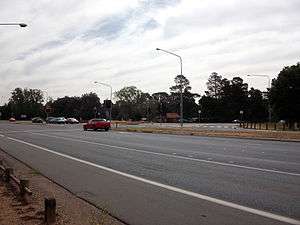
The Gundaroo Drive/Barton Highway round-about is surrounded by a number of trees to the south of the intersection. The pine tree plantation was originally planted in the shape of a map of Australia
Murrumbateman bypass and staged duplication
The Barton Highway passes through farmlands and the NSW town of Murrumbateman. In October 2001 the Australian Government announced that they would bypass to the town to the east. A$20 million was set aside in the 2006 federal budget for planning and duplication costs associated with the bypass.[4] The same year, the National Roads and Motorists' Association had named the Barton Highway as the worst highway on the AusLink National Network in New South Wales; accounting for three road fatalities annually.[5][6] While 42 kilometres (26 mi) of the 52-kilometre (32 mi) highway are located in New South Wales (NSW), only 6 kilometres (3.7 mi) of the NSW section are dual carriageway.[2]
Various NSW[7] and Federal[8] governments have committed funding towards improvements to the Barton Highway, including a bypass east of Murrumbateman and a staged duplication to create 33 kilometres (21 mi) of dual carriageways.[9] Construction work has not commenced.[10]
Major intersections
| State | LGA / District | Location | km[11] | mi | Destinations | Notes |
|---|---|---|---|---|---|---|
| New South Wales | Yass Valley | Yass | 0 | 0.0 | Northern highway terminus; trumpet interchange | |
| 4.6 | 2.9 | Yass Valley Way – Yass | Dumbbell interchange | |||
| Murrumbateman | 18.3 | 11.4 | Murrumbateman Road – Gundaroo, Bungendore | |||
| Wallaroo | 40.1 | 24.9 | New South Wales–Australian Capital Territory border | |||
| Australian Capital Territory | Hall | Hall | ||||
| Gungahlin | Kinlyside–Nicholls boundary | 43.4 | 27.0 | Tourist Drive 4 northern concurrency terminus | ||
| Gungahlin–Belconnen boundary | Nicholls–Crace–Giralang tripoint | 46.1 | 28.6 | William Slim Drive west / Gundaroo Drive east – Belconnen, Gungahlin, Gundaroo | Roundabout | |
| Crace–Mitchell–Kaleen tripoint | 49.8 | 30.9 | Gunghalin Drive – Mitchell, Belconnen, Woden | Parclo interchange | ||
| North Canberra | Lyneham–Downer border | 52.0 | 32.3 | Southern highway terminus; Tourist Drive 4 continues south | ||
1.000 mi = 1.609 km; 1.000 km = 0.621 mi
| ||||||
See also
References
- ↑ National Route 25, Ozroads: the Australian Roads Website. Retrieved on 11 May 2008.
- 1 2 3 "Barton Highway". OzRoads. Retrieved 20 March 2015.
- 1 2 3 4 "Barton Highay: Former alignments". OzRoads. Retrieved 20 March 2015.
- ↑ "Labor commits $20m to improving Barton Highway". ABC News. Australia. 21 November 2007. Retrieved 20 March 2015.
- ↑ Hodgkinson, Katrina (17 June 2008). "Barton Highway Funding". Hansard. Parliament of New South Wales. Archived from the original on 2 April 2015. Retrieved 20 March 2015.
- ↑ Hodgkinson, Katrina (15 May 2008). "Murrumbateman Bypass". Hansard. Parliament of New South Wales. Archived from the original on 2 April 2015. Retrieved 20 March 2015.
- ↑ "Barton Highway duplication: Preferred road corridor boundaries report" (PDF). Manidis Roberts Pty Ltd (PDF). Roads & Maritime Services, Government of New South Wales. November 2011. ISBN 978-1-922040-05-3. Retrieved 20 March 2015.
- ↑ Albanese, Anthony (22 October 2012). "Barton Highway: Federal Labor delivers more safety upgrades" (Press release). Australian Government.
- ↑ Taylor, Angus (3 September 2014). "Barton Highway duplication plan". Yass Tribune. Retrieved 20 March 2015.
- ↑ "Barton Highway: Future duplication". Projects: South West NSW. Roads & Maritime Services, Government of New South Wales. Retrieved 20 March 2015.
- ↑ Google (8 April 2014). "Barton Highway" (Map). Google Maps. Google. Retrieved 8 April 2014.
External links
| Wikimedia Commons has media related to Barton Highway. |
| Controlled-access roads: | ||
|---|---|---|
| Limited-access roads: |
| |
| Major interchanges: | ||
| Proposed or cancelled |
| |
*Partially limited-access ^Partially controlled-access roadway under construction | ||