Olympic Highway
| Olympic Highway New South Wales | |
|---|---|
_sign_with_an_alphanumeric_route_plated_fitted_on_Olympic_Highway_in_Wagga_Wagga_(3).jpg) | |
| Advance directional sign in Wagga Wagga, on the Olympic Highway heading south from Cootamundra | |
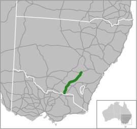 | |
| Map of south-eastern Australia with Olympic Highway highlighted in green | |
| General information | |
| Type | Highway |
| Length | 318 km (198 mi) |
| Route number(s) |
|
| Former route number |
|
| Major junctions | |
| Northeast end |
|
|
| |
| Southwest end |
|
| Location(s) | |
| Major settlements | Young, Cootamundra, Wagga Wagga, Culcairn |
| Highway system | |
|
Highways in Australia National Highway • Freeways in Australia Highways in New South Wales | |
| |
The Olympic Highway is a rural road in the central western and south-eastern Riverina regions of New South Wales, Australia. The 318-kilometre (198 mi) highway services rural communities and links the Hume Highway with the Mid-Western Highway and provides part of an alternate road link between Sydney and Albury via Bathurst and Cowra as well as servicing Wagga Wagga, linking with the Sturt Highway.[1]
Initially a series of trunk routes, the road was named the Olympic Way on 5 July 1963, in honour of part of the path that the Olympic Torch took on its journey from Cowra to Albury for the 1956 Melbourne Olympic Games. It was renamed as the Olympic Highway in 1996,[1] and the route between Wagga Wagga and Cowra was used for torch relay for the 2000 Sydney Olympic Games. In spite of its name, the road is not an official highway as classified by NSW Roads & Maritime Services, yet considered a rural road.[2]
The Olympic Highway carries the A41 shield for its entire length, the majority of which is a single carriageway and also includes wider sections within urban areas and some passing lanes. Where the road passes through suburban areas it accommodates both parking and pedestrian needs of the town shopping centre and highway through traffic. A 2-kilometre (1.2 mi) section of the highway through Wagga Wagga is a four-lane divided urban road where the highway is concurrent with the Sturt Highway.[2]
Route
The highway runs generally north-south, roughly aligned to sections of the Sydney–Melbourne and the Blayney–Demondrille railway lines. The Olympic Highway approximately parallels the Hume Highway to the east and the Newell Highway to the west. The Olympic shares a short concurrency with the Sturt Highway in Wagga Wagga.[2]
At its northern terminus in Cowra, the Olympic Highway adjoins the Mid-Western Highway that, from the northeast carries the A41 shield from Bathurst and, from the west carries the State Route B64 shield to Grenfell; and the Lachlan Valley Way that generally runs northwest-southwest between Forbes and Boorowa and beyond. The Olympic Highway heads generally south by west through Koorawatha, Young, Cootamundra, Junee, Wagga Wagga, and Culcairn towards its southern terminus via a trumpet interchange with the Hume Highway located 18 kilometres (11 mi) north of Albury at Table Top.[1][2][3]
The only major river crossing is the Murrumbidgee River, crossed between Boorooma and Wagga via the Gobbagombalin Bridge, at 1.4 kilometres (0.87 mi) long believed to be the longest continuous-span viaduct in New South Wales, situated about 6 kilometres (3.7 mi) northwest of the Wagga CBD and opened on 26 July 1997.[4] Prior to the completion of the "Gobba" Bridge, the Olympic Highway followed a route that took it through the Wagga central business district via the Hampden Bridge, a wooden Allan Truss bridge that was opened in 1895 and eventually demolished in 2014.[5]
Major intersections
| LGA | Location | km[6] | mi | Destinations | Notes |
|---|---|---|---|---|---|
| Cowra | Cowra | 0 | 0.0 | Northern highway terminus | |
| Hilltops | Koorawatha | 25.6 | 15.9 | Greenethorpe–Koorawatha Road west / Prince Street south – Greenethorpe | |
| Young | 67.3 | 41.8 | Iandra Avenue to Henry Lawson Way – Grenfell, Forbes | ||
| 69.1 | 42.9 | Lovell Street to Murringo Road east / to Boorowa Street west – Murringo, Boorowa | Roundabout | ||
| Wombat | 83.4 | 51.8 | Harden–Wombat Road – Murrumburrah, Harden | ||
| Cootamundra-Gundagai | Wallendbeen | 91.1 | 56.6 | Roundabout | |
| Junee | Junee | 171 | 106 | Wantabadgery Road – Gundagai | |
| 171.1 | 106.3 | Broadway Street to Junee–Coolamon Road – Coolamon, Temora | Roundabout | ||
| 172 | 107 | Kemp Street to Junee–Harefield Road – Harefield | |||
| Old Junee | 179 | 111 | |||
| Wagga Wagga | Wagga Wagga | 206 | 128 | Coolamon Road – Coolamon, Ardlethan | Roundabout |
| Murrumbidgee River | 211 | 131 | Gobbagombalin Bridge | ||
| Wagga Wagga | Wagga Wagga | 213 | 132 | Sturt Highway (A20) eastern concurrency terminus | |
| 215 | 134 | Sturt Highway (A20) western concurrency terminus | |||
| Lockhart | The Rock | 241 | 150 | Urana Street – Lockhart, Collingullie, Mangoplah | |
| Greater Hume | Culcairn | 288 | 179 | Balfour Street east to Culcairn–Holbrook Road / Mellville Street south – Holbrook | |
| 288.1 | 179.0 | Balfour Street west to Culcairn Road / Railway Parade north – Walbundrie | Roundabout | ||
| Gerogery | 307 | 191 | Main Street to Gregory Road – Jindera, Burrumbuttock | ||
| Albury | Table Top | 318 | 198 | Southern highway terminus; trumpet interchange | |
1.000 mi = 1.609 km; 1.000 km = 0.621 mi
| |||||
Gallery
 Olympic Highway, Route A41, links Albury to Cowra
 Sturt and Olympic Highway Intersection at Wagga Wagga
See also
References
- 1 2 3 "Olympic Highway National Route 41". Ozroads. Retrieved 25 May 2008.
- 1 2 3 4 "Albury to Cowra Corridor Strategy" (PDF). Roads & Traffic Authority (PDF). Government of New South Wales. December 2010. p. 24. ISBN 978-1-921766-92-3. Retrieved 2 April 2015.
- ↑ Rands, Paul (7 December 2013). "Mid Western Highway & Olympic Highway (A41)". Road Photos & Information: New South Wales. Expressway: The Australian Highway Site. Retrieved 2 April 2015.
- ↑ "Wagga's Gobbagombalin bridge proves its worth". The Daily Advertiser. 9 December 2010. Retrieved 2 April 2015.
- ↑ Owen, Brodie (20 August 2014). "Hampden Bridge erased from Wagga's landscape". The Daily Advertiser. Retrieved 20 August 2014.
- ↑ Google (4 June 2014). "Olympic Highway" (Map). Google Maps. Google. Retrieved 4 June 2014.
External links
-
 Media related to Olympic Highway at Wikimedia Commons
Coordinates: 34°52′12″S 147°32′40″E / 34.87000°S 147.54444°E