Barrier Highway
| Barrier Highway South Australia–New South Wales | |
|---|---|
 | |
| General information | |
| Type | Highway |
| Length | 1,014 km (630 mi) |
| Route number(s) |
Giles Corner - SA/NSW Border SA/NSW Border - Nyngan |
| Former route number |
Entire route |
| Major junctions | |
| West end |
Giles Corner, South Australia |
| |
| East end |
Nyngan, New South Wales |
| Location(s) | |
| Major settlements | Saddleworth, Burra, Peterborough, Yunta, Olary, Broken Hill, Wilcannia, Cobar |
| Highway system | |
|
Highways in Australia National Highway • Freeways in Australia Highways in South Australia Highways in New South Wales | |
| |
The Barrier Highway is a highway in New South Wales[1] and South Australia[2] signposted as part of route A32.
Route
The Barrier Highway starts at Nyngan where it joins the Mitchell Highway. It heads west past Hermidale and Boppy Mountain to Cobar, a mining town. It then continues to Wilcannia where it crosses the Darling River. Further west it passes through Broken Hill and enters South Australia, turning southwest towards Adelaide. It joins Main North Road at Giles Corner between Riverton and Tarlee. Route A32 continues on Main North Road to Gawler where it joins Route A20 (the Sturt Highway).
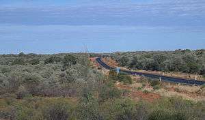
The area traversed by the Barrier Highway is remote and very sparsely settled. The name of the highway is derived from the Barrier Ranges, an area of moderately high ground in the far west of New South Wales, which the highway traverses.
Major intersections
| State | LGA | Location | km[3] | mi | Destinations | Notes |
|---|---|---|---|---|---|---|
| South Australia | Clare and Gilbert Valleys | Giles Corner | 0 | 0.0 | South-western highway terminus | |
| Saddleworth | 17.6 | 10.9 | B84 southern concurrency terminus | |||
| 18.3 | 11.4 | B84 northern concurrency terminus | ||||
| Goyder | Hanson | 56.9 | 35.4 | Farrell Flat Road – Farrell Flat, Clare | ||
| Burra | 71.6 | 44.5 | B64 southern concurrency terminus | |||
| 78.4 | 48.7 | B64 northern concurrency terminus | ||||
| Hallett | 102 | 63 | ||||
| Peterborough | Ucolta | 156 | 97 | |||
| Outback Areas CDT | Yunta | 227 | 141 | Yunta–Waukaringa Road – Waukaringa | ||
| Cockburn | 377 | 234 | South Australia–New South Wales border | |||
| New South Wales | Broken Hill | Broken Hill | ||||
| 423 | 263 | Brookfield Avenue north-west / Galena Street south-east – Silverton | Roundabout | |||
| 425 | 264 | Williams Street (Silver City Highway) north-east / Iodide Street north-west – Tibooburra | Eastbound traffic turns south-east; westbound traffic turns south-west | |||
| 426 | 265 | Eastbound traffic turns north-east; westbound traffic turns north-west | ||||
| 427 | 265 | Menindee Road – Menindee | ||||
| Central Darling | Wilcannia | 621 | 386 | White Cliffs Road – White Cliffs | ||
| Darling River | 622 | 386 | Bridge over river | |||
| Central Darling | Wilcannia | 641 | 398 | |||
| Cobar | Cobar | 882– 883 | 548– 549 | Pair of closely spaced intersections | ||
| Bogan | Nyngan | 1,012 | 629 | North-eastern highway terminus | ||
1.000 mi = 1.609 km; 1.000 km = 0.621 mi
| ||||||
See also
References
- ↑ Barrier Highway (NSW), Ozroads: the Australian Roads Website. Retrieved on 21 February 2010.
- ↑ Barrier Highway (SA), South Australia Central. Retrieved on 21 February 2010. Archived 8 October 2009 at the Wayback Machine.
- ↑ Google (21 January 2014). "Barrier Highway" (Map). Google Maps. Google. Retrieved 21 January 2014.
Road infrastructure in South Australia | ||
|---|---|---|
| Freeways | ||
| Interstate highways | ||
| State highways | ||
| Arterial roads |
| |
| Outback tracks | ||