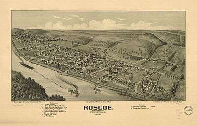
Roscoe, Pennsylvania
| Roscoe | |
|---|---|
| Borough | |
 | |
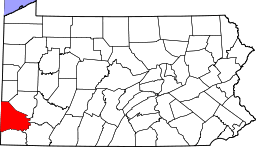
 Location of Roscoe in Washington County | |
 Roscoe Location of Roscoe in Pennsylvania | |
| Coordinates: 40°4′43″N 79°51′55″W / 40.07861°N 79.86528°WCoordinates: 40°4′43″N 79°51′55″W / 40.07861°N 79.86528°W | |
| Country | United States |
| State | Pennsylvania |
| County | Washington |
| Established | 1869 |
| Government | |
| • Mayor | Thomas J. Wilkinson |
| Area | |
| • Total | 0.24 sq mi (0.6 km2) |
| • Land | 0.18 sq mi (0.5 km2) |
| • Water | 0.06 sq mi (0.2 km2) |
| Population (2000) | |
| • Total | 848 |
| • Density | 3,500/sq mi (1,400/km2) |
| Time zone | EST (UTC-4) |
| • Summer (DST) | EDT (UTC-5) |
| Zip Code | 15477 |
| Area code(s) | 724 |
Roscoe is a borough in Washington County, Pennsylvania, United States. The population was 848 at the 2000 census.
History
The Allenport & Roscoe Street Railway was formed in 1903 and was purchased by Pittsburgh Railways to form part of their interurban line to Pittsburgh in 1906. The 2.4 miles (3.9 km) extension to Roscoe was completed on June 20, 1910.[1] The line was closed in 1953.
Geography
Roscoe is located at 40°4′43″N 79°51′55″W / 40.07861°N 79.86528°W (40.078513, -79.865225).[2]
According to the United States Census Bureau, the borough has a total area of 0.2 square miles (0.5 km2), of which, 0.2 square miles (0.5 km2) of it is land and 0.04 square miles (0.10 km2) of it (16.67%) is water.
Demographics
| Historical population | |||
|---|---|---|---|
| Census | Pop. | %± | |
| 1900 | 1,354 | — | |
| 1910 | 1,450 | 7.1% | |
| 1920 | 1,480 | 2.1% | |
| 1930 | 1,310 | −11.5% | |
| 1940 | 1,372 | 4.7% | |
| 1950 | 1,396 | 1.7% | |
| 1960 | 1,315 | −5.8% | |
| 1970 | 1,176 | −10.6% | |
| 1980 | 1,123 | −4.5% | |
| 1990 | 872 | −22.4% | |
| 2000 | 848 | −2.8% | |
| 2010 | 812 | −4.2% | |
| Est. 2015 | 795 | [3] | −2.1% |
| Sources:[4][5][6] | |||
As of the census[5] of 2000, there were 848 people, 398 households, and 243 families residing in the borough. The population density was 4,256.0 people per square mile (1,637.1/km²). There were 426 housing units at an average density of 2,138.0 per square mile (822.4/km²). The racial makeup of the borough was 98.35% White, 0.94% Black, 0.12% from other races, and 0.59% from two or more races. Hispanic or Latino of any race were 0.35% of the population.
There were 398 households out of which 20.6% had children under the age of 18 living with them, 47.0% were married couples living together, 11.3% had a female householder with no husband present, and 38.9% were non-families. 36.7% of all households were made up of individuals and 19.6% had someone living alone who was 65 years of age or older. The average household size was 2.13 and the average family size was 2.77.
In the borough the population was spread out with 17.8% under the age of 18, 6.8% from 18 to 24, 24.4% from 25 to 44, 25.7% from 45 to 64, and 25.2% who were 65 years of age or older. The median age was 46 years. For every 100 females there were 80.8 males. For every 100 females age 18 and over, there were 80.6 males.
The median income for a household in the borough was $31,094, and the median income for a family was $41,250. Males had a median income of $33,167 versus $23,529 for females. The per capita income for the borough was $17,508. About 4.1% of families and 6.1% of the population were below the poverty line, including 8.4% of those under age 18 and 5.3% of those age 65 or over.
References
| Wikimedia Commons has media related to Roscoe, Pennsylvania. |
- ↑ Electric Railroads, Number Twenty. Lackawanna Terminal, Hoboken, New Jersey: Electric Railroaders Association, Inc. July 1952. Retrieved 6 June 2009.
- ↑ "US Gazetteer files: 2010, 2000, and 1990". United States Census Bureau. 2011-02-12. Retrieved 2011-04-23.
- ↑ "Annual Estimates of the Resident Population for Incorporated Places: April 1, 2010 to July 1, 2015". Retrieved July 2, 2016.
- ↑ "Census of Population and Housing". U.S. Census Bureau. Retrieved 11 December 2013.
- 1 2 "American FactFinder". United States Census Bureau. Retrieved 2008-01-31.
- ↑ "Incorporated Places and Minor Civil Divisions Datasets: Subcounty Resident Population Estimates: April 1, 2010 to July 1, 2012". Population Estimates. U.S. Census Bureau. Retrieved 11 December 2013.
| Counties |  Map of the Pittsburgh Tri-State with green counties in the metropolitan area and yellow counties in the combined area. | |
|---|---|---|
| Major cities | ||
| Cities and towns 15k-50k (in 2010) | ||
| Airports | ||
| Topics | ||
| ||