Centerville, Washington County, Pennsylvania
| Centerville | |
|---|---|
| Borough | |
|
Former service station in the borough's historic district | |
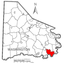 Location of Centerville in Washington County | |
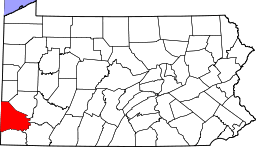
 Centerville Location of Centerville in Pennsylvania | |
| Coordinates: 40°1′51″N 79°57′33″W / 40.03083°N 79.95917°WCoordinates: 40°1′51″N 79°57′33″W / 40.03083°N 79.95917°W | |
| Country | United States |
| State | Pennsylvania |
| County | Washington |
| Established | 1895 |
| Government | |
| • Mayor | Dylan Lamp |
| Area | |
| • Total | 13.6 sq mi (35 km2) |
| • Land | 13.2 sq mi (34 km2) |
| • Water | 0.3 sq mi (0.8 km2) |
| Population (2010) | |
| • Total | 3,263 |
| • Density | 240/sq mi (93/km2) |
| Time zone | EST (UTC-4) |
| • Summer (DST) | EDT (UTC-5) |
| Area code(s) | 724 |

Centerville is a borough in Washington County, Pennsylvania, United States. The population was 3,263 at the 2010 census.
History
The Centerville Historic District, Joseph Dorsey House, Harrison House and Welsh-Emery House are listed on the National Register of Historic Places.[1]
Geography
Centerville is located at 40°1′51″N 79°57′33″W / 40.03083°N 79.95917°W (40.030766, -79.959107).[2]
According to the United States Census Bureau, the borough has a total area of 13.6 square miles (35 km2), of which, 13.2 square miles (34 km2) of it is land and 0.3 square miles (0.78 km2) of it (2.57%) is water.
Demographics
| Historical population | |||
|---|---|---|---|
| Census | Pop. | %± | |
| 1880 | 150 | — | |
| 1900 | 746 | — | |
| 1910 | 1,413 | 89.4% | |
| 1920 | 4,793 | 239.2% | |
| 1930 | 6,467 | 34.9% | |
| 1940 | 6,317 | −2.3% | |
| 1950 | 5,845 | −7.5% | |
| 1960 | 5,088 | −13.0% | |
| 1970 | 4,175 | −17.9% | |
| 1980 | 4,207 | 0.8% | |
| 1990 | 3,842 | −8.7% | |
| 2000 | 3,390 | −11.8% | |
| 2010 | 3,263 | −3.7% | |
| Est. 2015 | 3,191 | [3] | −2.2% |
| Sources:[4][5][6] | |||
As of the census[5] of 2010, there were 3,263 people, 1,359 households, and 971 families residing in the borough. The population density was 255.9 people per square mile (98.8/km²). There were 1,455 housing units at an average density of 109.8/sq mi (42.4/km²). The racial makeup of the borough was 98.85% White, 0.18% African American, 0.15% Native American, 0.21% Asian, 0.24% from other races, and 0.38% from two or more races. Hispanic or Latino of any race were 0.27% of the population.
There were 1,359 households out of which 27.7% had children under the age of 18 living with them, 57.7% were married couples living together, 10.7% had a female householder with no husband present, and 28.5% were non-families. 26.4% of all households were made up of individuals and 16.1% had someone living alone who was 65 years of age or older. The average household size was 2.49 and the average family size was 3.00.
In the borough the population was spread out with 21.7% under the age of 18, 7.5% from 18 to 24, 25.5% from 25 to 44, 25.9% from 45 to 64, and 19.4% who were 65 years of age or older. The median age was 42 years. For every 100 females there were 92.9 males. For every 100 females age 18 and over, there were 89.0 males.
The median income for a household in the borough was $34,598, and the median income for a family was $40,741. Males had a median income of $35,804 versus $23,245 for females. The per capita income for the borough was $16,648. About 8.1% of families and 13.3% of the population were below the poverty line, including 24.8% of those under age 18 and 13.1% of those age 65 or over.
References
- ↑ National Park Service (2010-07-09). "National Register Information System". National Register of Historic Places. National Park Service.
- ↑ "US Gazetteer files: 2010, 2000, and 1990". United States Census Bureau. 2011-02-12. Retrieved 2011-04-23.
- ↑ "Annual Estimates of the Resident Population for Incorporated Places: April 1, 2010 to July 1, 2015". Retrieved July 2, 2016.
- ↑ "Census of Population and Housing". U.S. Census Bureau. Archived from the original on 11 May 2015. Retrieved 11 December 2013.
- 1 2 "American FactFinder". United States Census Bureau. Archived from the original on 2013-09-11. Retrieved 2008-01-31.
- ↑ "Incorporated Places and Minor Civil Divisions Datasets: Subcounty Resident Population Estimates: April 1, 2010 to July 1, 2012". Population Estimates. U.S. Census Bureau. Archived from the original on 17 June 2013. Retrieved 11 December 2013.
| Counties |  Map of the Pittsburgh Tri-State with green counties in the metropolitan area and yellow counties in the combined area. | |
|---|---|---|
| Major cities | ||
| Cities and towns 15k-50k (in 2010) | ||
| Airports | ||
| Topics | ||
| ||