River Bend, Missouri
| River Bend, Missouri | |
|---|---|
| Village | |
 Location of River Bend, Missouri | |
| Coordinates: 39°11′2″N 94°23′44″W / 39.18389°N 94.39556°WCoordinates: 39°11′2″N 94°23′44″W / 39.18389°N 94.39556°W | |
| Country | United States |
| State | Missouri |
| County | Jackson |
| Area[1] | |
| • Total | 1.75 sq mi (4.53 km2) |
| • Land | 1.52 sq mi (3.94 km2) |
| • Water | 0.23 sq mi (0.60 km2) |
| Elevation | 732 ft (223 m) |
| Population (2010)[2] | |
| • Total | 10 |
| • Estimate (2012[3]) | 10 |
| • Density | 6.6/sq mi (2.5/km2) |
| Time zone | Central (CST) (UTC-6) |
| • Summer (DST) | CDT (UTC-5) |
| FIPS code | 29-62056[4] |
| GNIS feature ID | 1699794[5] |
River Bend is a village in Jackson County, Missouri, United States. The population was 10 at the 2010 census. It is the only part of Jackson County that lies north of the Missouri River. In 1951 the Missouri River was relocated to a new channel, creating River Bend, (also known as Liberty Bend). The county line still follows the original riverbed.
Geography
River Bend is located at 39°11′2″N 94°23′44″W / 39.18389°N 94.39556°W (39.183954, −94.395614).[6]
According to the United States Census Bureau, the village has a total area of 1.75 square miles (4.53 km2), of which, 1.52 square miles (3.94 km2) of it is land and 0.23 square miles (0.60 km2) is water.[1]
Demographics
| Historical population | |||
|---|---|---|---|
| Census | Pop. | %± | |
| 2000 | 10 | — | |
| 2010 | 10 | 0.0% | |
| Est. 2015 | 10 | [7] | 0.0% |
2010 census
As of the census[2] of 2010, there were 10 people, 5 households, and 3 families residing in the village. The population density was 6.6 inhabitants per square mile (2.5/km2). There were 5 housing units at an average density of 3.3 per square mile (1.3/km2). The racial makeup of the village was 100.0% White.
There were 5 households of which 60.0% were married couples living together and 40.0% were non-families. 20.0% of all households were made up of individuals. The average household size was 2.00 and the average family size was 2.33.
The median age in the village was 52.5 years. 0.0% of residents were under the age of 18; 0.0% were between the ages of 18 and 24; 20% were from 25 to 44; 70% were from 45 to 64; and 10% were 65 years of age or older. The gender makeup of the village was 40.0% male and 60.0% female.
2000 census
As of the census[4] of 2000, there were 10 people, 5 households, and 4 families residing in the village. The population density was 7.6 people per square mile (2.9/km²). There were 5 housing units at an average density of 3.8 per square mile (1.5/km²). The racial makeup of the village was 100.00% White.
There were 5 households out of which none had children under the age of 18 living with them, 80.0% were married couples living together, and 20.0% were non-families. 20.0% of all households were made up of individuals and none had someone living alone who was 65 years of age or older. The average household size was 2.00 and the average family size was 2.25.
In the village the population was spread out with 10.0% from 18 to 24, 30.0% from 25 to 44, 40.0% from 45 to 64, and 20.0% who were 65 years of age or older. The median age was 45 years. For every 100 females there were 66.7 males. For every 100 females age 18 and over, there were 66.7 males.
The median income for a household in the village was $70,000, and the median income for a family was $70,000. Males had a median income of $46,667 versus $41,250 for females. The per capita income for the village was $27,820. None of the population and none of the families were below the poverty line.
References
- 1 2 "US Gazetteer files 2010". United States Census Bureau. Retrieved 2012-07-08.
- 1 2 "American FactFinder". United States Census Bureau. Retrieved 2012-07-08.
- ↑ "Population Estimates". United States Census Bureau. Retrieved 2013-05-30.
- 1 2 "American FactFinder". United States Census Bureau. Retrieved 2008-01-31.
- ↑ "US Board on Geographic Names". United States Geological Survey. 2007-10-25. Retrieved 2008-01-31.
- ↑ "US Gazetteer files: 2010, 2000, and 1990". United States Census Bureau. 2011-02-12. Retrieved 2011-04-23.
- ↑ "Annual Estimates of the Resident Population for Incorporated Places: April 1, 2010 to July 1, 2015". Retrieved July 2, 2016.
- ↑ "Census of Population and Housing". Census.gov. Retrieved June 4, 2015.
Municipalities and communities of Jackson County, Missouri, United States | ||
|---|---|---|
| Cities | 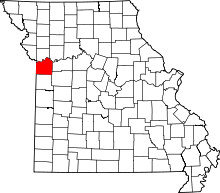 | |
| Villages | ||
| Townships | ||
| Unincorporated communities | ||
| Footnotes | ‡This populated place also has portions in an adjacent county or counties | |
Kansas City metropolitan area's cities and counties | ||
|---|---|---|
| Central city | 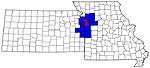 | |
| Largest cities (over 100,000 in 2000) | ||
| Medium-sized cities (10,000 to 100,000 in 2000) | ||
| Smaller Cities (between 5,000 and 9,900 in 2010) | ||
| Counties | ||